Denver Weather: Wintry mix hits and impacts us into the weekend

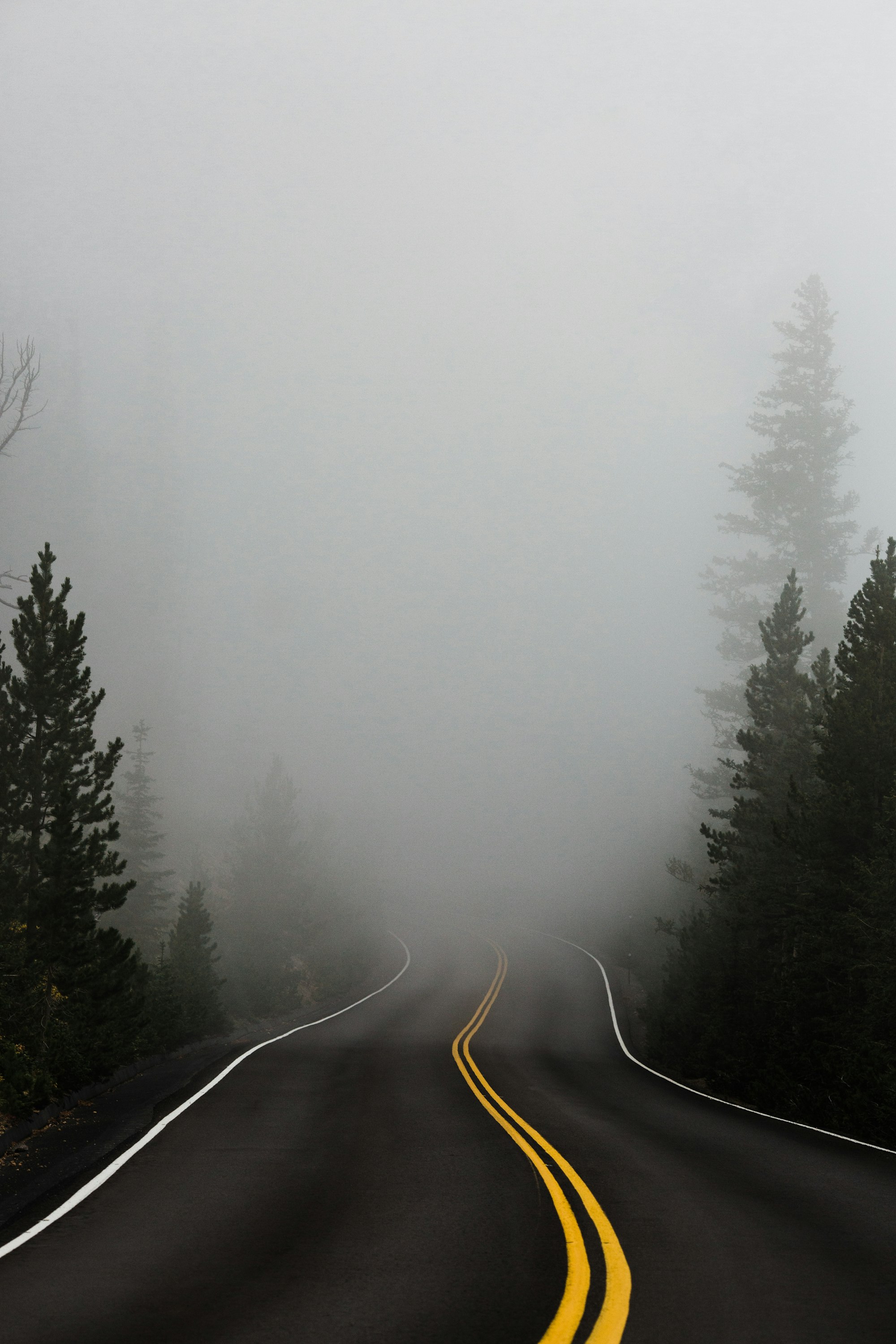
A cold front swept through the region (swept, odd we use that word for this phenomenon) last night and many of us woke to fog and some icy accumulation on our patios. For the next few days, a wintry mix remains possible, and even some snow accumulation by Saturday morning.
Let's set the stage with an hourly planner for both temperatures and precipitation for Denver.
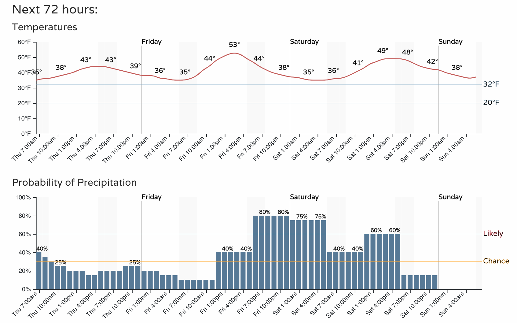
See the temperatures top out in the middle 40s for us today, then into the lower 50s for Friday, and back into the 40s for Saturday. So, although cool we aren't talking about an overly cold pattern. We are looking at a wetter pattern, though.
The timeline shown for precipitation chances peaks later Friday and remains elevated through Saturday. This, considering the temperatures we just discussed, will lead to a rain/snow mix during this period.
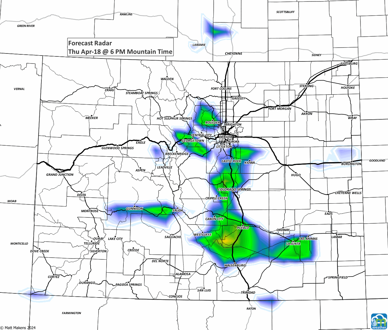
Let's get a bit more specific with locations and timings. Here is an animation through Saturday night to show the location of this wet weather.
Now, how much total water is to move through out of that? For most of the metro areas, we are looking at somewhere in the ballpark of a quarter of an inch.
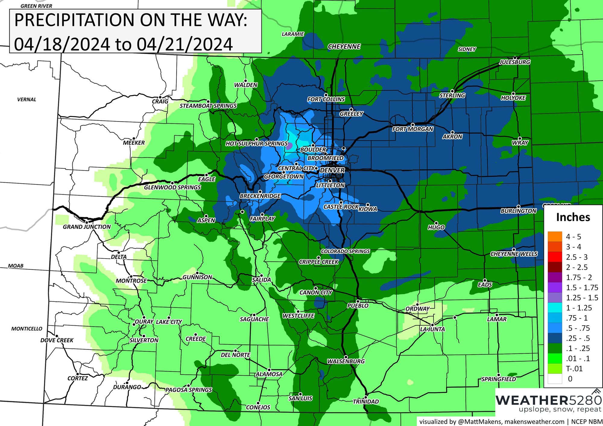
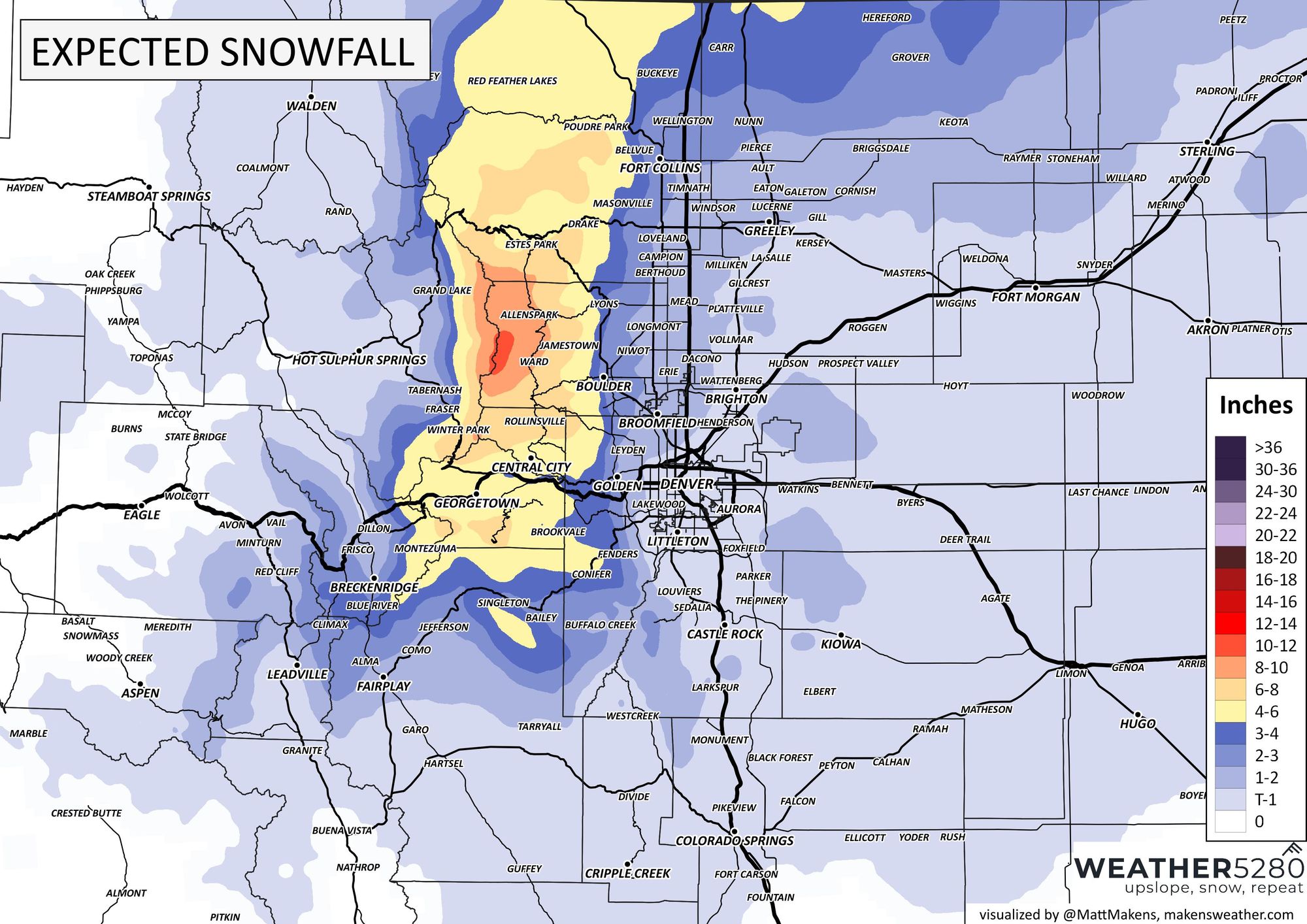
What of that total water is snowfall? Not a great deal of that water turns into snowfall, but parts of the Front Range Mountains will pick up six to twelve inches.
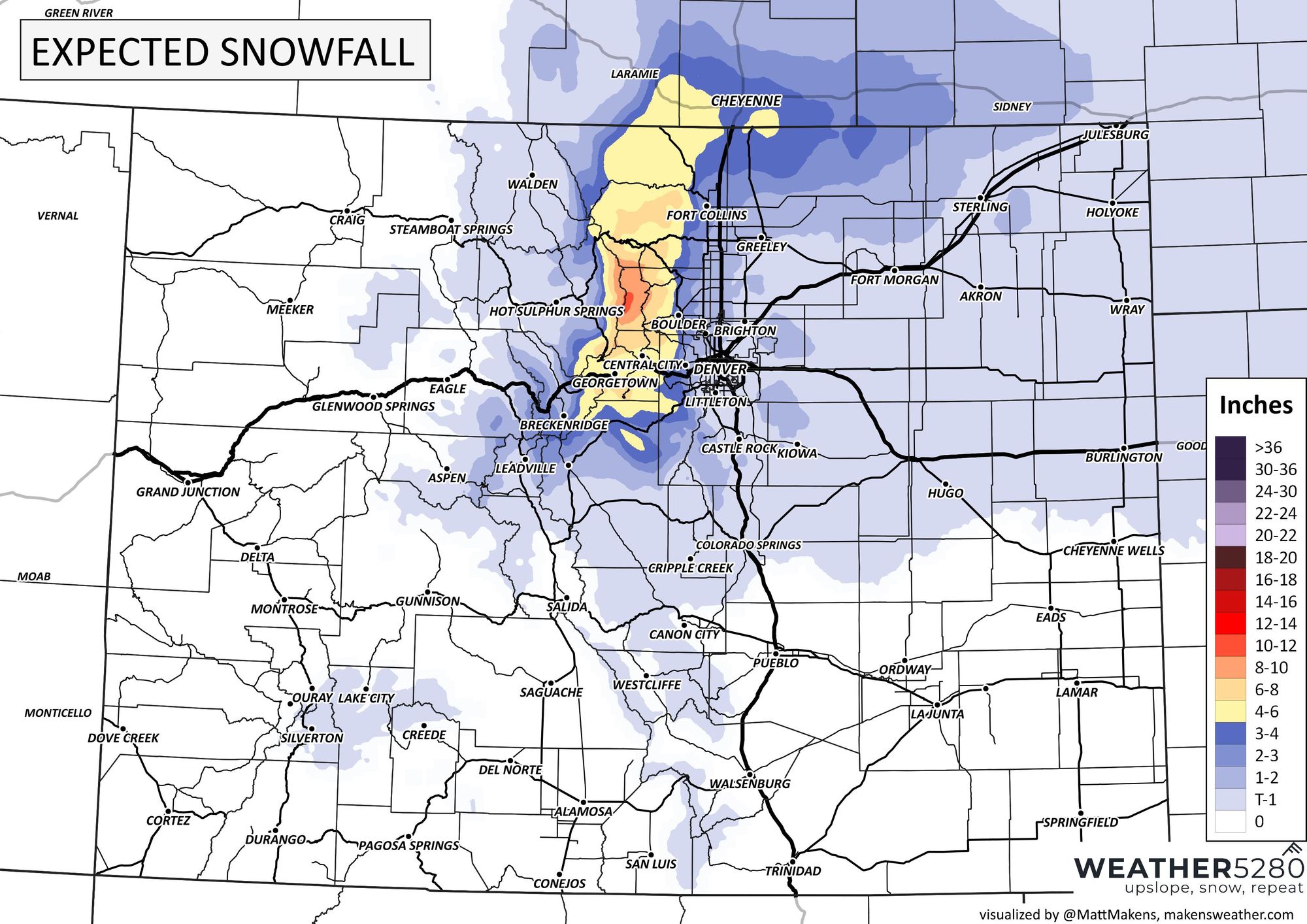
Zoom that map into the Front Range, please. Most metro locations could see upwards of a couple inches of snowfall - most likely Saturday morning.
I'm glad we are seeing some moisture; our landscapes and native vegetation need this as they begin to green. I also am glad we aren't looking at a super cold outbreak, considering my fruit trees are also trying to do their thing.
Have a good Thursday; chat with us about how much rain/snow you see over the days ahead, please. We'll keep tabs on the next few days for you, so stick with us and as subscribe to that email list if you haven't - pretty please!