
Denver weather: Saturday morning's super soaker is on track to produce big-time rainfall totals and some snow too

The next system is set to arrive as we hit the weekend, and its timing looks to spread remarkably heavy rainfall across the Front Range and Plains as early as Saturday morning. If you have outdoor plans on Saturday (we have soccer and lacrosse games...well, maybe we do), you may need to cancel/rearrange those plans. In this post, catch up on the latest with this storm system's timing, rainfall totals, and who sees snow.
This is the second system that we have been watching closely for you this past week, Luke discussed it in this post:
Little has changed since that post, so let's update you on the details. Here is an hourly timeline for Denver. Then, we can look at the animation of the showers.
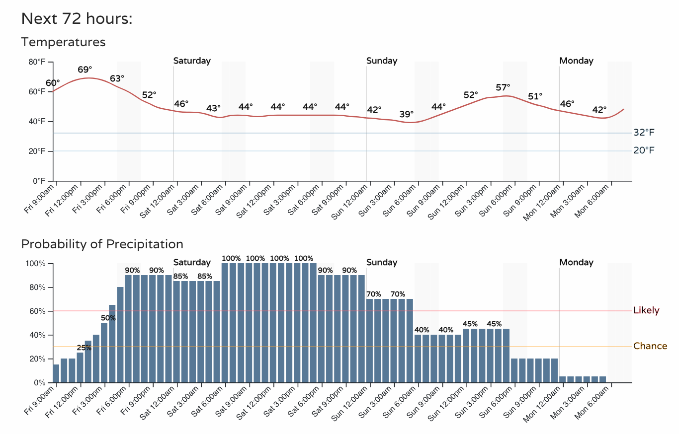
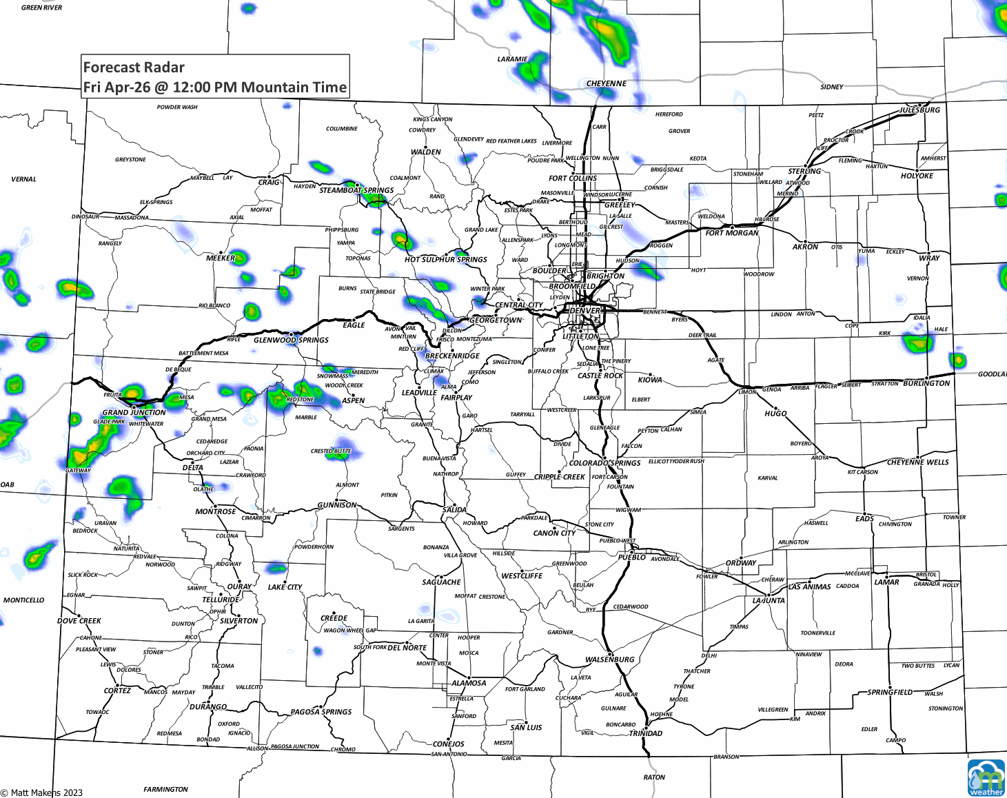
That is one soggy/chilly timeline! This animation will show the location and timing of showers across the state.
Okay, now that we have the timing down—and yes, it is inconvenient for outdoor plans (although one of the best concerts my wife and I have ever been to was at Red Rocks during a similar rain)—let's get to the total water coming through this weekend. Yes, that a large patch of more than two-inch totals covering the Front Range.
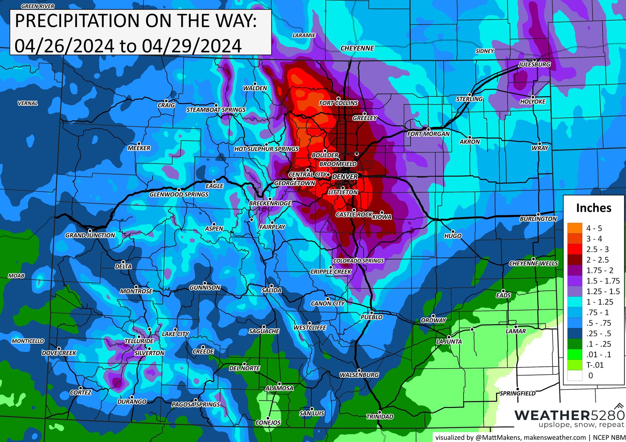
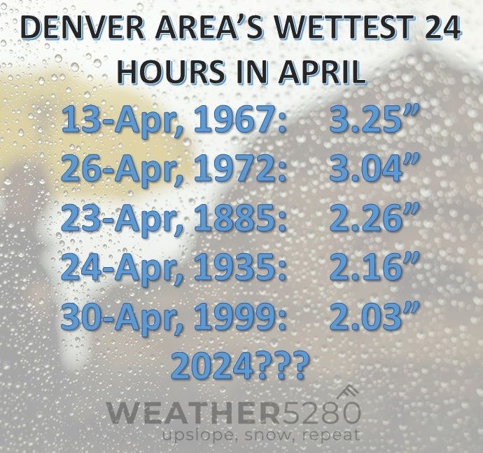
Let's assume for a moment that Denver receives at least two inches of water tomorrow, there are only five other years on which an April date received so much water!
There is just enough cold air so that parts of the Front Range will have some snowfall. Here is that projection, a bit of snow for those near Castle Rock and Kiowa. Speaking of that area, those on the Palmer Divide, or any of the foothills where there is snow, make sure to shake off your trees if able, this snow will be heavy and we could see enough of it accumulate on branches to create issues.
While the current forecast does not call for too much snow across the higher elevations of the metro area, there's some "boom" potential here (some models show 4 - 6" of thump/heavy snow over the Palmer tonight) – so if you live in the areas mentioned above, keep an eye on the sky (and that temp!) and see if you can help your trees should you make that shift to snow and see some more bullish accumulation than anticipated.
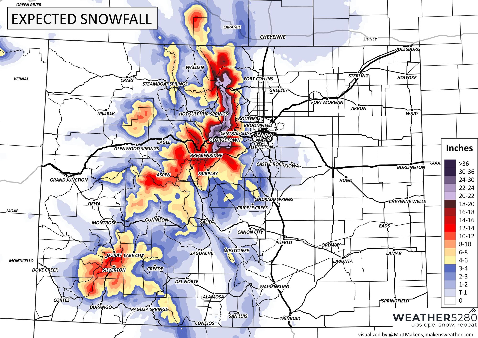
Now, to our west a bit... check out the deep snow that is forecast!
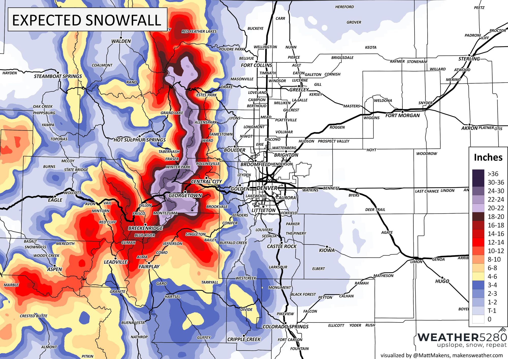
Yes, the big/heavy snow will stay in the mountains - a great late-season supply to the snowpack.
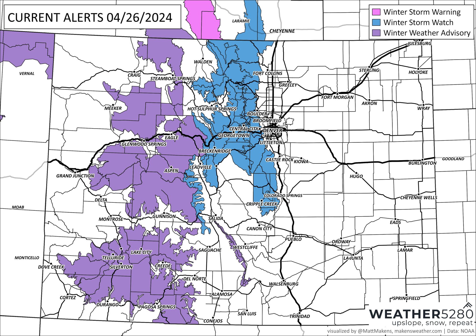
Speaking of which, anyone traveling in the high country may have some issues with the intensity of the snow there. We have several alerts spanning the mountains for this storm system.
I think by this point in the post; you get the idea for this weekend: Saturday looks wet, and Sunday, we clear out. I wonder how many games will shift from Saturday to Sunday, or even into next weekend.
We received a fantastic question from Roger in Parker based on his own observations of a wind pattern he sees when looking at the following product:
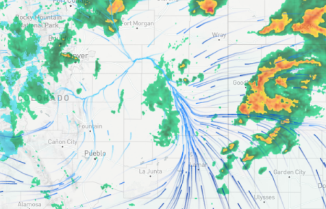
Q: I see a wind pattern that funnels into a single map area (see attachment). I have no idea how that can happen? Does wind just die somewhere? Does this pattern tell a knowledgeable person, e.g., you, anything of interest?
A: That is a great observation and a good question. When the wind flow comes together at a point or along a line, it is an area of convergence. Convergence is a location where surface winds come together and force an upward motion (where else can wind go when it comes together at the surface...can't go down, it must go up). From that upward rising motion, we will usually always call that the lift; you generate the necessary rising motion for creating showers/storms/etc. So, it's a very real thing and incredibly important for the physical processes leading to storm development, maintenance, etc. You'll see this along frontal boundaries (cold, warm, dry lines, etc.) and into the center of low-pressure systems.
Enjoy your weekend! And now it's that moment when I ask you to sign up for our emails (click here). They are as free as the chips and salsa from any local Tex-Mex restaurant ;-).