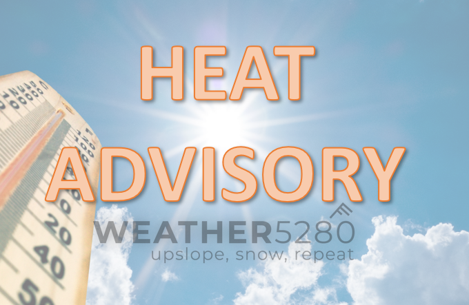
Colorado Weather: Denver's poor air quality, Colorado Springs under Heat Advisory

Record-setting heat returns Thursday across the state, with poor air quality across the Denver metro area and Northern Front Range. Friday, however, offers a stormier outlook which will cool us off a bit.
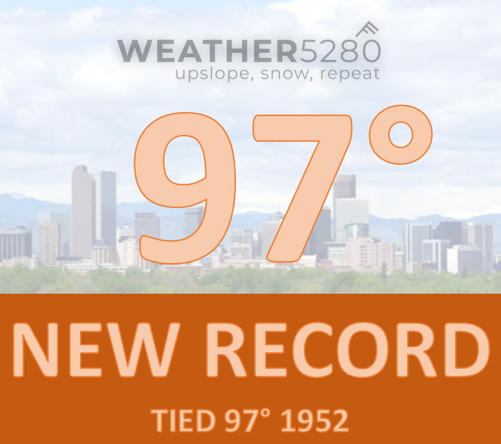
Wednesday, Denver hit 97° adding to the record books for the date. The last time the city was this hot was September 1st, 2023 hitting 99°.
Today's heat covers the state, but there are a few areas where the heat is considered "excessive" and the NWS has heat advisories in place. Here is a map showing those areas as well as the air hazards.

Specifics on the air quality alert:
The Colorado Department of Public Health and Environment has issued the following...
WHAT...Ozone Action Day Alert.
WHERE...Douglas, Jefferson, Denver, western Arapahoe, western Adams, Broomfield, Boulder, Larimer, and Weld Counties
WHEN...400 PM Wednesday June 12 to 400 PM Thursday June 13
IMPACTS...Ozone Action Day Alert is now in effect for the Front Range Urban Corridor. Request to limit driving gas and diesel- powered vehicles is now in effect until at least 4 p.m. Thursday, June 13, 2024. Although ozone is expected to remain in the Moderate category on Wednesday due to gusty westerly winds developing, higher ozone is anticipated for Thursday. The highest ozone concentrations on Thursday are most likely for southwestern parts of the Denver metro area, northward along the foothills to around Golden. For areas included in this advisory that are not expected to reach the Unhealthy for Sensitive Groups (USG) air quality designation, we request that activities, such as driving non-ZEV vehicles (i.e., gas or diesel), be reduced to lessen the impacts on neighboring air quality. Additional air pollution in this region may directly worsen air quality or contribute to precursors which may also adversely affect air quality. For Colorado air quality conditions, forecasts and advisories, visit: https://www.colorado.gov/airquality/colorado_summary.aspx
HEALTH INFORMATION...Increasing likelihood of respiratory symptoms and breathing discomfort in active children and adults and people with lung disease, such as asthma. Active children and adults, and people with lung disease, such as asthma, should reduce prolonged or heavy outdoor exertion.
Specifics on the heat advisory:
...HEAT ADVISORY REMAINS IN EFFECT FROM NOON TODAY TO 7 PM MDT THIS EVENING...
WHAT...Heat index values up to 99 expected.
WHERE...El Paso, Pueblo, Crowley, Otero, Bent, Prowers, and Canon City Vicinity/Eastern Fremont County.
WHEN...From noon today to 7 PM MDT this evening.
IMPACTS...Hot temperatures and high humidity may cause heat illnesses.
PRECAUTIONARY/PREPAREDNESS ACTIONS... Drink plenty of fluids, stay in an air-conditioned room, stay out of the sun, and check up on relatives and neighbors.
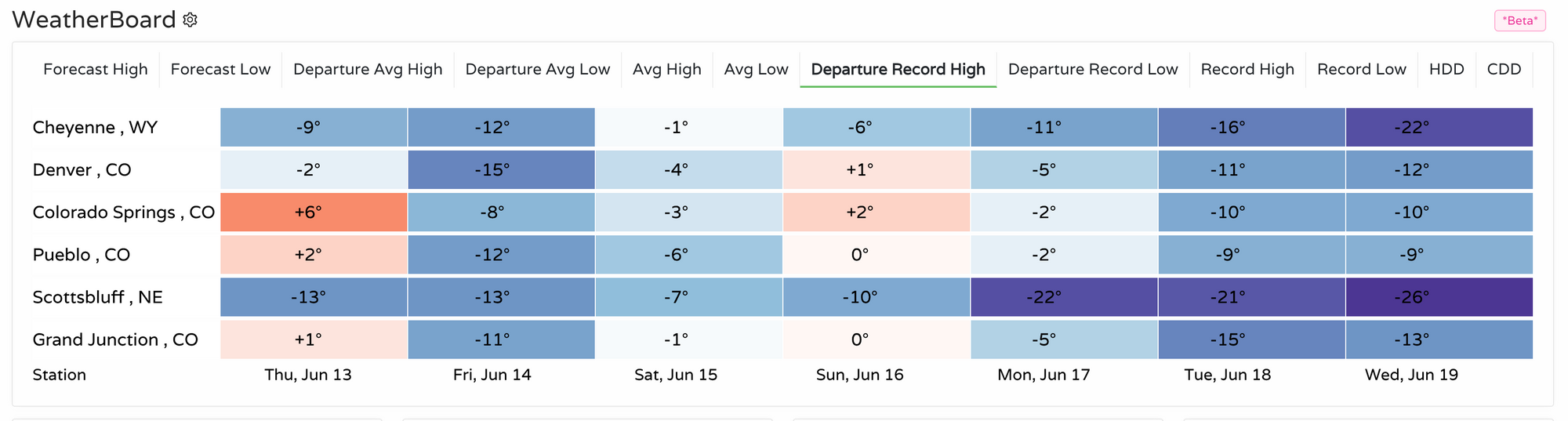
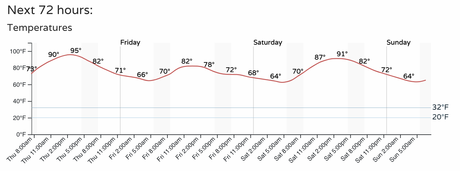
Today, we expect Colorado Springs to set a new record by +6°, Pueblo and Grand Junction are also headed toward records. Using our Insider's WeatherBoard, this image will show you how far forecast highs are from existing records. Notice we cool off tomorrow, so we are well below records but by Sunday we see we could beat the existing records by a couple degrees.
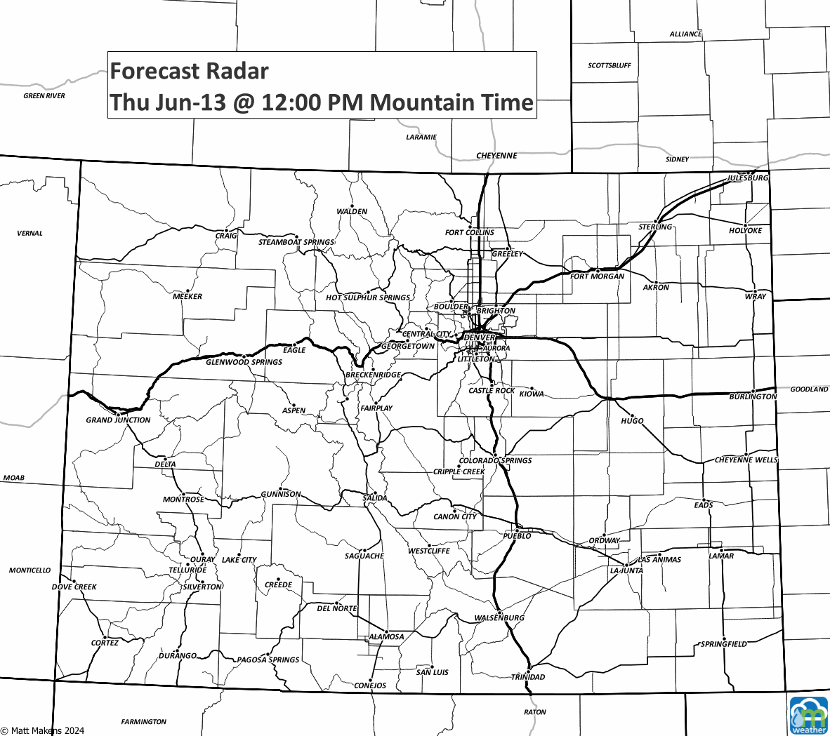
So, what will it take to cool us off a bit? A system with some rain would be nice, and that's what will arrive Friday. Although today could see an isolated storm, tomorrow is clearly the busier day. Here's an animation of estimated storminess through the next 36 hours:
So, judging from that animation you can see there's a high chance you catch a storm tomorrow. Here's a timeline just for Denver of hourly precipitation chances.
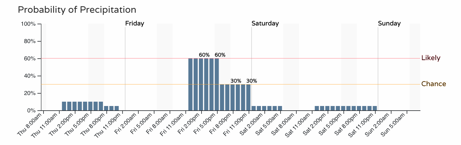
With that spike in chances for Friday, it'll also allow for a dip in temperatures – 80s, but we do warm right back for the weekend with highs back in the 90s.
So, find that cool spot for your day today and tomorrow nature will try to cool us off with some rain. If you are worried about severe weather tomorrow, like hail/wind/etc., keep an eye on the forecast and we will have more on that in a Friday morning post.