Stormy Start to Week for Eastern Colorado
Colorado as strong storms are expected to develop this afternoon after we had a rather quiet day Sunday.
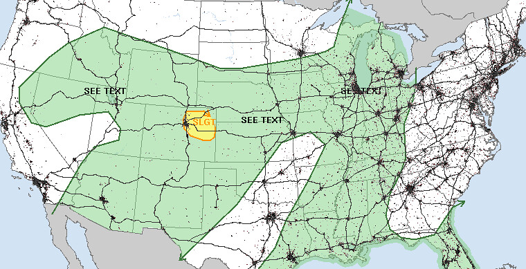
Today’s storm risks includes the threat for tornadoes, as well as large hail and damaging wind. The SPC puts Denver in their 2% tornado probabilities with any storms that do develop today.
Related: Current conditions page
The best potential for strong storms should occur just east/southeast of Denver proper, though cannot rule out a strong storm developing over the city. Best ingredients for severe weather will be from just south of I-70 extending east, north to I-76. Hi-Res models continue to try and develop strong storms near Agate and Limon, CO this afternoon. Along the Palmer Divide and north/northeast will have the best chance of seeing severe weather. HRRR shows storms initiating by mid afternoon near Denver, then pushing northeast into the evening. Flash flooding doesn’t appear to be a huge concern with fairly rapid storm motions. The caveat will be any areas that see training or repeated rounds of heavy cells.
![]()
We expect a few areas to get good rainfall with storms that develop today. As is typically the case, best precipitation numbers will vary greatly from one location to the next due to the scattered natured of storms, but anywhere from a few tenths of an inch to >1.5” will be possible.
We keep a good chance of storms in the forecast through Wednesday in Denver across much of the plains, with temperatures below normal. We’ll have updates here as needed to get through the next several days.