The State of the Atmosphere: Sunday, October 12, 2014

The weather pattern really quiets down over the next week to 10 days after today’s system works through the region and exists Monday. If you’re not quite ready for snow, this forecast is for you; if you’re jumping at the bit for our first measurable snow… we’re going to keep you waiting a while longer.
Sunday and Sunday night
Afternoon highs will be chilly across the region Sunday, as a strong upper level trough passes through. We may see our high temperatures for the day early, with temperatures dropping into the 40s and low 50s through early evening. Morning lows Monday will be in the low to mid 30s for lower elevations, with widespread 20s forecast at higher elevations.
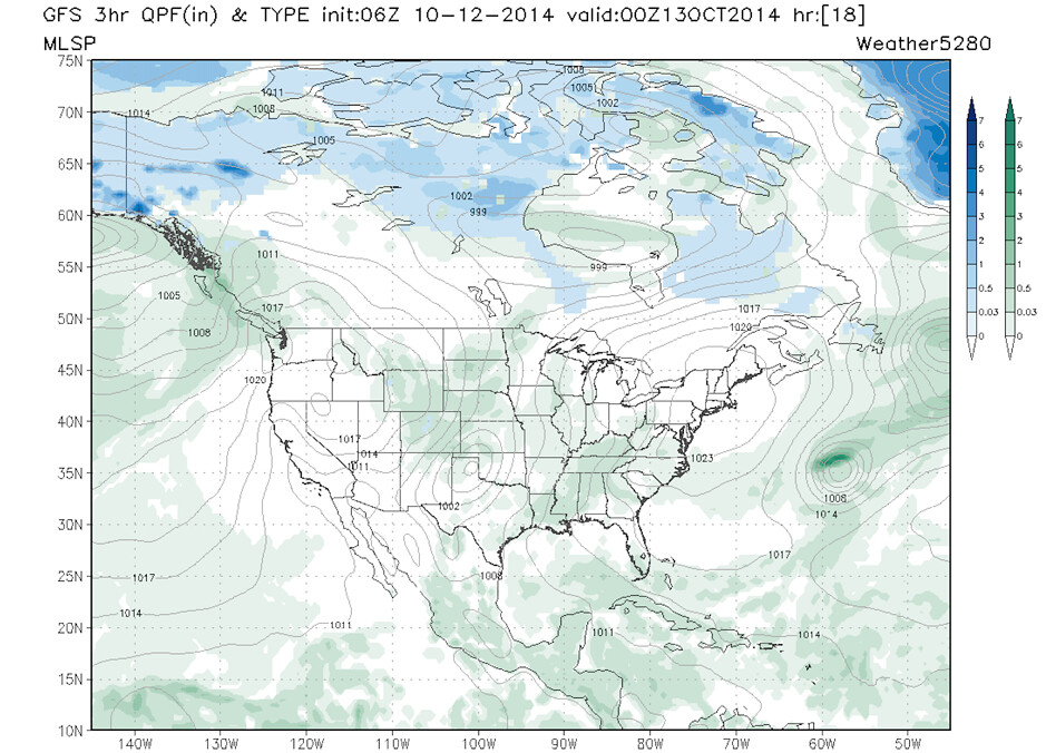
There will be some moisture to work with associated with this system, but most should come in the form of rain for lower elevations. The coolest temperatures of the coming week will work into the region Monday morning, but likely after the best chance for precipitation at lower elevations.
At higher elevations there will definitely be some snow. The latest ECMWF produces upwards of 7 inches for the higher peaks of north central Colorado through Monday morning.
GFS 3 hour QPF 00z tonight. Snow at higher elevations, rain showers at lower elevations.
The week ahead
By Monday we really start to clear things out. The week ahead looks to be very quiet and warm overall. Our Sunday/Sunday night system will push into the middle of the country sparking several days of severe weather across the south central U.S. and eventually up into the mid-Atlantic. Behind it, high pressure builds in and we enter a period of sustained quiet weather.
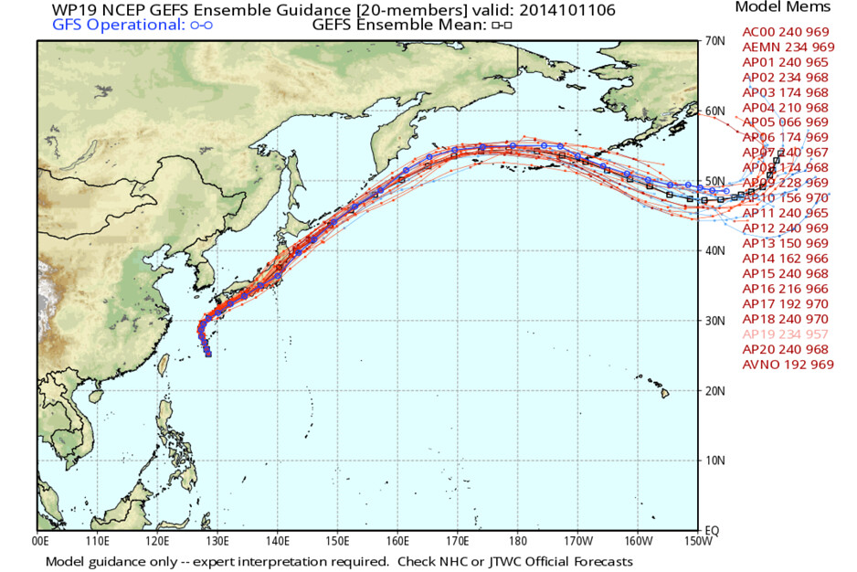
Really all ensemble suites are in pretty good agreement with this. A large trough off the west coast, upper ridging across the mid-section of the U.S., and troughing to the east for the next week -- if not longer. Typhoon Vongfong is forecast to recurve and eventually help to super-change that trough off the west coast which offers additional confidence to this pattern.
Deep trough in the northern Pacific Ocean, ridging overhead…

The pattern can’t last forever. Our attention will start to shift toward the latter part of October and beginning of November for possibly the best chance at seeing winter finally arrive.
Meetup Thursday!
Thursday is weather meetup day, and we hope to see you there (weather won’t be an excuse!). There are still a few tickets left, and while free (you don’t need to bring your ticket to get in), we do ask that you let us know if you’re coming so we have some idea of how many to expect.
Registration: https://www.eventbrite.com/e/lets-meet-and-talk-weather-tickets-12749278435
We’ll try to get started as close to 6:30pm as possible. There will be three presentations and some time to hang around and chat afterwards. If you’ve got a favorite snow dance, maybe you’ll consider sharing it with the group, as it seems we need it!