Western Snowpack Update January, 2016

As we near the end of January it seems prudent to take stock of how we're doing with snowpack in the west this super El Niño year. The answer is, much better than last year, but more rain and snow is needed to overcome persistent drought conditions across much of the western United States.
To begin, here's a look at the latest drought monitor from the third week of January. For our Colorado friends, things continue to look good across the state. A few areas of "Abnormally Dry" showing up, but nothing of too much concern for now. Across the Pacific Northwest we've also seen great improvements over a year ago, while a good portion of California continues to be classified as experiencing "Exceptional Drought" conditions.
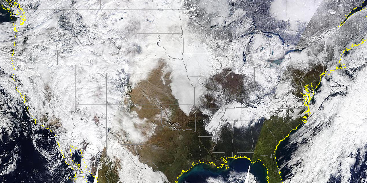
It's estimated that currently 48.1% of the nation is under snow cover, that's compared to just 31.8% this time a year ago, and 32.2% the year prior. This is thanks in large part to a much healthier western snowpack than we've seen in recent years.
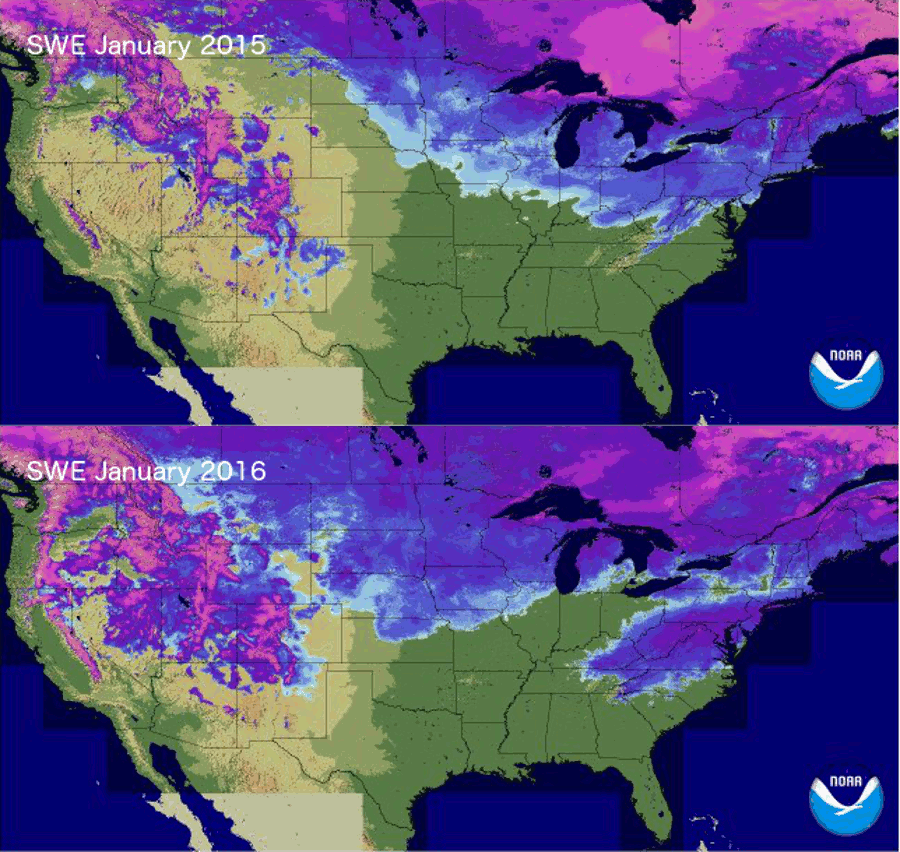
Below is a snow water equivalent (SWE) map for the U.S. comparing January 26, 2015 and January 26, 2016. The lighter blues mean lower SWE, while the brighter purples more. A tremendous turnaround across Oregon, California, and Nevada from a year ago, when there was virtually no snowpack across these states. Also notable, the snow cover across the mid-Atlantic states after this past weekend's storm:
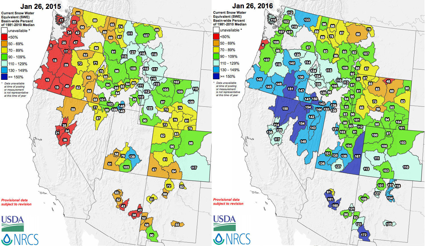
Not surprisingly, this means basin-wide snowpack numbers are MUCH better than they were a year ago. The average snowpack across Washington, Oregon, California, and Nevada was a very poor 51.25% of normal, compared with an impressive 126.5% of normal today.
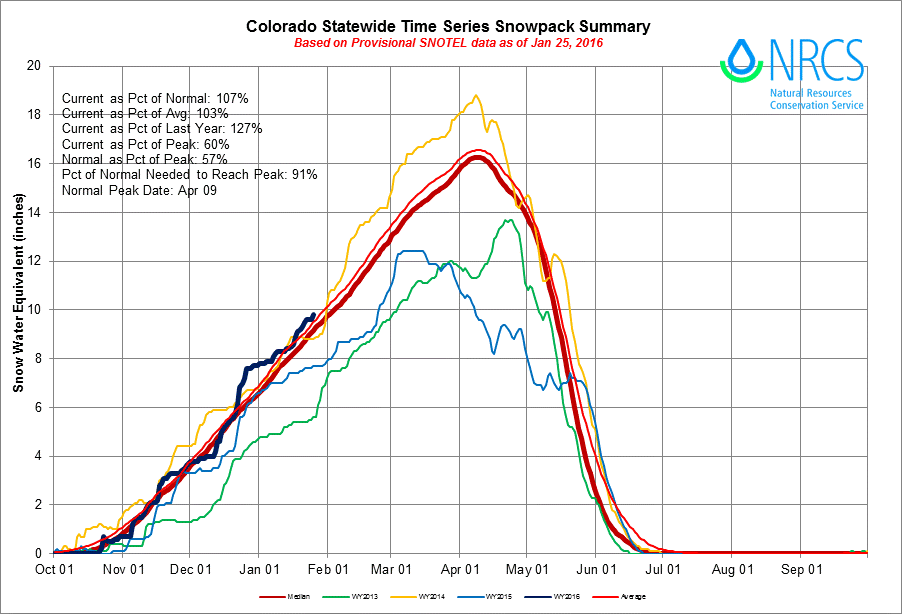
For Colorado, our snowpack numbers are hovering right above the long-term average for this time of year. Considering what strong El Niños often mean for Colorado during the winter months, this is great news.
The hits keep coming
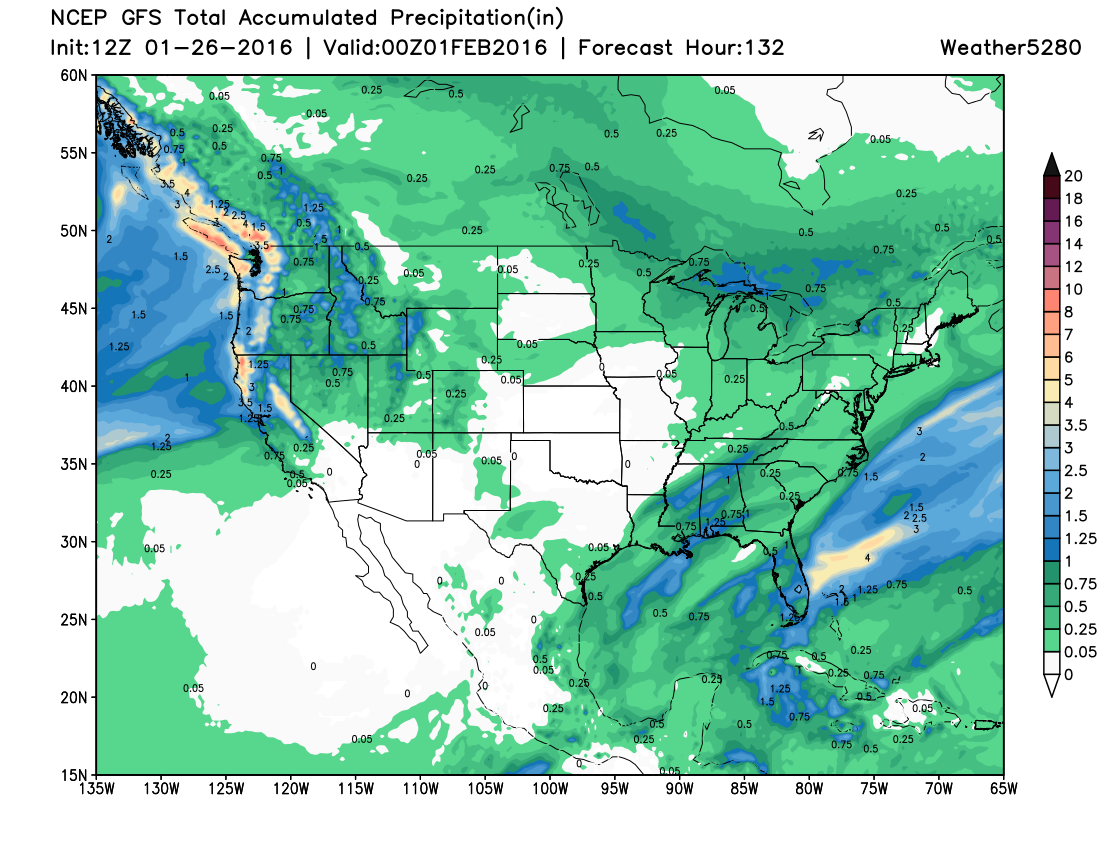
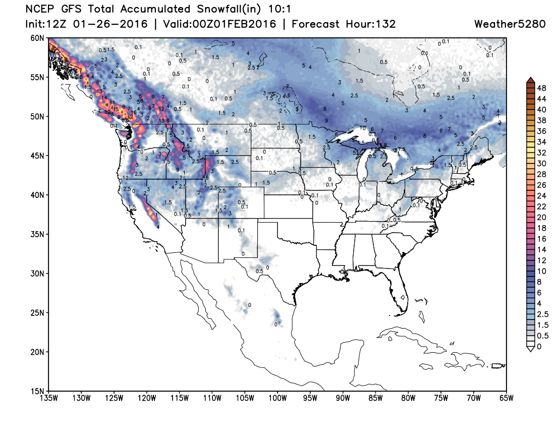
For north-central California, extending north into Oregon and Washington the next week looks to again bring a good moisture flow, with more rain and mountain snow expected through much of the week.
The GFS precipitation forecast through the 31st looks very promising for these areas, with many areas progged to receive more than 4" of precipitation:
Translating to more snow at higher elevations:
Medium range models suggest ridging will reestablish itself across the west by the latter half of the first week of February, at least for a time. As is always the case in the west, enjoy the moisture while it's here!
