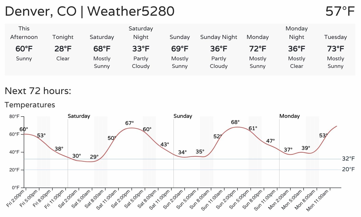
Beautiful week on tap, temperatures will climb into the 70s across much of Eastern Colorado!

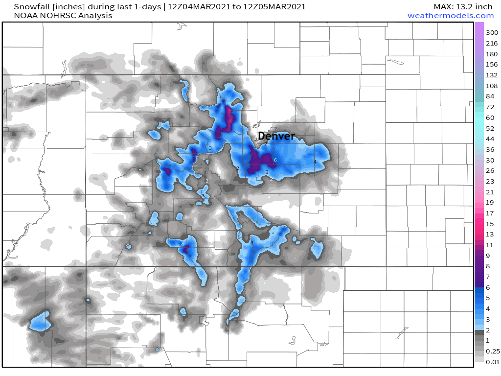
A quick recap of yesterday's storm, shows what proved to be a great forecast. Not much snow in the Denver metro area, but several inches of snow fell along the Palmer Divide, with some locales picking up some appreciable precipitation as well.
For precipitation, upwards of 0.5" fell across portions of the Palmer and the eastern Denver metro area. North of I-76 remained mostly dry, with lesser totals on the south side of the Palmer as well. Here are estimated totals from the last two days:
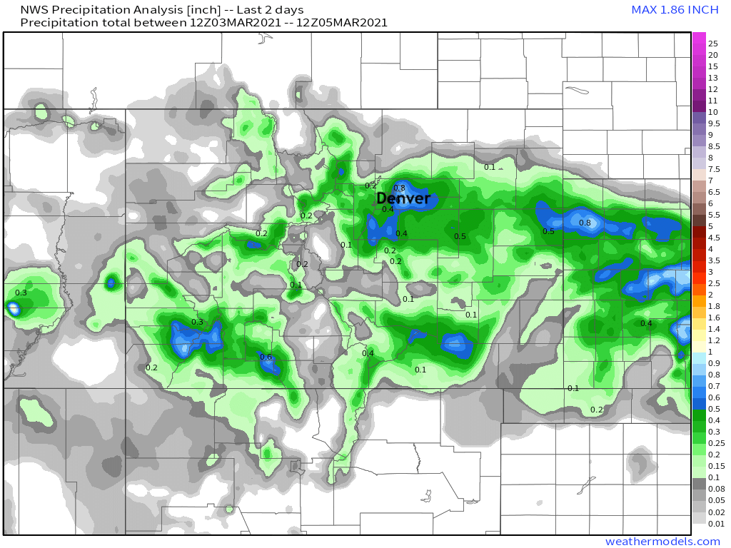
Where we did see snow totals from 3 - 6" were common. Elevation was key yesterday as much of the best moisture fell during the day, and temperatures were quite mild with this system.
The snow will be a distant memory by tomorrow if it's not already. The warmth on the way is timed perfectly with the weekend, so get outside and enjoy!
Take a look at this forecast, Denver!
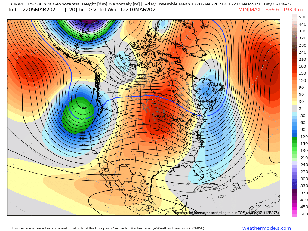
The 5day 500mb height map ending next Wednesday morning shows plenty of ridging overhead this weekend and into next week to support very warm weather and mild temperatures across the entire region:
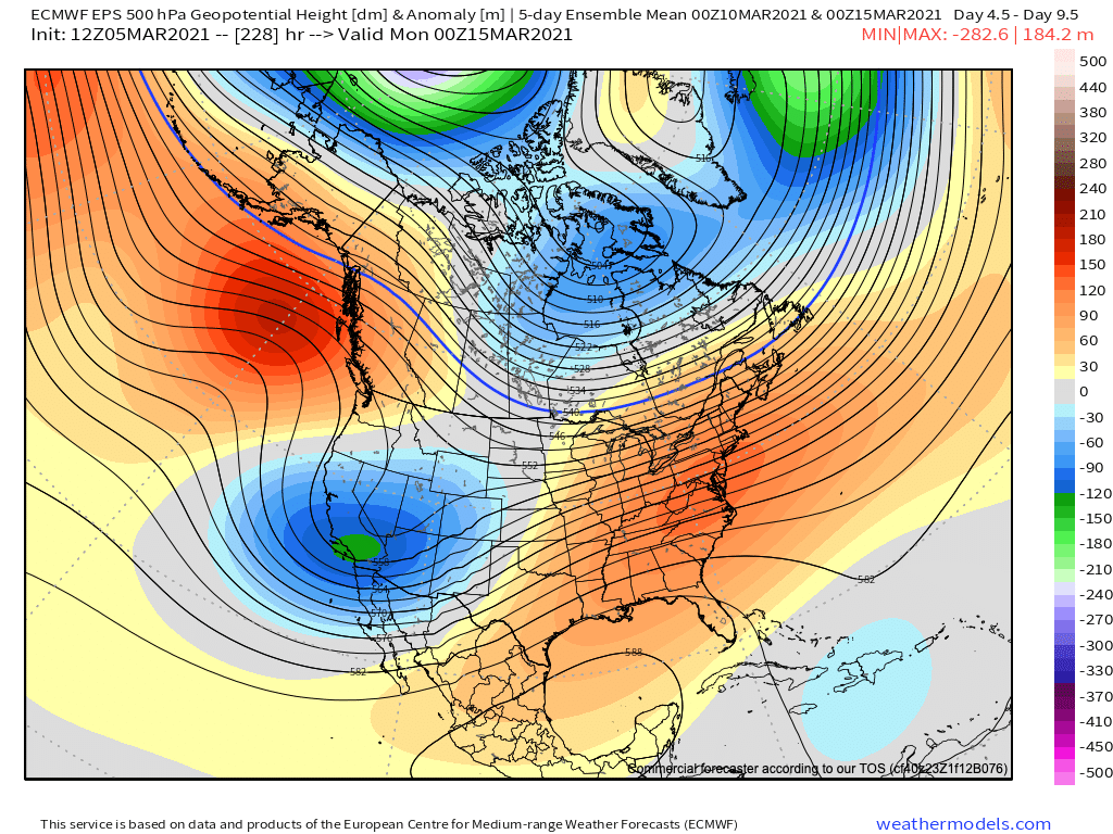
By the second half of next week we see that trough in the image above move into the Western United States, which should begin a cooler and perhaps more unsettled pattern for our area.
Through Tuesday, however? Nothing but gorgeous.
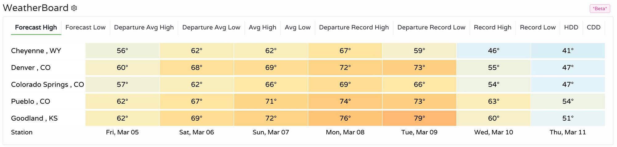
Here's a look at highs from across the region over the next week. Hints of a cool down by Wednesday next week.