
The warm before the storm! Snow returns to Colorado on Wednesday

It'll be another mild day across Eastern Colorado today ahead of our next storm system set to bring mixed precipitation and snow on Wednesday.
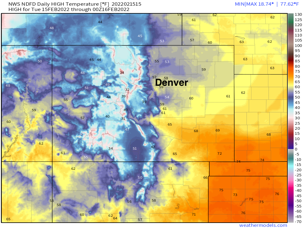
Highs around the Denver area will be near the 60°F mark, with temperatures climbing into the mid 60s and low 70s across Southeast Colorado:
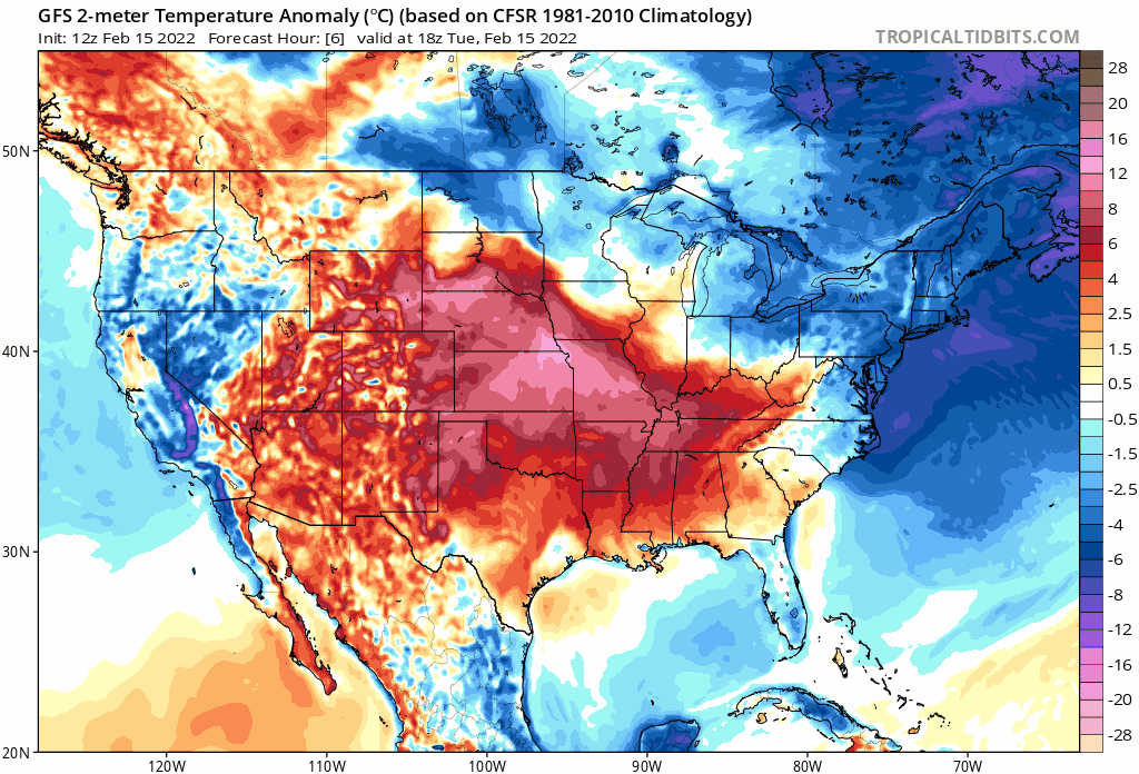
This of course is well above average. In the animation below we see all the warmth across the plains today being replaced by cooler than average temperatures Wednesday as a cold front drops south early Wednesday:
We could see some mixed precipitation (freezing drizzle) with the initial passage of the front tonight and early Wednesday, eventually giving way to all snow across the Front Range by midday Wednesday and on into the overnight hours.
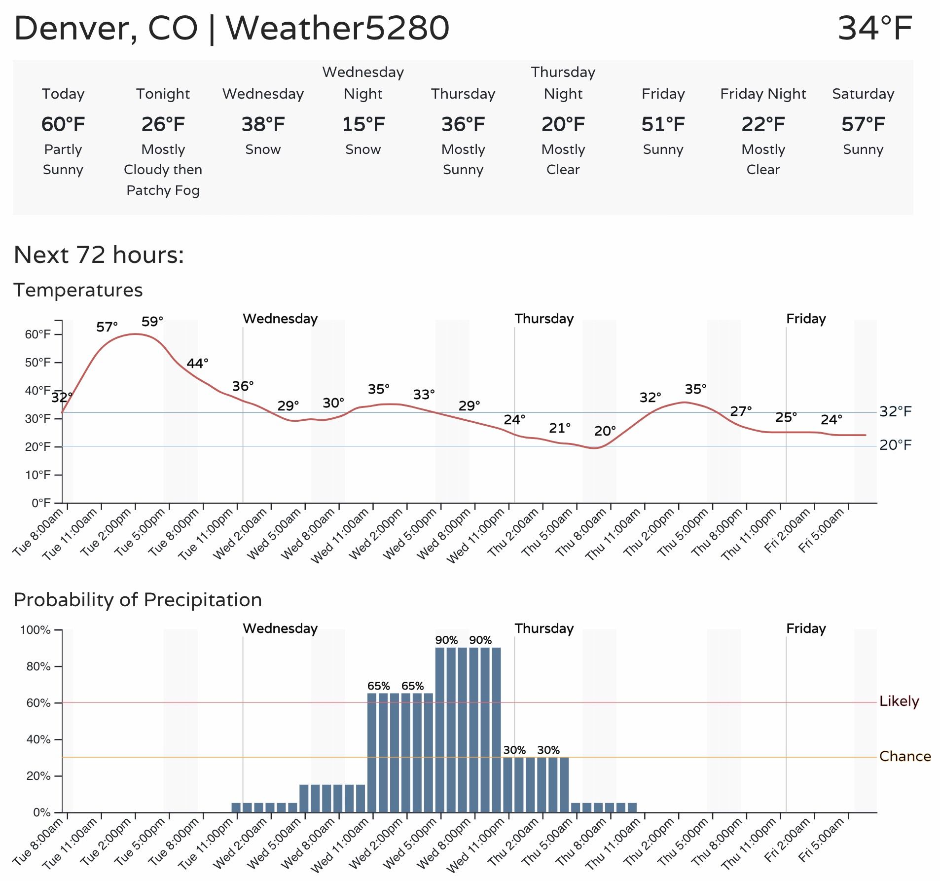
A look at the latest timeline for Denver shows highs near 60°F today, but topping out in the low to mid 30s on Wednesday. The best chance of snow for Denver will come between late morning Wednesday and midnight, with a good chance many areas will be dealing with a slow-and-go commute Wednesday evening with slushy and snow-packed roads becoming an issue as we head toward sundown, corresponding with the greatest probability for snowfall in the 4pm to midnight timeframe:
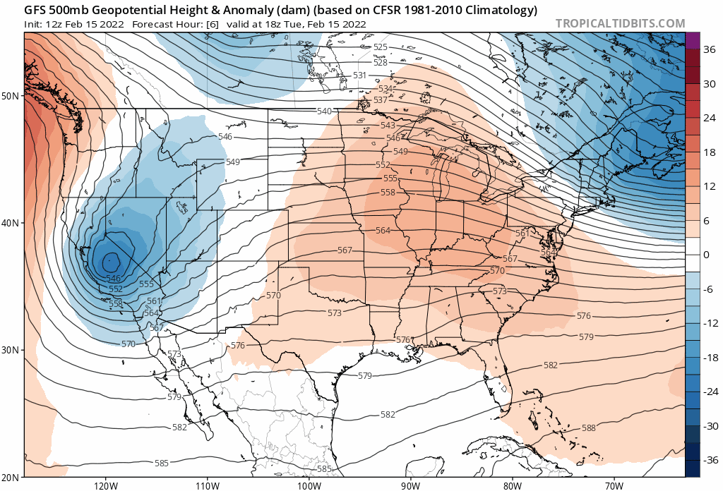
Models have been remarkably consistent with this system for some time now. The main low has dropped into central California today, and will dig south and east today, with an elongated trough eventually passing over Colorado Wednesday, with main low southeast of the state Wednesday evening:
The GFS shows the best moisture in place along with good upslope flow right during the evening rush on Wednesday,
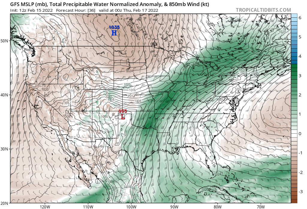
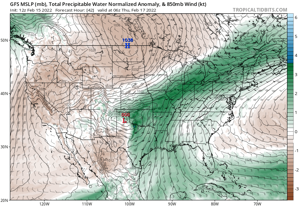
With winds gradually shifting out of the north, and the heaviest snowfall moving south and east of Denver after midnight:
Right now, we don't see the same boom potential as we saw with the last system, though many of our recent systems have been underdone in the modeling. Still, several inches will be possible tomorrow and tomorrow night, with the greatest totals expected along and west of I-25 for the urban corridor and across the Front Range foothills.
SREF forecast plumes, which have been very consistent over recent runs, show the following and are hard to argue with too much:
- Fort Collins: 2.0"
- Broomfield: 3.0"
- Denver: 3.0"
- South Denver/Palmer Divide: 4.0"
- Colorado Springs: 2.5"
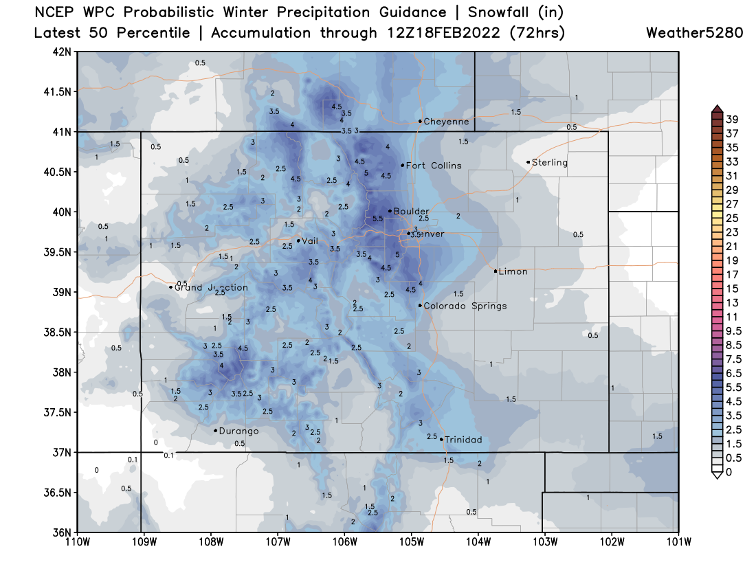
A look at probabilistic guidance from the WPC we see a similar idea with their 50 percentile output. It's easy to see here that the foothills (and those close to) are likely to see a few more inches than the immediate lower elevations.
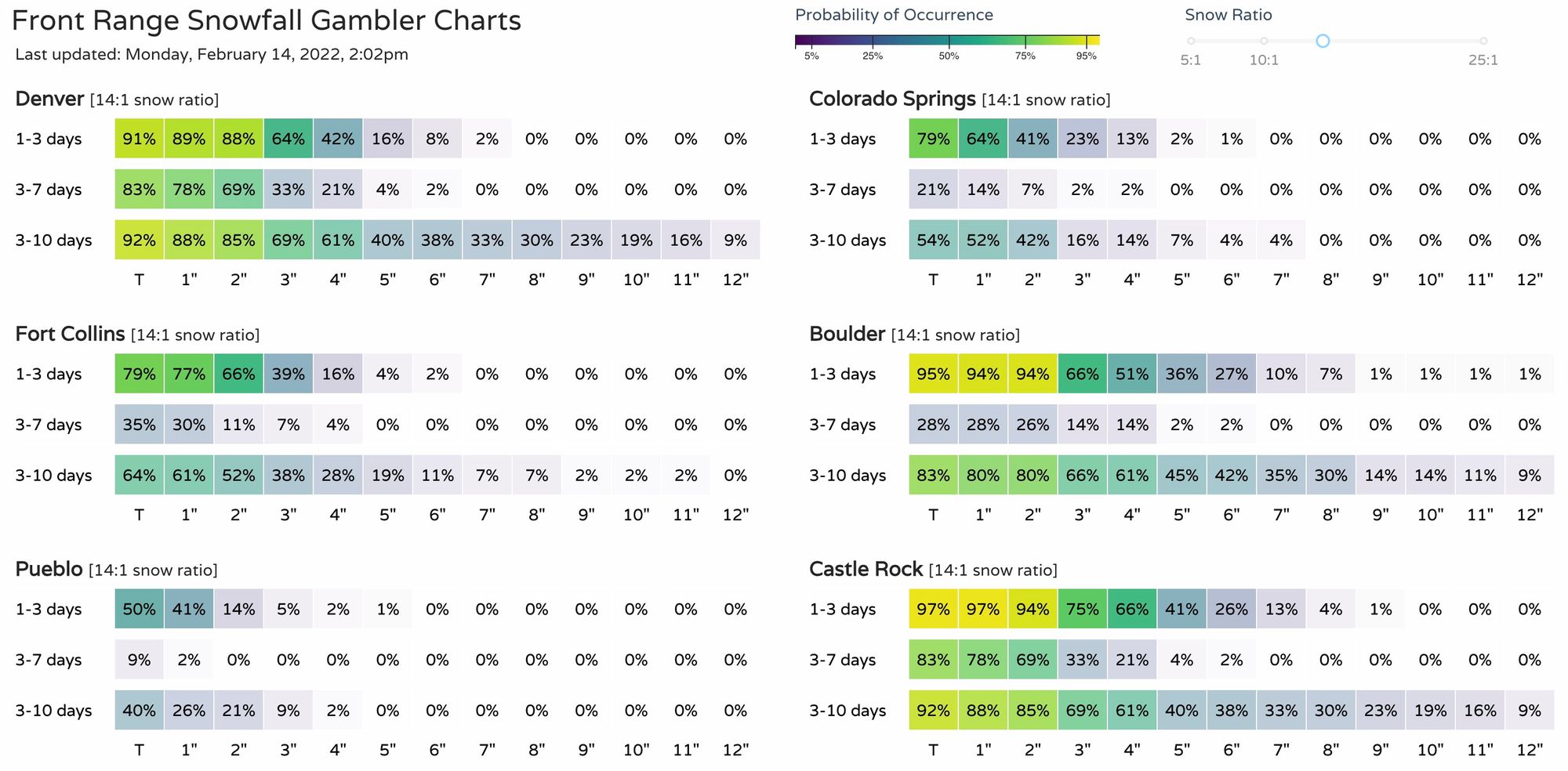
For Denver, we see about a 40% chance of seeing 4" of snow or more according to our gamblers. At the same time, Boulder and Castle Rock are sitting at a greater than 50% chance for seeing 4" or more. Data, overall, are less excited about prospects for Fort Collins and Colorado springs, though the higher terrain surrounding these cities could fair better.
Finally, our snowfall forecast. Generally 2 - 4" for the urban corridor from Denver through (west) Fort Collins, with 3 - 7" for the west side, and Denver's southern suburbs extending across the Palmer Divide. Colorado Springs will be in the Trace to 3" range, with 2 - 4" on the west and north sides of town.

Temperatures remain in the 30s for highs on Thursday ahead of a nice warm up for the weekend. Highs Saturday and Sunday look to be in the mid 50s along the Front Range ahead of another system set to move through by early next week.