
Frigid weather on tap for Denver and parts of Colorado this week

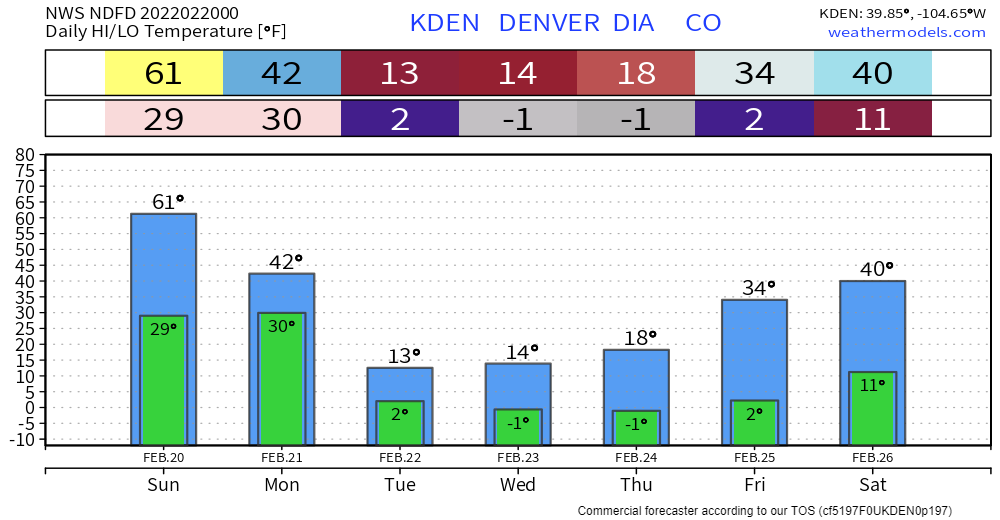
There's a very strong push of colder temperatures that will arrive during the workweek ahead. What to plan on will be below-zero overnight temperatures and highs in the teens.
This won't impact our weekend, rather enjoy the 60s for Sunday before change arrives Monday.
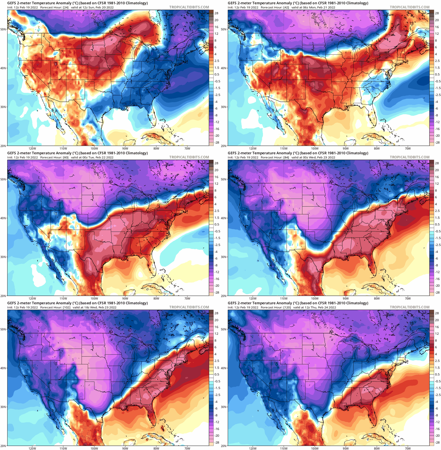
Watch the colder air spill into the northern U.S. Sunday, then plunge into the central and southern U.S. from Monday through Wednesday.
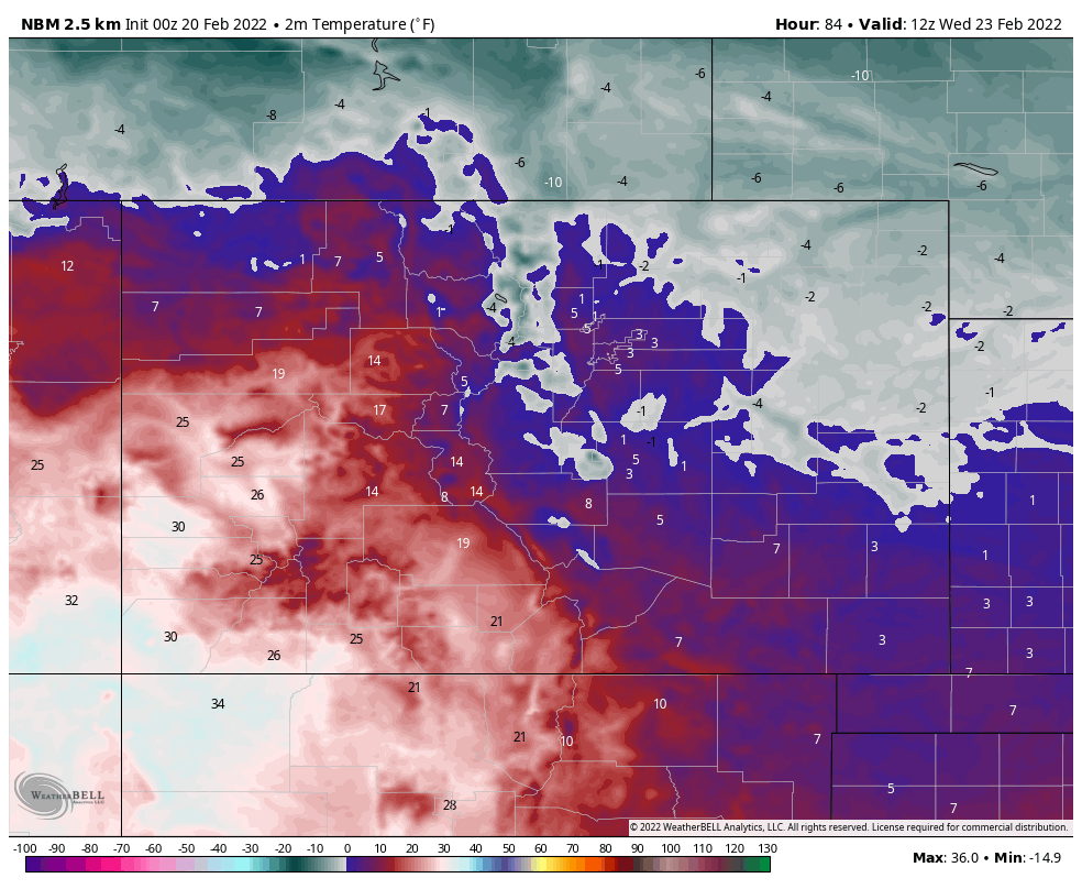
An example as to how cold this air is will be the lows Wednesday morning, which will be in the single digits above and below zero for much of the state, as shown in this next image.
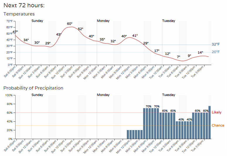
Here's how the hourly data shapes up for Denver:
As far as how it impacts the entire week, here are daily high and lows:
School districts that operate on the policy of sub-zero temperatures require delayed starts, may see a couple of those delays this week.
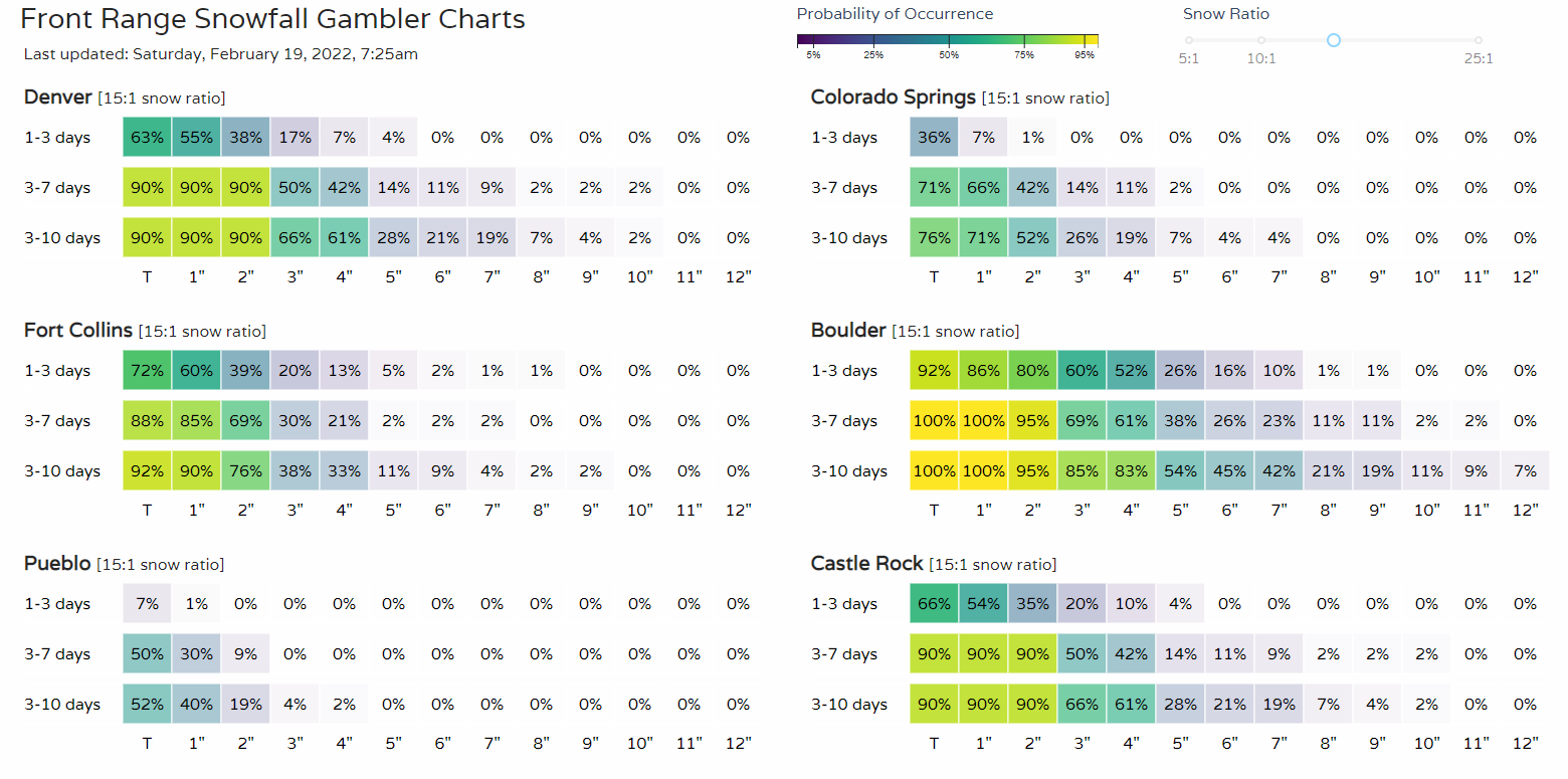
There will also be some snow with this system, quite a bit for the mountains in fact, and some accumulation is possible across the metro areas, too.
Probabilities do support several inches, particularly near Boulder, during the cold.
Consider this your heads up as to the cold. We will have more about the change including snowfall totals in tomorrow's SOTA.
