
Denver & Colorado Weather: Coolest temperatures in five months arrive to end the week

There's a cold front on the way, and for the first time since mid-May, Denver will have lows near 40.
It isn't a lasting change, as temperatures rebound quickly but we are seeing cold front becoming more frequent, which is not surprising for the time of year.
For quick summary, here's where Denver will be for temperatures the next week.
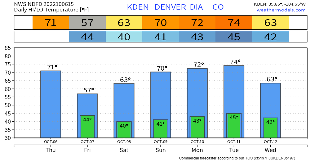
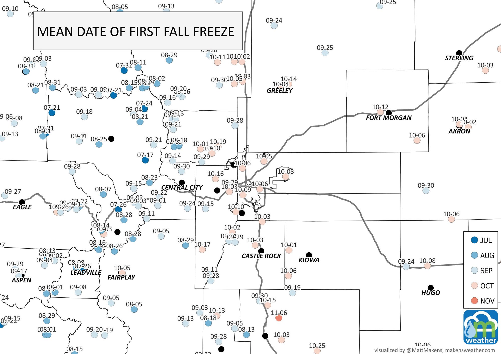
So, we still don't see our first freeze on the chart yet; this is a bit behind schedule. The mean first freeze date since 1990 is shown for some Front Range stations, here:
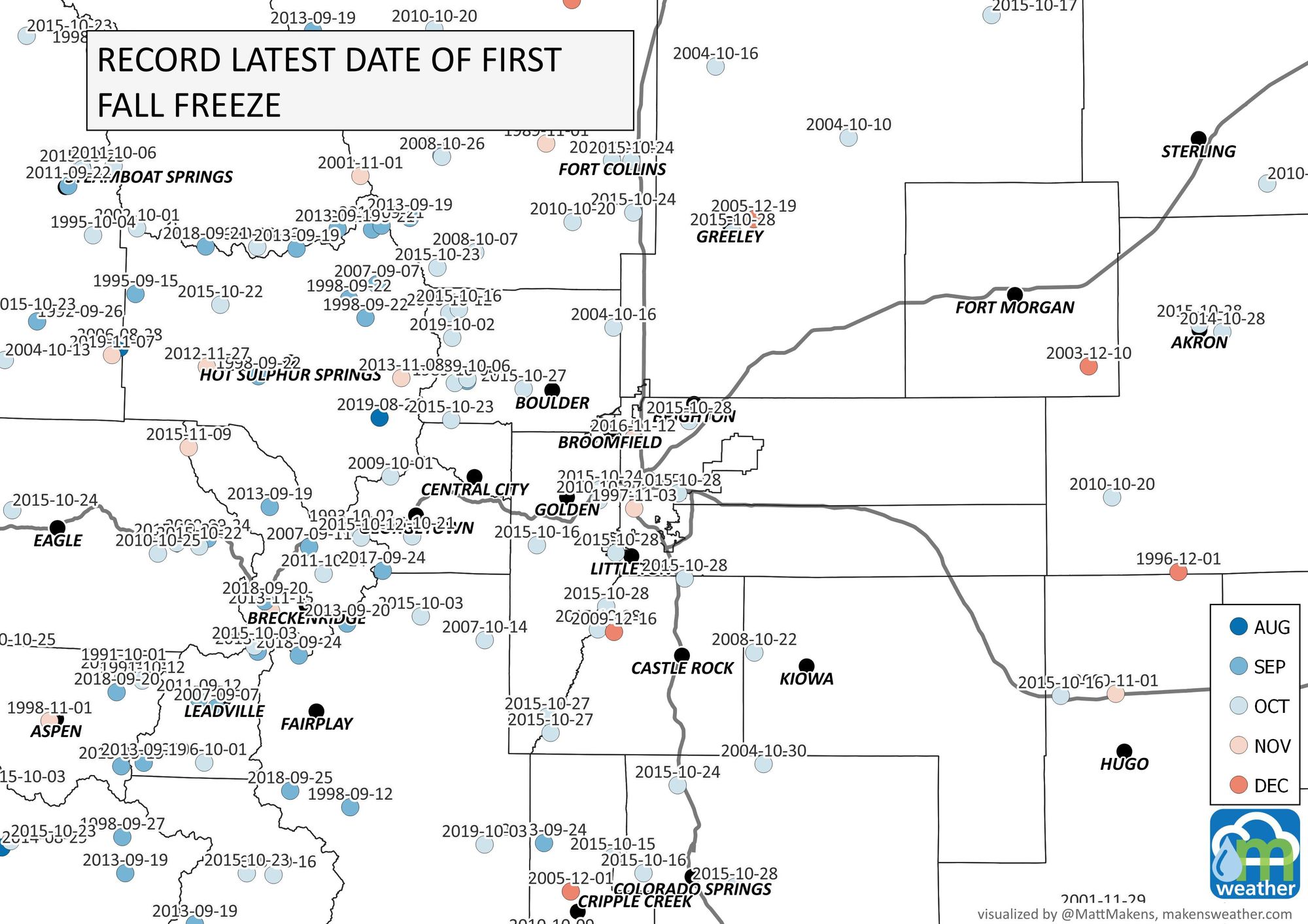
And, I mapped the latest first freeze date also. We could set a record this year for some spots if the cold air doesn't hurry.
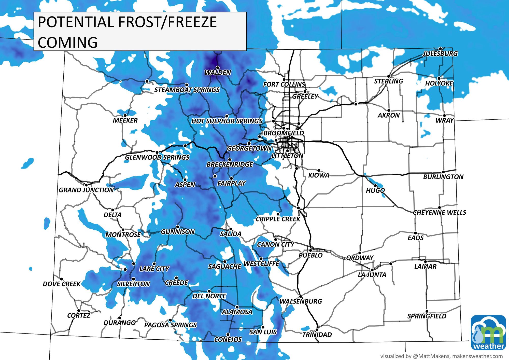
So for the metro area, a freeze isn't likely with the cooler air headed in this time. Although other parts of Colorado may feel their first freeze coming in.
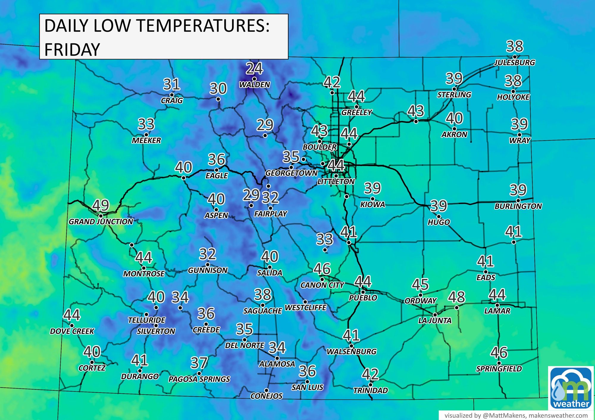
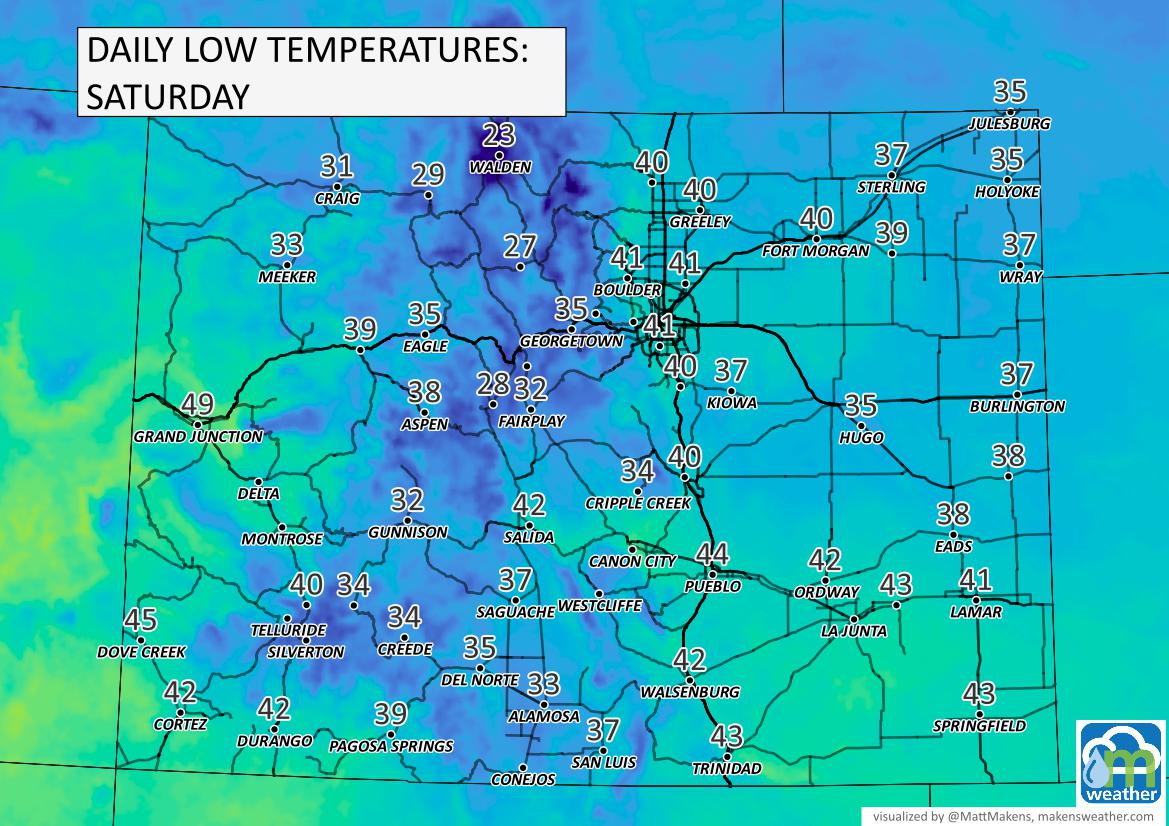
A freeze is possible for the San Luis Valley from Friday morning into next week. This will be the first widespread freeze for valley.
Let's look across Colorado for those areas that will freeze during the next few days.
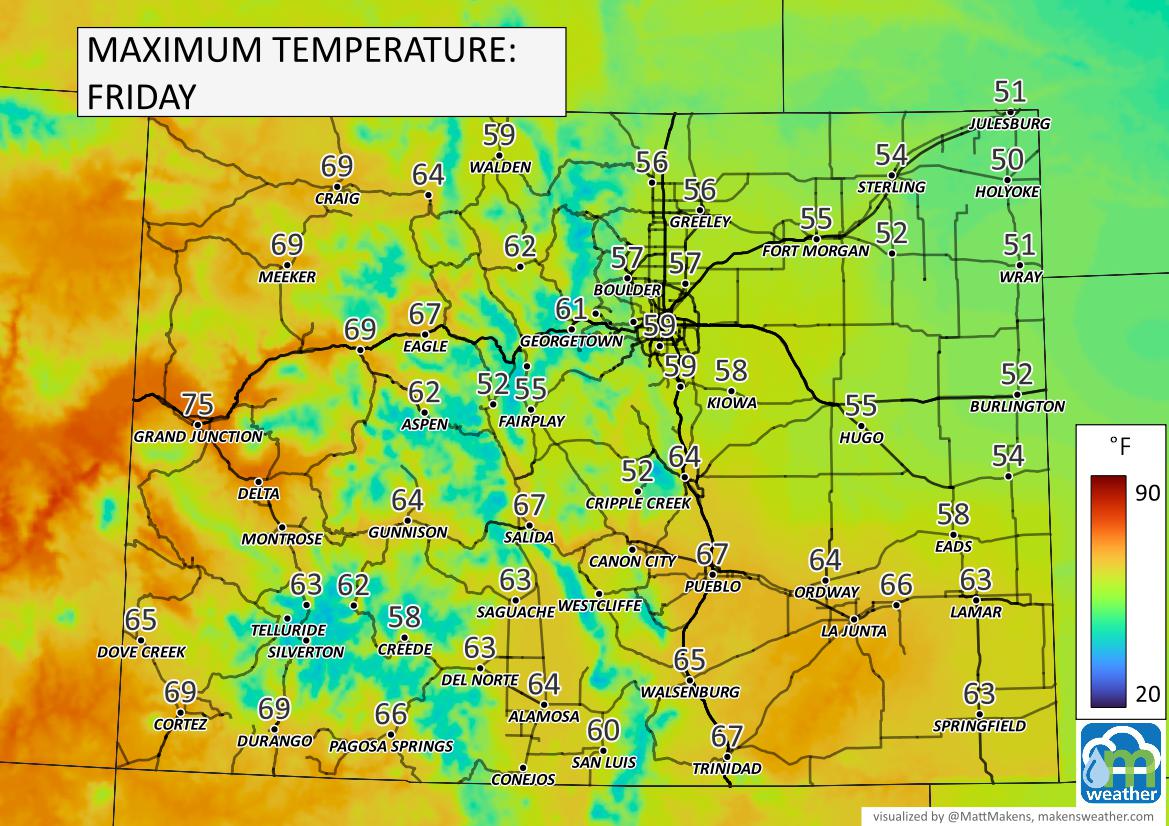
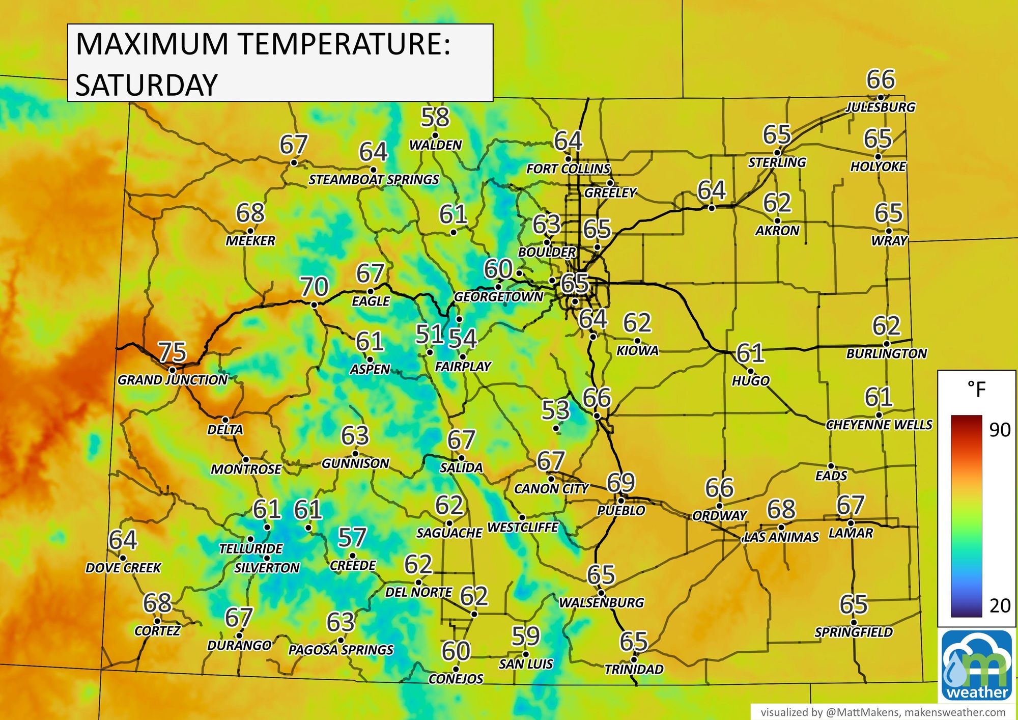
Let's step through the highs and lows the next few days.
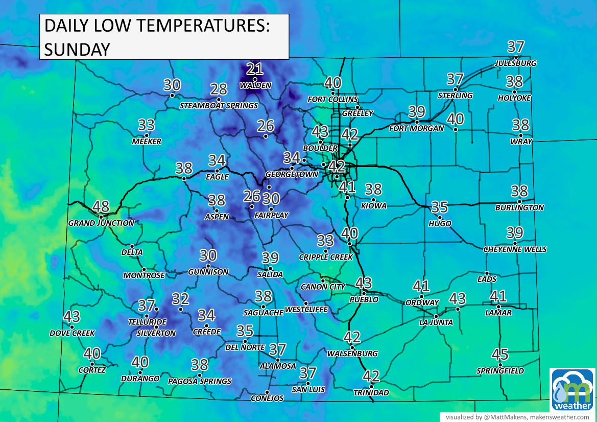
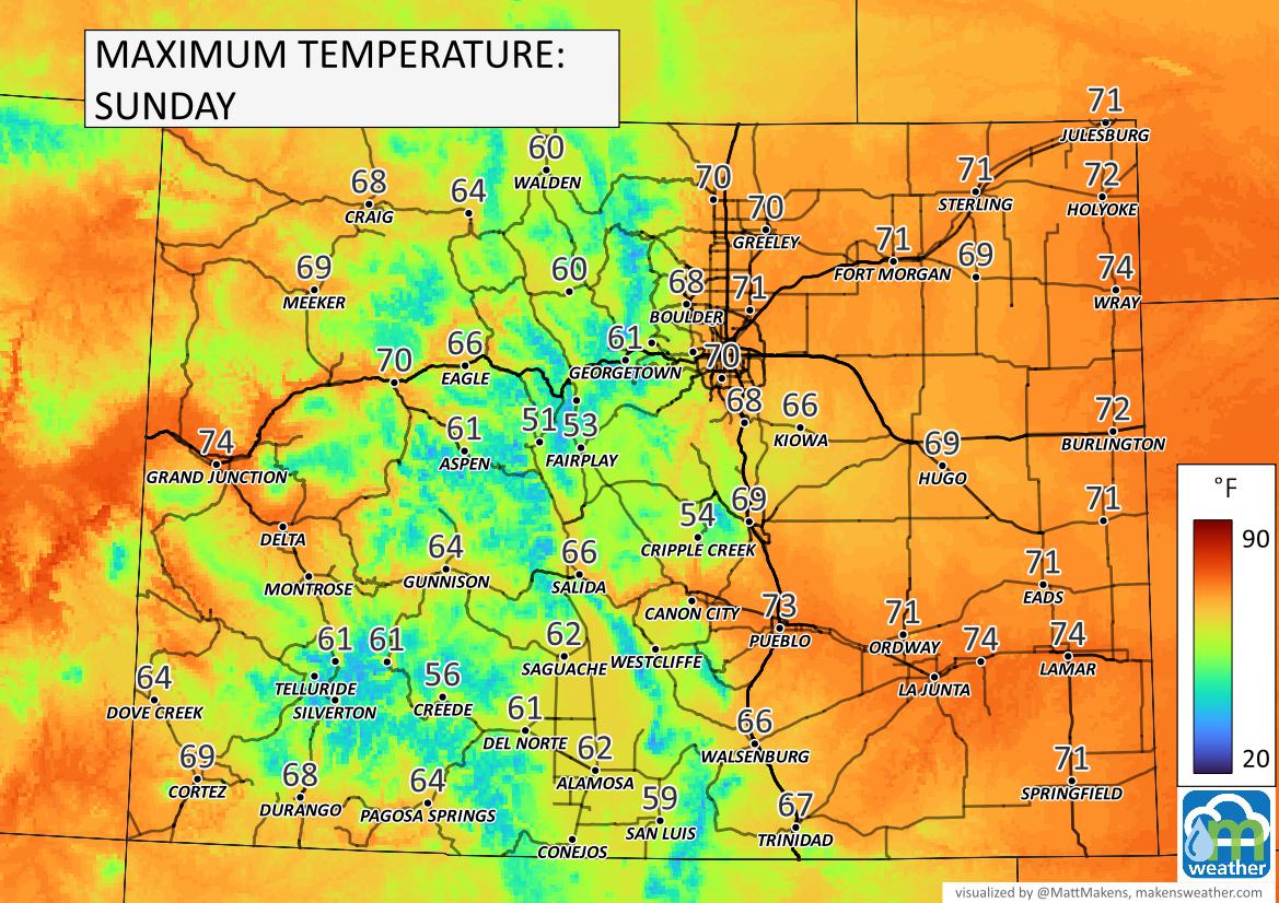
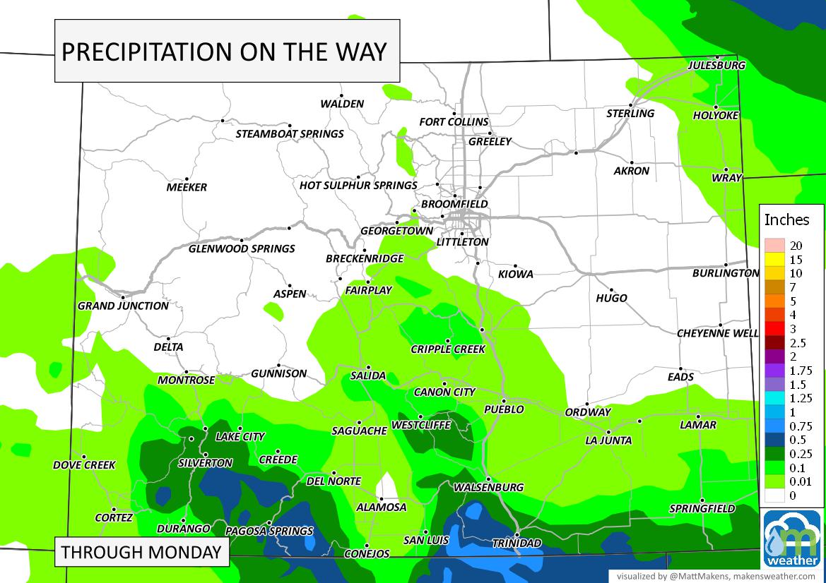
Although the focus of this post is on temperatures, let's take a quick look at precipitation. There will be areas of showers to move through the next few days, and here is the estimated precipitation totals from that activity.
In terms of snow, sure we will probably find some new snowfall on the peaks and perhaps a touch of flake activity east on the Plains:
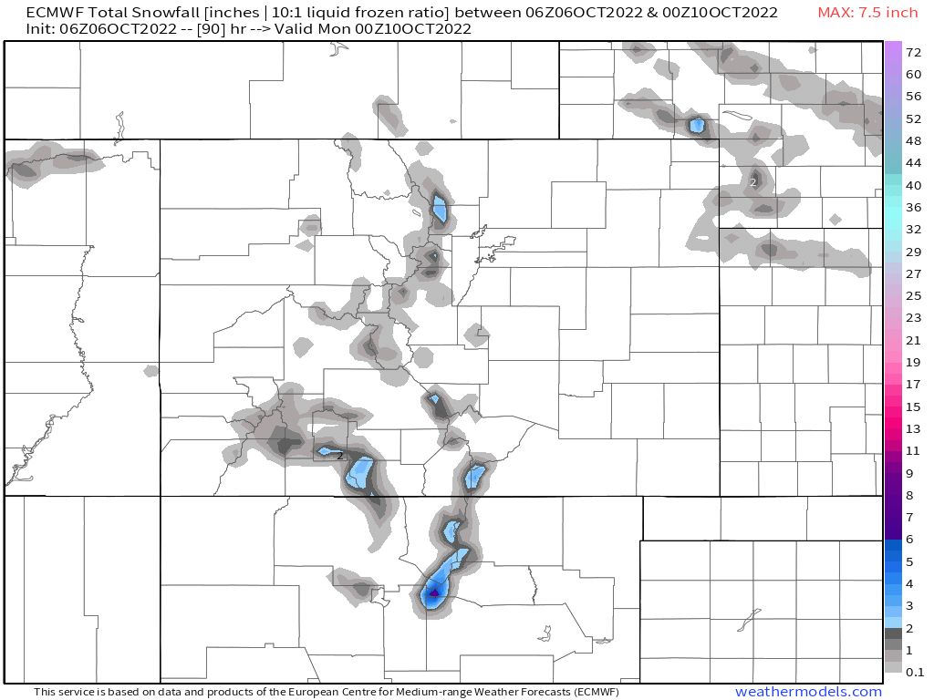
However, the impact of any snow is limited.
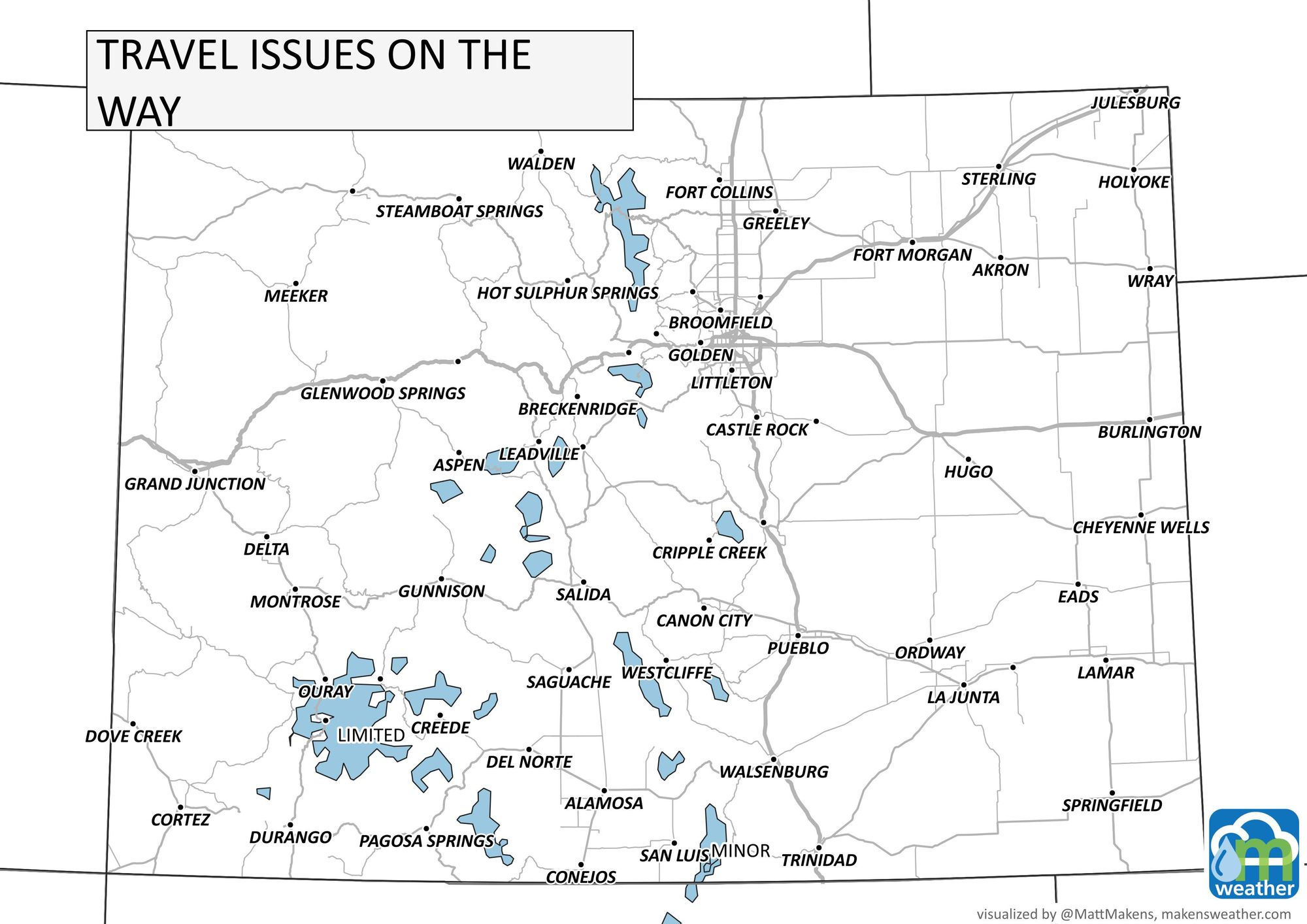
How does all of this impact Denver's weekend?
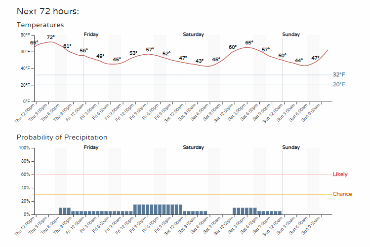
Well, low-end chances for showers but feeling fall-like for sure.
