Colorado weather set to turn dramatically colder; several inches of snow possible for Denver area

Good Wednesday morning to you all from the weather desk!
I suspect at this point everyone is about as prepared as they can be for the incoming cold and snow. The relatively mild (albeit windy) weather most of us see during the morning hours today will be quickly replaced Wednesday afternoon and evening by a sharp cold front and increased chance of snow.
Below is a quick recap on what to expect with regard to the incoming cold, and another look at our snowfall forecast before the flakes start to fly later today.
Bitter cold on the way
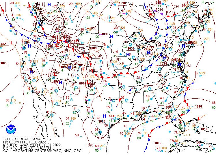
The latest surface analysis shows our cold front parked to our north across central Wyoming and western Montana:
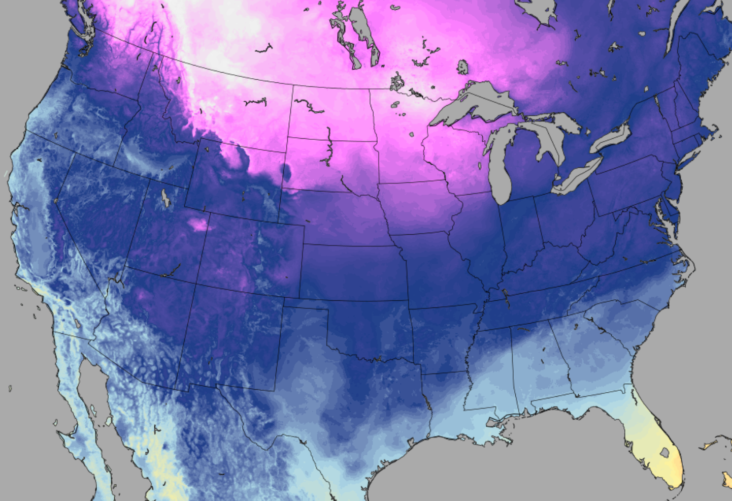
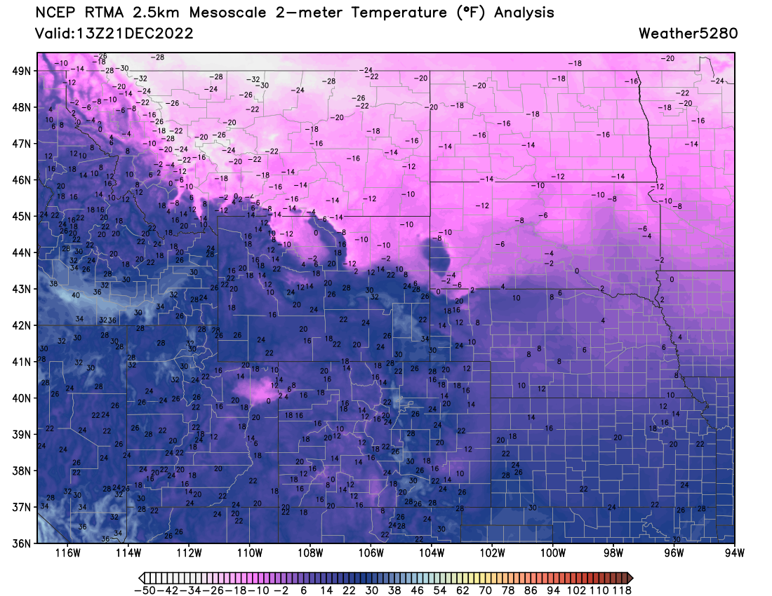
A look at surface temperatures from the last hour shows the front quite vividly, with temperatures some -15 to -30°F below zero across Montana, the Dakotas, and Minnesota this morning.
In the coming hours that front will start to move, and when it does... it'll drop south in a hurry.
Modeled temperatures for the upcoming 48 hours from the HRRR show just how dramatic today's cold front is likely to be along the Front Range and eastern plains when it finally moves through later today. Highs will climb into the mid to upper 40s (even some 50s across southeast Colorado) before temperatures crash behind the front tonight!
The wind and dangerous wind chills
Not all fronts that move bring a lot of wind with them. This one will. Winds will increase during the daytime hours across the greater metro area, with sustained winds of 20mph and gusts to 30mph forecast as the front moves in this evening.
The wind, in combination with the cold, will make things feel much (much) colder than what any temperature forecast will communicate. With that, a Wind Chill Warning goes into effect at 8pm tonight for Northeast Colorado, and extends through 11am Friday morning.
From the NWS in Boulder:
WIND CHILL WARNING REMAINS IN EFFECT FROM 8 PM THIS EVENING TO 11 AM MST FRIDAY...
* WHAT...Winds gusting as high as 45 mph. Dangerously cold wind chills as low as 50 below zero.
* WHERE... The Front Range foothills, Palmer Divide and adjacent plains.
* WHEN... Wind Chill Warning, from 8 PM this evening to 11 AM MST Friday.
* IMPACTS...Exposed skin may become quickly frostbitten or frozen. Wind chill values may fall to extremely dangerous levels. Plan on slippery road conditions. The hazardous conditions could impact the Wednesday evening and Thursday morning commutes. The dangerously cold wind chills could cause frostbite on exposed skin in as little as 5 minutes.
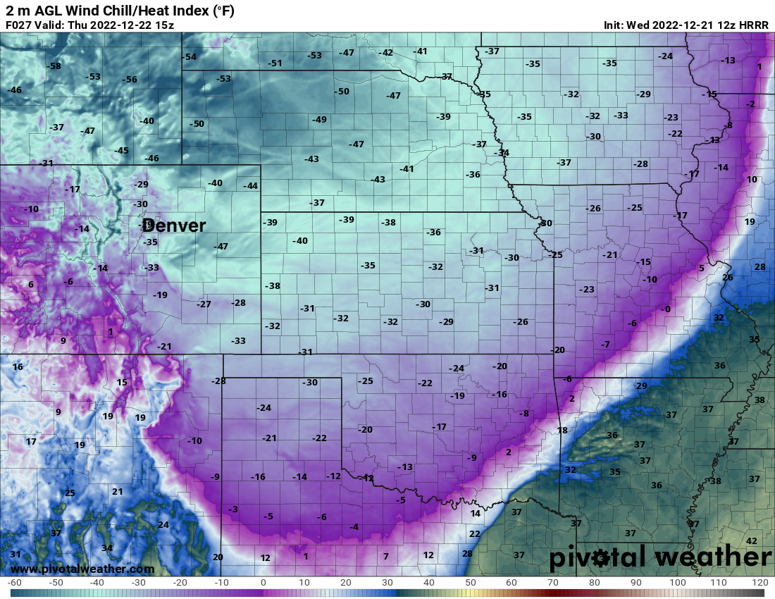
A snapshot of wind chill values forecast by the HRRR Thursday morning shows -30 to -50°F across Eastern Colorado, with wind chill values in excess of -50°F for our neighbors the the north. Wow!
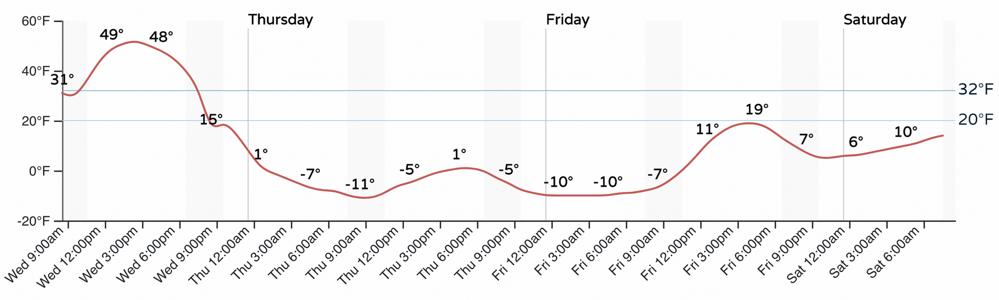
As for the timing of the front... it doesn't look all that different from our update yesterday, likely to move through the Denver area between 4pm and 7pm, and for northern Colorado a few hours prior to that. Here is the hourly temperature planner for Denver (that's a roughly 60°F temperature drop between this afternoon's highs and Thursday morning in Denver, but who's counting!):
Snowfall forecast
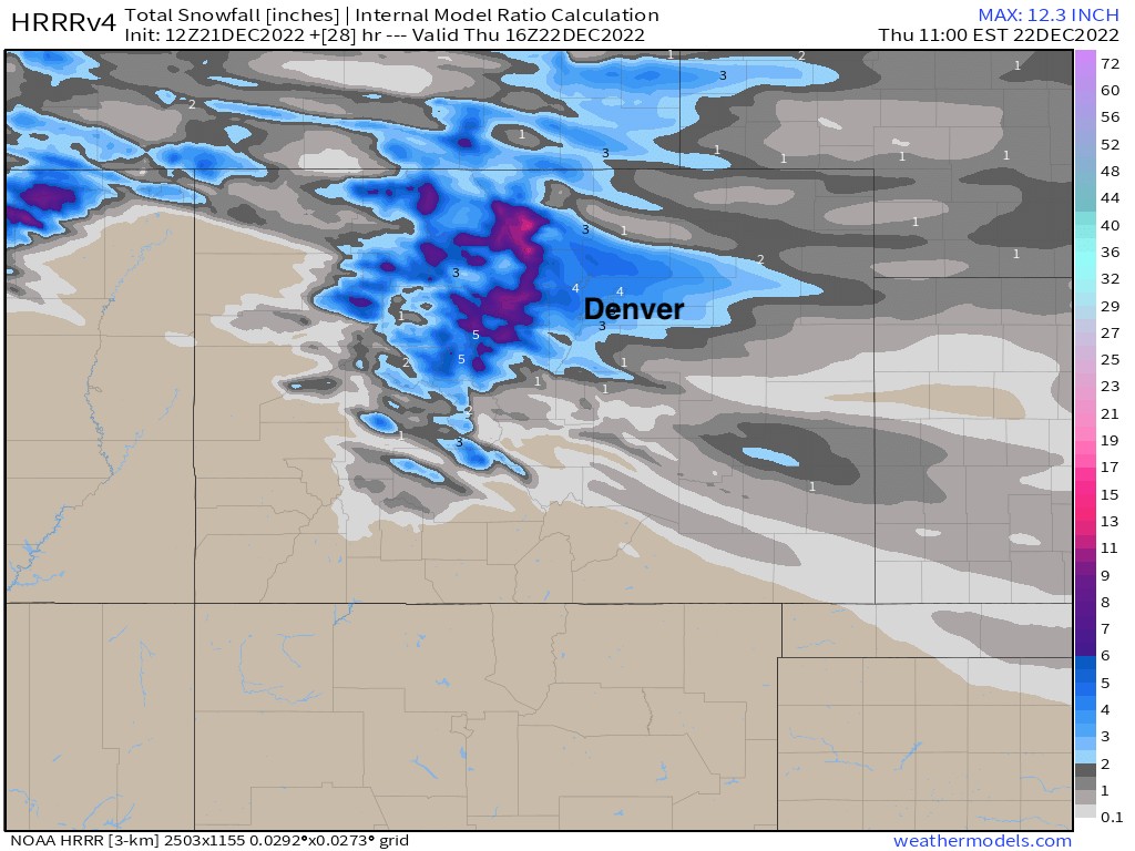
Snow gets going behind the front this evening, and for some of us several inches will be possible. Given the setup, and given the kind of cold we are talking, this won't be a big snow producer for everyone. The wildcard this evening is likely to be some jet-induced banded snowfall likely to setup somewhere along the urban corridor, under which we could see some good (fluffy!) snowfall pile up.
Whether you see 1" or 5" the impact will be more or less the same, as the wind and cold will make travel quite treacherous and ill-advised.
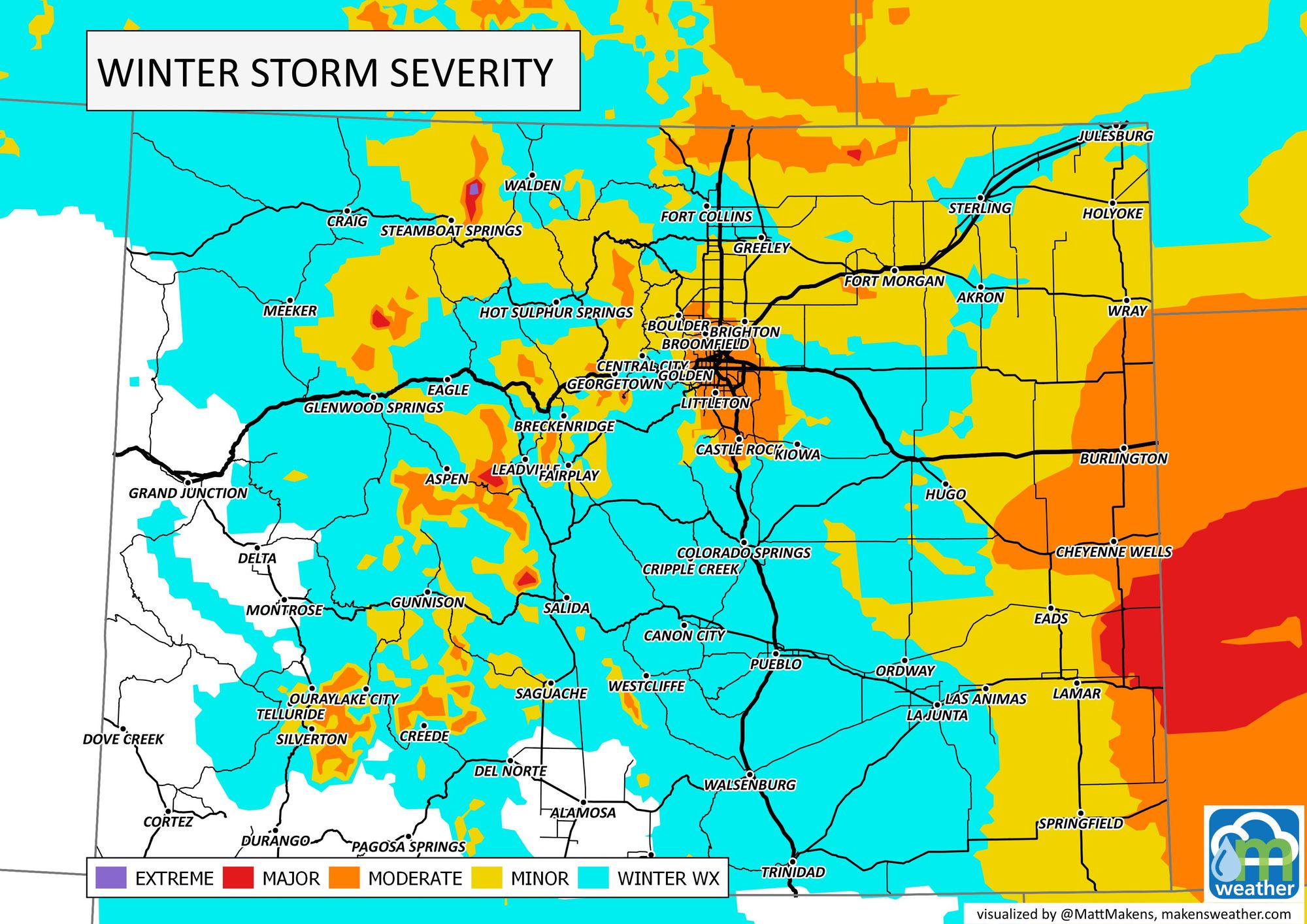
Here is the latest impact map for your Thursday morning, no fun!
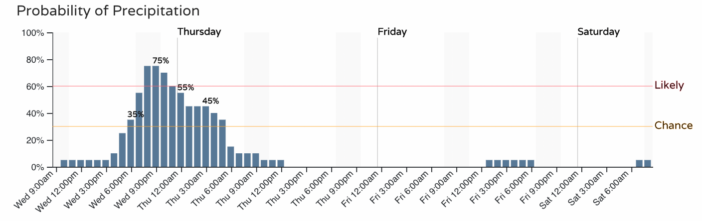
For Fort Collins, snow becomes likely by 6pm this evening (if not before). The best chance of snow should be wrapping up by midnight up north, with just flurries expected after midnight or so.
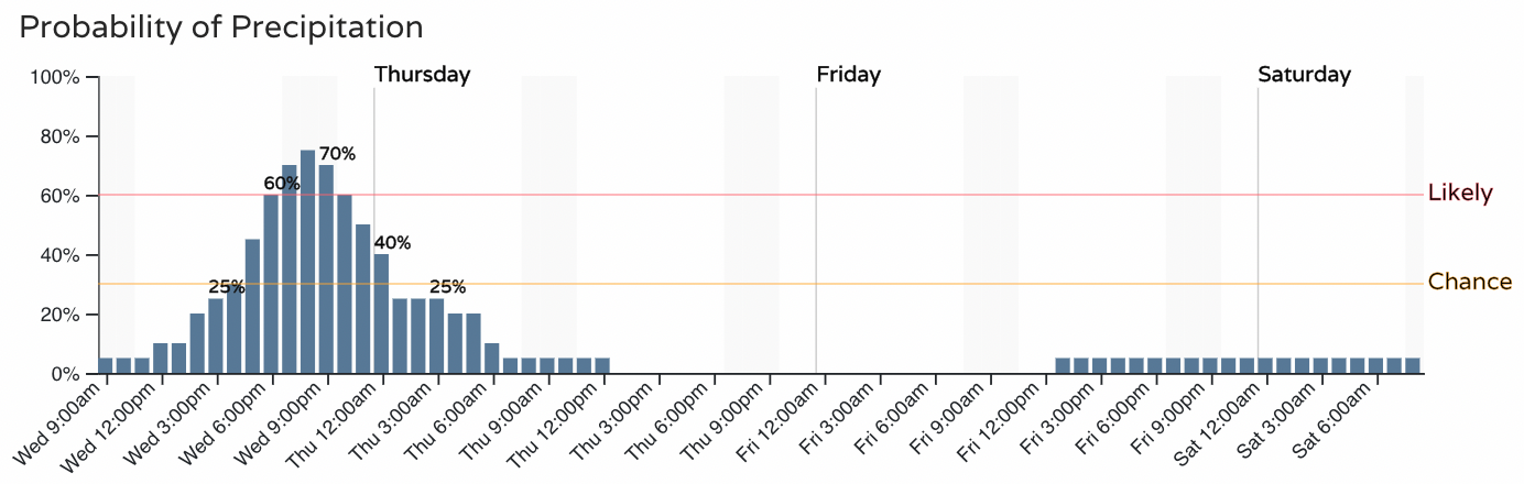
For the Denver metro area the chance ramps up after 7pm (again, could be sooner if the front arrives faster), with most of the snow falling between 7pm and 1am, before gradually coming to an end into Thursday morning.
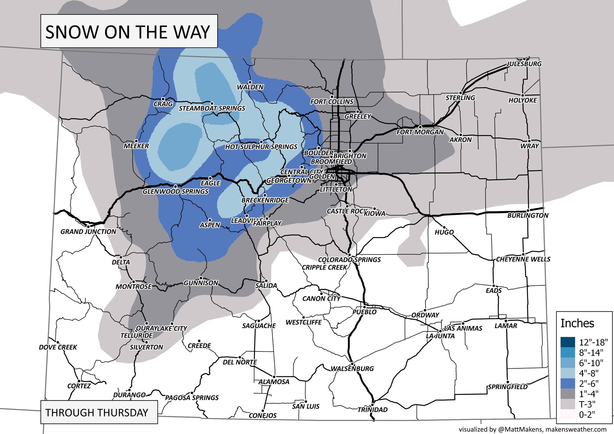
Until the expected band sets up this evening, it's hard to feel too confident with the snowfall forecast below – it'll definitely a case of the haves and have-nots.
Most guidance puts the band just to Denver's north, extending east/southeast from Boulder/Larimer Counties through southern Weld, Adams, and northern Arapahoe County. It's under this band that we could see some 4 to 6" snowfall totals. Again, the snow will be fluffy and wind-blown, so measuring will be challenging!
Outside of that band totals will range from a Trace to 3" of fluffy snow.
And below is the 3km NAM snowfall forecast showing just how narrow the band of heavier snowfall could end up being. A few miles north or south is all the difference between several inches of snow, and most a nothing-burger. (Not to be taken verbatim as the the below map shows 10:1 snowfall ratios and this snow will be much higher than that).
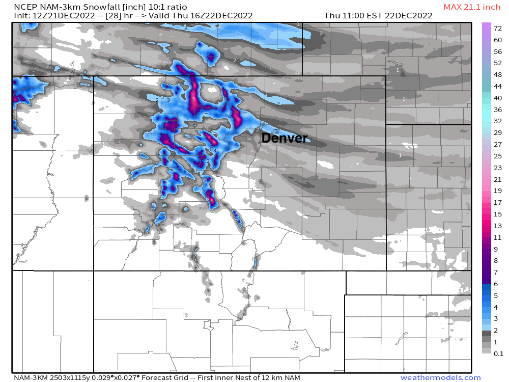
Needless say if that band ends up over Denver/Boulder the snow will be far more impactful to a lot more folks, if it ends up squeezed between Denver and Fort Collins, those cities will be left wondering where all the snow is. Time will tell.
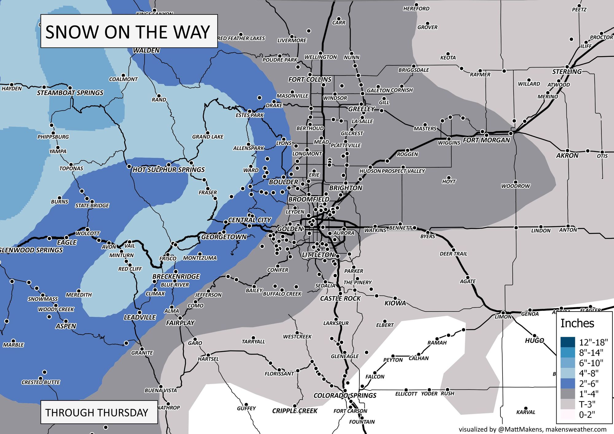
Here's our snowfall forecast:
- Fort Collins: 1 - 4"
- Greeley: 1 - 4"
- Loveland: 1 - 4"
- Boulder: 2 - 6"
- North Denver: 1 - 4"
- South Denver: T - 3"
- Palmer Divide: T - 3"
- Colorado Springs: T - 2"
And our latest snowfall forecast map:
Let us know how much snow you see, and bundle up!
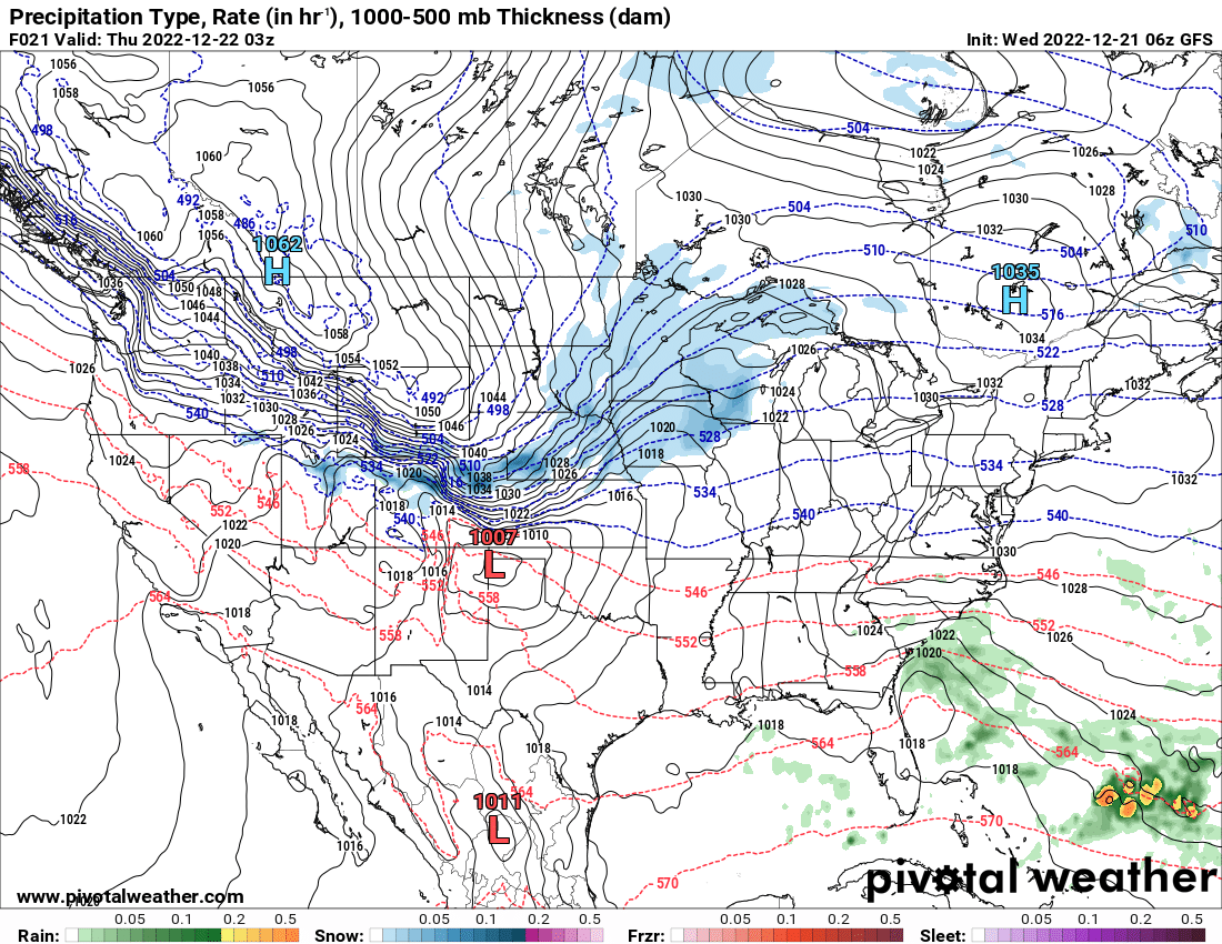
Finally, if you are traveling and need to plan ahead, here's a national forecast for the days ahead.