Denver weather: Snow chance increases Wednesday, timing and totals

There's a quick wave that will pass through the region Tuesday through Wednesday and this will deliver some rain, snow and a drop in temperatures from Wednesday into Thursday.
Let's begin by setting the stage with the hourly planner for Denver, which shows both temperatures and shower chances.
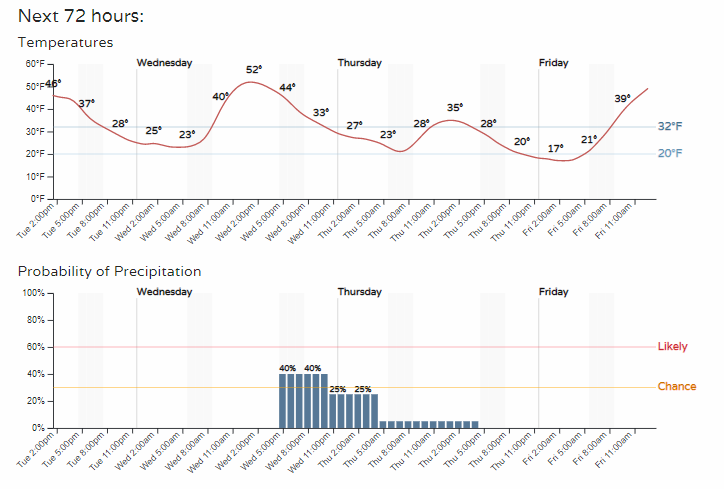
Considering the warmth during the initial chances for some precipitation, rain is possible to kick things off before snow as temperatures drop into the evening.
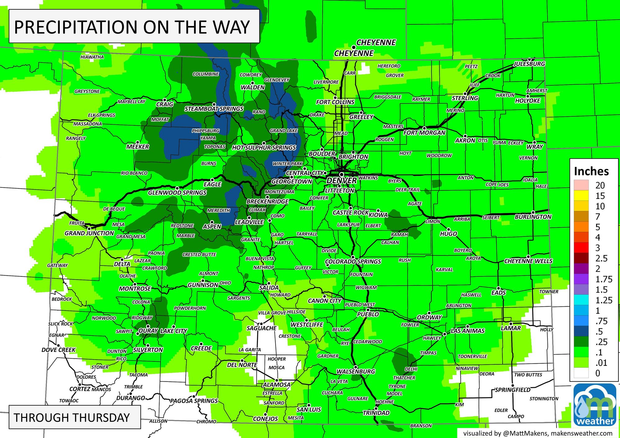
We aren't talking about a lot of moisture in either case, and IF you actually catch a shower or two, odds are it'll be less than 0.10". There are some isolated 0.1 to 0.5" totals here and there other than the northern mountains. Here's the total potential water to come through.
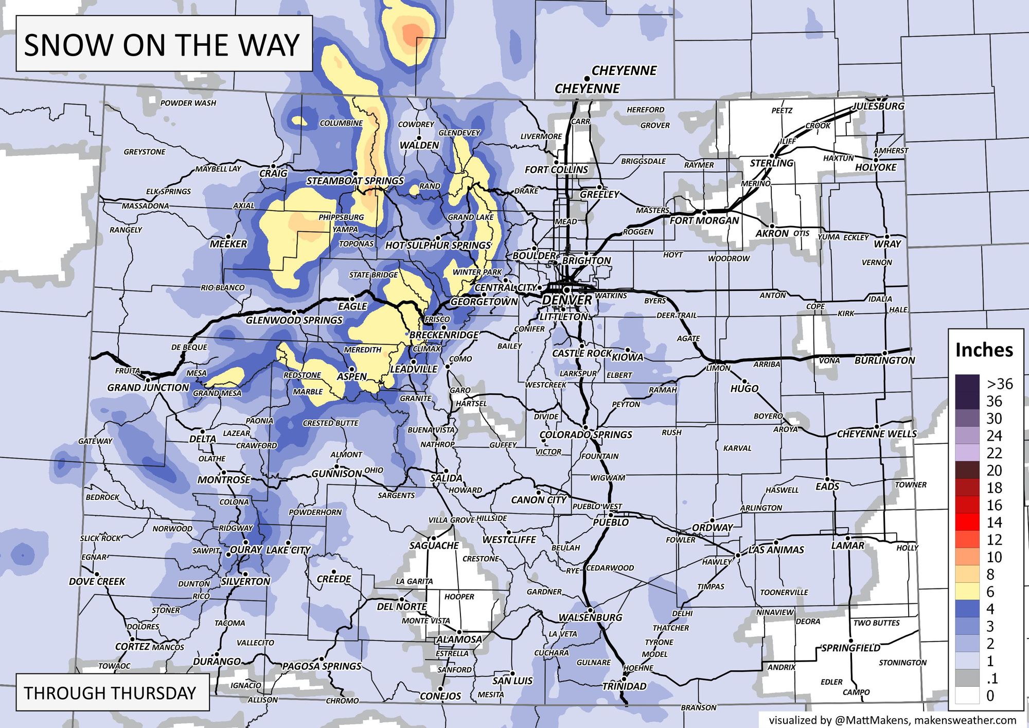
Just in terms of snowfall, we have:
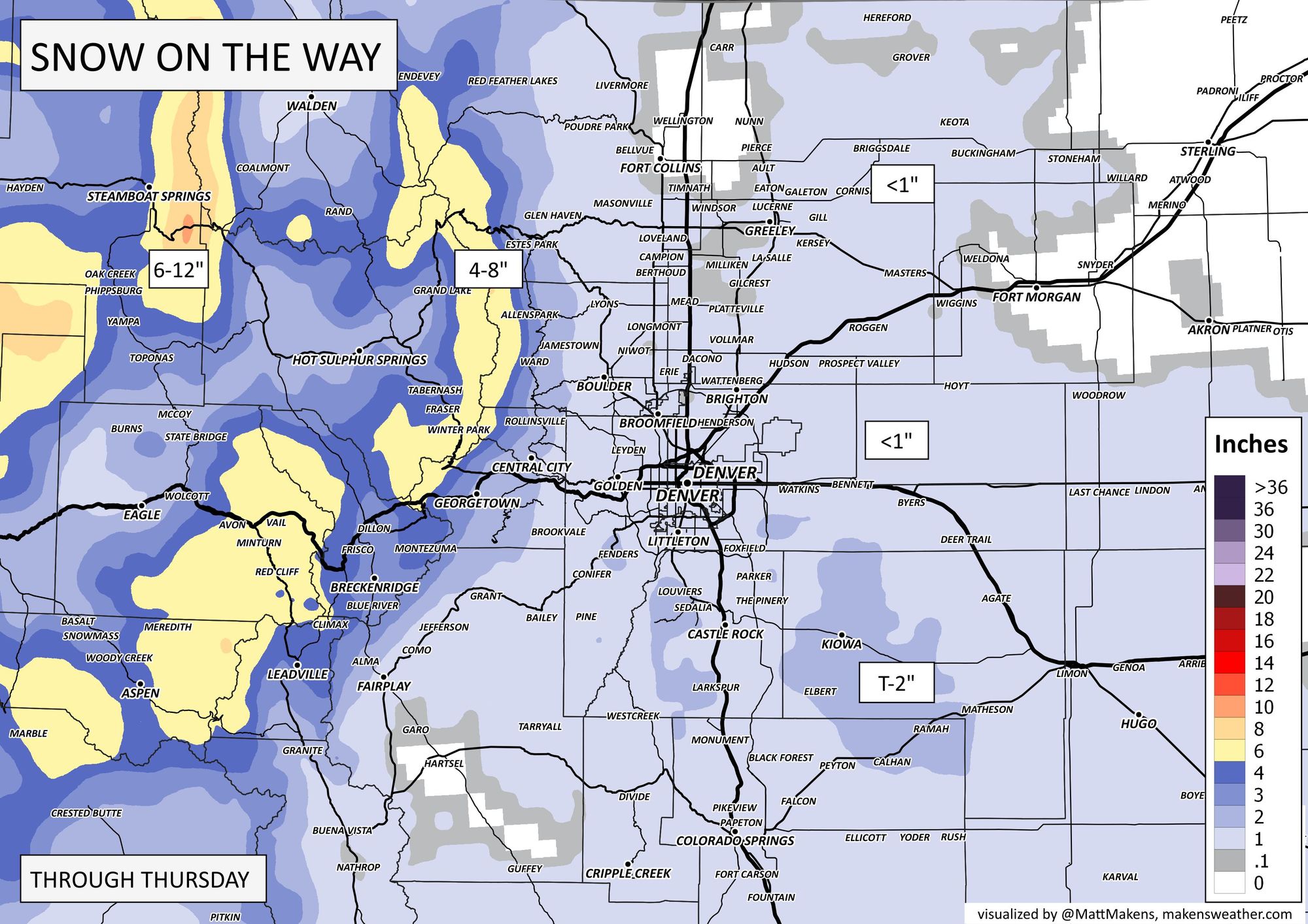
And, I'll zoom that map into the Front Range.

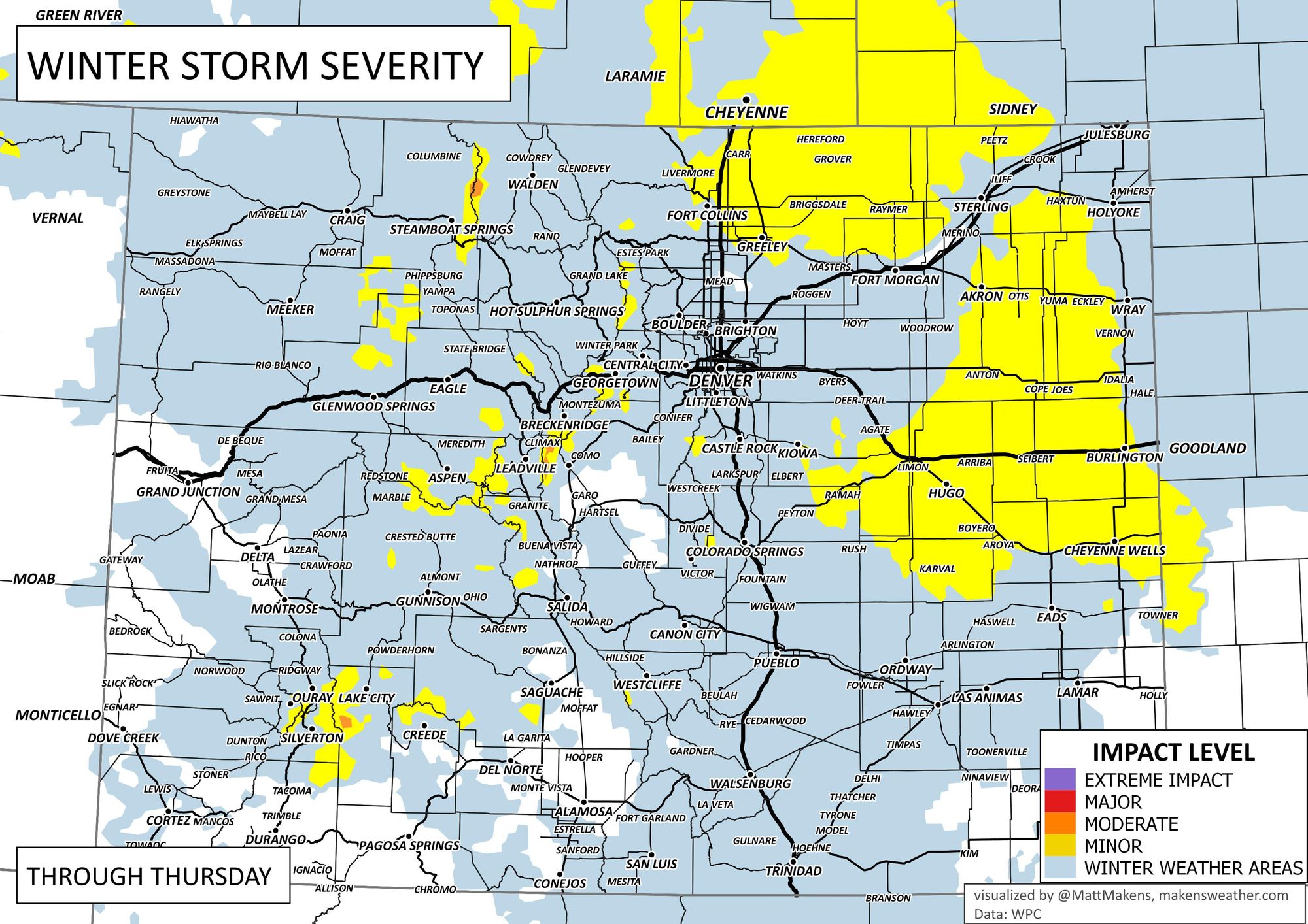
Boil this down into a total impact on a relative scale, we have:
Beyond this chance, it remains relatively quiet until later this weekend. Plus, there are some systems to watch out for next week, too, especially for anyone with agricultural interests. I discuss the threat to cattle/livestock producers, click here, or click on "watch on YouTube" below on this thumbnail.
Keep us posted with conditions at your location by entering comments below, and don't get left out in the cold – subscribe to our email list today – it's free, and we just send you an email when there's important information to deliver.
