As spring starts, classic Colorado weather kicks the season off

Astronomical Spring starts today, and it will have a "springy-vibe" across the state with rain and snow chances, including parts of the Denver area. Over the weekend we talked about the slow March weather for the city, which does continue for a couple more days at least.
First off, let's look at temperatures and the precipitation timeline.
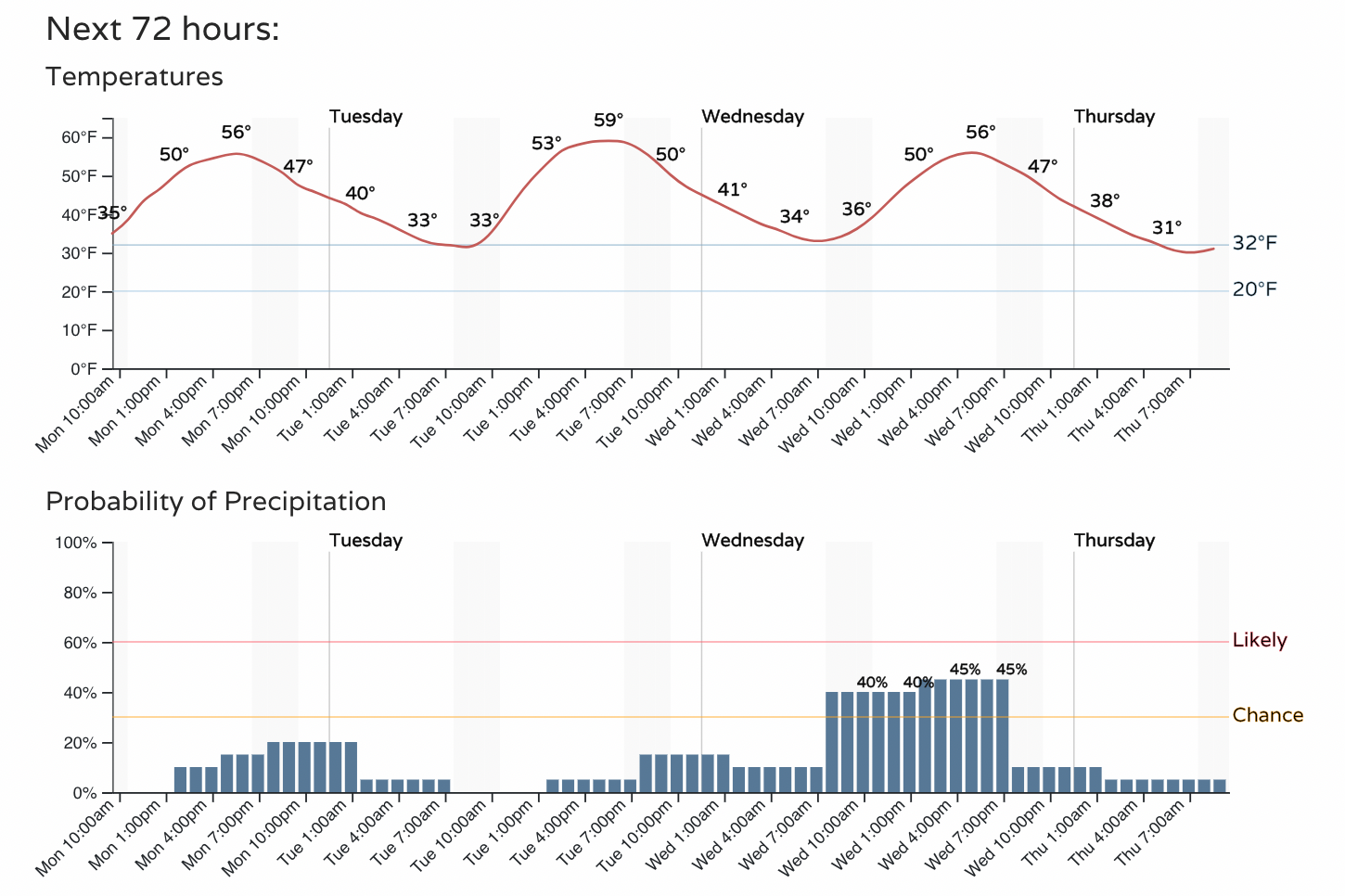
You'll see warmth, but also lower-end chances for some moisture in the next few days; more likely rain than snow in the metro area.
Next, let's watch a timeline of the projected radar picture to show you where and when the showers will be.
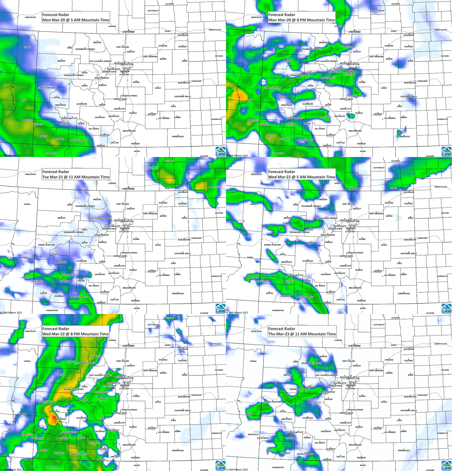
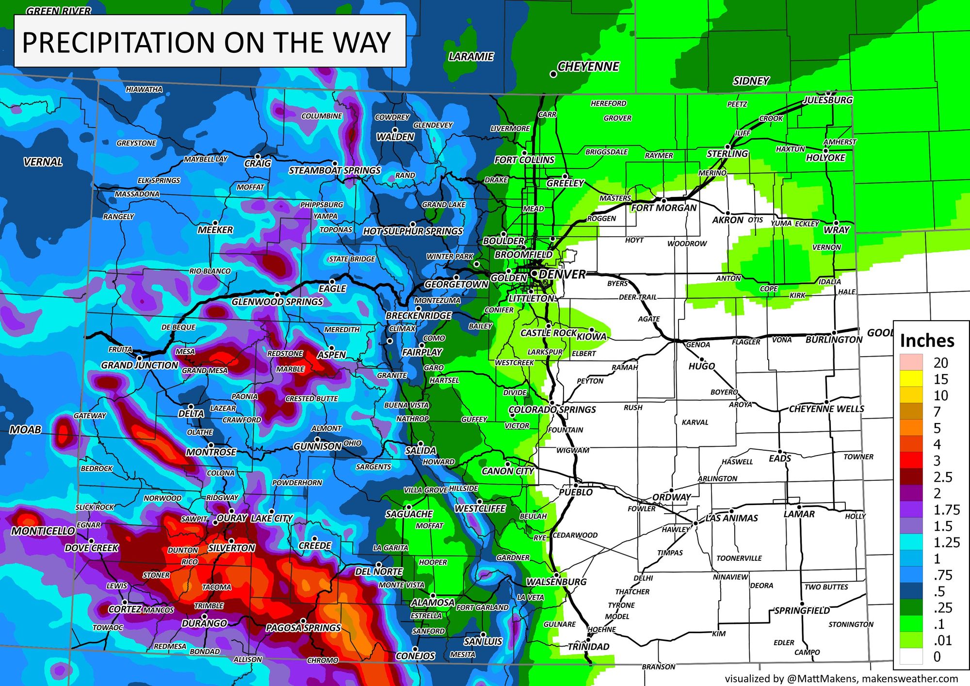
No, nothing crazy for the metro areas, but some of us will see showers and the higher folks could have some snow - like around Castle Rock. Here's a look at the total water coming through.
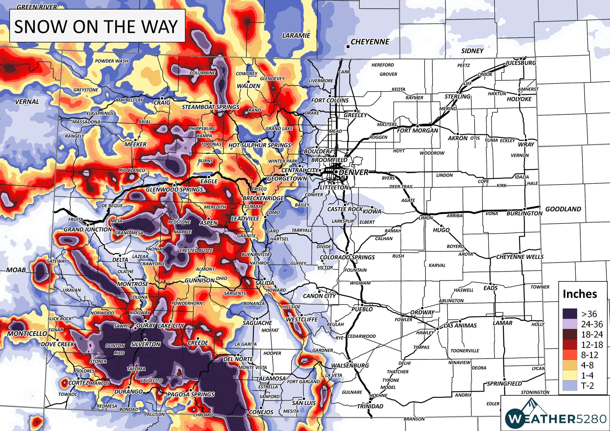
And now a look at snowfall potential.

The mountains though, especially the San Juans in the southwest, will have some crazy good snow the next few days. There are some that will near four feet of fresh in the next few days!
The high country does have alerts posted for travelers/residents due to the impact coming with this moisture.
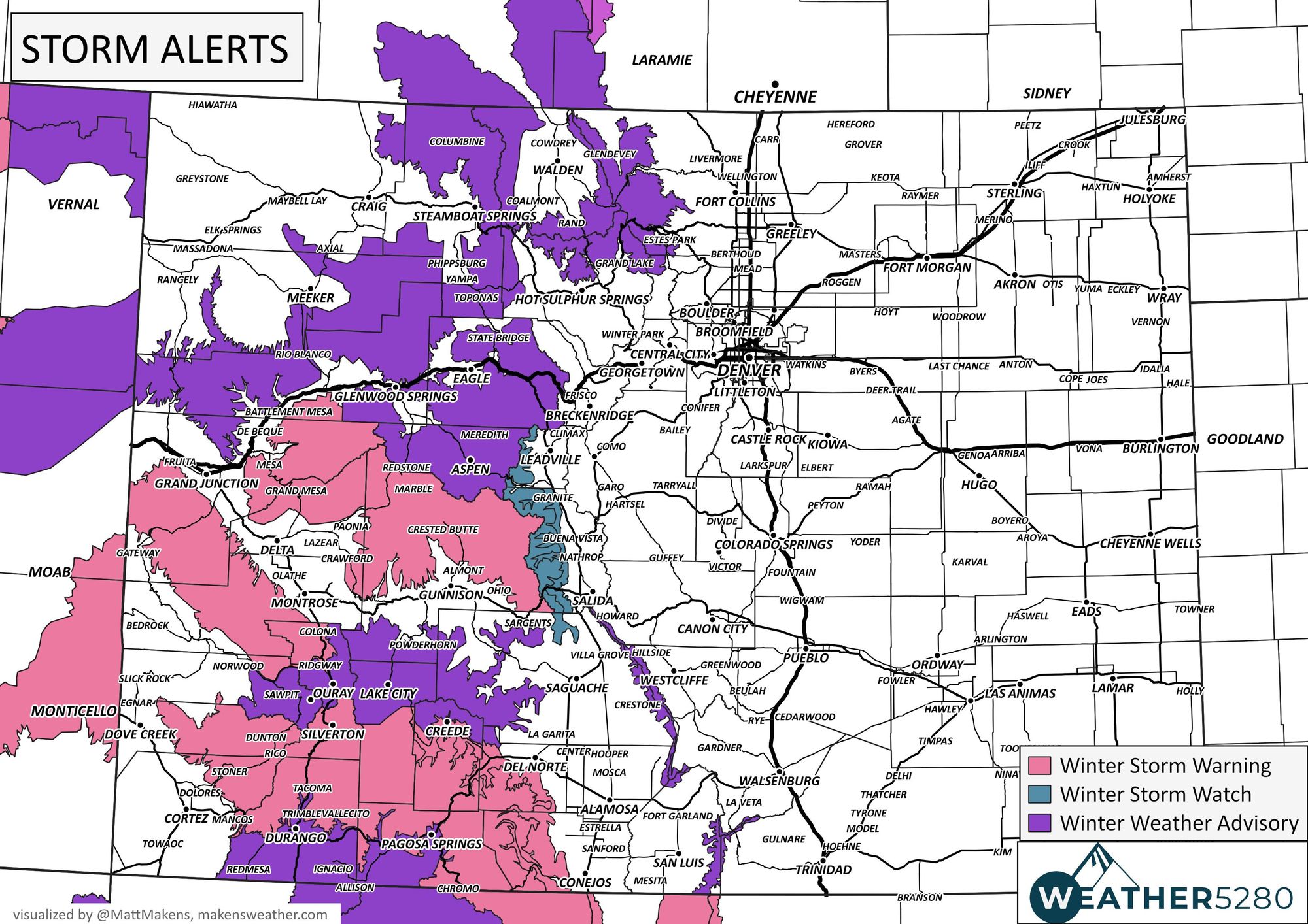
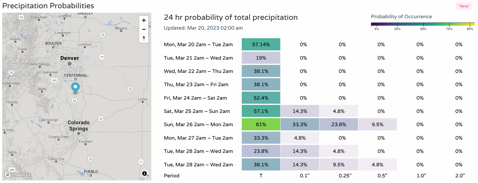
No alerts are this time for Denver and the Front Range, but we do have some moisture on tap this week. Albeit, the totals are low for what we classically think of happening in March. A spring-like week is ahead though, with some higher chances for moisture in the days ahead. Here's a look at daily chances.
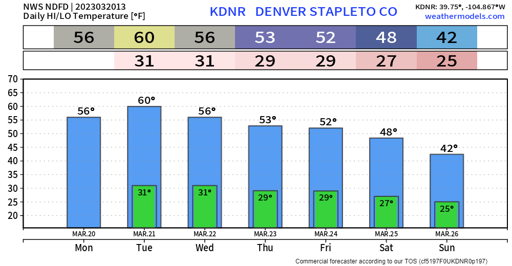
As far as temperatures, we have some early week warmth, then cool it down as the weather gets more and more unsettled into the late week and the weekend (when we see some of our chances for rain and snow increase).
Some bigtime storms have happened this time of the year, don't be left out on knowing when – subscribe to our email list today – we send you an email when there's important information and Colorado forecasts to deliver.
