
Colorado Forecast: Wet weather to hit this week, snow included

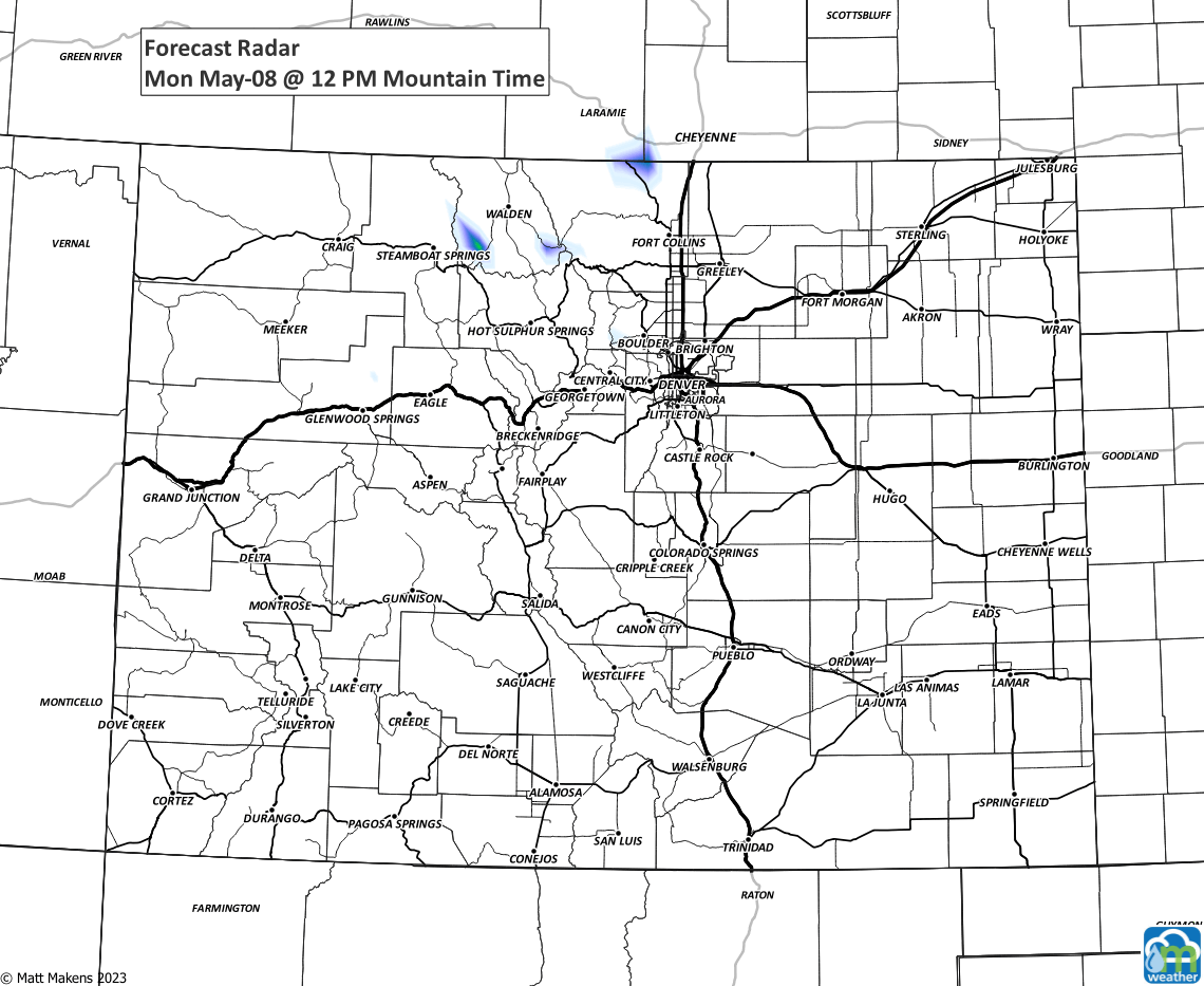
Denver and the state have an active weather week ahead! A system is slowly churning over the southwestern U.S. and will drift over Colorado by the midweek to give us healthy chances for heavy rainfall and snowfall to the mountains.
Let's track the changes with the hourly planner for Denver first off.
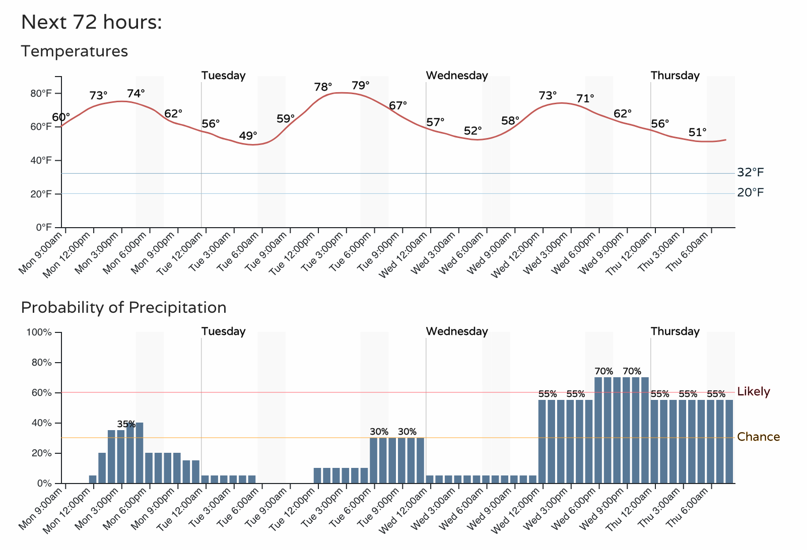
There are chances for thunderstorms Monday and Tuesday before we see a marked increase in the rainfall chances later Wednesday into Thursday.
Let's see the total precipitation we may be talking about with this week's storminess.
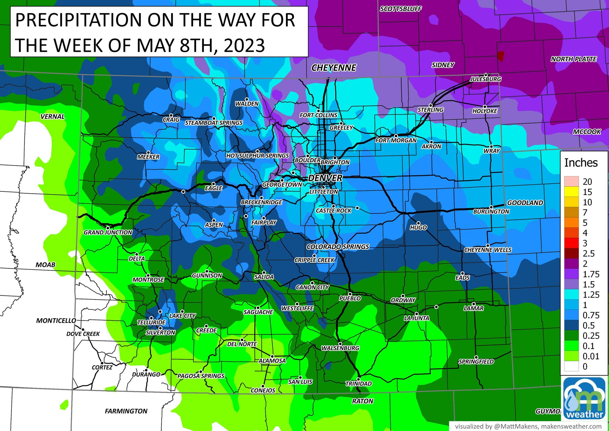
Parts of Northern Colorado have the potential for more than 2" and Denver sits in a reasonable chance for an inch or so.
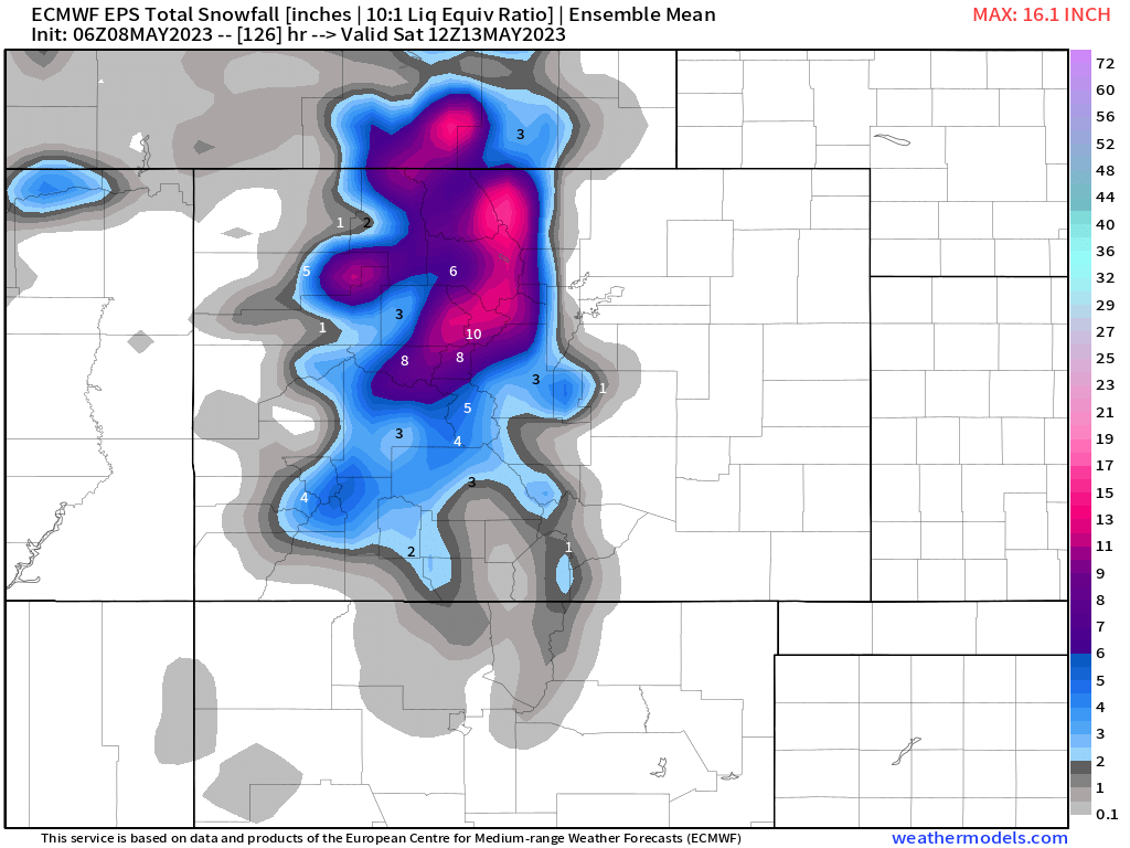
For the mountains, from Wednesday night through Thursday there will be areas of snow, but we are unlikely to see the snow level drop into the city this time. The Palmer Divide and foothills from Golden to Boulder and West Fort Collins have a hint of a chance to get some snow.
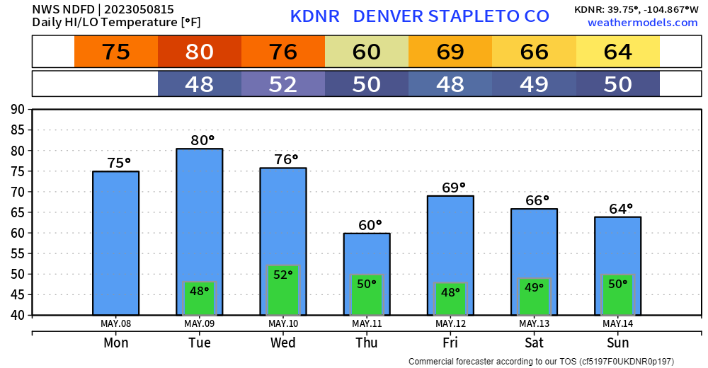
For the greater metro area, considering the increase in rain chances, temperatures will be cool, especially Thursday. But, not cold enough for snow - at least as it appears at this time - for Denver or Colorado Springs.
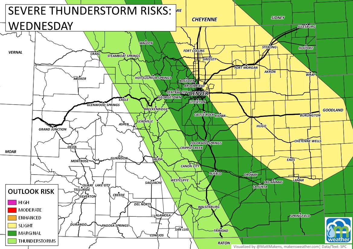
The warmth leading into this system is one ingredient to increase the chances for severe/damaging thunderstorms. Wednesday is a day to keep an eye out and to keep the car in the garage.
Bottom line: A strong sytem will drift over the state in a few days to give most of us a dose of wet weather and cooler temperatures. Beware of damaging thunderstorms and you may have to alter your plans a bit to dodge the heaviest rains.
Making your plans early? The weekend appears to be unsettled with additional chances for showers and storms with cooler than normal temperatures.