Tornado watch issued in Colorado, includes Denver and Colorado Springs

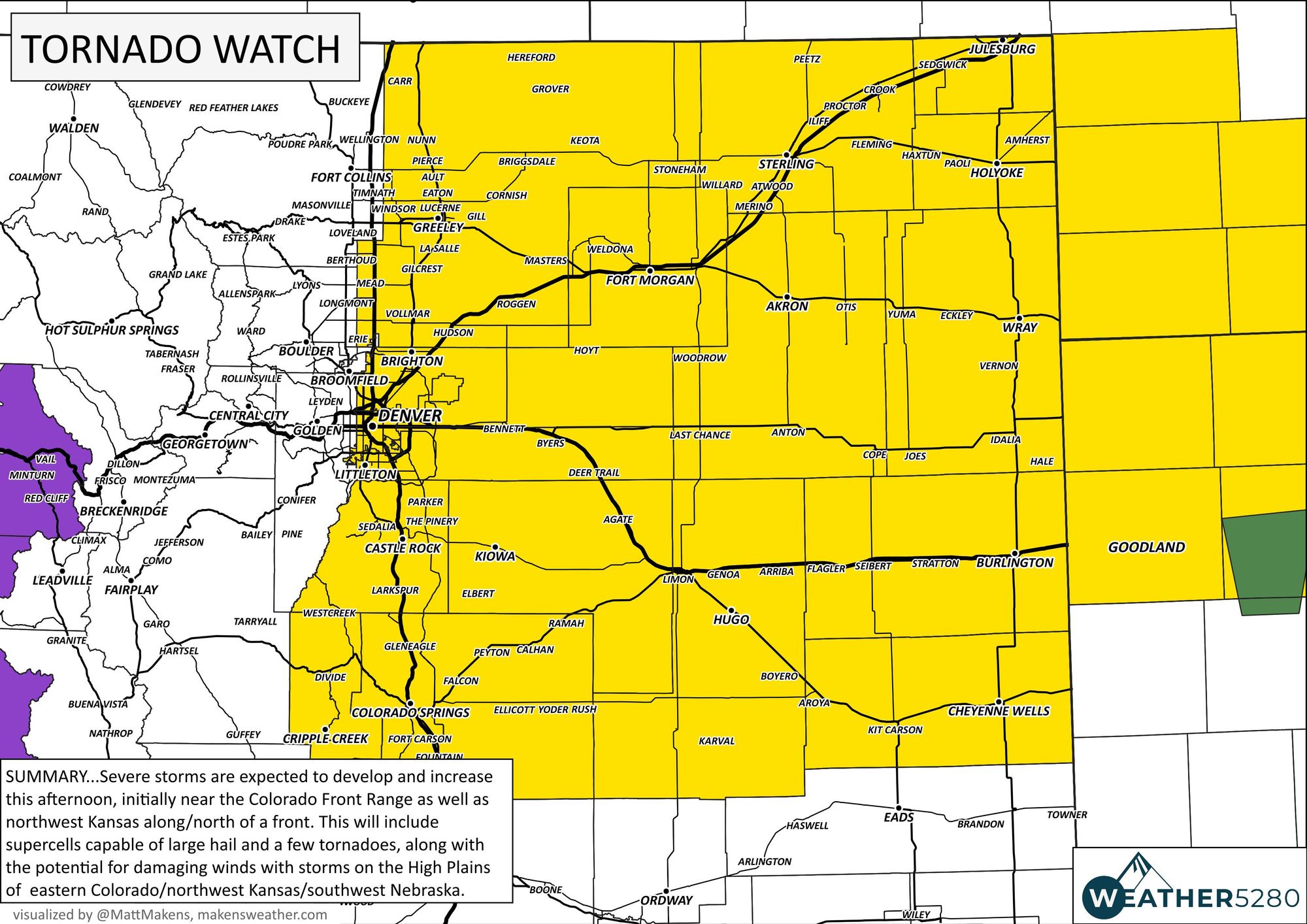
A tornado watch has been issued for parts of Northeastern Colorado including the Denver metro area and Colorado Springs due to the increased threat that afternoon and evening thunderstorms will be strong enough to produce tornadoes in addition to large hail.
The official watch area is as follows with the threat lasting through Wednesday evening:

The storms began to fire up after the sky cleared a bit and the instability increased with the heating of the day.
T’storms firing up over Douglas and El Paso Counties, headed north toward the Denver metro area #cowx pic.twitter.com/mJlLKMyPtX
— Matt Makens (@MattMakens) May 10, 2023
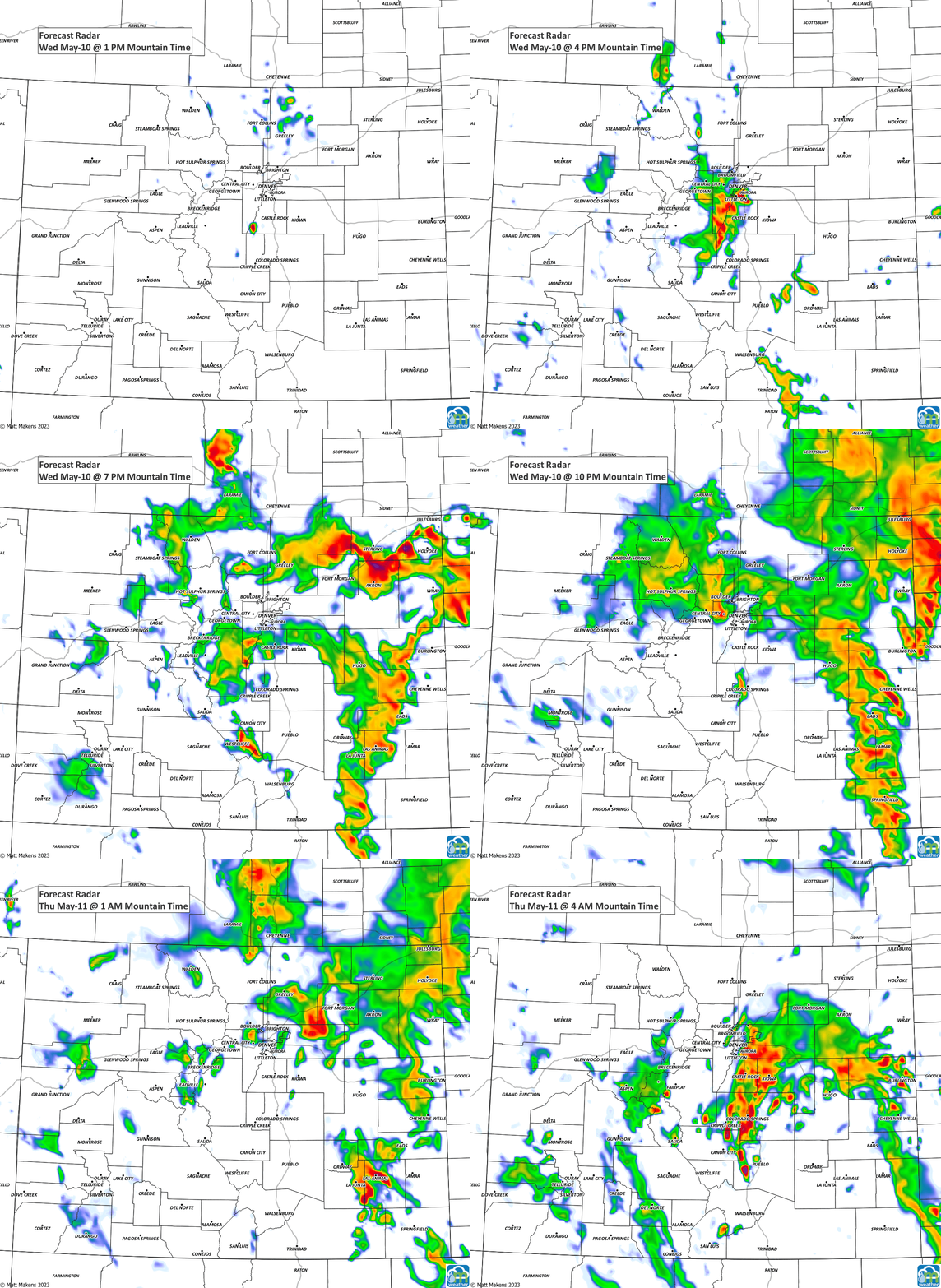
Here's a forecast of the radar picture as we go through the night.

Be prepared for an active several hours across the area. Keep an eye to the sky, get those cars under cover, make alternate plans for the kids pickup and after school sports, etc.
Please refer to previous postings about the detailed outlook beyond today, including the wet weather on tap for tomorrow.

