Colorado Weather: Golf ball size hail part of today and tomorrow's severe thunderstorms

Storms will fire up along the Front Range, pass over the Denver metro area, and onto the plains throughout the afternoon and evening. With Tuesday's thunderstorms comes a risk of damaging hail, golf ball size potentially, damaging wind and heavy rainfall.
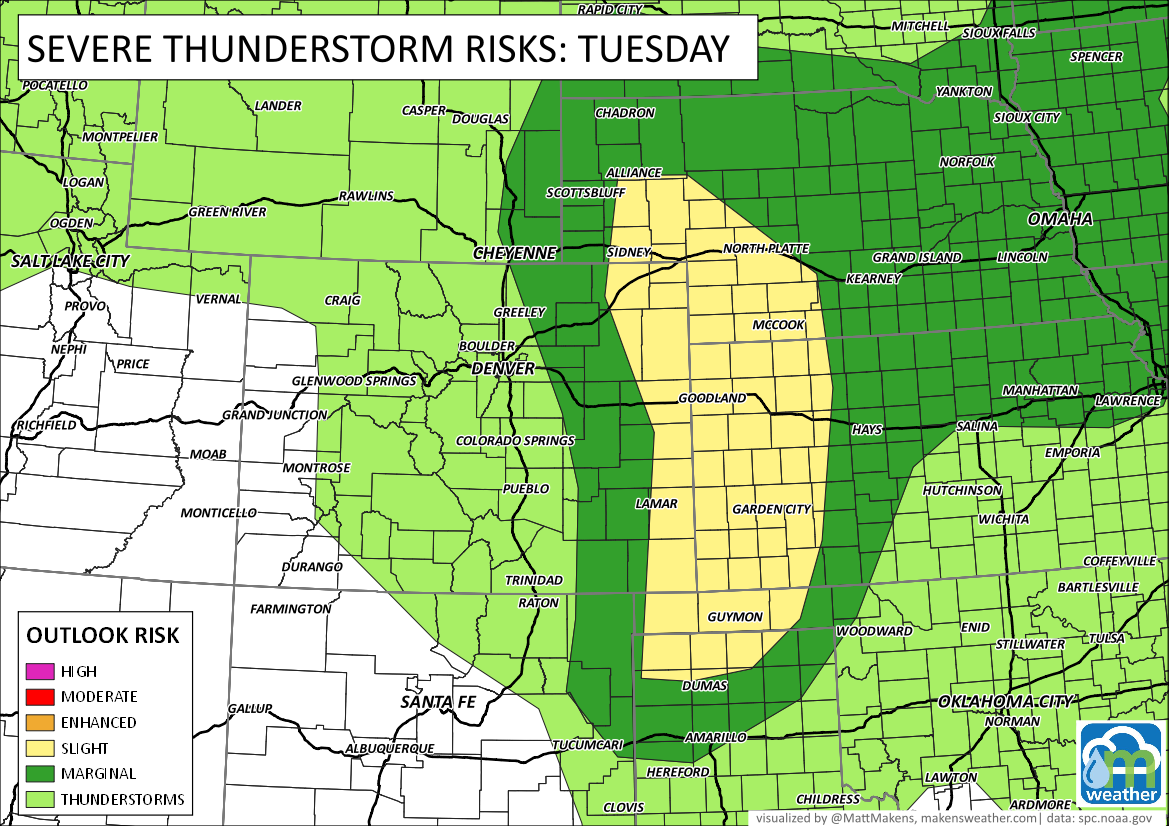
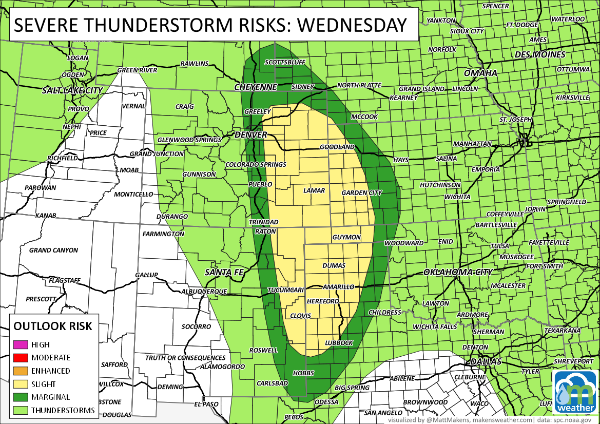
UPDATED 10:45 am to change the severe weather outlook graphic for Tuesday, the threat has increased.
The overall risk areas for Tuesday are shown here, with the highest risk being the farthest eastern areas of Colorado.
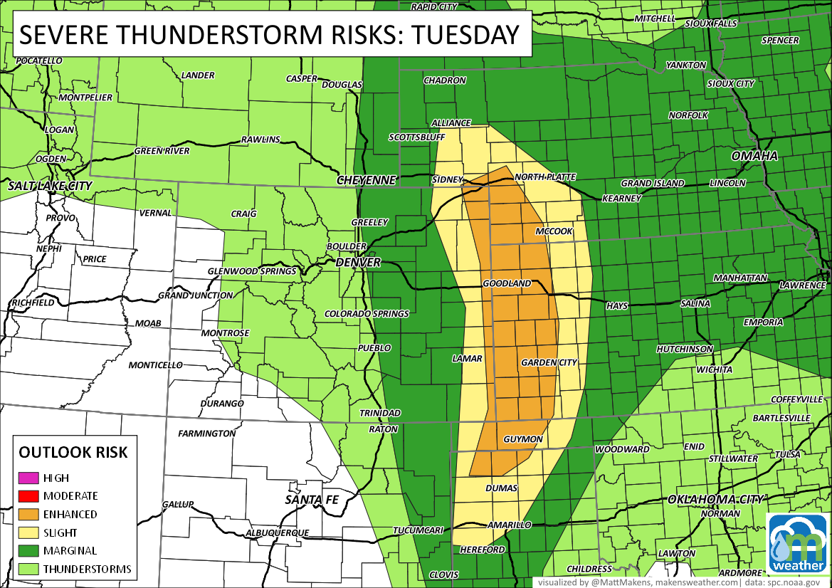
Although the risks for damaging hail grow along I-25 and east of, the potential for the strongest wind gusts, approaching 80 mph, will be along the Kansas and Nebraska state lines.
Here's a rough timeline of the storminess today:
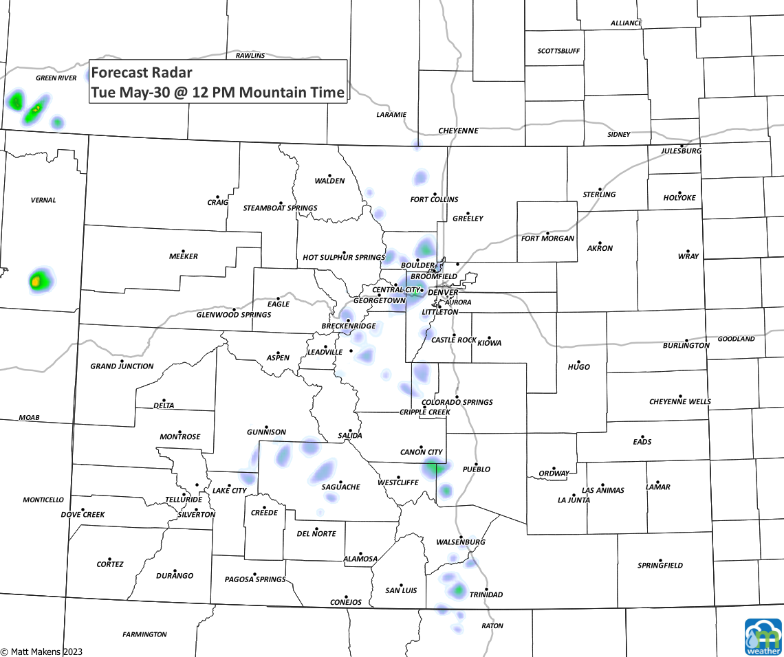
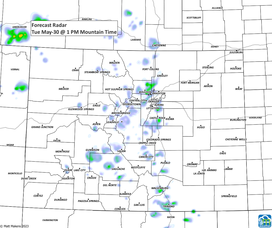
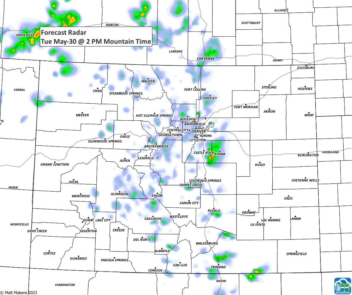
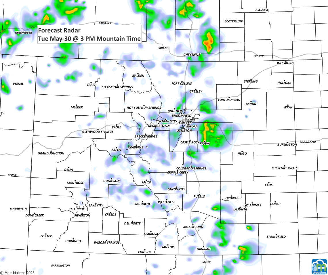
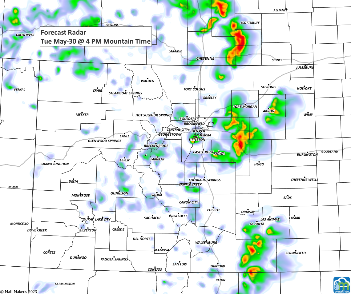
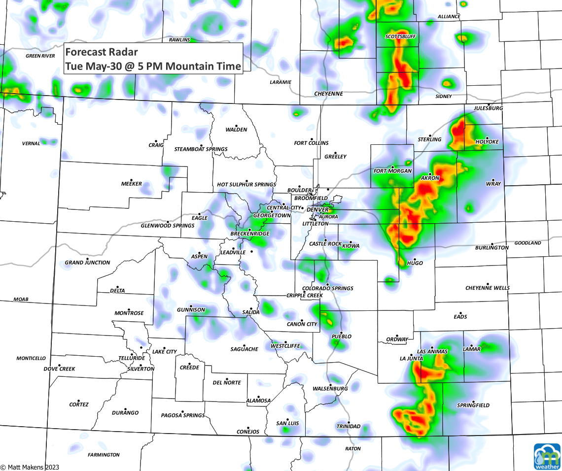
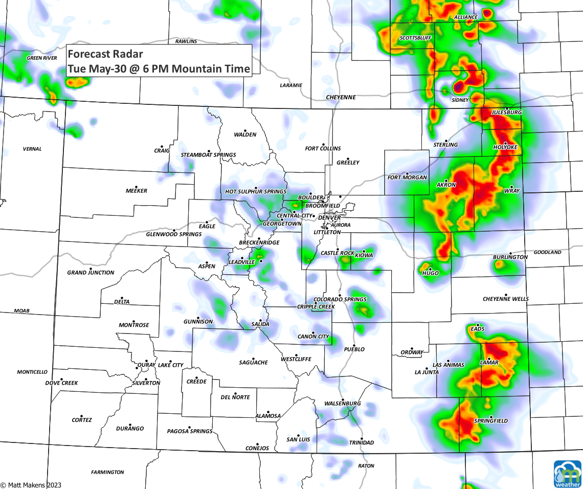
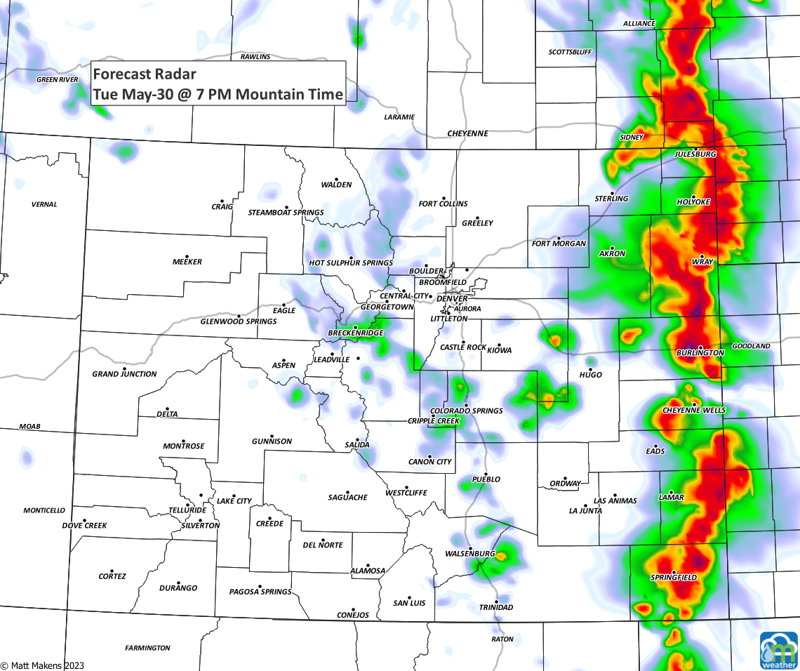
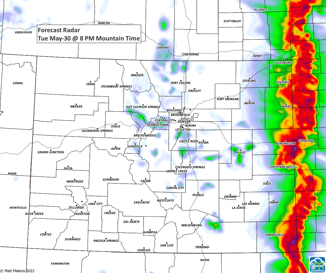
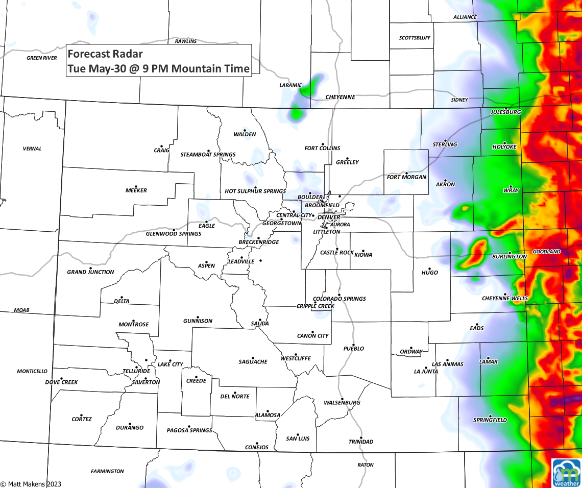
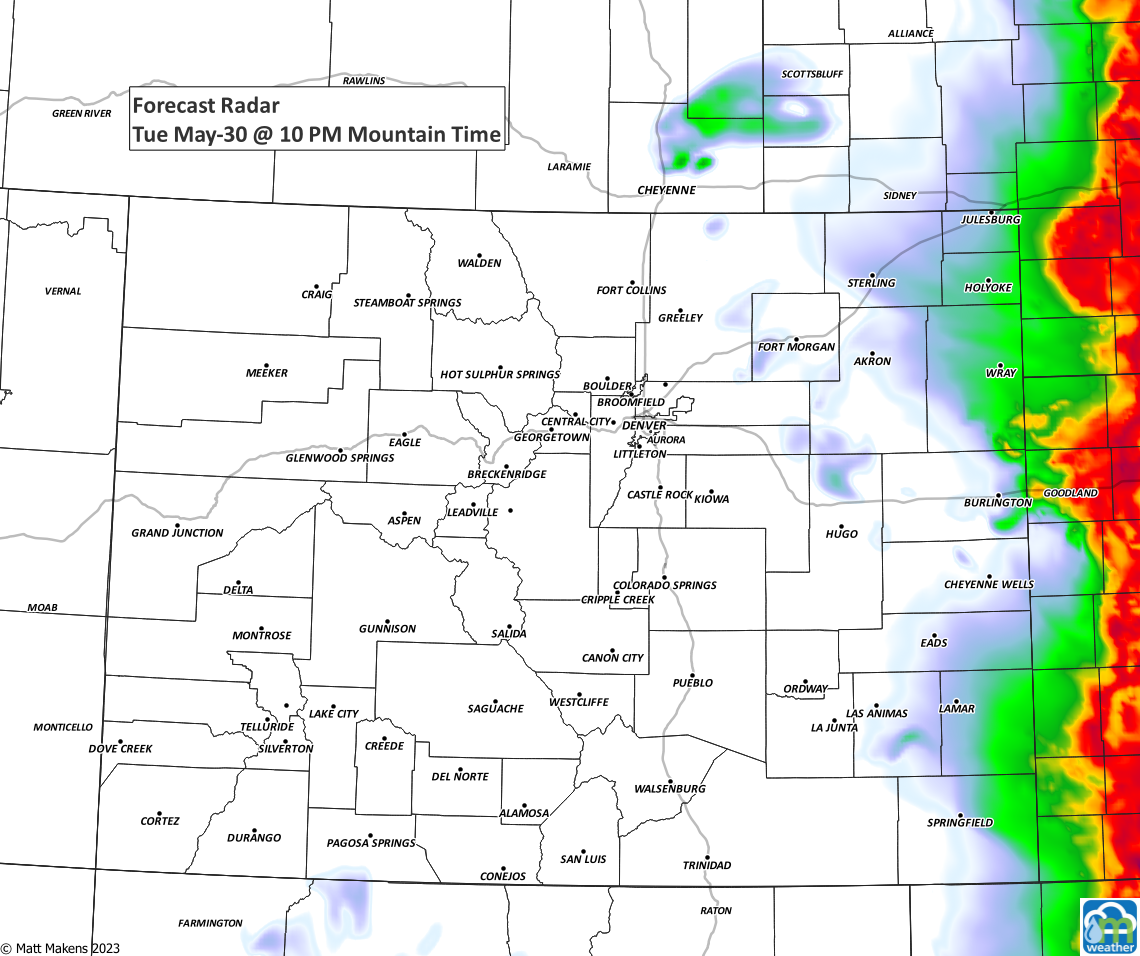
As those images show, the number of storms near the cities is limited today, but the risk for damaging weather increases for metro areas and plains Wednesday.
The risk for damaging storms in terms of hail and wind decreases Thursday through Saturday, however, the risk of heavy rain leading to some flash flooding is increased to end the week.
Stay weather aware! If you'd like to be getting the "heads up, hey there is a forecast to be aware of"' style emails from us, you can sign up for those for free by clicking here.