Denver Weather: Your risk of seeing severe weather today

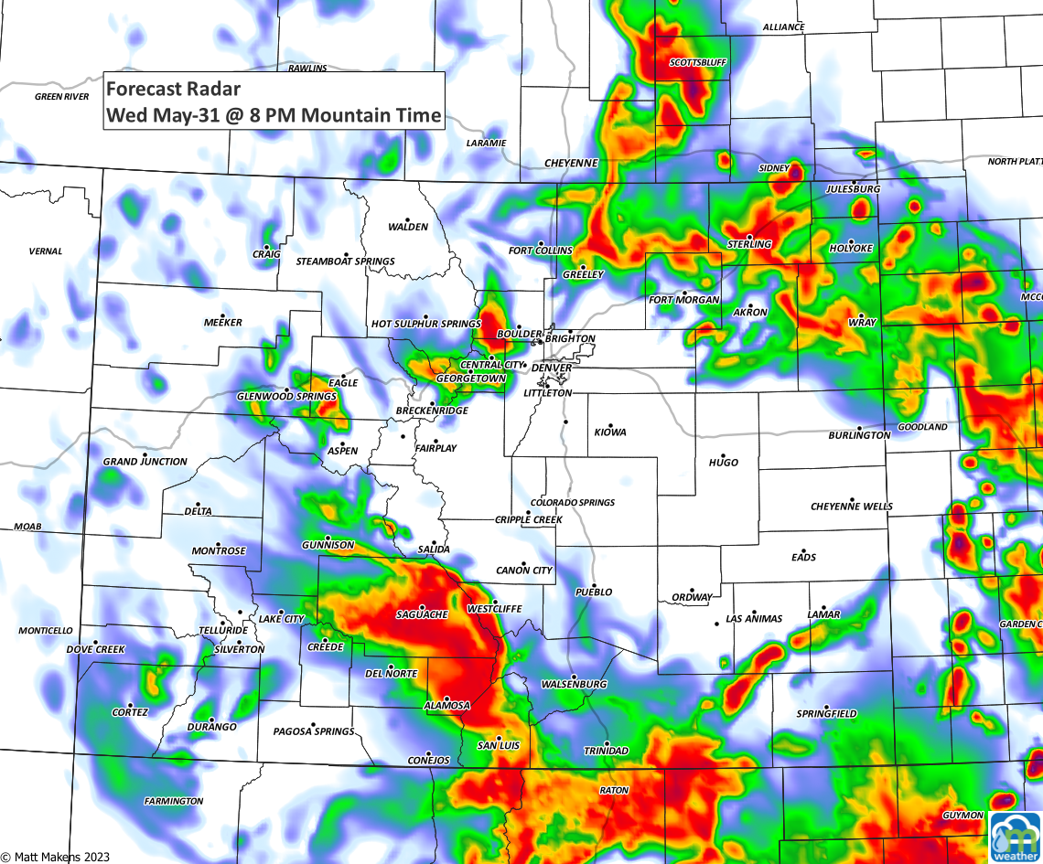
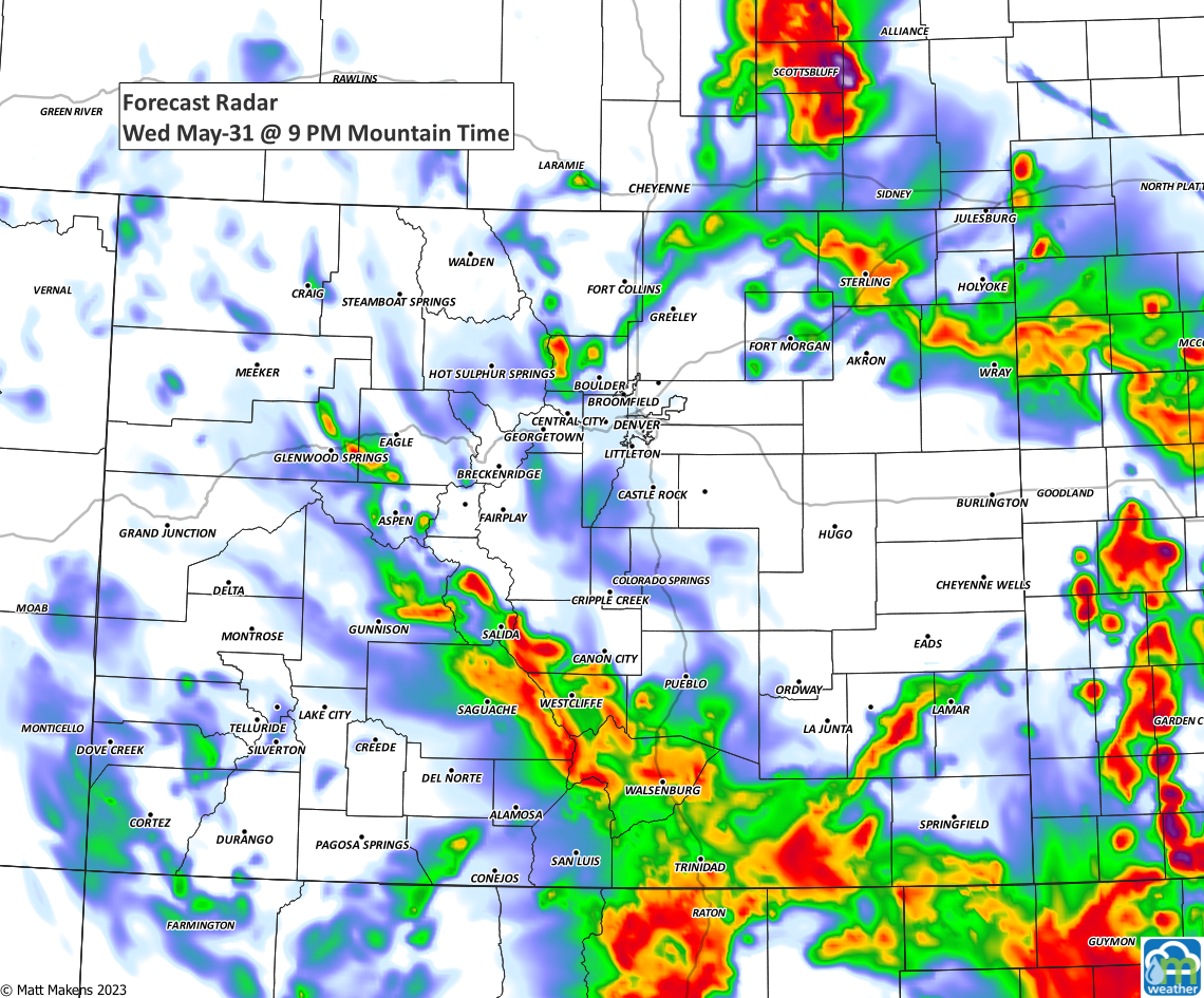
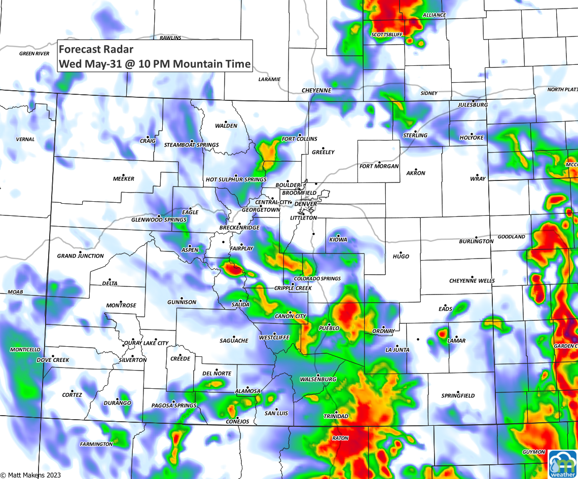
Conditions Wednesday are much like yesterday's, so we will see afternoon and evening thunderstorms with a risk of being severe. There will be more coverage by the storms, too, so your chance of getting rain will be higher today versus yesterday.
The risk of strongest storms as shifted farther south versus yesterday as some of the ingredients for damaging thunderstorms today are not quite as high as we thought they would be.
Here's the overall risk threat levels.
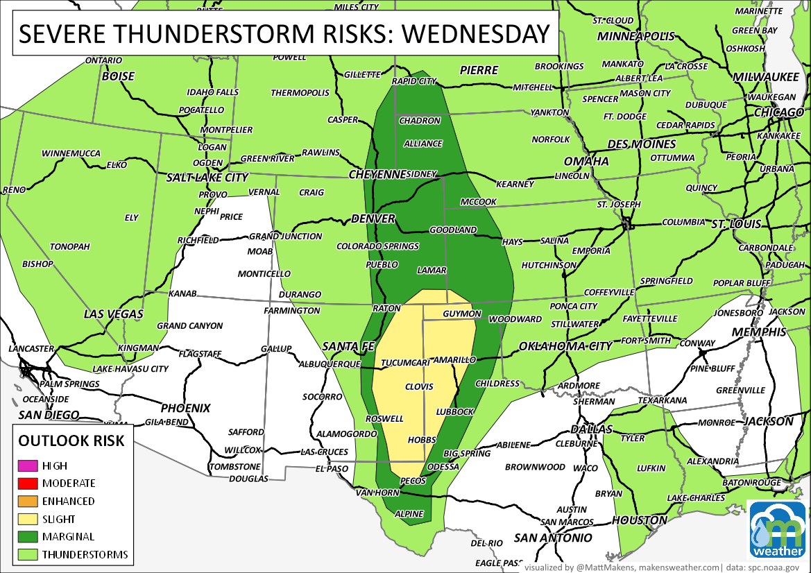
With that said, this does not mean storms can't become severe today, so be mindful about hail and damaging wind with any storm that comes your way.
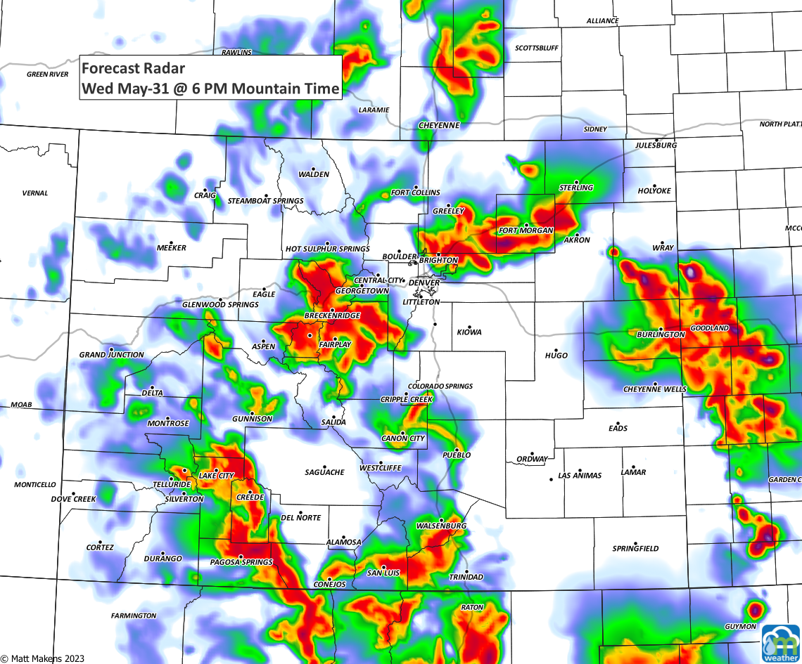
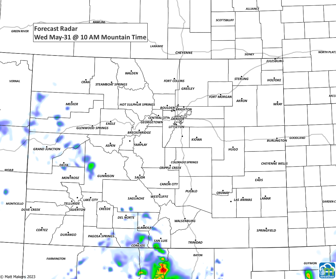
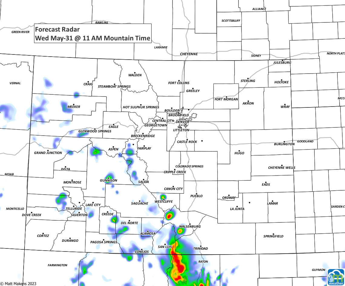
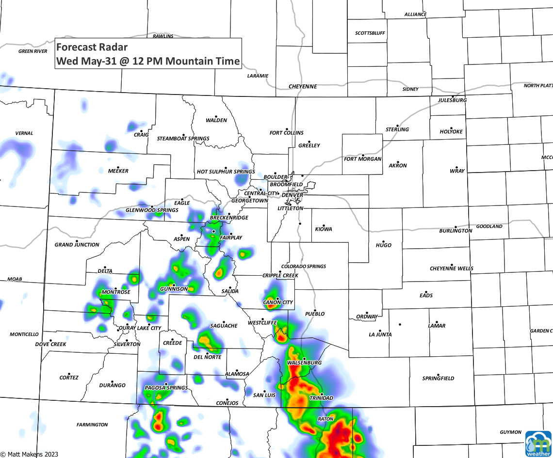
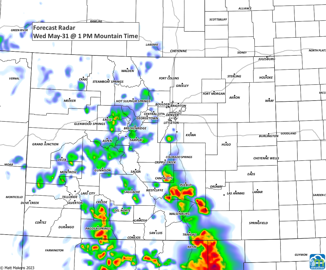
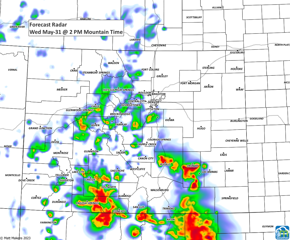
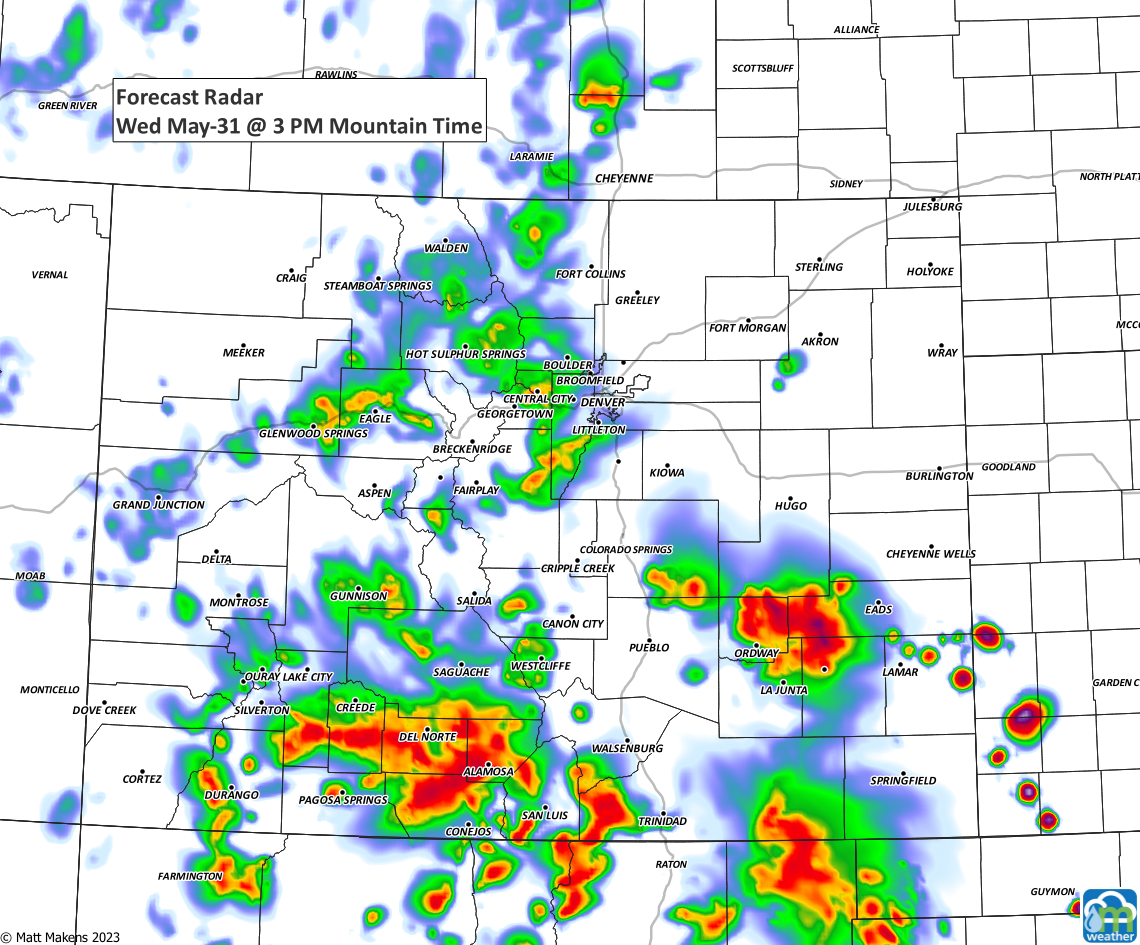
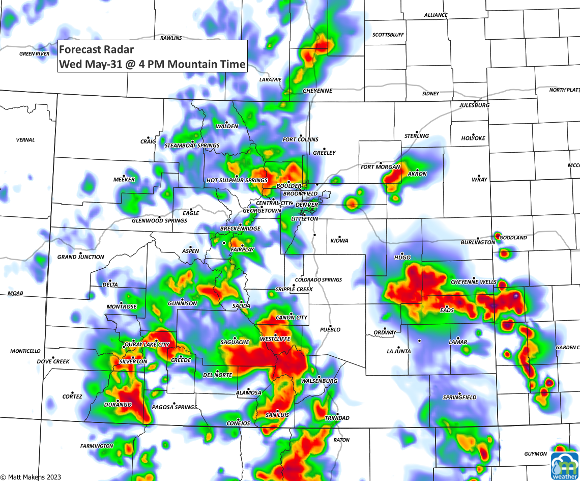
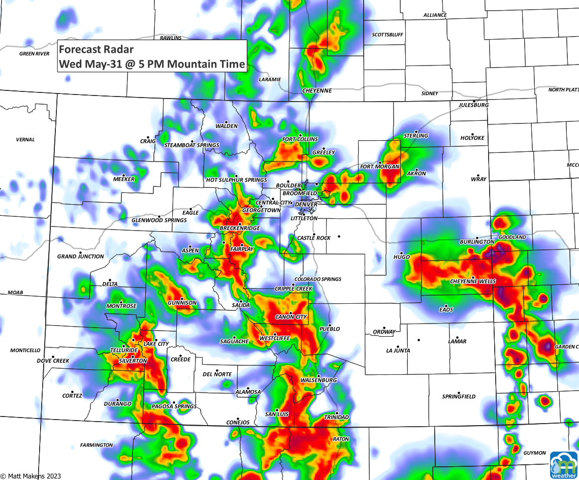
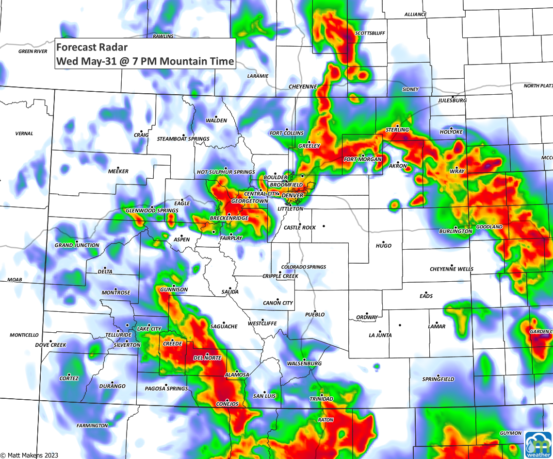
Let's walk through the timeline of storms as they pop up on the mountains, drift to the northeast toward the metro areas gaining strength and then off to the east where they reach their strongest moments. Notice the change in storm motion today, coming at us from the Southwest.

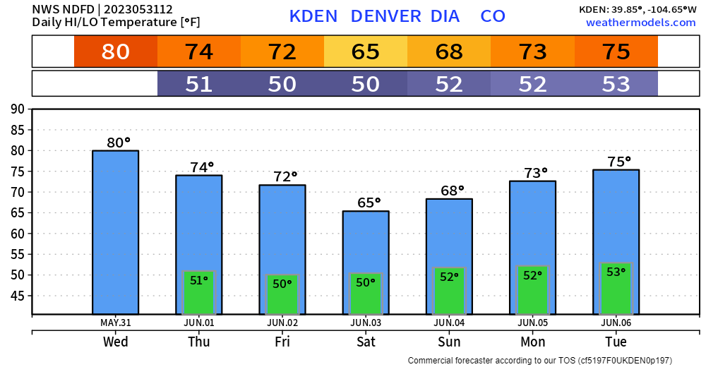
This unsettled pattern with daily thunderstorms will continue through the weekend. Friday and Saturday, especially Saturday, may be the wettest days with the most number of storms during this period.
Temperatures will be dropping quite a bit during the next few days, so warm weather fans and neighborhood pool users take note.