
Denver Weather: Morning sunshine, warmer temperatures, & more rain ahead

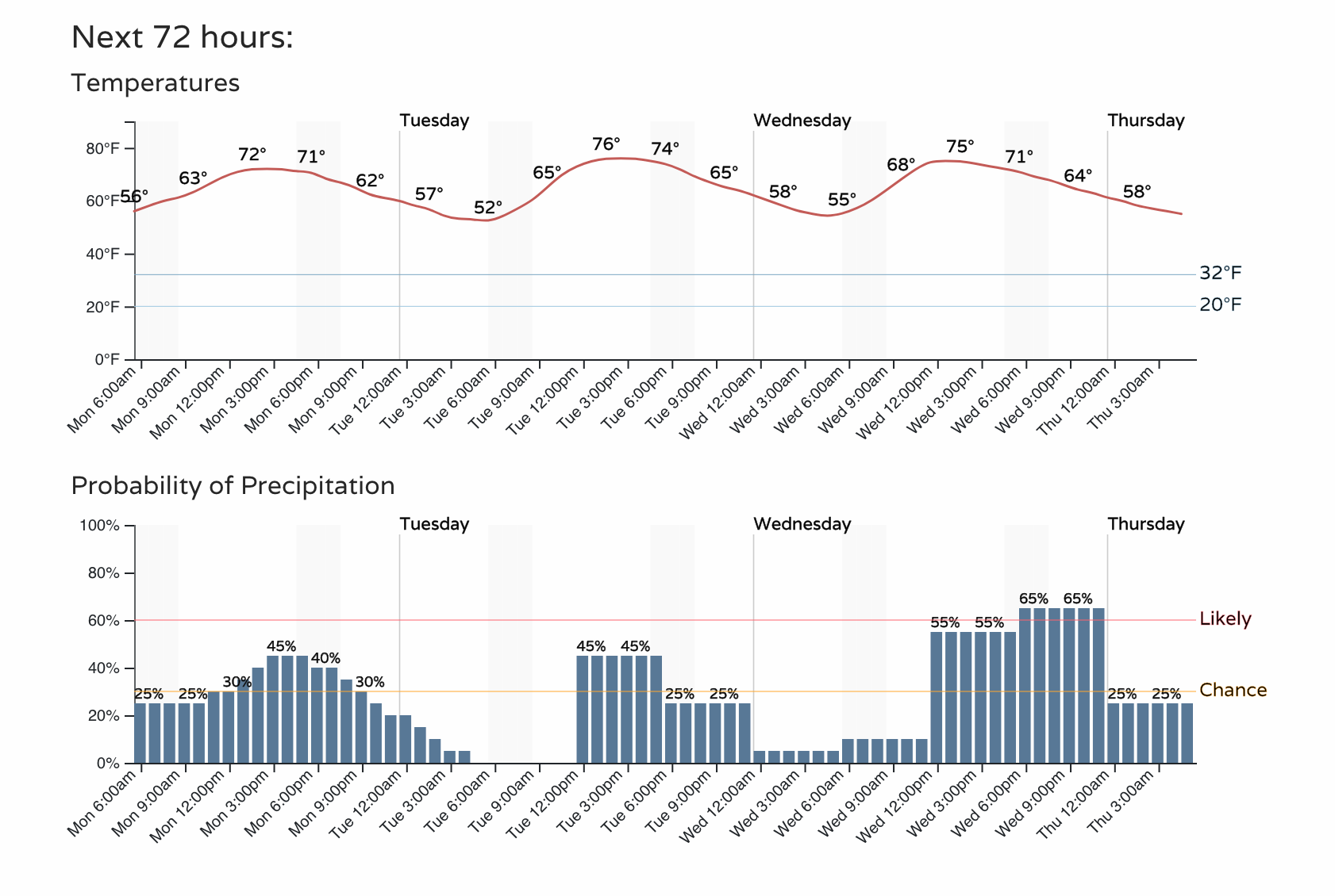
Warmer temperatures for the Denver metro area today will be drier, NOT dry, as scattered thunderstorms remain possible. The hourly planner gets us started; I like seeing the 70s return here:
I woke up to bright sunshine this morning and hope to feel some of the warmer temperatures today - I'm sure the kids will want it to be poolside; I should use the opportunity to mow the grass field, though. I have yet to turn on the sprinkler system, and I am thankful for that.
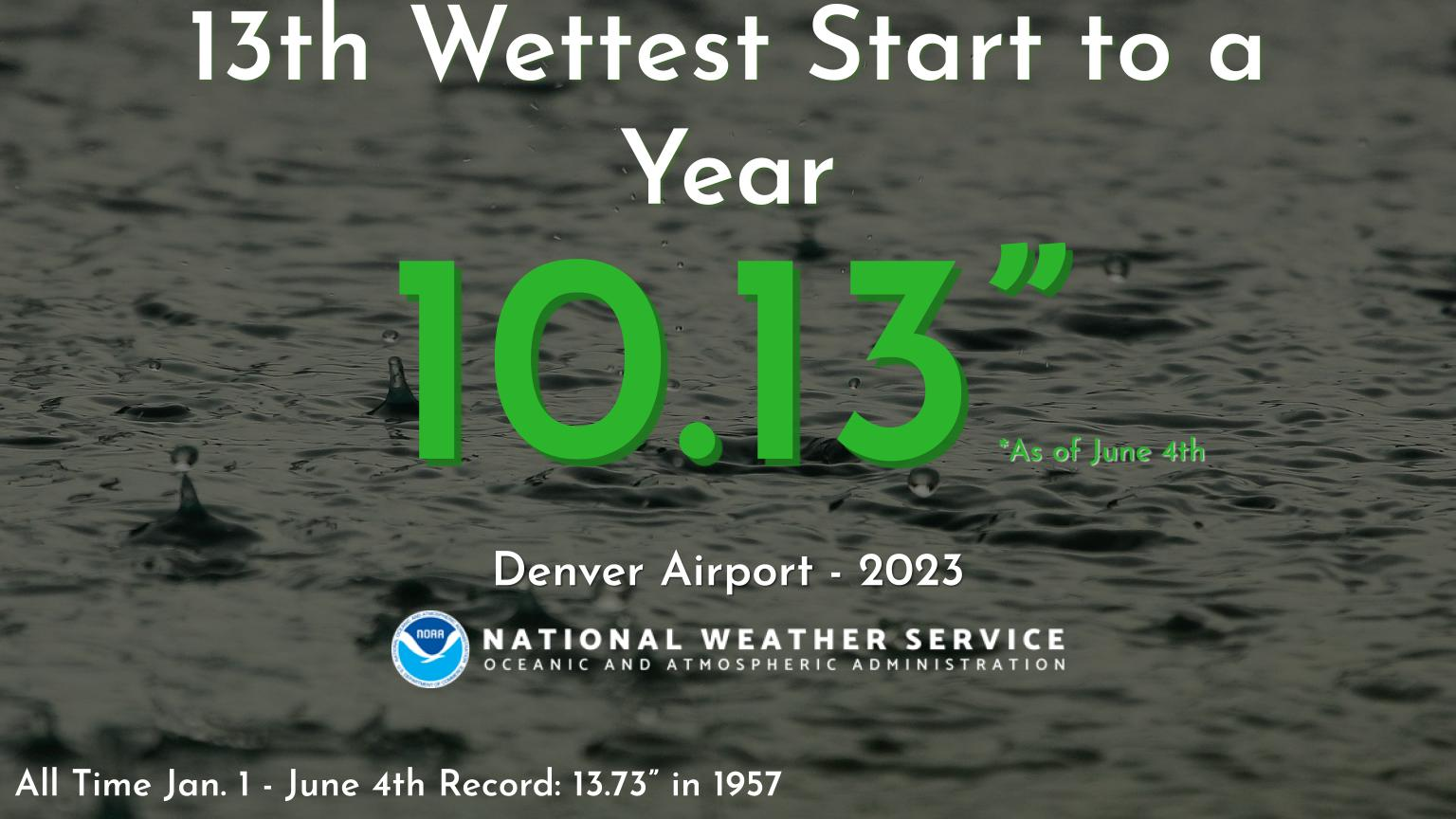
I dropped that image in here in case you are curious about the wet weather records (it was mainly the result of May's wet weather to put us into this position. May 2023 is 4th wettest on record with just over 5.5"). Denver's record-keeping began in 1872 in Downtown, moved to Stapleton in 1948 then to DIA in 1994.
We included more information on the rainfall totals received and what's ahead this week in yesterday's State of the Atmosphere:
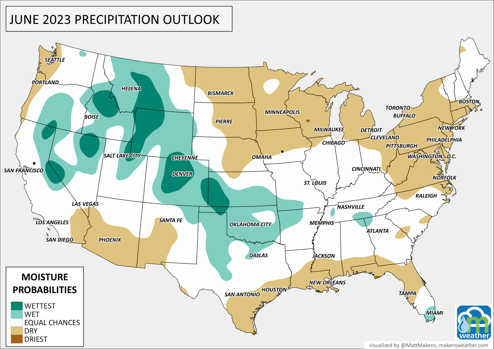
As you know, we have additional rain on the way as June is off to a wet start, but what about the entire month? Our monthly outlook was posted last week for members:
For today, scattered storms will develop on the mountains, drifting toward I-25 and then onto the Plains. The coverage won't be as extensive as the past few days; keep an umbrella handy. For Southern Colorado, morning thunderstorms will continue over the area, mostly east of I-25, until the mountain thunderstorms drift in later.
Although hail is possible with strong wind, the chance of getting those threats is low.
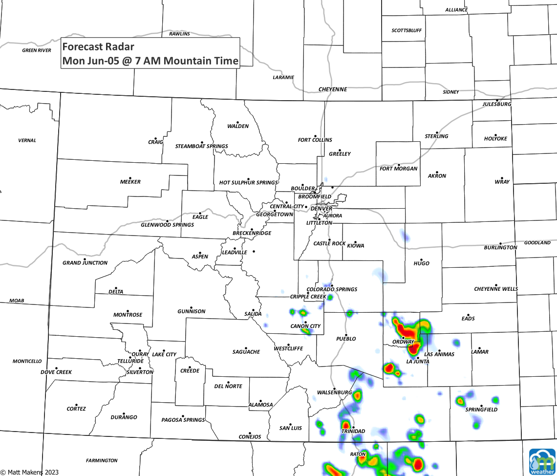
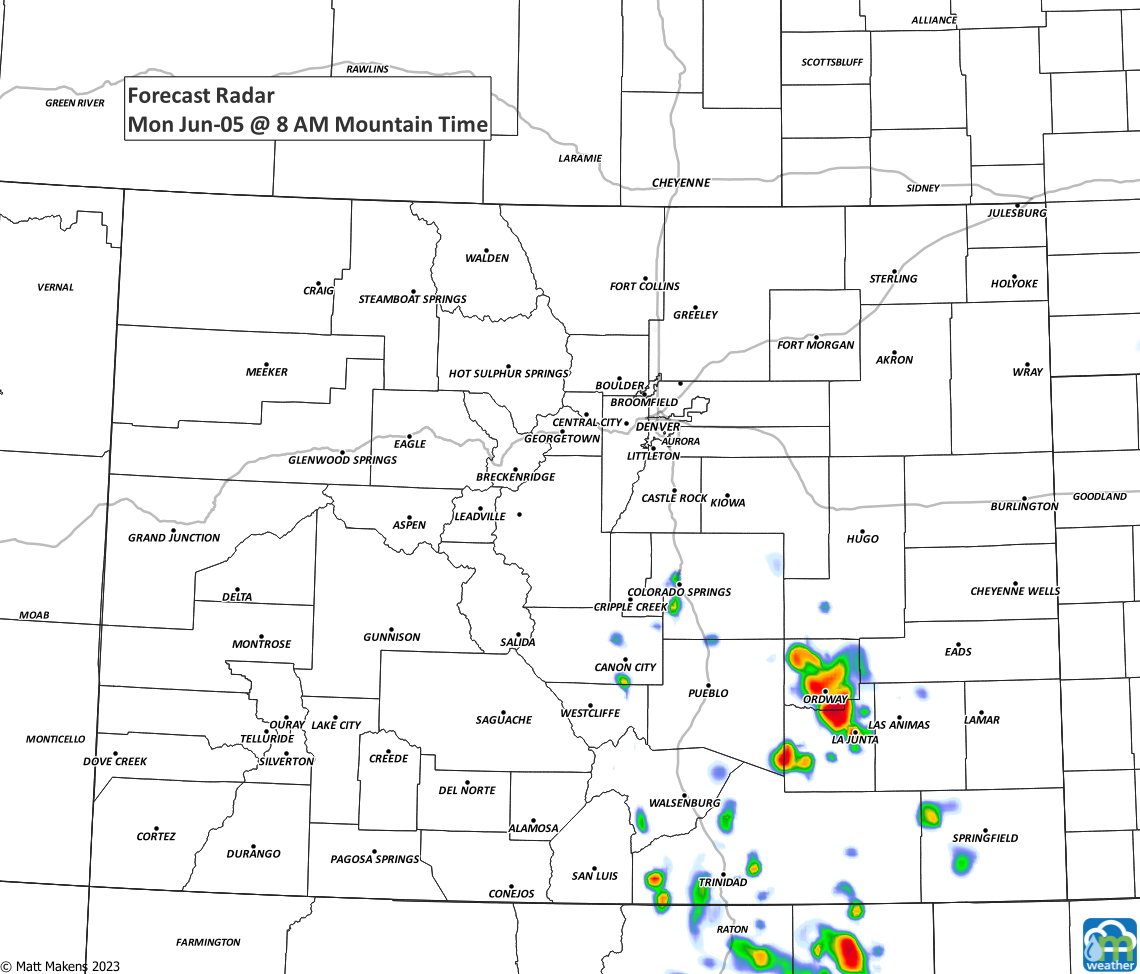
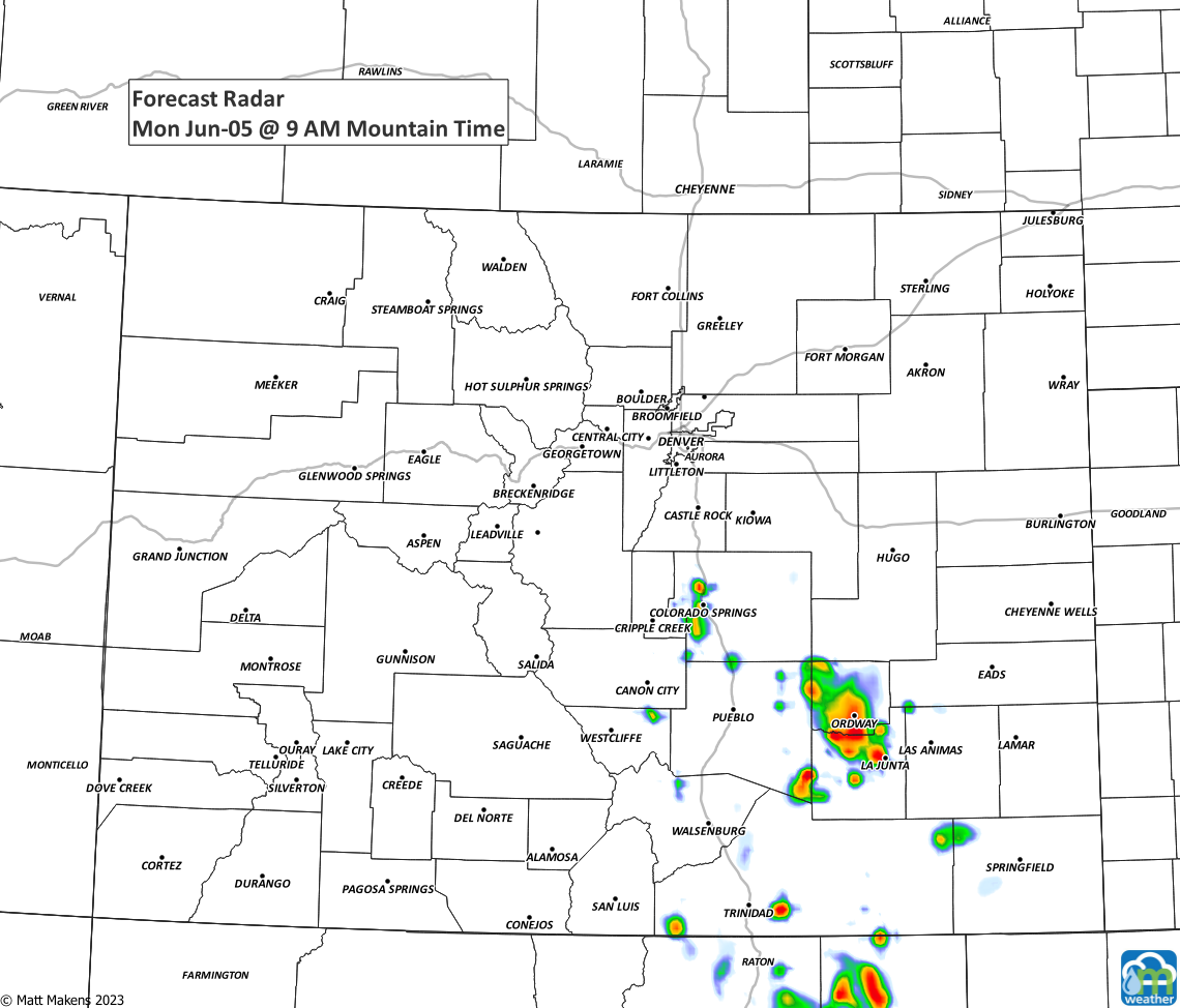
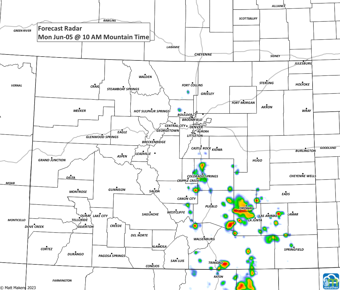
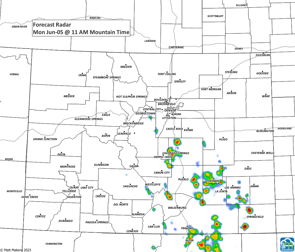
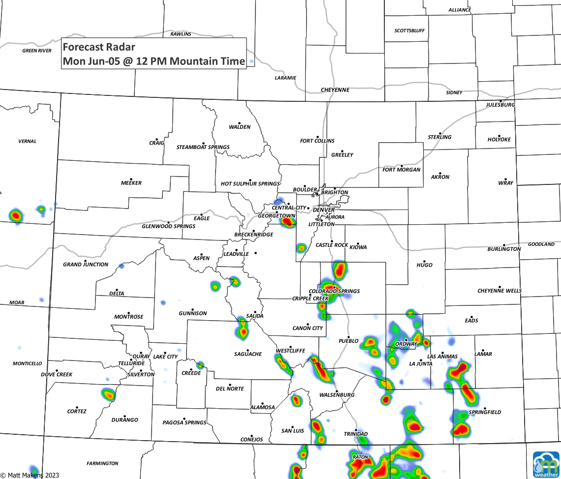
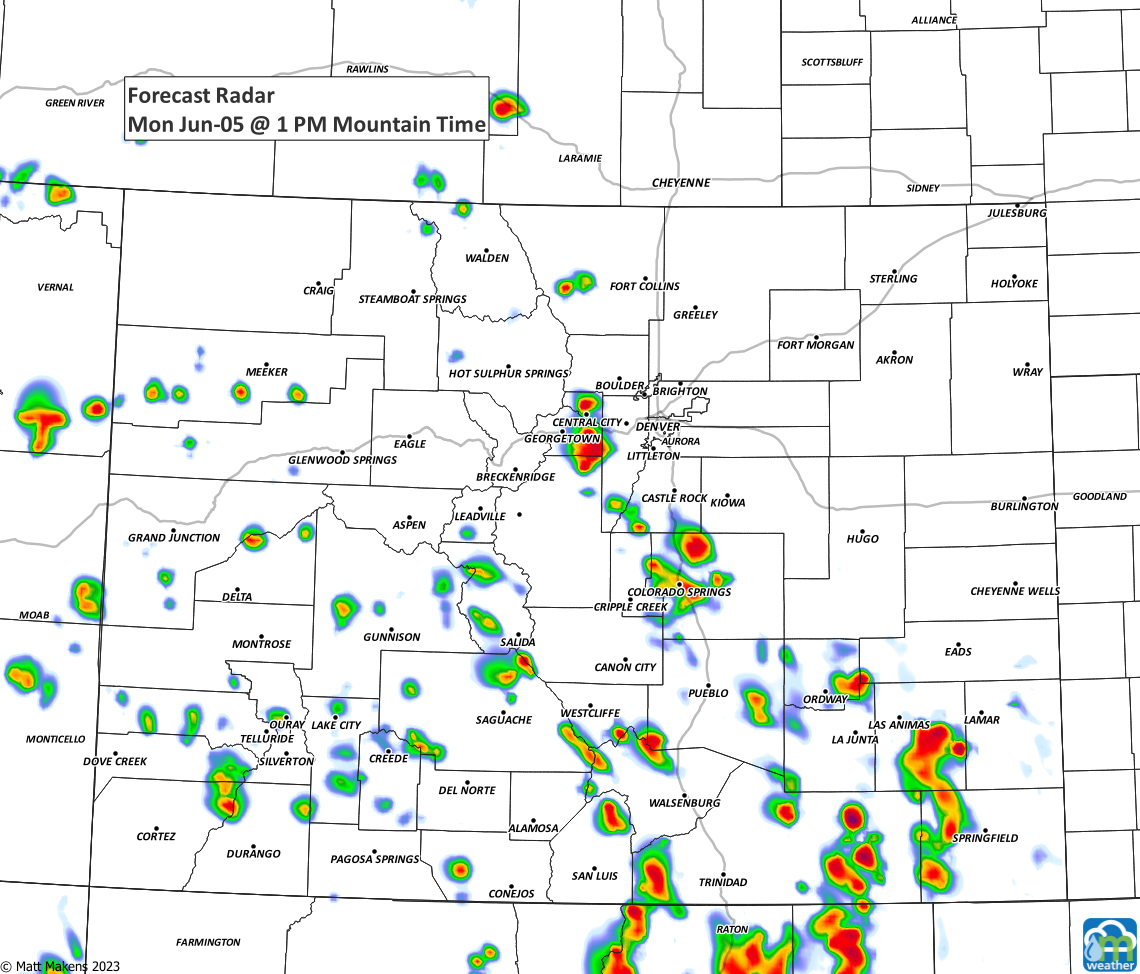
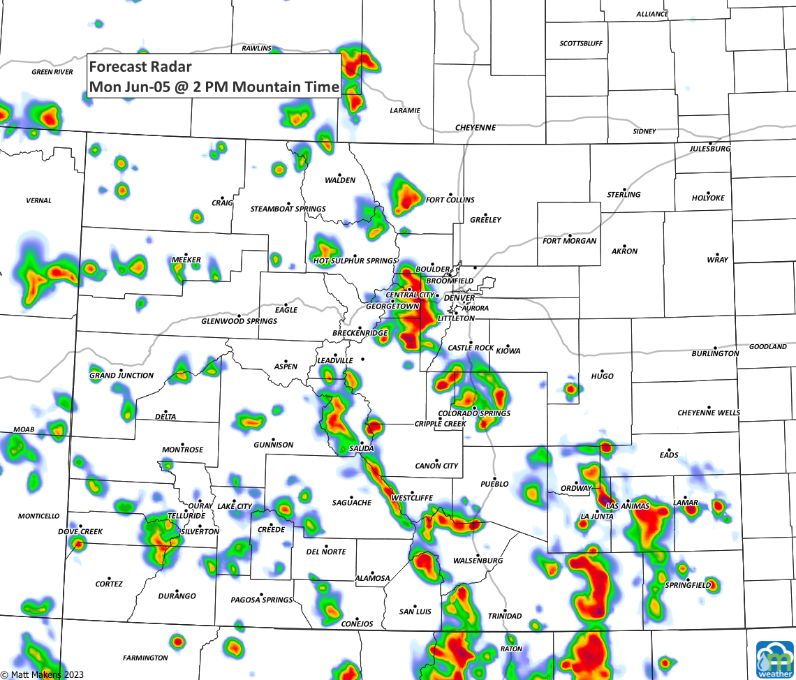
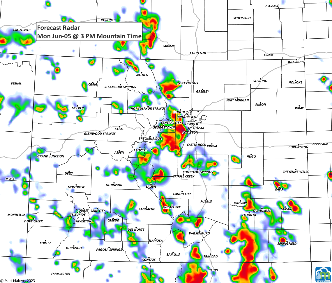
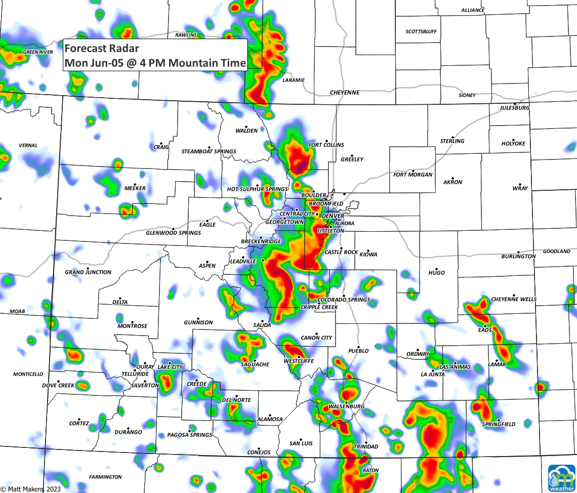
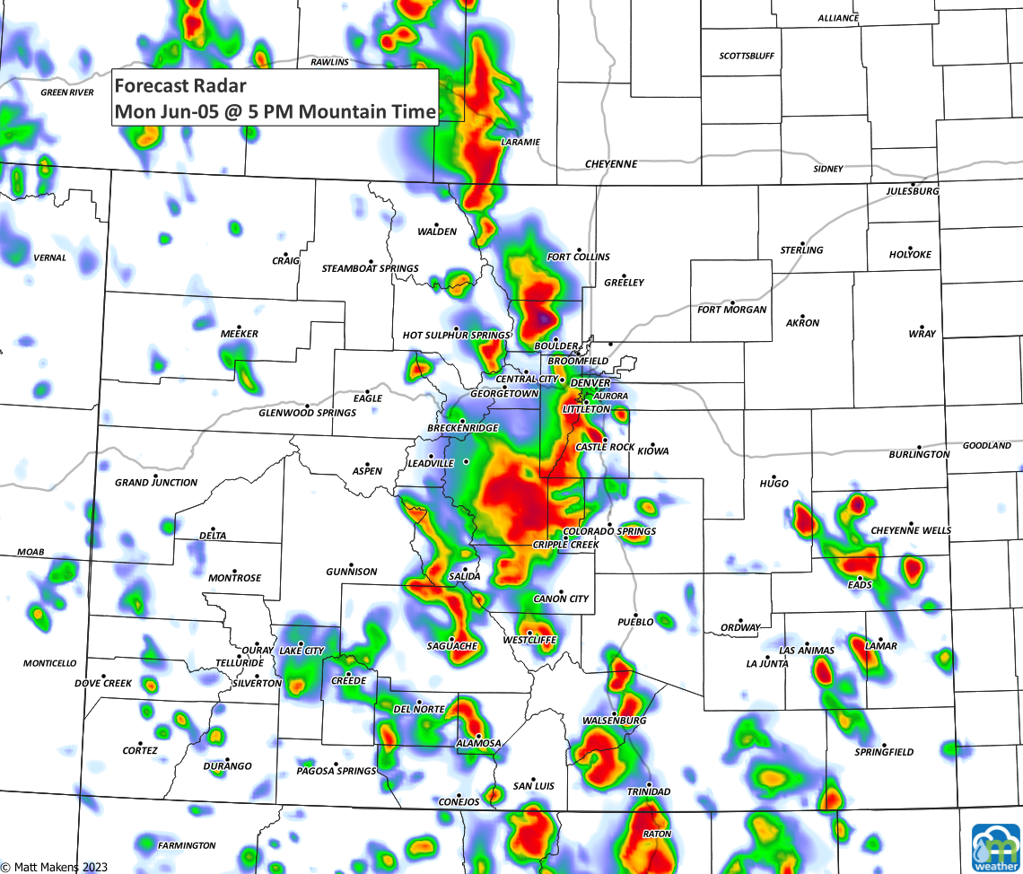
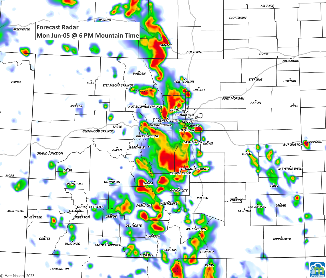
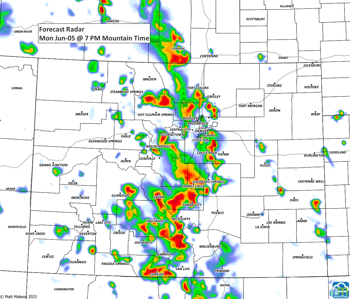
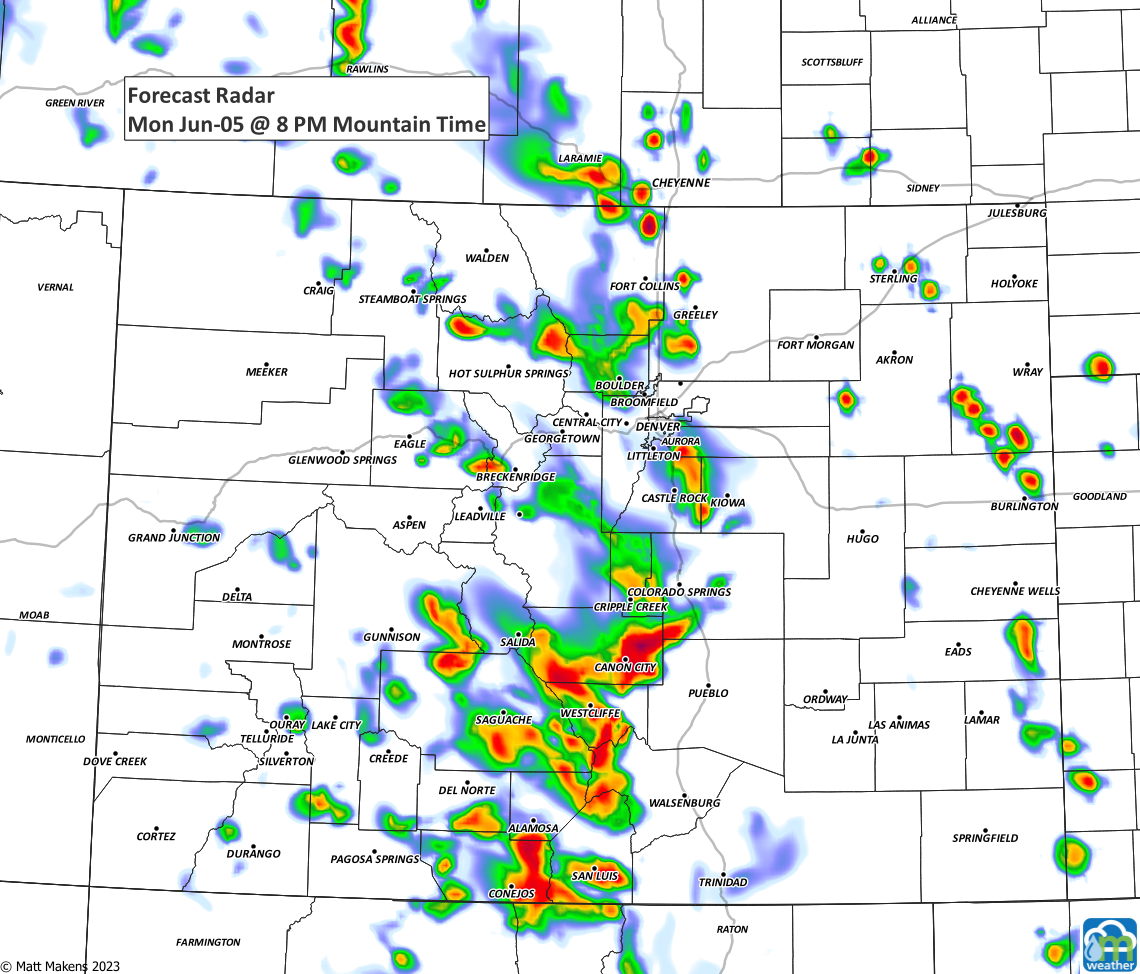
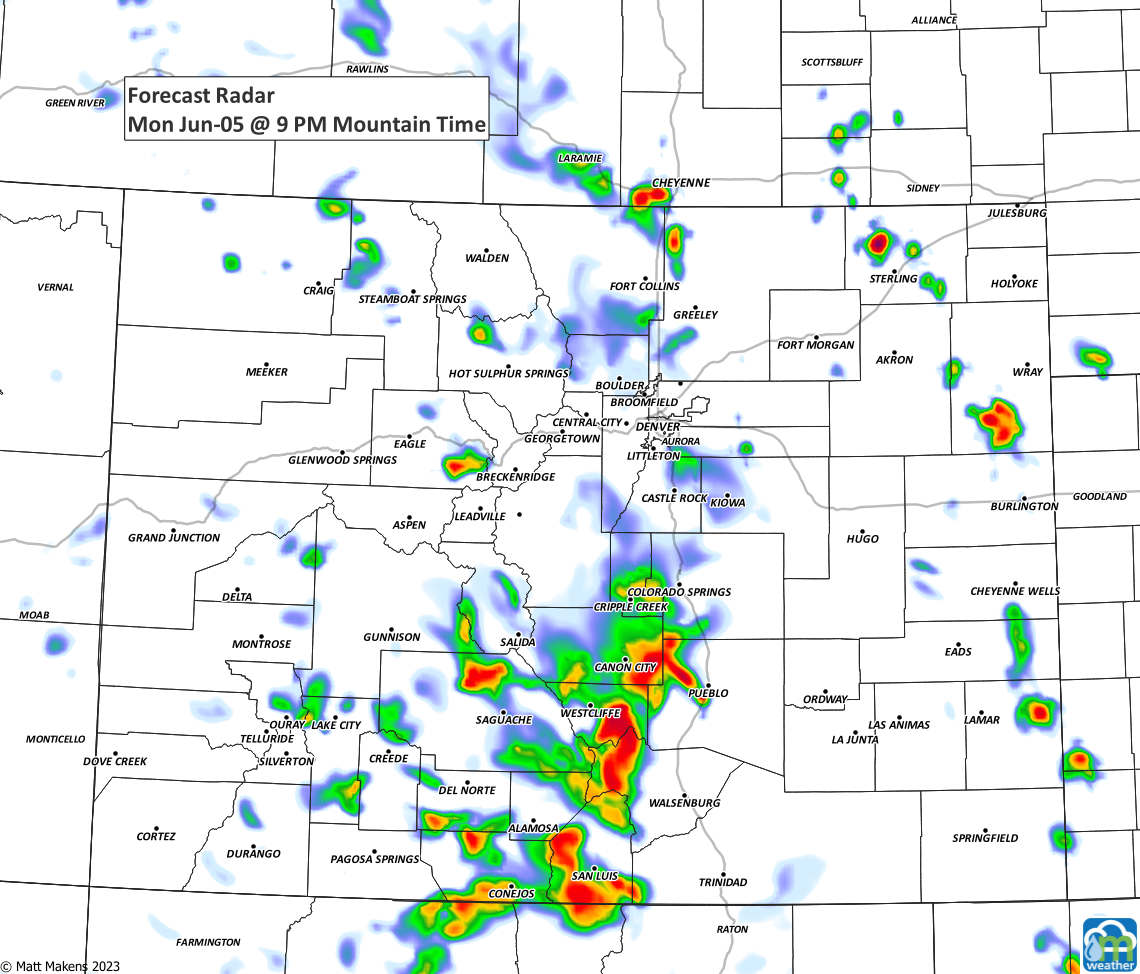
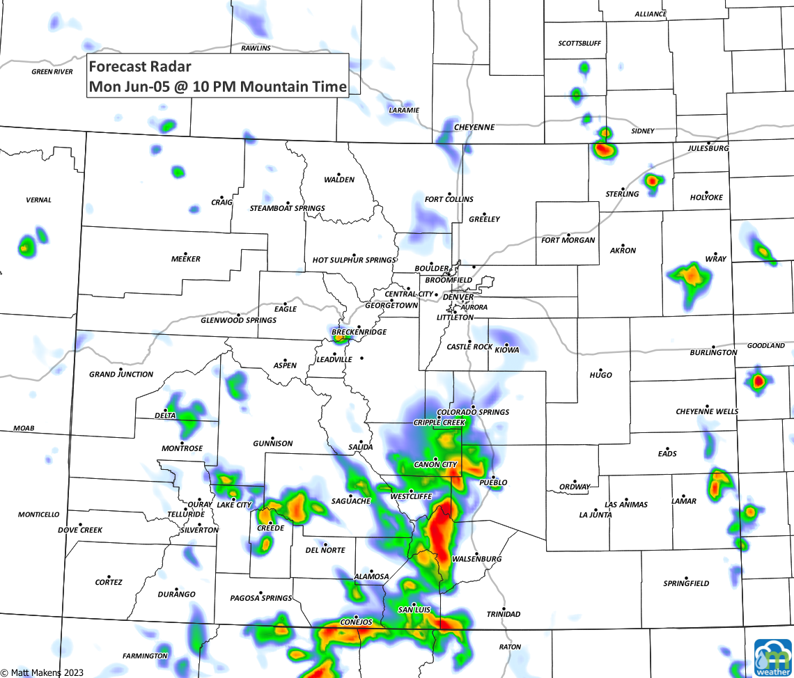
As is usually the case with those model images above, the timing may shift as the day goes on and we will make a note if we need to swap out for new images. So, swing back by the post in the early afternoon to double check.