
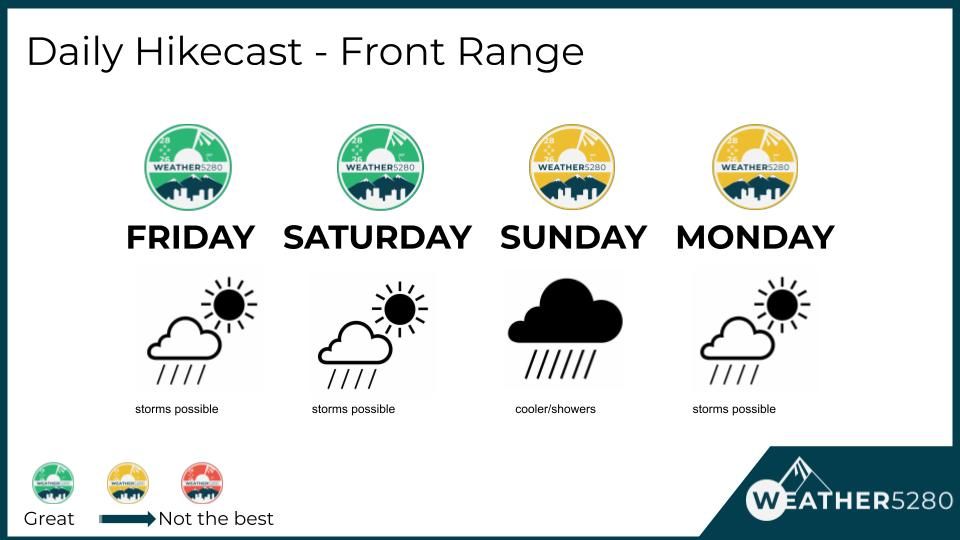
Denver Weather: Was a late-show yesterday, do today's thunderstorms follow suit

The lightning show Thursday evening around the Denver area was impressive as severe thunderstorms with hail developed and moved over parts of the city after sunset.
@NWSBoulder @MattMakens @BianchiWeather @daisyrothschild @9NEWSWeather
— Eric Nubarrón (@KE0OEA) June 9, 2023
Things are about to pop off in east Aurora #cowx Skywarn AR1145 pic.twitter.com/BAFNMAzwS2
Awesome lightning show tonight over downtown Denver #lightning #weather #lightningstrike #denver #downtown @NWSBoulder @NWS @NOAA @CReppWx pic.twitter.com/UsY70Ppqmo
— John Leyba 📸 (@Presto89) June 9, 2023
@MattMakens pic.twitter.com/imU6Pv8PgJ
— Brent Wilford (@bhwilford) June 9, 2023
Let's look at today's run-through to see where/when storms are probable.
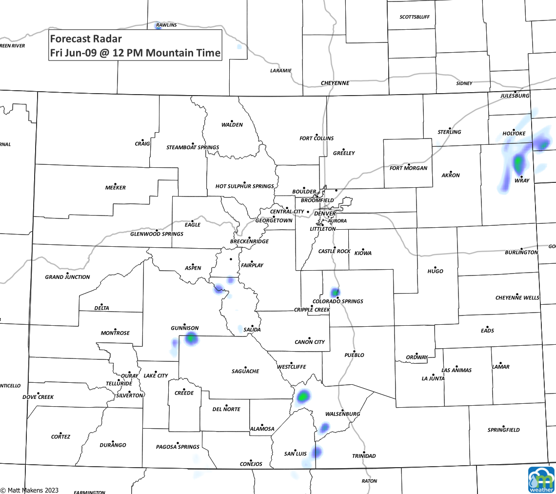
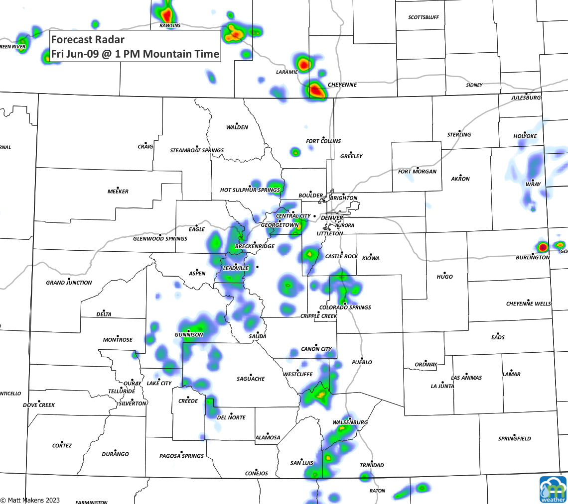
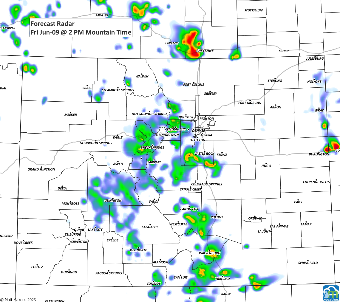
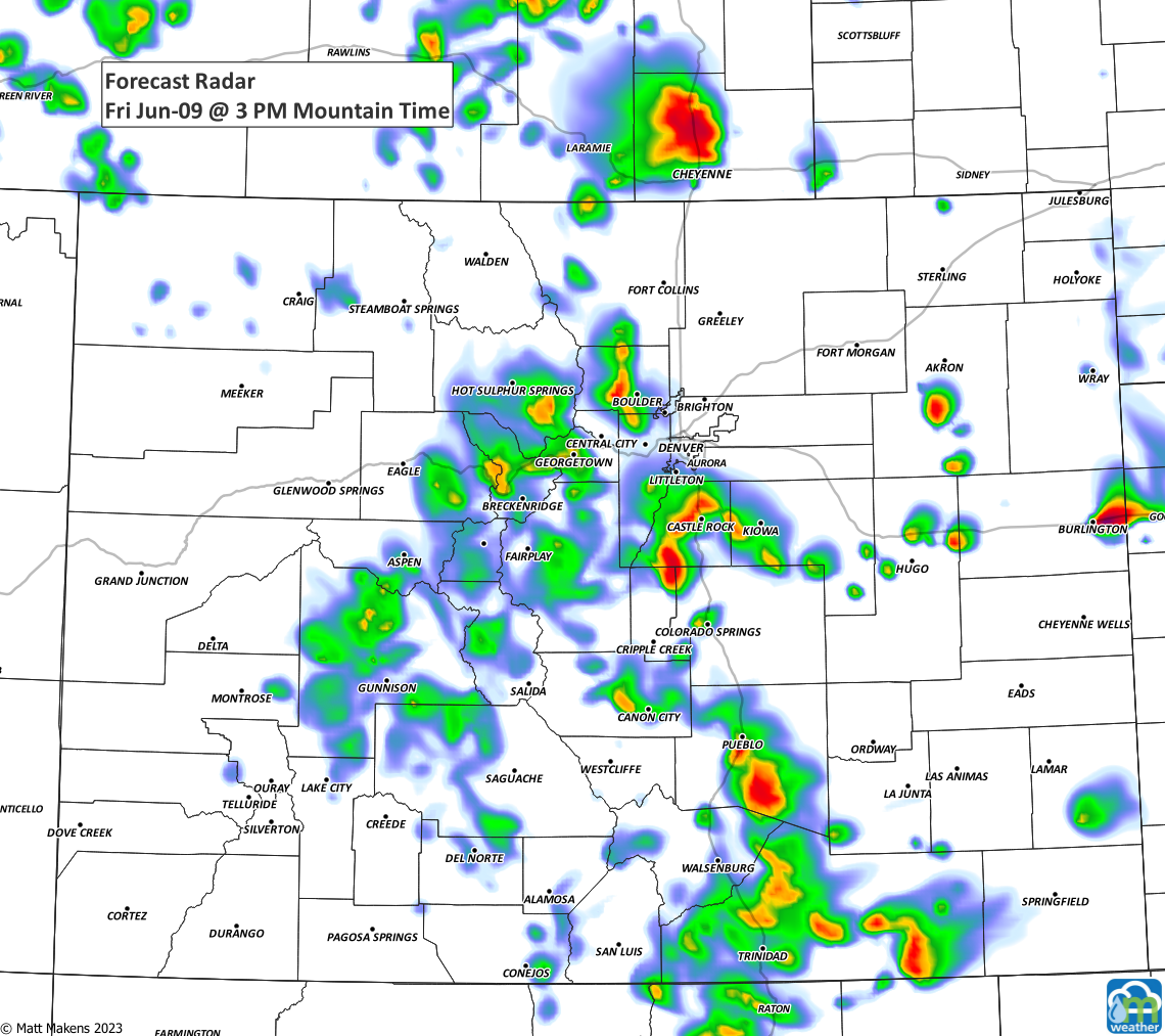
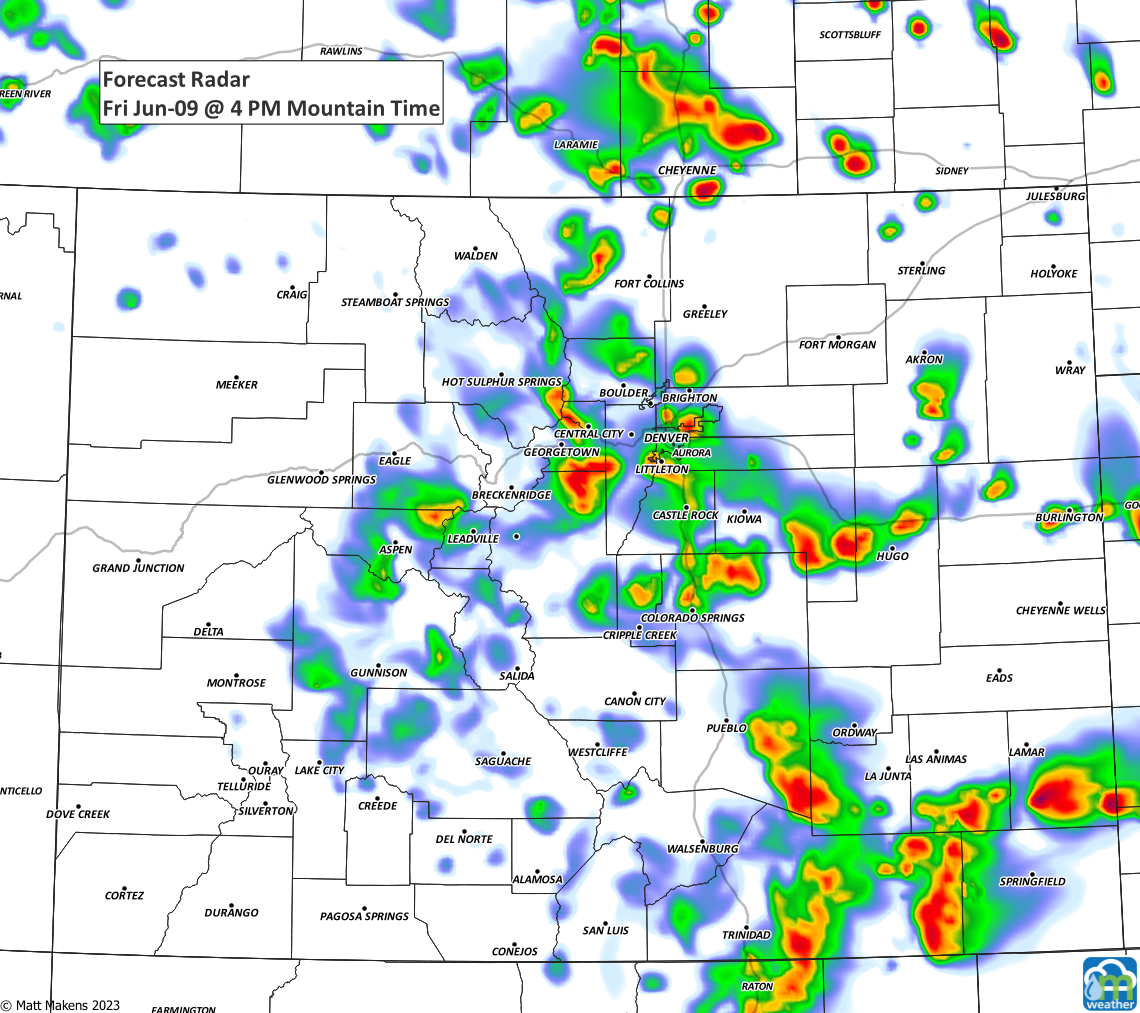
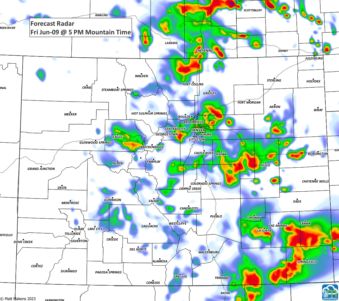
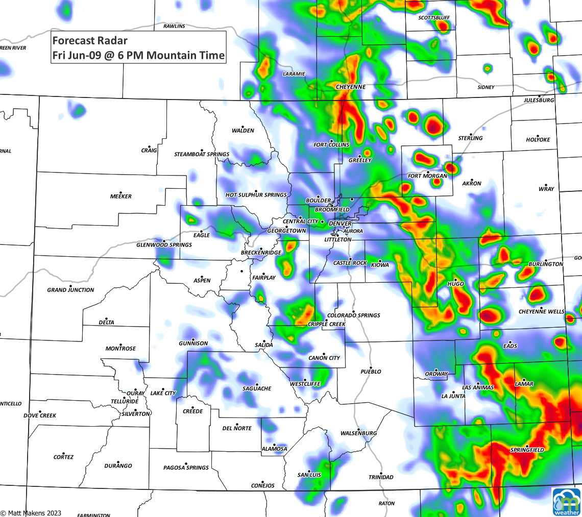
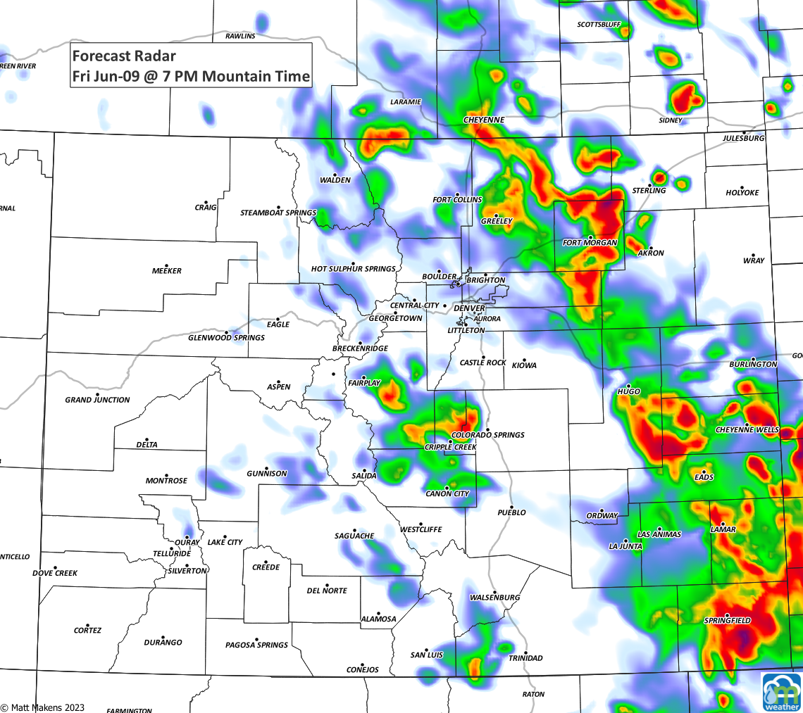
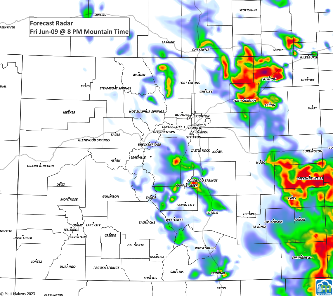
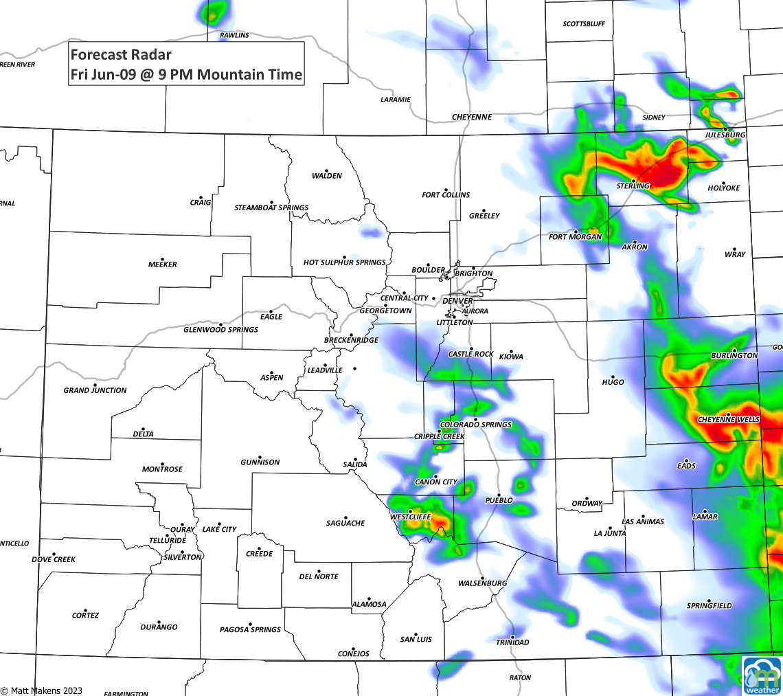
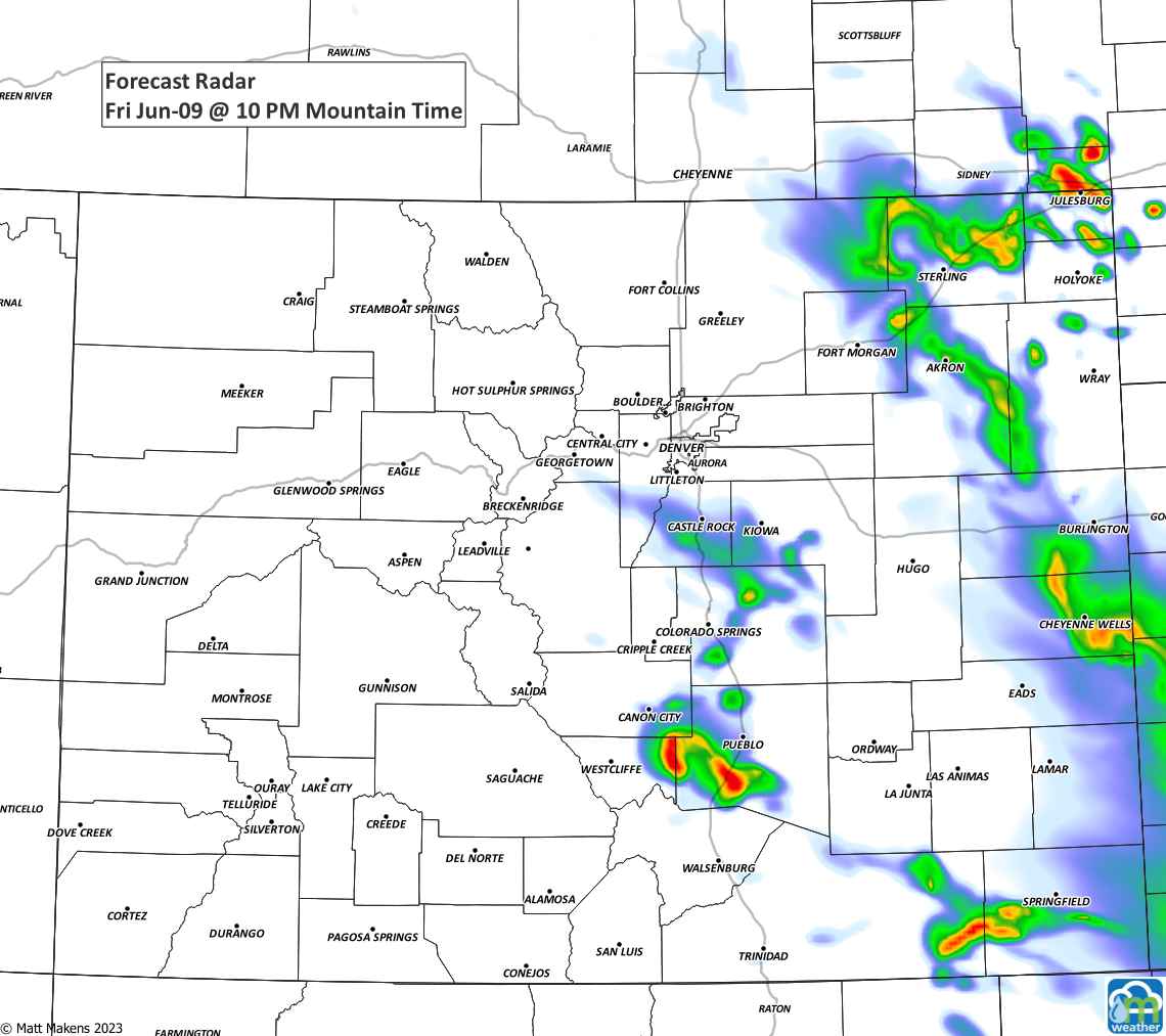
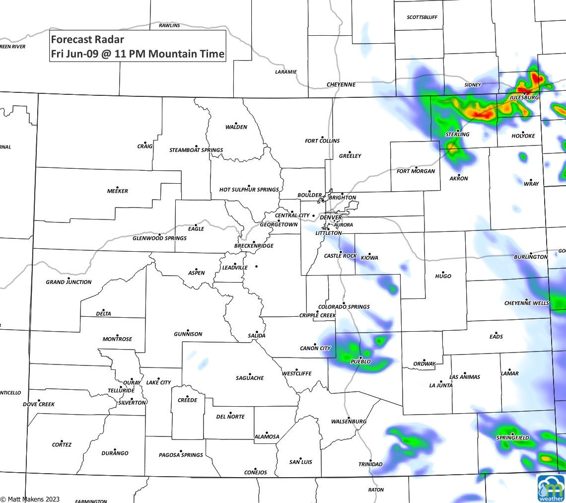
As you see, scattered storms fire up this afternoon, and some of these may become severe. The overall risk of severe weather remains low, but it only takes one storm to bring damaging hail and we are certainly in hail season; hail is today's primary threat.
This is part of the beginning to an active weekend. Note the rain chances here increase markedly for late Sunday.
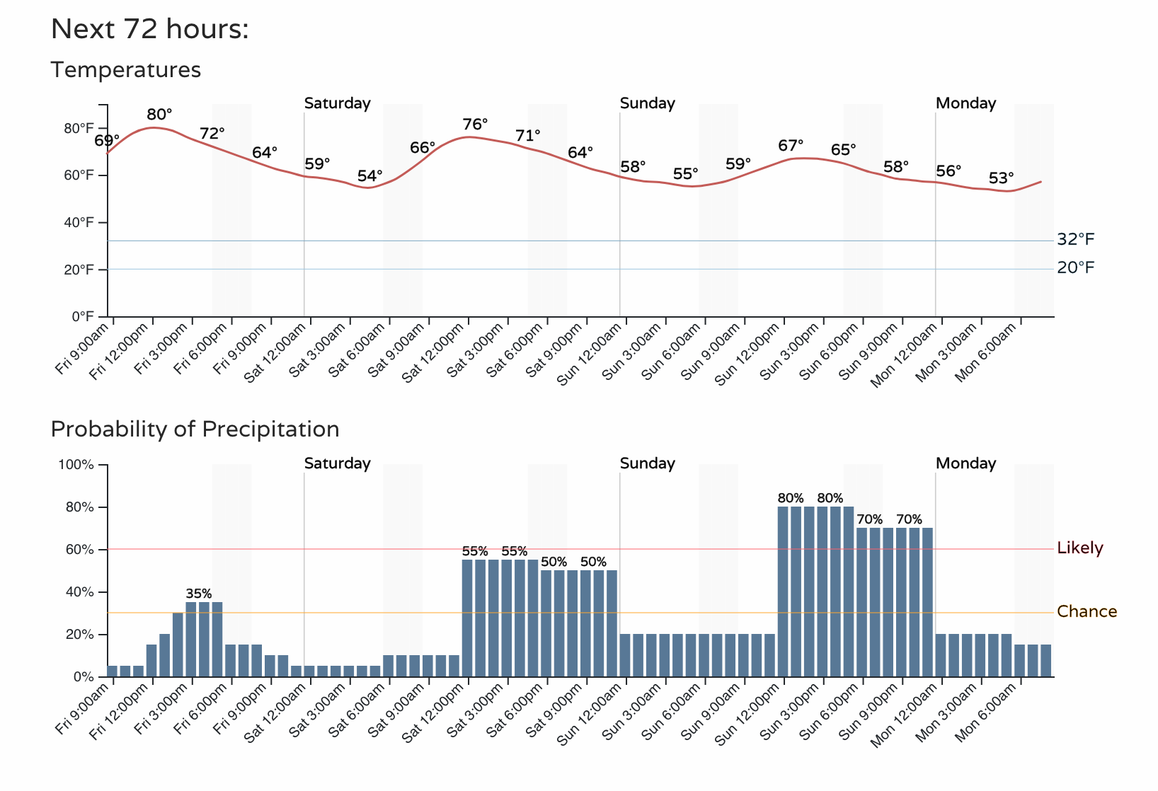
Heavy rainfall will be possible Sunday into Monday with a system draped across us. This will also be cooling us off in addition to widespread rain, and that's why we've made Sunday and Monday "cautionary" days for your outdoor plans.
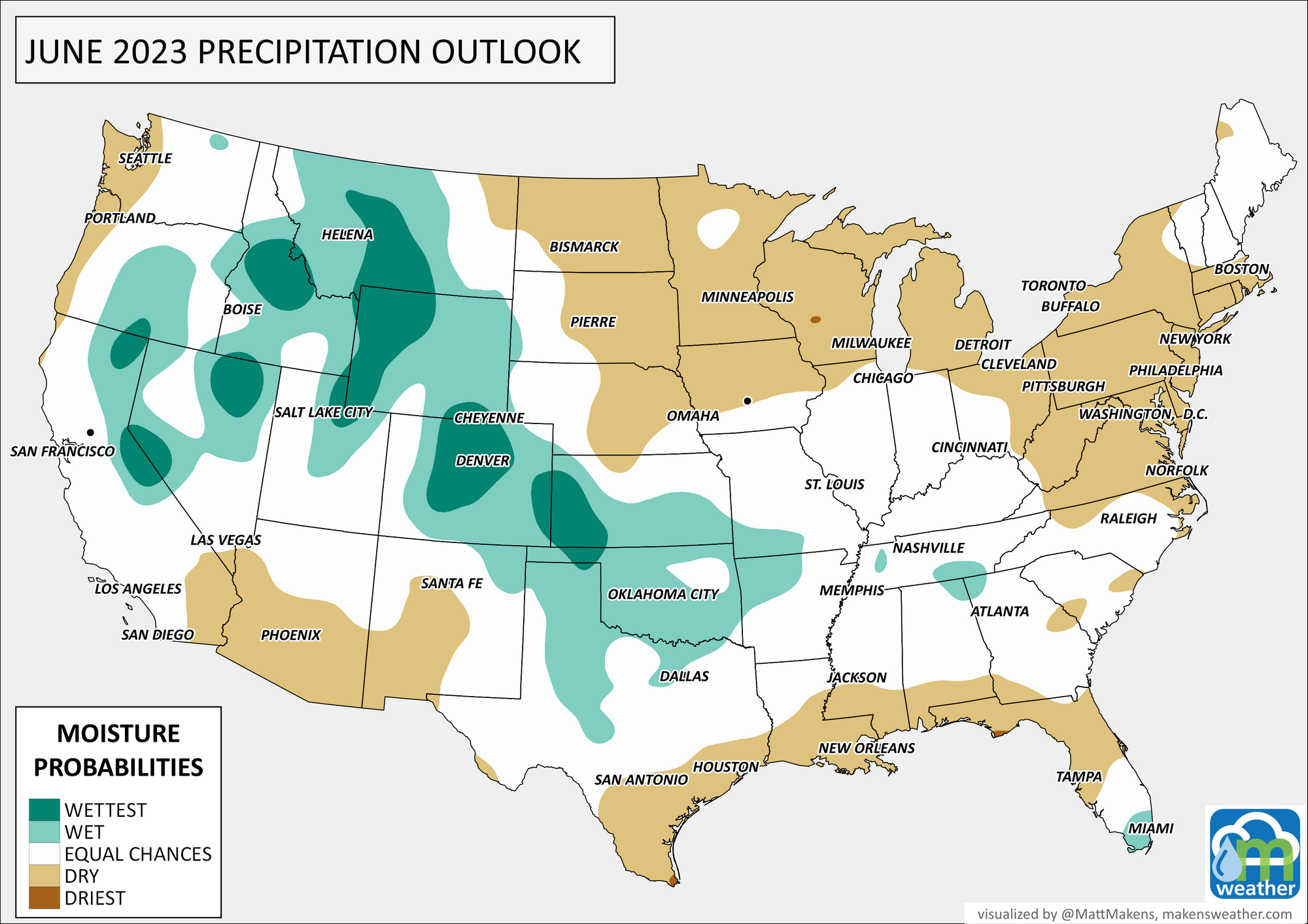
If you've wondered why June has been so active after a wet May, it's part of the atmosphere's transition to El Niño. Although we aren't officially in El Niño yet, the atmosphere has behaved that way. This is noted by the wet season being that and much more in many cases from the Texas Panhandle through our area toward the Northern Rockies. We discussed this with our members back in our June outlook update.
We are nearing Father's Day, and if you are looking for the perfect weather station for Dad, here are our recommendations based on our personal use of each.
Tempest°: (Enter "weather5280" at checkout to receive an additional 10% off)
Ambient Weather WS-5000
KestrelMet 6000