
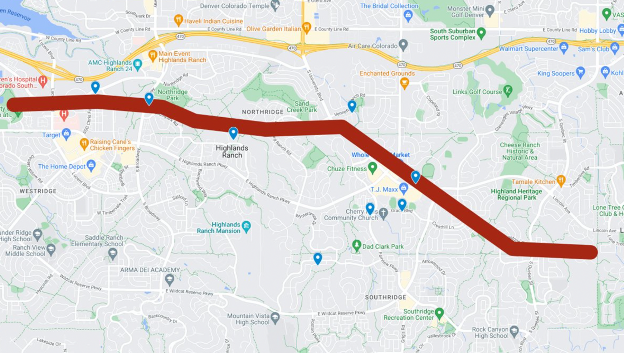
Highlands Ranch tornado damage estimated to be EF-1 rating with a 6.3 mile track

The National Weather Service in Boulder has issued their initial damage report for the tornado that ripped through the Denver suburb of Highlands Ranch on Thursday. Damage from the tornado is consistent with a EF-1 rated tornado, with peak winds of 97mph and a track of 6.3 miles.
From the NWS:
All of the Below are Preliminary Rating:
- EF-1 Estimated Peak Wind:97 mph
- Path Length: 6.3 miles
- Path Width /maximum/: 0.25 miles
- Fatalities: 0
- Injuries: 0 known
- Start Date: June 22, 2023
- Start Time: 3:28 PM MDT (could also be 3:25 PM MDT, confirming tomorrow)
- Start Location: 39.5559, -105.0159, Highlands Ranch, Douglas County
- End Date: June 22, 2023
- End Time: 3:48 PM MDT (could change by +/- 4 minutes)
- End Location: 39.5354, -104.9086 just west of Lone Tree, Douglas County
More:
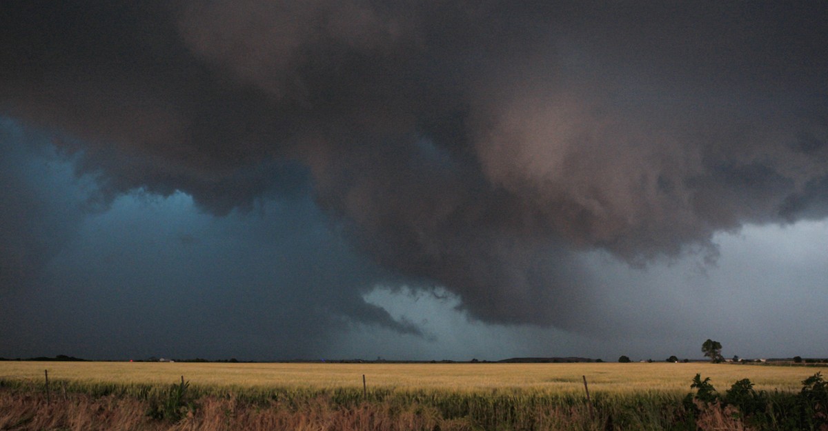
Thursday afternoon June 22 a tornado touched down just south of CO-470 in Douglas County, west of Lucent Blvd, impacting the city of Highlands Ranch. The tornado looks to have lifted just west of the intersection of Lincoln Ave and Lone Tree Parkway. The NWS in Boulder has been in constant contact with Douglas County Emergency Management regarding damage, and we are also heavily using social media photos and video. The prelminary damage track, start/stop times, and EF- rating are the culmination of numerous photos, videos, and other reports. There have been several damage reports (mainly trees down) 0.5 miles or so south of the general track, which as likely due to straight line winds from the rear flank downdraft, a typical occurrence with many tornadoes. Most all of the damage we have seen so far has been EF-0. There have been a few pockets of low-end EF-1 damage to well built single family homes, which is the reason for the preliminary EF-1 rating.
Here is a look at the estimated path of the tornado:
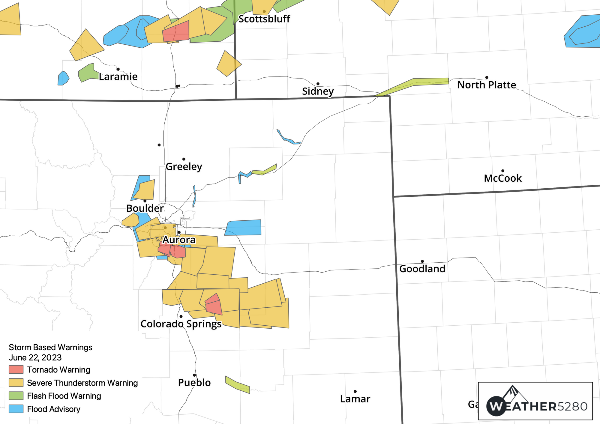
And here's a look at all the warnings that were issued yesterday, across the region, with several tornado warnings, and numerous severe thunderstorm warnings:
You can find images and other reports from the storm damage here:
While tornados are not uncommon to Colorado, in fact by sheer numbers Weld County boasts the most tornadoes of any county in the country. Still, most tornadoes (particularly those along the I-25 urban corridor) are rated EF-0 (relatively weak), and are landspout tornadoes rather than supercell tornadoes as we saw form yesterday.
Climatologically speaking, Northeast Colorado is exactly where you'd expect to see tornadoes form this time of year, and this week has certainly fit the mold:
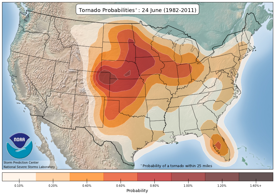
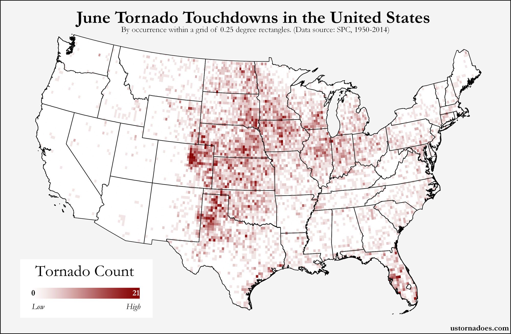
And from U.S. Tornadoes, here's where tornadoes typically form across the U.S. in June:
Related:
A break from the severe weather?
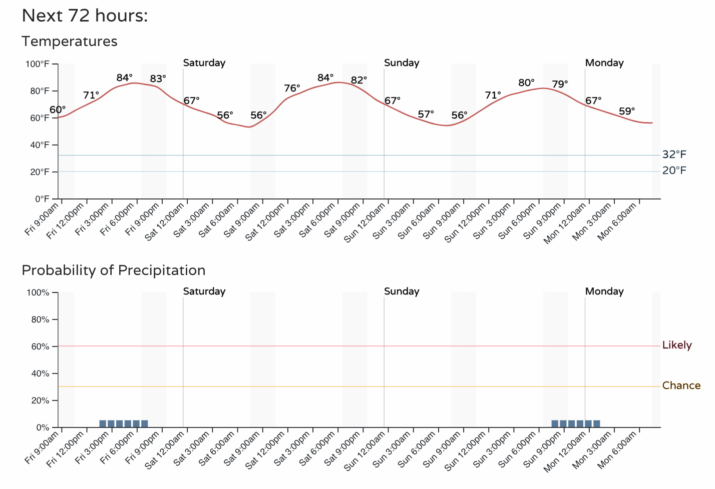
We are hopeful to get a much deserved break from the severe weather today along the urban corridor. Below is a look at the hourly planner for the Denver metro area through the weekend:
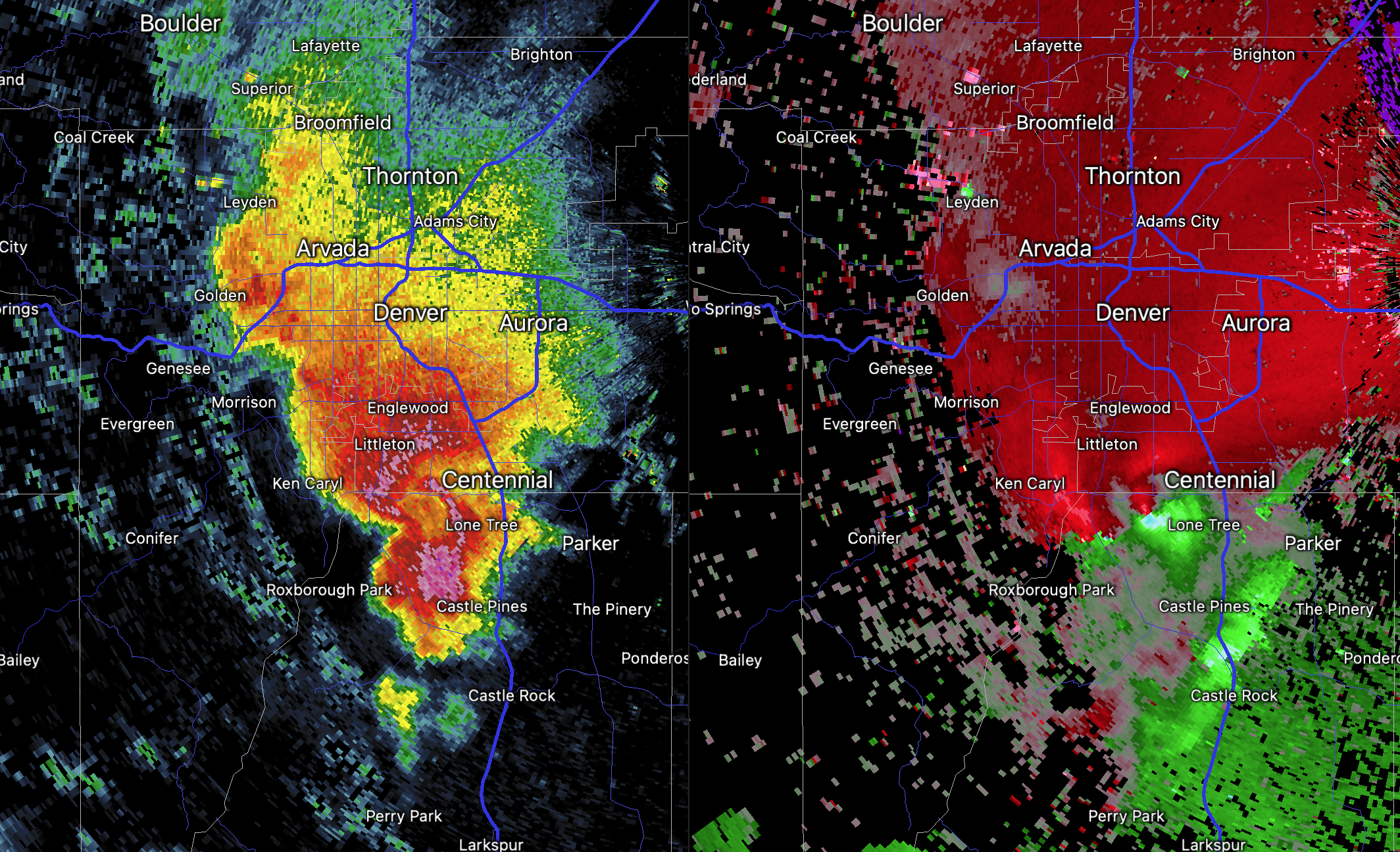
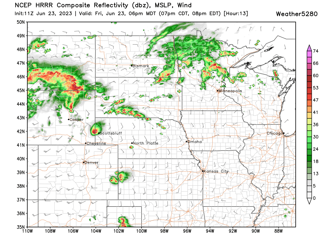
Regionally, however, the active patter persists. Here's a look at forecast radar for 6pm this evening with several discrete supercells forecast by the HRRR late today across Southeast Wyoming, Western Nebraska, and perhaps far Eastern Colorado:
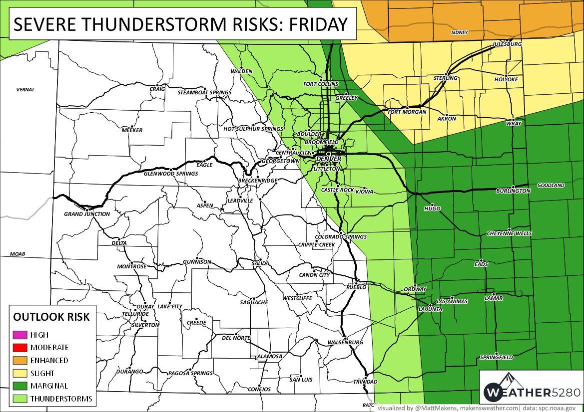
The SPC shows these areas with a risk of severe weather today as well, with that chance for severe storms being quite close to the Denver area, but with any luck storm development remaining 100 miles northeast.
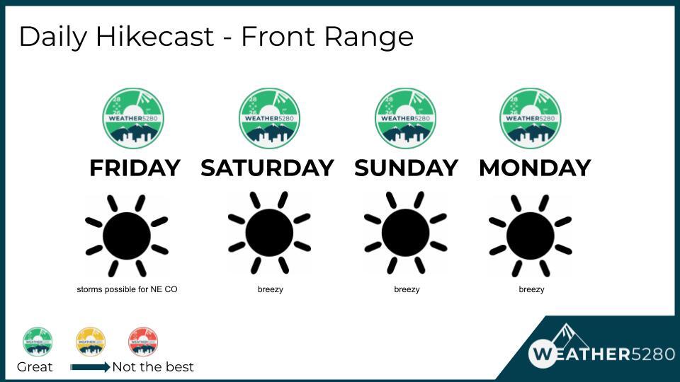
So, we'll need to keep an eye to the sky as always is the case this time of year, but for the urban corridor and Front Range we expect big improvements to the weather starting today and carrying through the weekend. Here's your hikecast as you get set to make those weekend plans today:
Don't miss out on the weather information you need to stay safe and make plans. If you'd like a "heads up, hey there is a forecast to be aware of" style emails from us, you can sign up for those for free by clicking here.