Denver weather: Wind and potentially the first 90° day

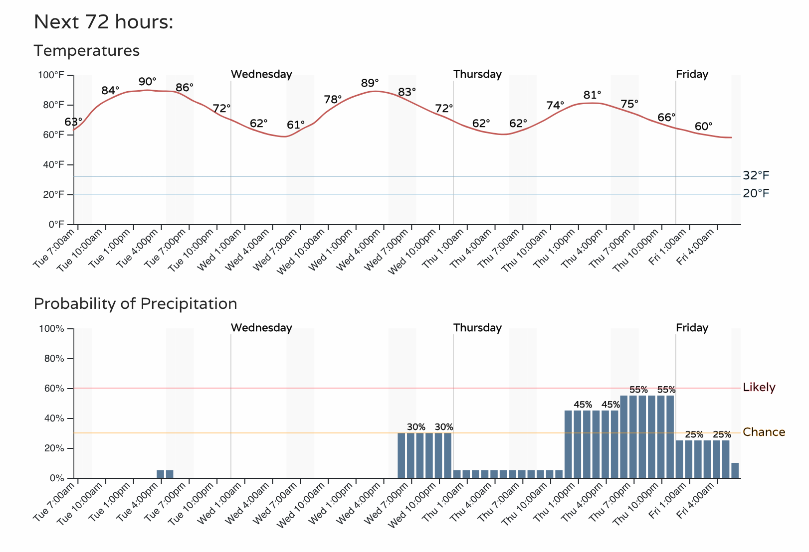
Denver has yet to hit the 90°s this year, but will give it a run again today. If the city should hit 90°, it'll be the latest first such day since 1982.
Let's give the hourly planner a look-see, yep it touches 90...
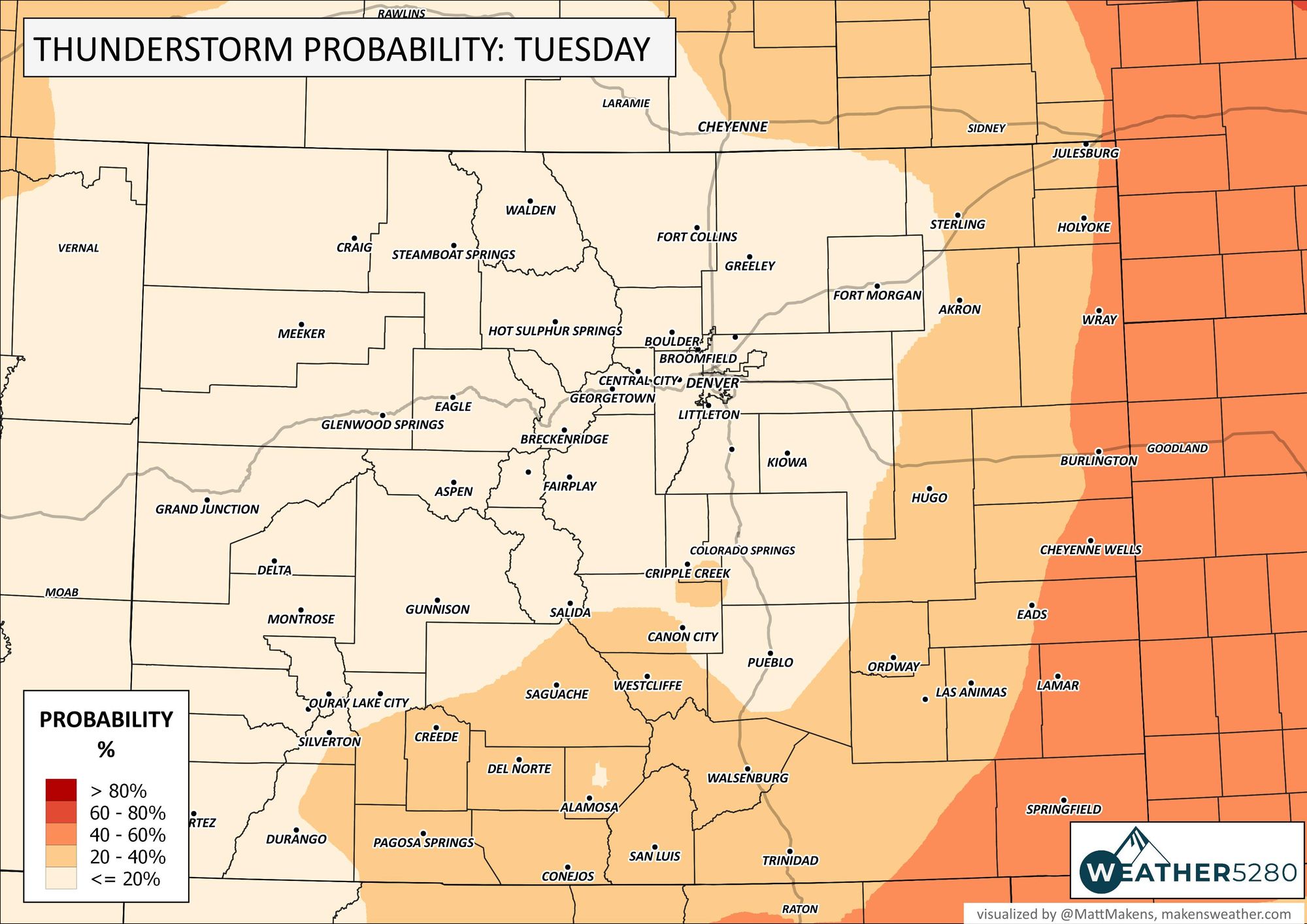
Although the storm chance is lower today, there's a higher likelihood for storms over the northeastern plains, and for the city the chances do increase in the next few days. Just for today, here is the probability of thunderstorms across the state.

Although seemingly a quiet weather pattern today, there will be wind. Wind gusts in the mountains may top 50 mph and down in the city to the plains we may have gusts top 40 mph later Tuesday.
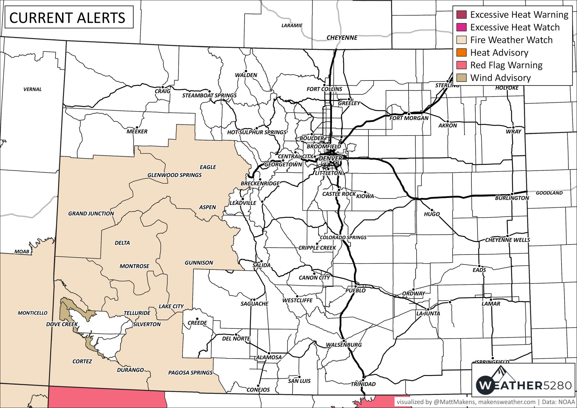
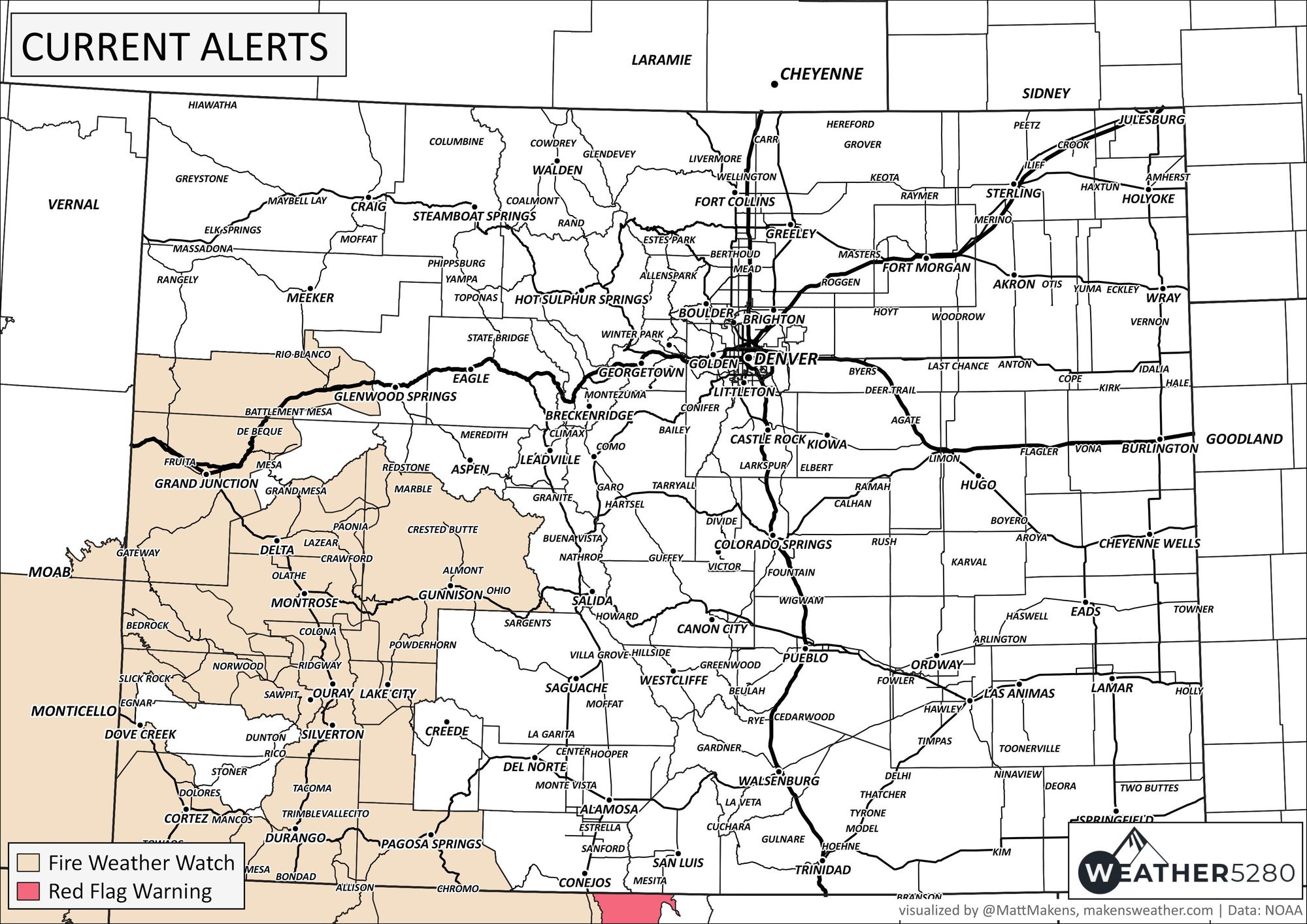
Wind, combined with some of the hottest temperatures of the year, so far, have combined to increase the fire potential across the Western Slope and San Juans.
That map legend above says some heat related issues... perhaps you've heard? Texas and the South are baking and more record heat on tap today through the week. Ouch!
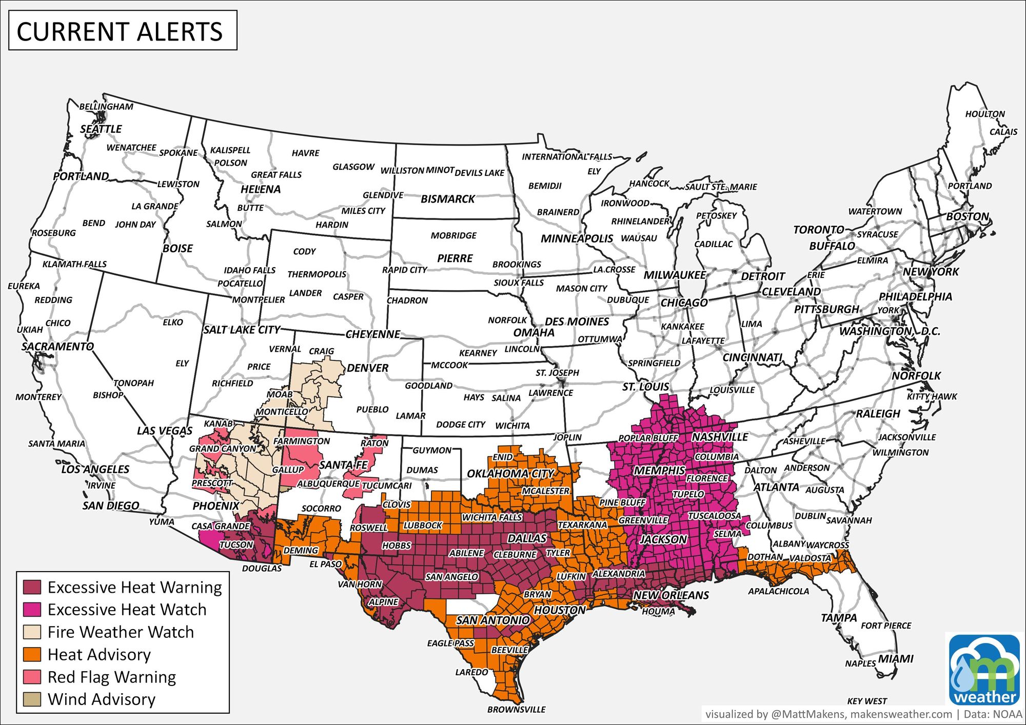
As we talked about in the State of the Atmosphere published yesterday, that heat dome - if you will - from the South eases up a bit so that Colorado cools headed toward July 4th. Here's that article:
Faithful readers, we have a question. In some cases we haven't had any comments on some recent posts - which is weird - are you all on vacation or did we hit a snag with Disqus? Let us know in the comments down below ;-)
