
Colorado weather: Today's severe weather forecast and a look ahead to July 4th forecast

An audible "oh, hail no!" from our readers this morning seeing there's a chance storms will again turn severe this afternoon. Thursday's storms once again delivered damaging hail to parts of the metro area and plains, and some storms that develop later today carry the same potential.
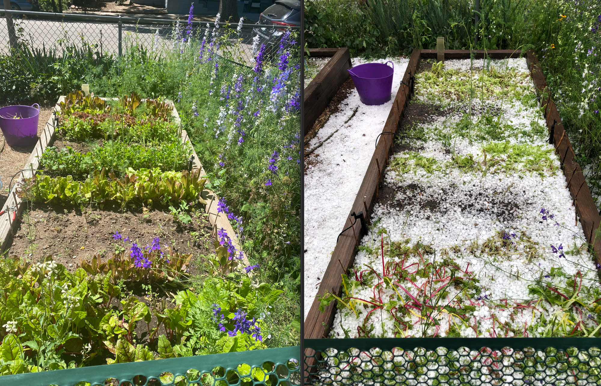
Take a look at the hail that flattened my dad's garden in northwest Denver! He assures me in a few weeks no one will be able to tell, but hard to see – and so much lettuce lost!
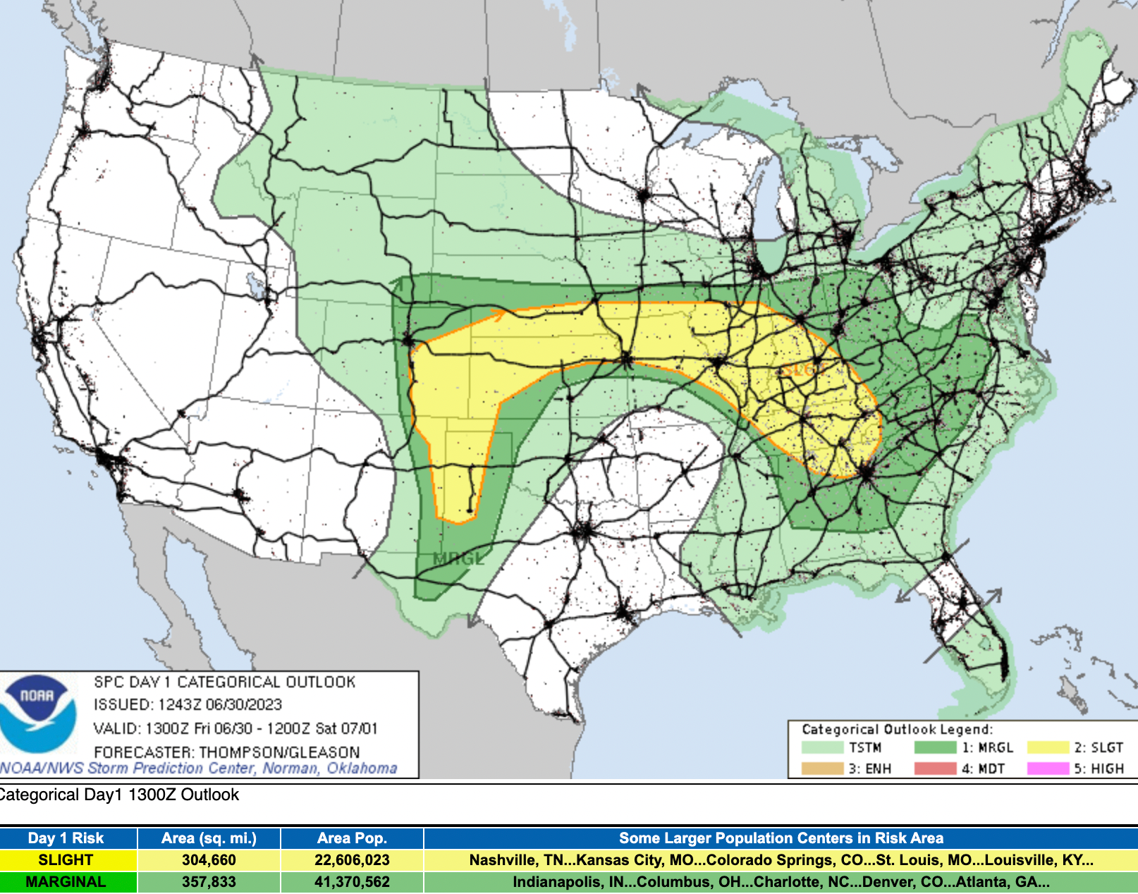
While Denver is not included in the Slight Risk for severe storms issued by the SPC this morning, it's not a zero chance either. Much of eastern Colorado is included in this elevated risk area today, similar to yesterday, mainly south of I-76 and along and east of I-25.
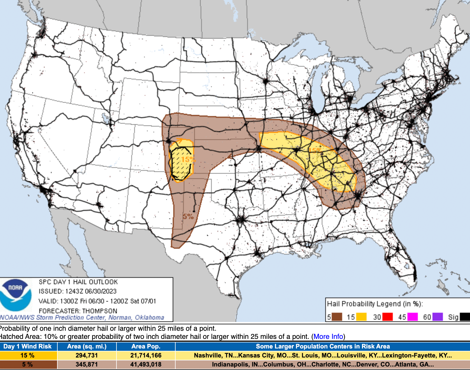
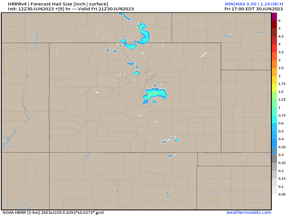
The hail threat exists for the metro area, but the greatest potential will be over the southeast plains, indicated in the hashed/circled area below:
The hourly planner shows the chance of storms will be with us most of the day, greatest this afternoon and early evening. That said, some folks are already seeing some early-morning storms rumble through, and while they are featuring quite a bit of lightning and heavy downpours, they are not yet severe.
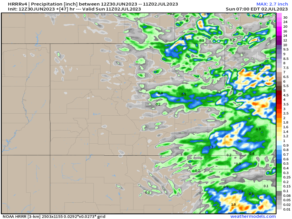
The latest HRRR, which did pretty well with yesterday's setup, shows the worst hail/severe storms for the metro area occurring over the Palmer Divide today, with locally 1"+ of precipitation as well. Otherwise it actually keeps the northern urban corridor relatively quiet, outside of this morning's storms:
July 4th outlook
While the 4th isn't until Tuesday, we know this is a long holiday weekend for many folks. The good news is, today's active weather and cooler temperatures will give way to a warmer and drier weekend, and pattern that is forecast to stick with us through into the early part of next week.
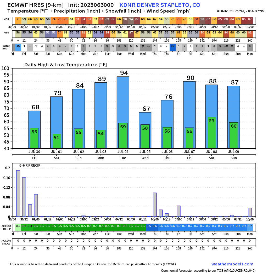
Tuesday is a bit of a questionmark as models diverge a bit in the timing of our next cold front. The latest European (below) has highs in the mid 90s for the 4th and keeps the urban corridor dry, while other models are a bit quicker with the cool air (and therefore have more storms on the 4th).
For now we'll focus on what looks like a very nice summer weekend, and keep an eye on the forecast for Tuesday as we get closer.
Stay weather aware today, and have a save and fun holiday weekend!