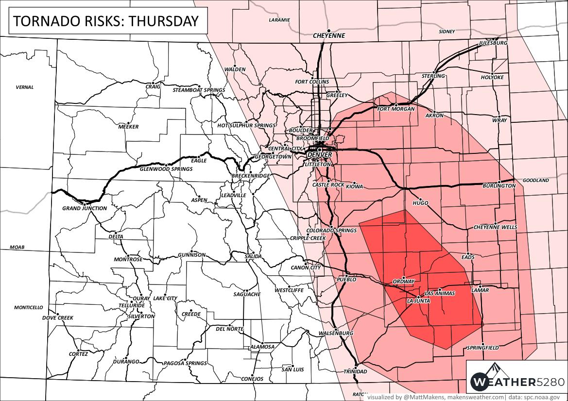
Colorado weather: Tornado risk increases Thursday, unusually high risk for Denver area

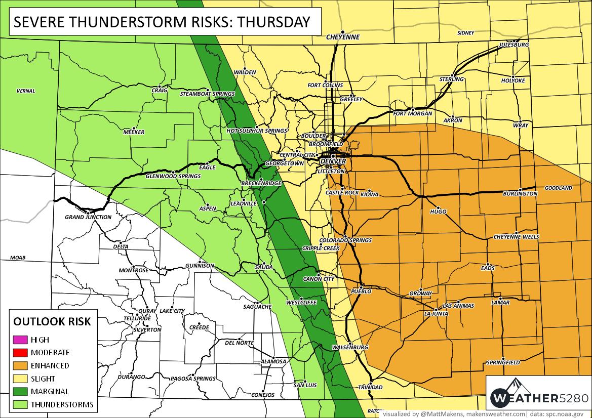
Tornado risks increase substantially across Eastern Colorado for thunderstorms expected later Thursday. In addition, very large hail will be possible. The risk of severe weather has increased in parts of the Denver metro area - higher risks than previous days.
Today's risks shouldn't be taken lightly. It is rare for parts of Denver to be in a 5% tornado risk, which the east and south sides are today.
Potential significant weather day across the plains today, with severe storms capable of producing very large hail and destructive winds, and tornadoes expected late this afternoon into the evening hours. #cowx pic.twitter.com/KODhNs3WSM
— NWS Pueblo (@NWSPueblo) July 6, 2023
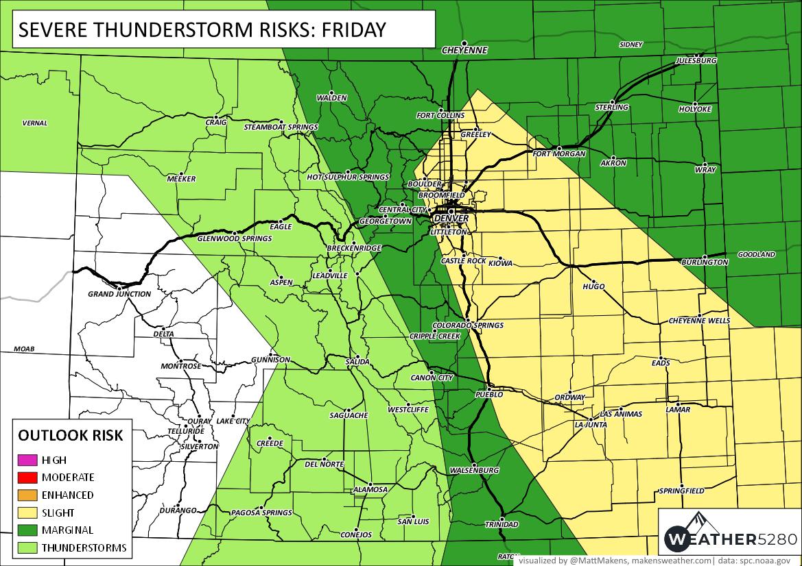
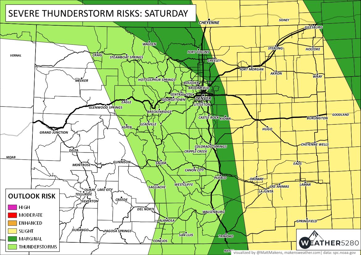
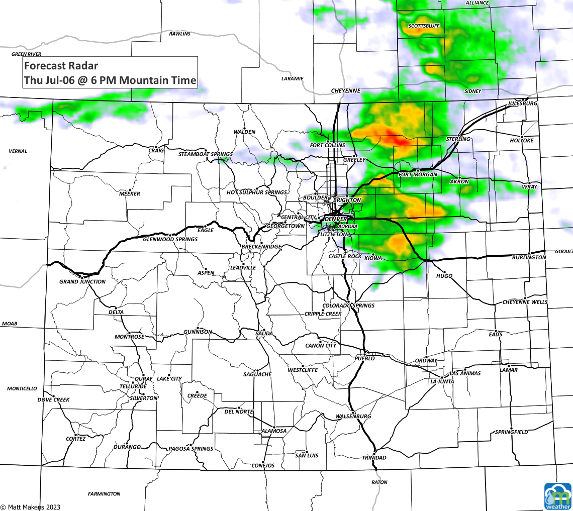
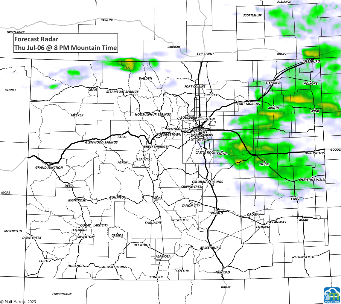
Begin with the outlook for storms and then the tornado risk areas, which are highest southeast of Denver on the Plains.

Let's get to the timing of these, the strongest activity is most likely in the late afternoon to early evening hours close to I-25 and then into the later evening on the Plains.
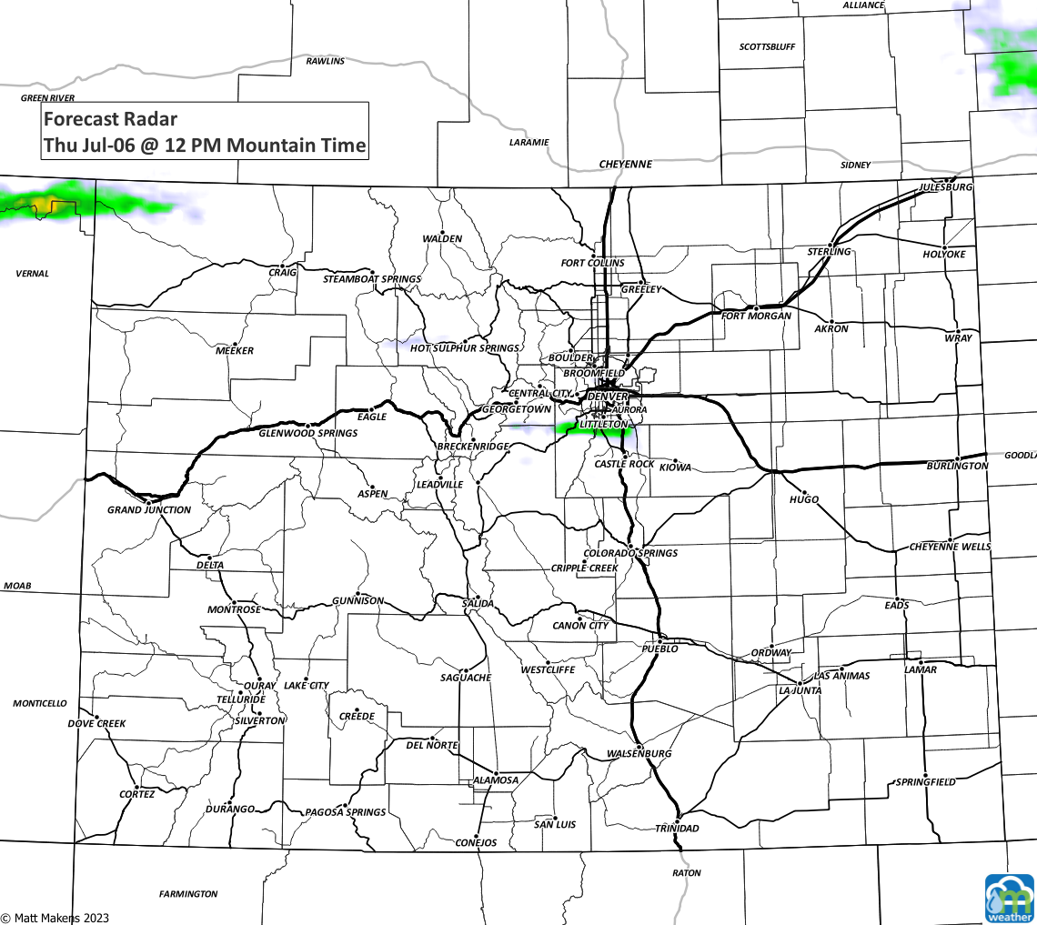
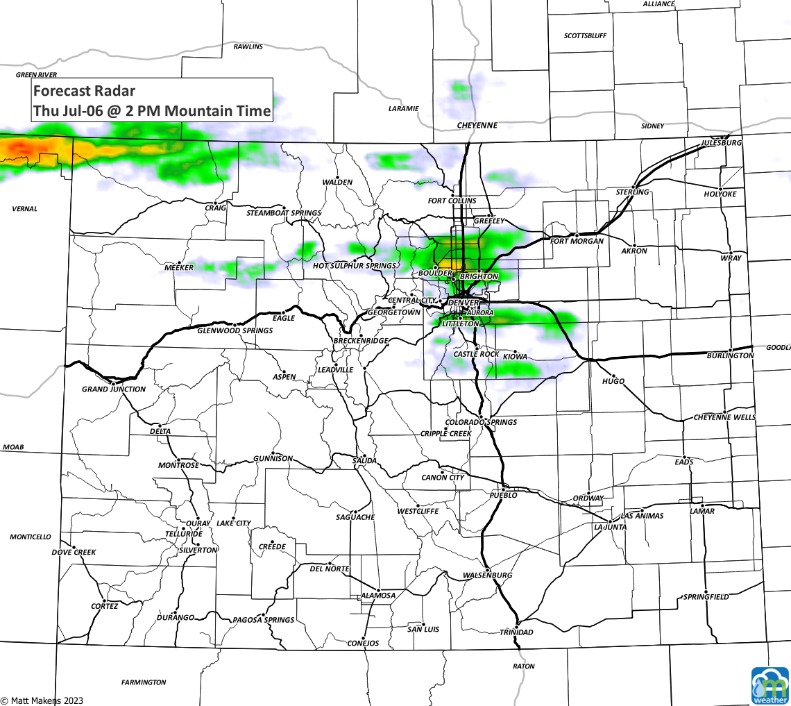
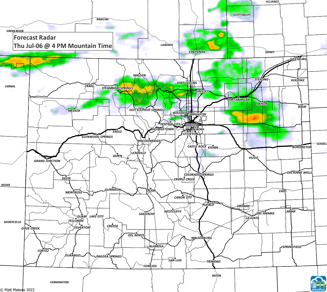

The modeling images above are missing out of some of the overnight data (I ran these early) and that data may include where smaller boundaries are sitting - act like activators for storms - and the modeling did not get a good look at the morning fog covering northern Colorado.
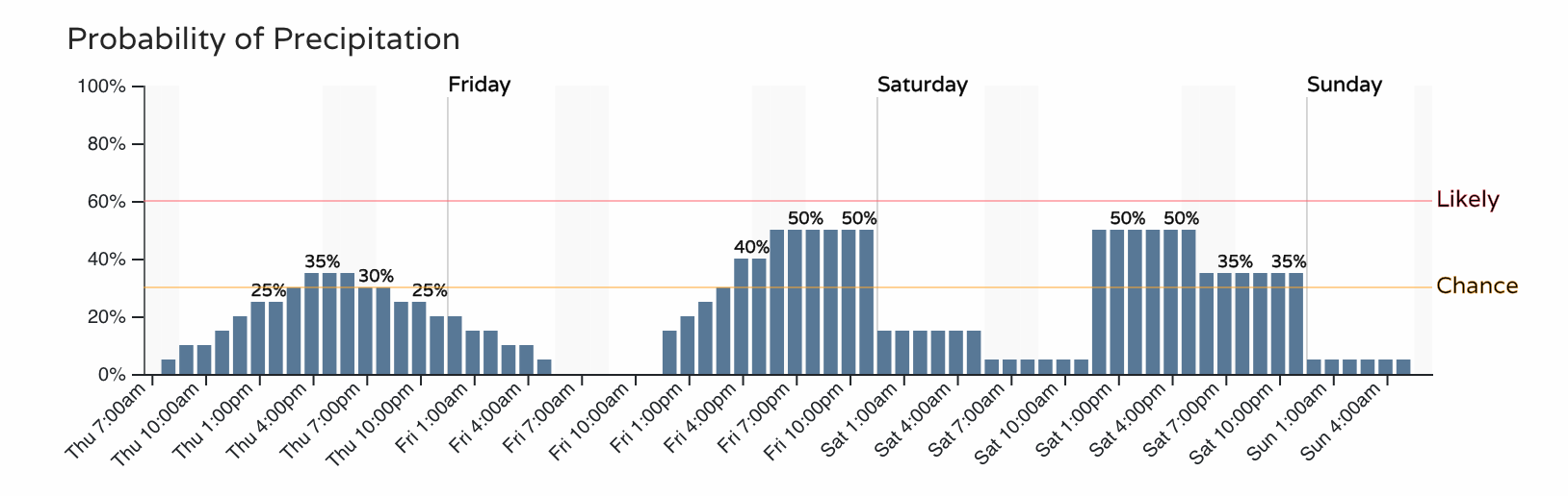
Chances for thunderstorms continue Friday and Saturday, the threats for damaging weather will continue.