
Colorado weather: Rain chance climbs, temperatures cool

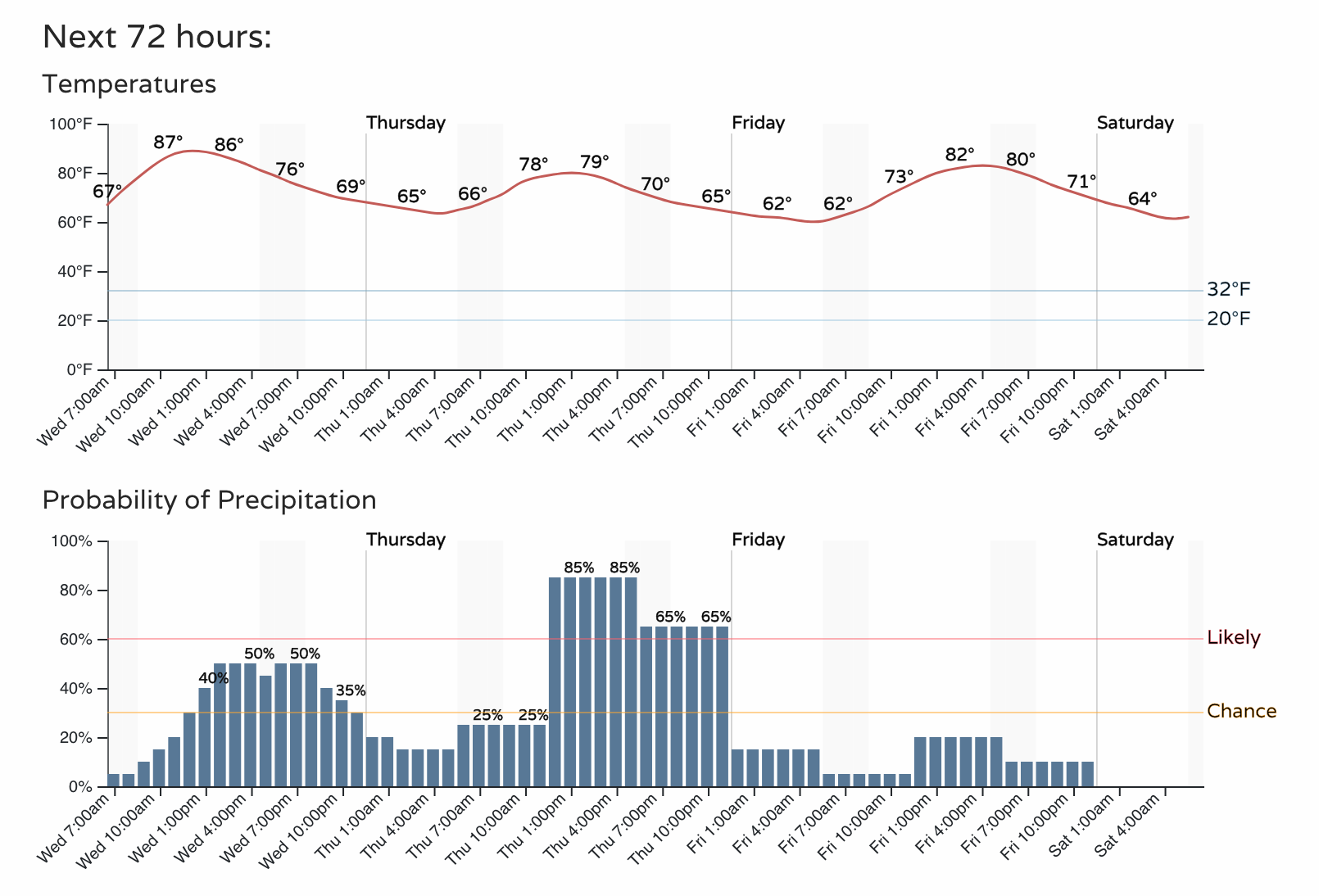
Rain chances increase the next few days and cooler temperatures will come along for a ride, too. For Denver, the highest chance for storms will be Thursday but the city stands a decent chance of hearing thunder today, too.
An hourly planner shows you those details through Friday.
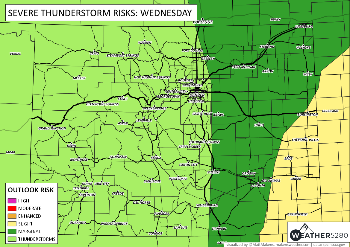
For today, lightning and wind gusts are the primary hazard around the metro areas. Meanwhile, severe storms on the eastern plains could have hail up to golf ball size and wind gusts to 60 mph along with brief heavy rain. The overall risk areas for today are shown.
The risk of severe weather does increase a bit for Thursday, which we will discuss for you in tomorrow's morning post.
Here's a timeseries for today's expected storminess.
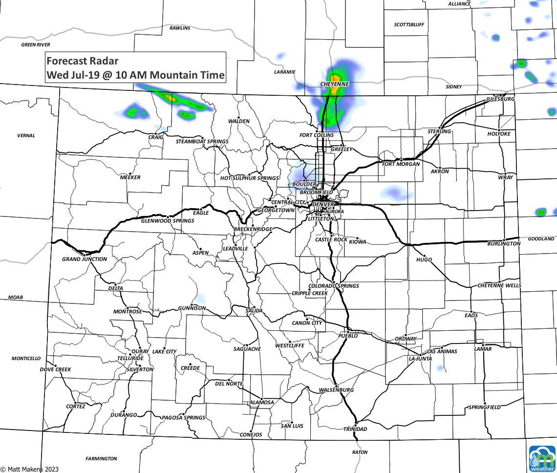

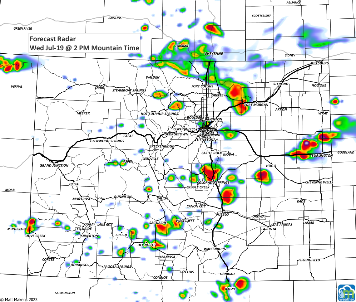
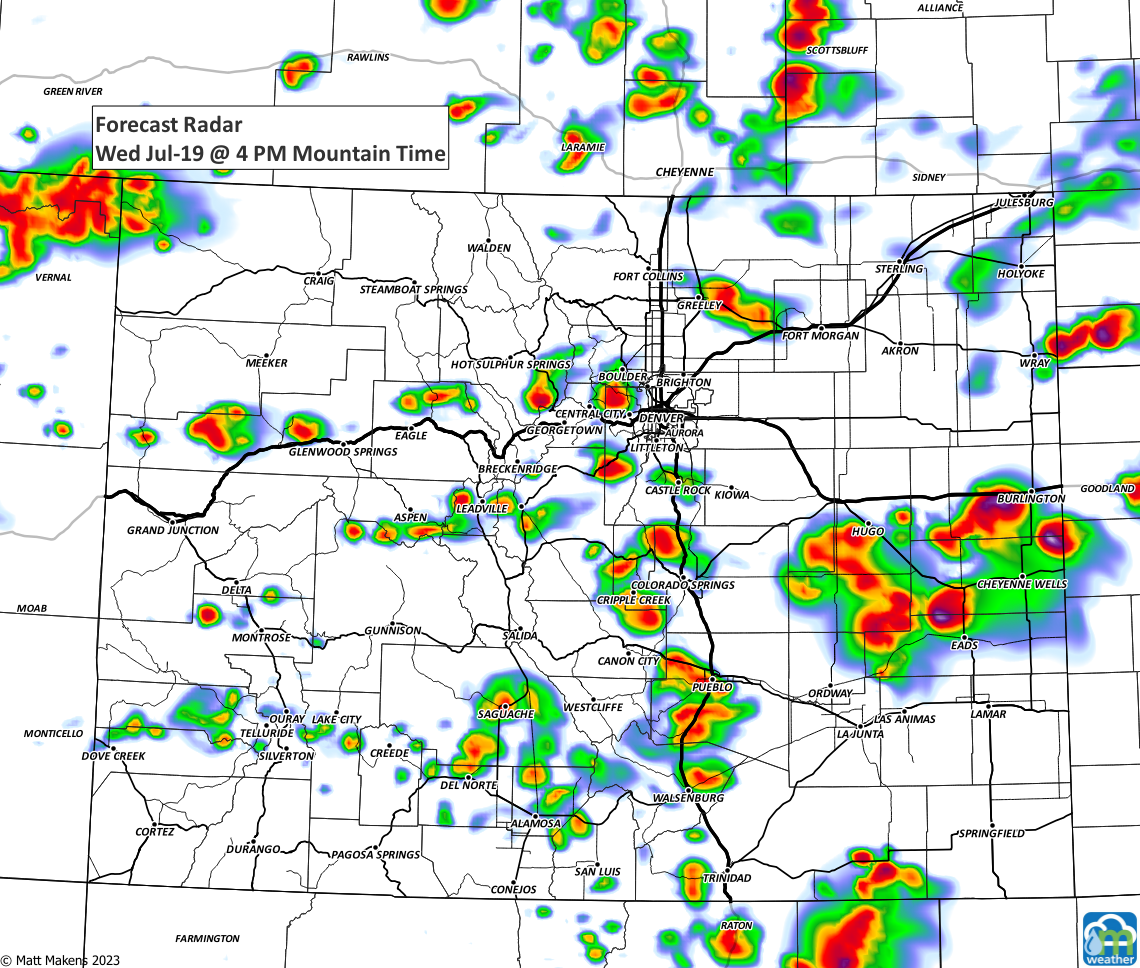
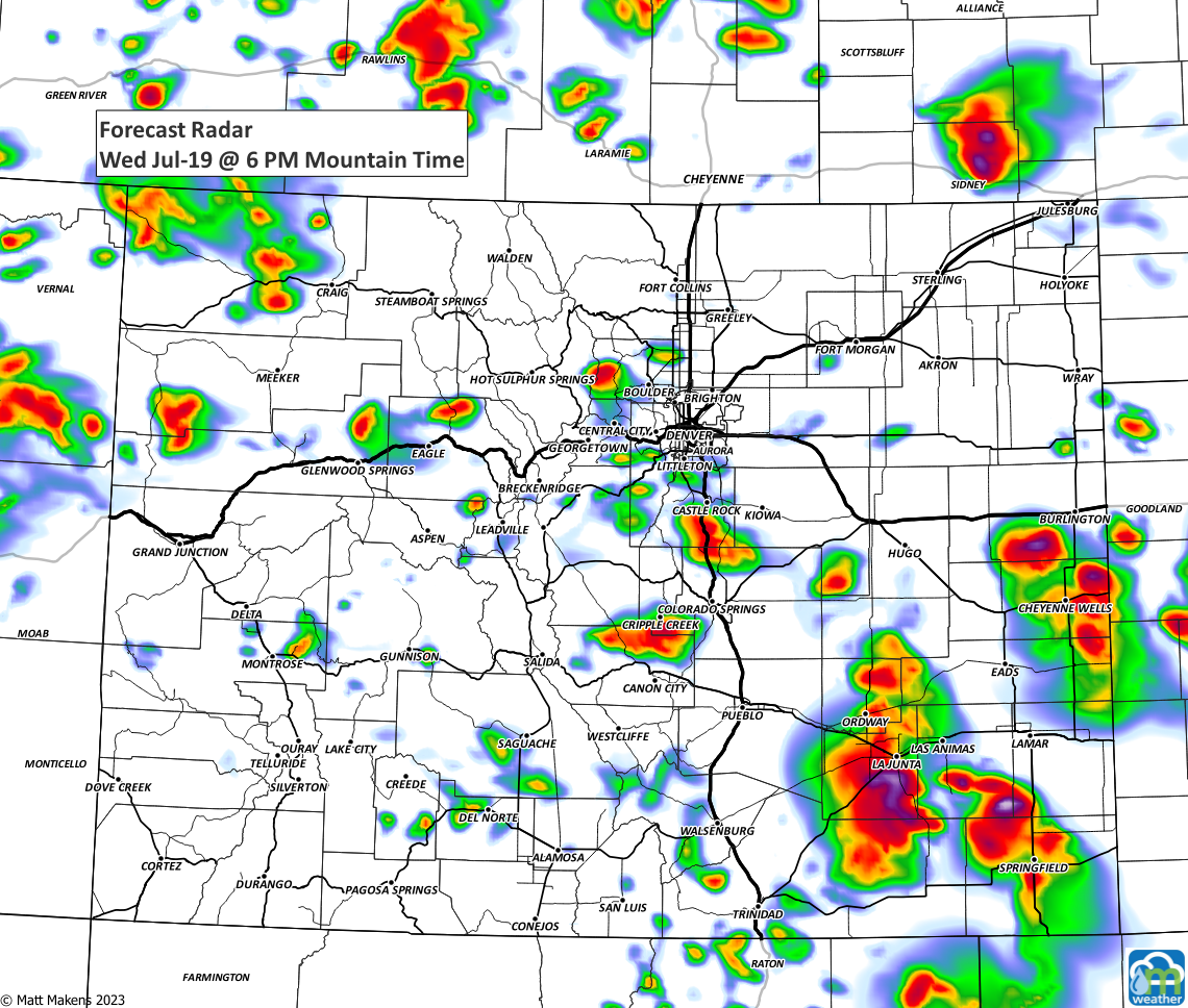
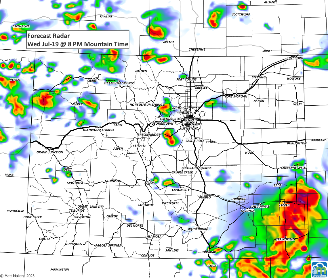
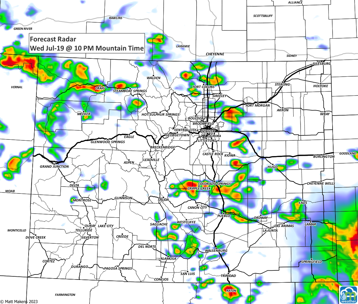
During the next three days, some decent rainfall totals will be expected. My yard could use a good drink at this point; here is a look at the totals for rest of the work week.
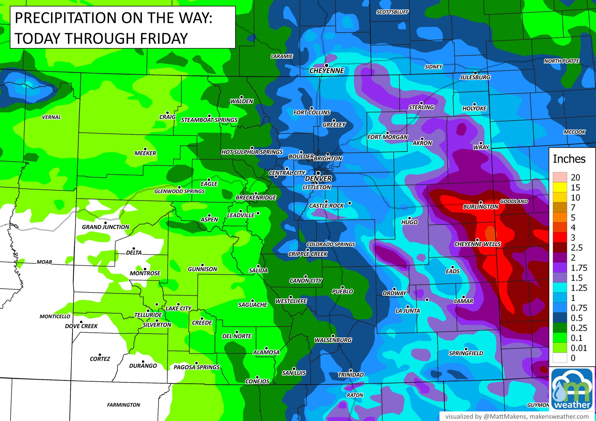
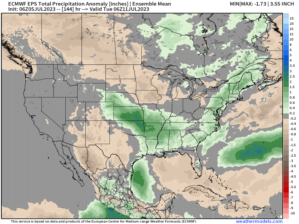
In case you were wondering, no this isn't part of our seasonal monsoon which remains a no-show in 2023. We anticipated that as our members have read in previous discussions. Here is the latest regarding the monsoon for this year:
Again, we will have an increased chance of rain Thursday. Tomorrow's severe weather threat also increases a bit. All those details coming at you in tomorrow's post. If you'd like to be getting the "heads up, hey there is a forecast to be aware of" style emails from us, you can sign up for those for free by clicking here.
