Perspective: Extraordinary heat grips parts of nation, for the High Plains July has been cooler than average

The rather eye-popping heat we've seen across the southern and southwestern U.S. this summer continues to grab headlines, and for good reason.
It's been hot. Remarkably so in some cases.
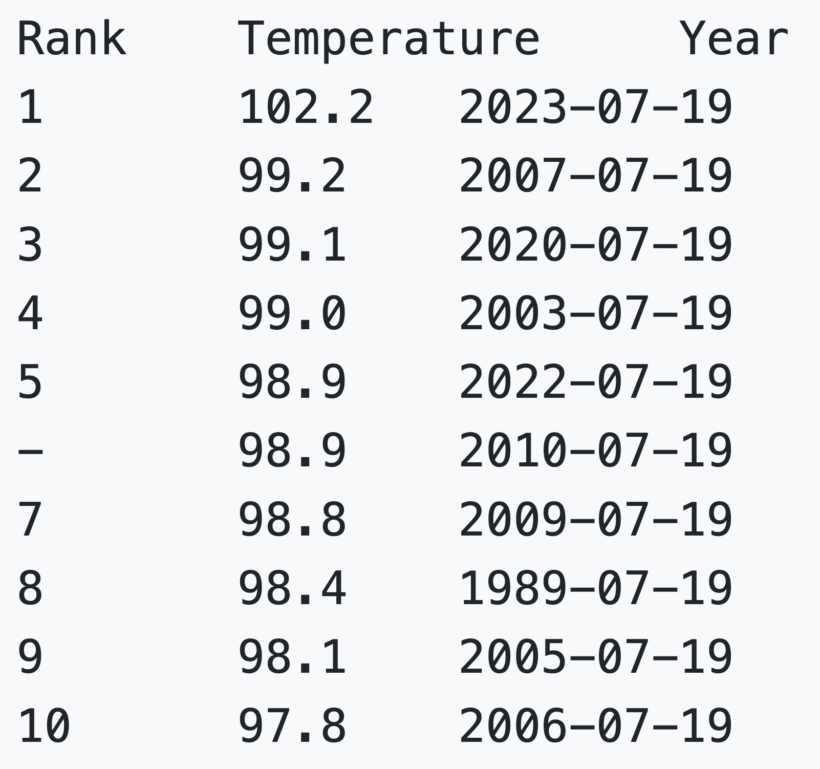
In Phoenix we've seen a record-setting heatwave on multiple levels. Through the first 19 days of July the city has run an average temperature of 102.2°F, making it the hottest July 1 - 19 period on record, crushing the previous record of 99.2°F by 3.0°F set back in 2007. Of the top 10 July 1 - July 19 average temperature on record for the Phoenix metro area, only 1 occurred prior to the year 2000.
This stretch of hot weather is also the hottest 19-day stretch on record for the city, not just for the start of July. The prior record was set in 2020, with an average of 100.7°F over 19 days ending August 16th of that year.
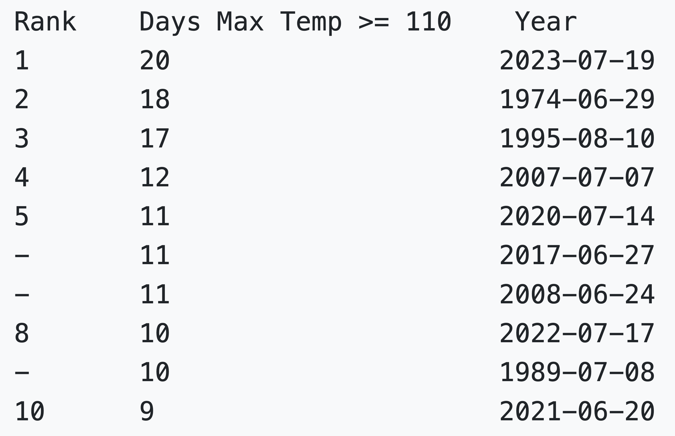
Yesterday (Wednesday) also marked the 20th consecutive day Phoenix saw a high temperature of 110°F or warmer. This too is a record for the city, beating the prior record of 18 days set in 1974. They will add to this tally today.
For Phoenix, and multiple cities across the Southwest, a warming climate in conjunction with ever increasing population growth means more and more of these records are set to fall and fall again in the coming years. The urban heat island effect (UHI) exacerbates the heat in these cities and will help drive up average temperatures in particular as overnight lows are disproportionately impacted.
Excessive heat does not end when the sun goes down! Temperatures across the Phoenix Metro area can still be very hot overnight due to the urban heat island effect. Buildings and areas with more pavement can retain heat easier, keeping temperatures very warm at night. #azwx pic.twitter.com/z1PrhHV4Fd
— NWS Phoenix (@NWSPhoenix) July 16, 2023
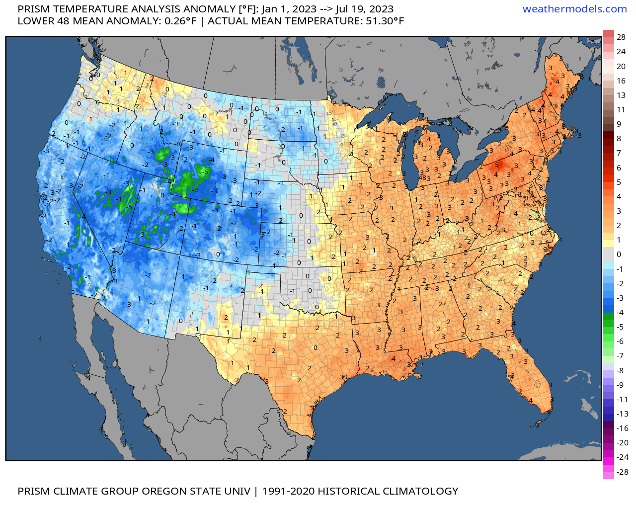
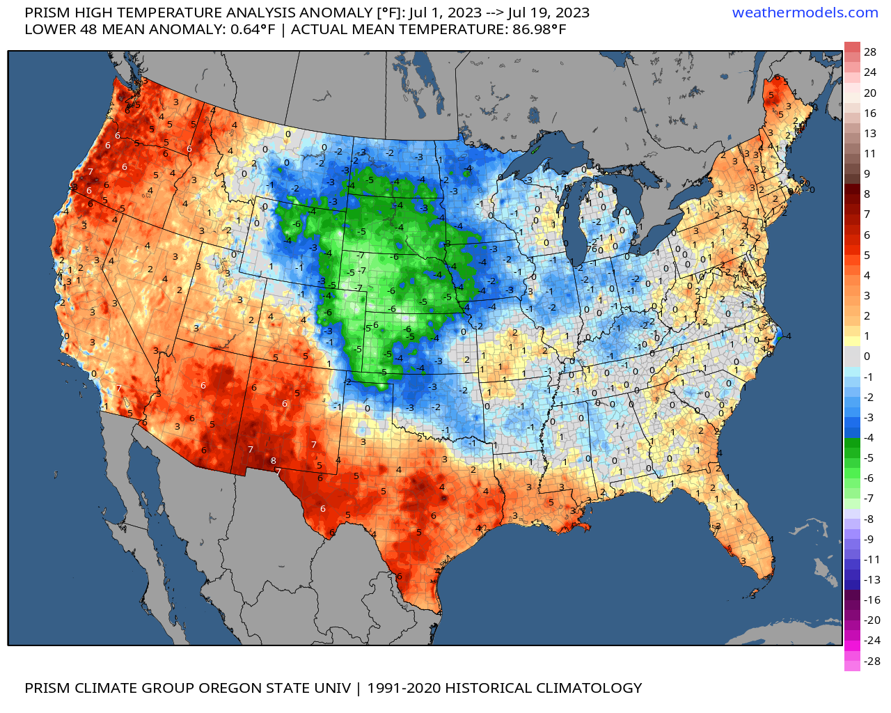
Even as much of the country sweats under record heat, a large part of the heart of the CONUS has actually experienced a cooler than average month thus far.
While south and coastal U.S. has largely run above average, areas from Oklahoma north to the Canadian boarder are enjoying temperatures some 2 to 5 degrees below average for the same period:
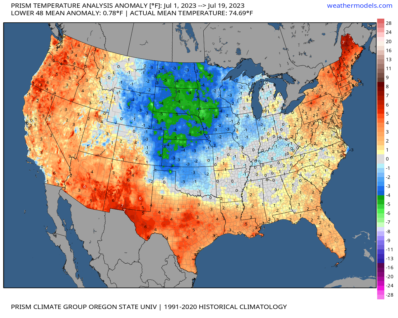
Interestingly, year to date much of the southwest and western U.S. remains cooler than average – even after this notable "heat dome" as been baking for the last couple of weeks. Quite a flip in temperature anomalies from the start of the year to what we're seeing so far this summer indeed:
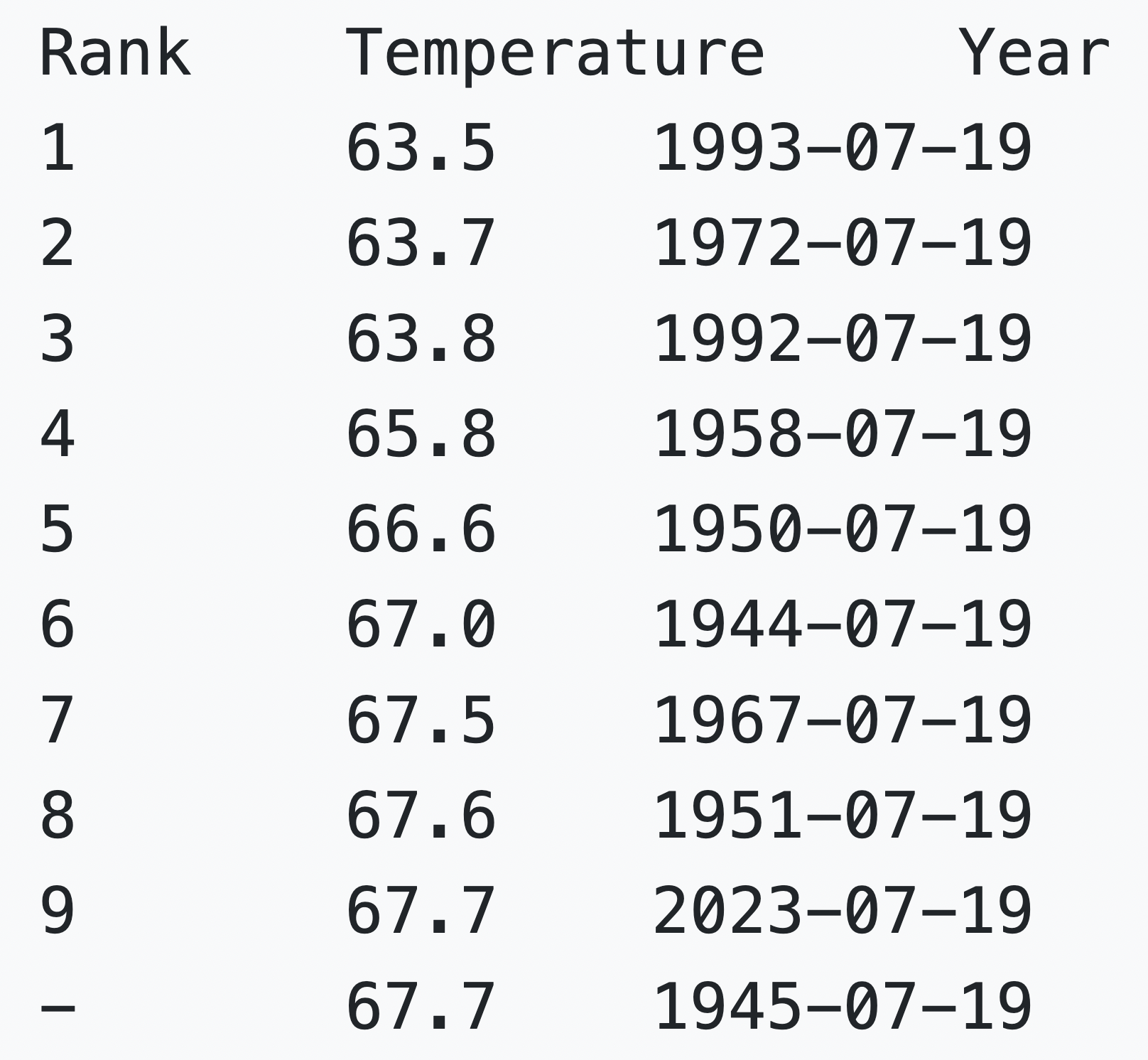
For Rapid City, for example, the month-to-date average temperature is just 67.7°F, which puts it in the 9th spot for coolest average temperature on record for the period!
Persistent troughing to the north so far this month has helped promote those cooler temperatures across the heart of the country, even as the south and coastal areas bake.
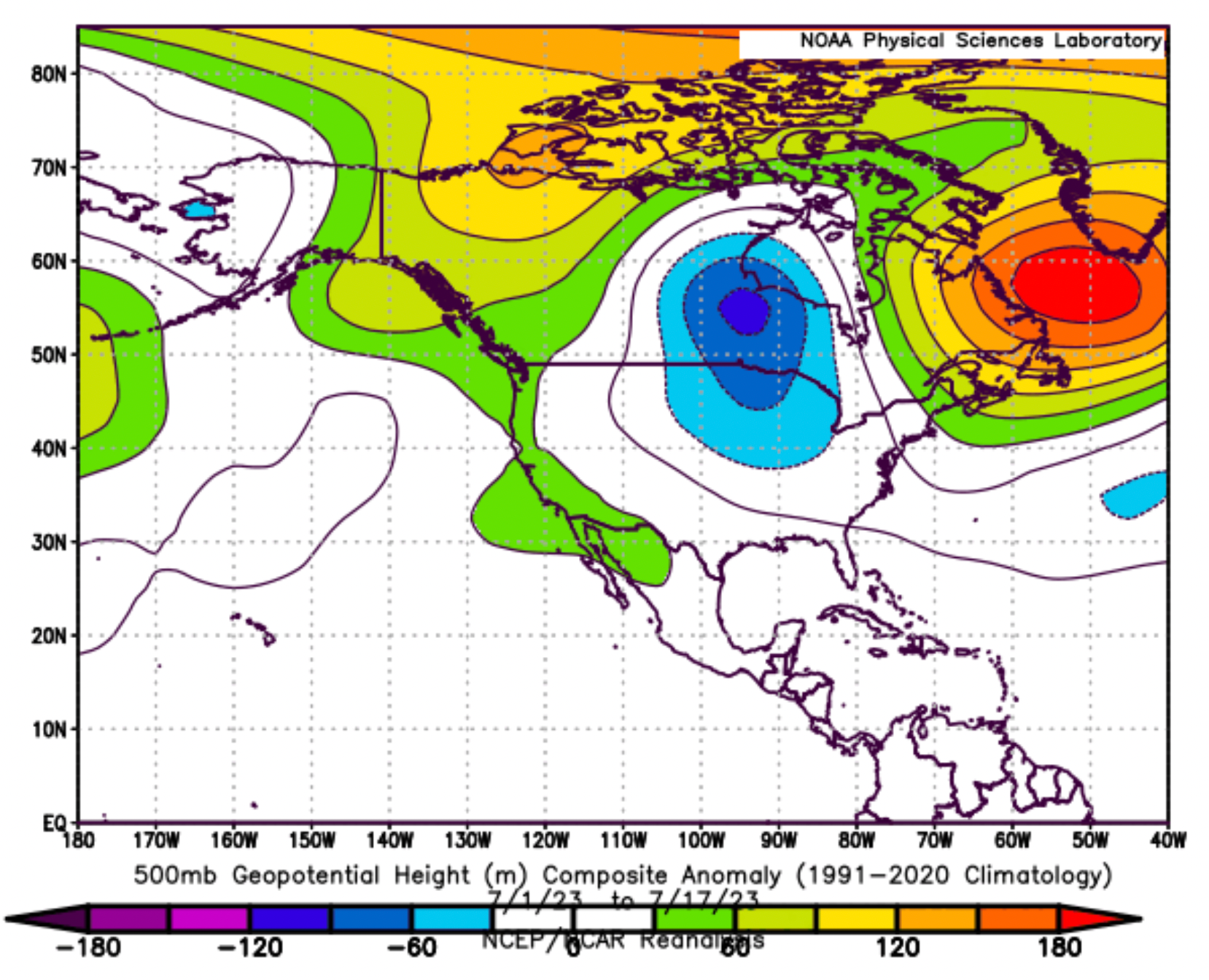
The placement of that trough and a reliably wet weather pattern – afternoon storms help keep afternoon highs in check – means many communities along and east of the Rockies are enjoying a very comfortable summer.
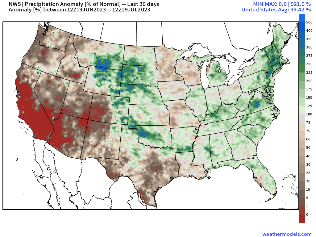
This is reflected in max temperature anomalies well, with high temperatures where we've seen the greatest precipitation anomalies over the last 30 days running from 5 - 7°F below average!
The heat, however, will be building.
For Denver, after today's brief cool down more hot weather is back in the forecast. By late in the weekend and early next week highs will climb back into the upper 90s (with some models forecasting highs upwards of 100°F, we'll see).

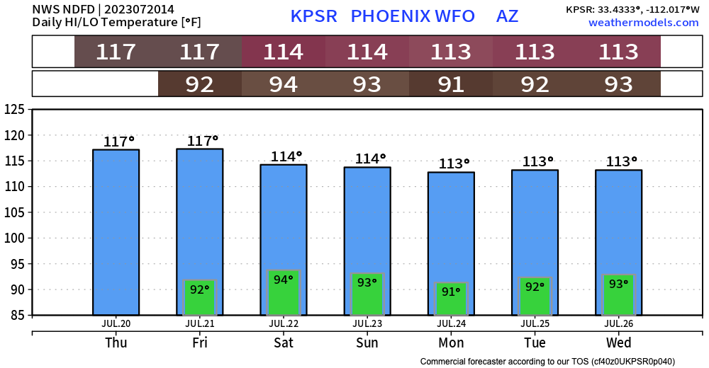
Phoenix, meanwhile, will be "cooling off", with highs around 117°F today and tomorrow, and a great chill on the way by early next week knocking back highs to 113°F or so... Part of what helps the Southwest cool down is the monsoon, which has yet to get established here and that's going to prolong the summer's heat.
Related: North American Monsoon forecast update
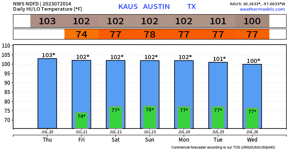
And finally, Texas too will continue to see above average temperatures through the next week at least, with Austin continuing its stretch of 100°F+ days into next week, about 3 to 5°F above the average high of 97°F this time of year.