
Colorado Weather: Enhanced risk of damaging hail and wind

Enhanced risk of severe weather today for Colorado's Eastern Plains as Denver and the metro areas can see a significant storm, too.
As I was walking the pup during lunch, the towers in the distance were rapidly growing. The top of a Cheyenne, Wyoming storm was what caught my attention first, but we had towers developing around our mountains, too.
As these storms develop through the afternoon, they move east into an environment that has some ingredients to put together that can lead to large hail and damaging wind gusts.
Here's the overall outlook.
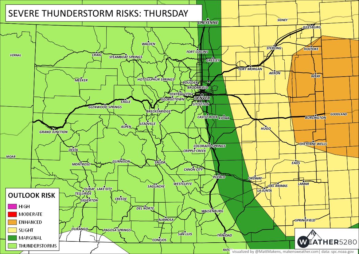
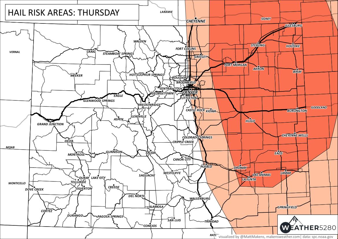
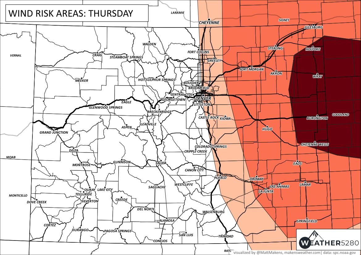
Denver and the Front Range sit in a "marginal" risk of severe storms, but points east have a considerably higher risk. Speaking of risks, here are the hail and wind outlooks.
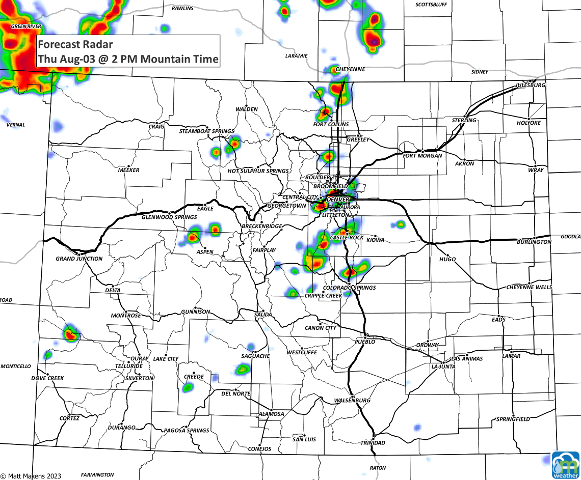
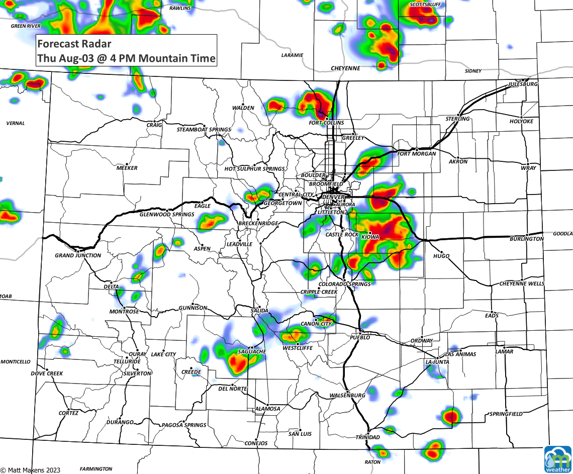
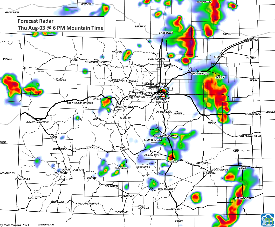
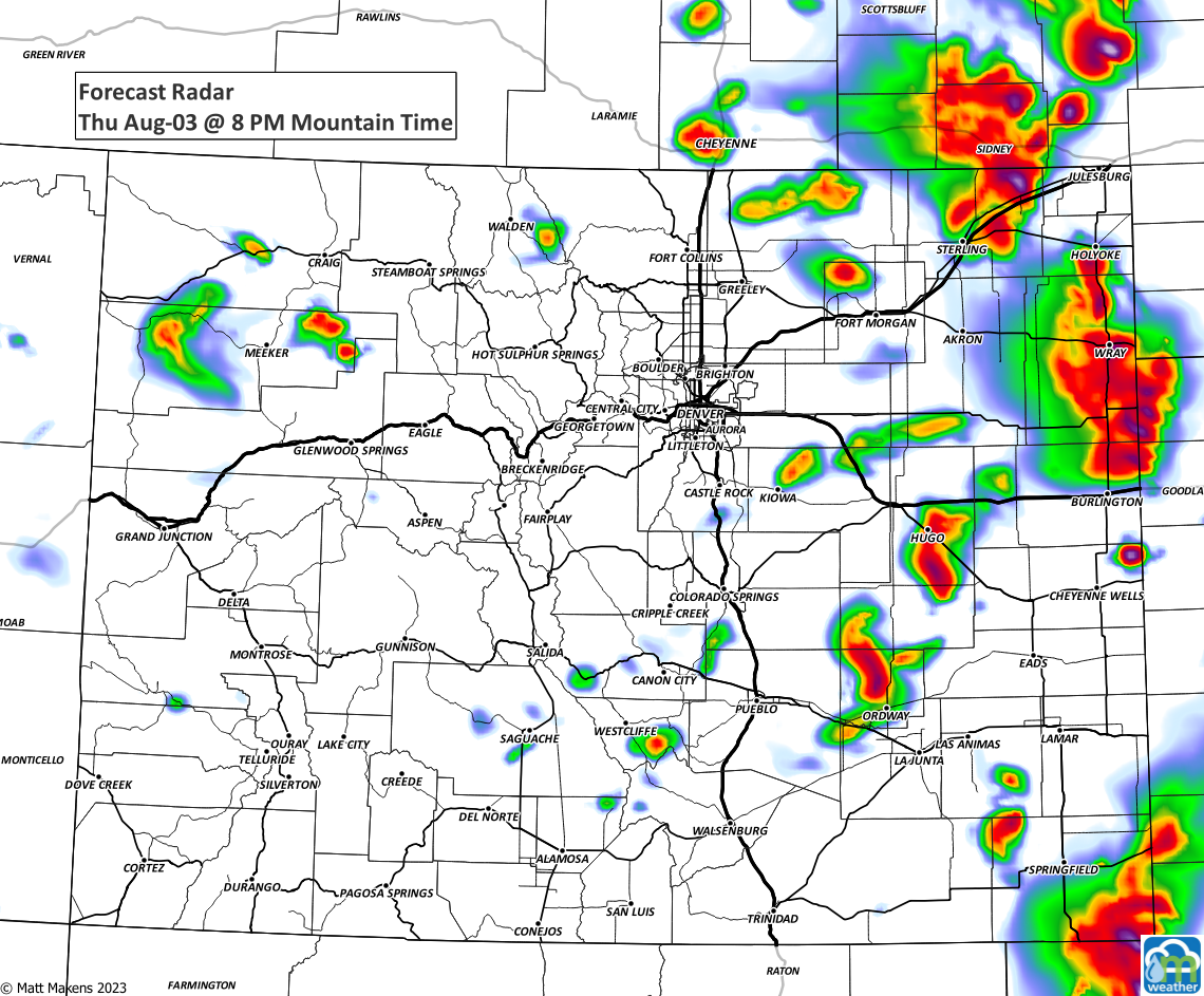
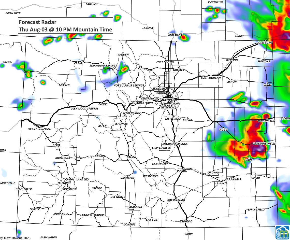
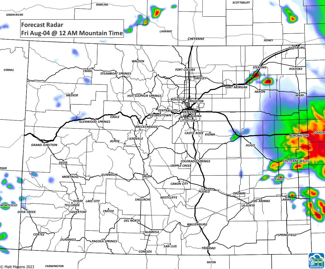
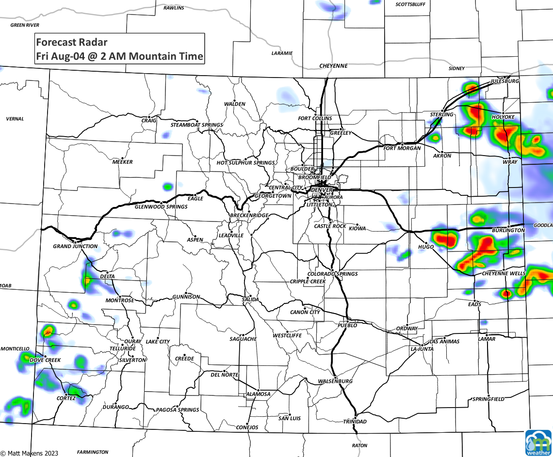
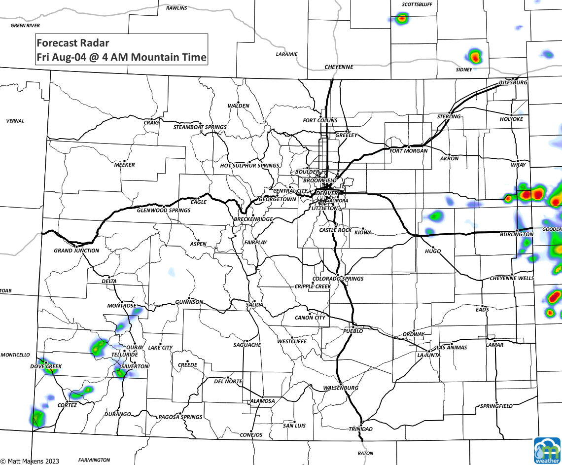
Here's a time series of images to show the placement of the thunderstorms through late tonight and early tomorrow.
Keep us posted with what happens at your place...it's always interesting to compare "notes."
