Colorado weather: Rain is on the way, how much and when it's forecast to arrive

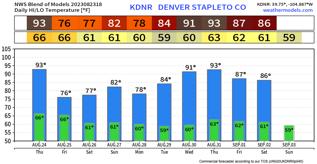
Across northeast Colorado one more hot day to work through on Thursday before a cold front arrives and brings a notable drop in daytime temperatures to the region Friday. The 10 days blended model data shows a high of just 76°F on Friday in Denver, a nice break indeed after our most recent streak of 90°F+ degree weather.
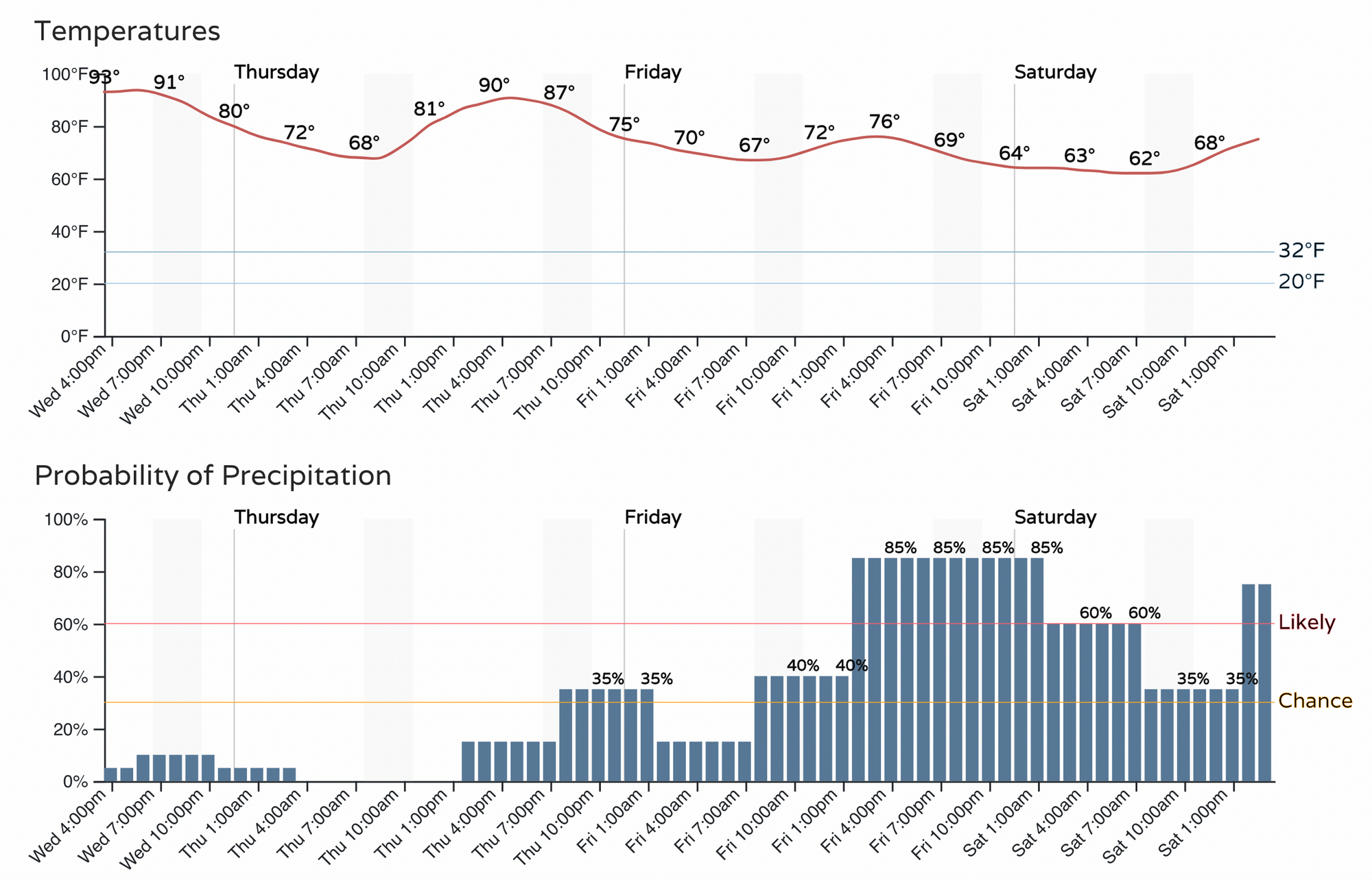
The best chance for appreciable rainfall along the northern urban corridor and northeast plains looks to come Friday and Friday night. That said, as early as tomorrow we should see better storm coverage across much of the state, including a 30 to 40% chance of rain in Denver Thursday evening:
The latest guidance from the GFS shows PWAT (precipitable water) values highest over the mountains tomorrow before shifting east Friday and Friday night. Storm coverage will be greatest across the high country Thursday and eventually transition east on Friday.
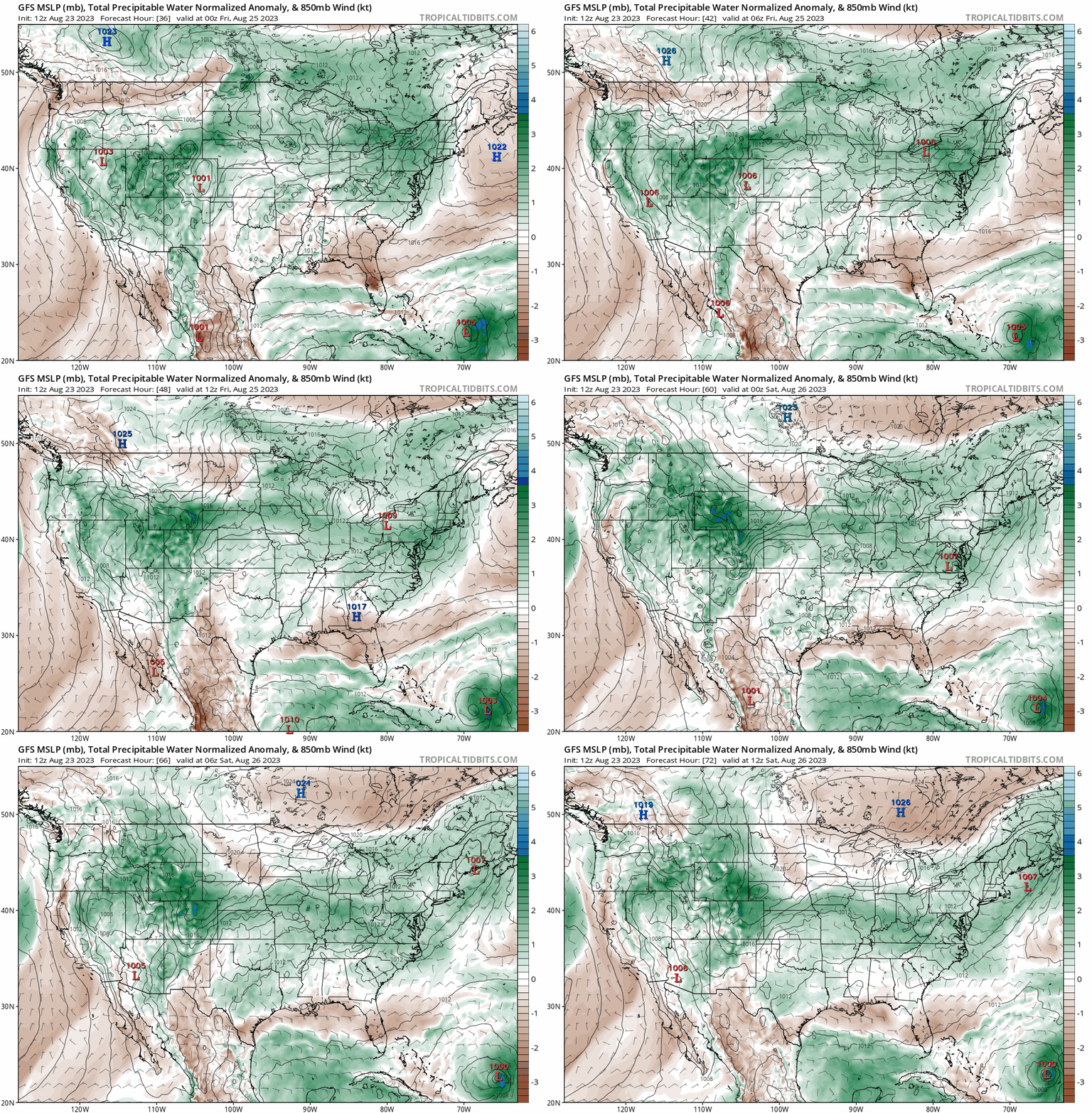
Models are quite bullish on precipitation totals across the region thanks to the influence of subtropical moisture from the remnants of Harold. This, in combination with post-frontal upslope flow along the Front Range should equate to a period of widespread light to moderate (even heavy at times) rainfall during the period.
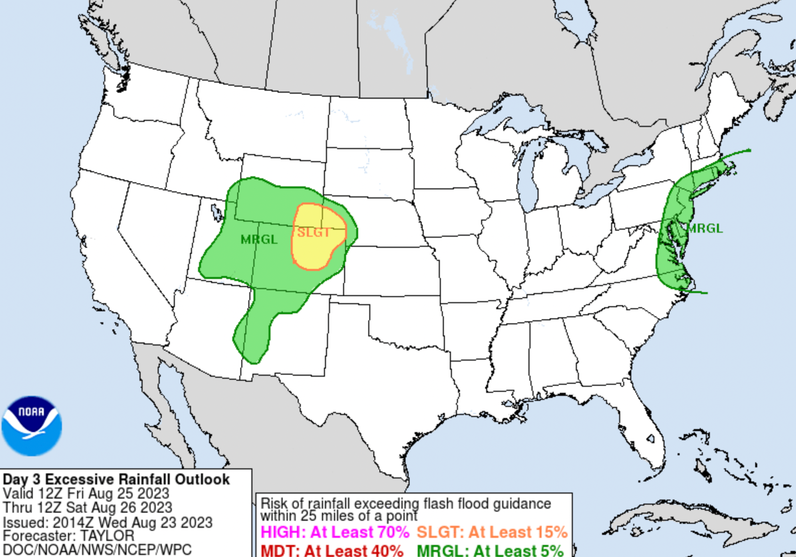
Here is the WPC "Excessive Rainfall" outlook for Friday into Saturday, showing the greatest risk across the CONUS for flash flooding to be focused over northeast Colorado:

How much rain?
It looks like a large area of 1 - 2" totals will be possible between now and Sunday, with the heaviest precipitation focused along the Front Range and urban corridor, but really some beneficial moisture showing up in the guidance for much of the state over the next couple of days:
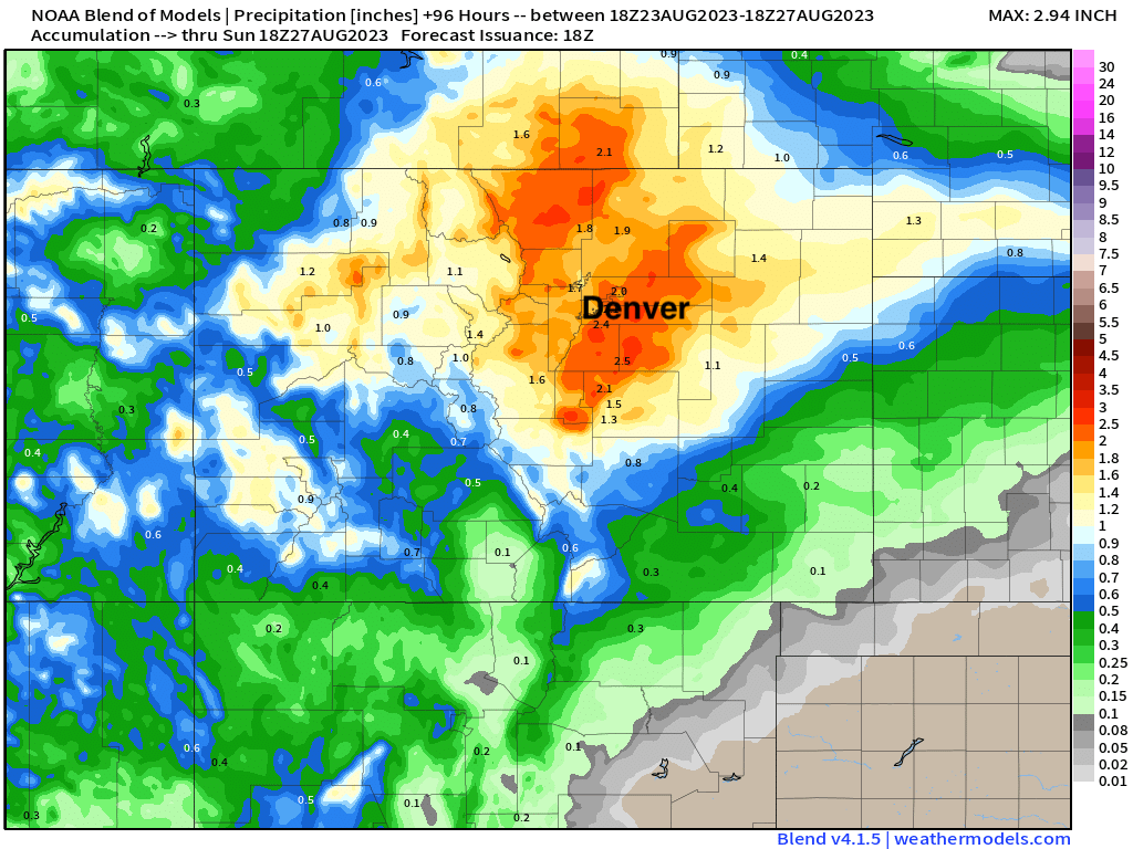
Some models show more, some show less, some have a secondary push of shower activity adding to totals as bit on Saturday as well.
Bottomline... relief from the heat is on the way, and be mindful of the forecast for Friday as we see those rain chances ratchet up.
In case you missed it...
