
Snow is in the forecast for Denver and much of Colorado this weekend, when it hits and how much to expect

Our newest contributor to Weather5280, Luke Victor, has been tracking changes to our weather set to arrive this weekend for well over a week now. Who's ready for some snow?
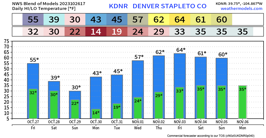
Temperatures have already cooled from the record heat last weekend and earlier this week across the region, with highs in Denver today expected to top out in the mid 50s, a few degrees below the average for the date of 63.5°F.
From here we'll only get colder, with a high of about 50°F forecast for the Denver area on Friday, then mid 30s Saturday, and perhaps not breaking the freezing mark Sunday with overnight lows in the teens early Sunday and Monday mornings. As we mentioned in previous updates, you'll want to make sure your irrigation is prepped for the hard freeze this weekend, and bring any plants indoors that you want to protect from the cold. Winter is coming!
The outlook
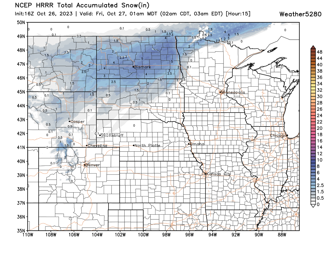
As system is passing largely to our north today, and as it does we'll see those cooler temperatures across the region, as well as areas of dense fog, high country snow showers, and perhaps some drizzle later in the day across the plains. As you can see below, little snow accumulation is expected across Colorado today, with more appreciable snow across the northern tier.
The system of interest for our area follows this one for the weekend, with snow picking up in earnest across the northern Rockies of Colorado late Friday night and eventually working its way across Northeast and east-central Colorado during the day Saturday into Saturday night. The best chance of accumulating snow for the northern urban corridor looks like it'll come Saturday afternoon and evening, before snow gradually comes to an end early Sunday from north to south.
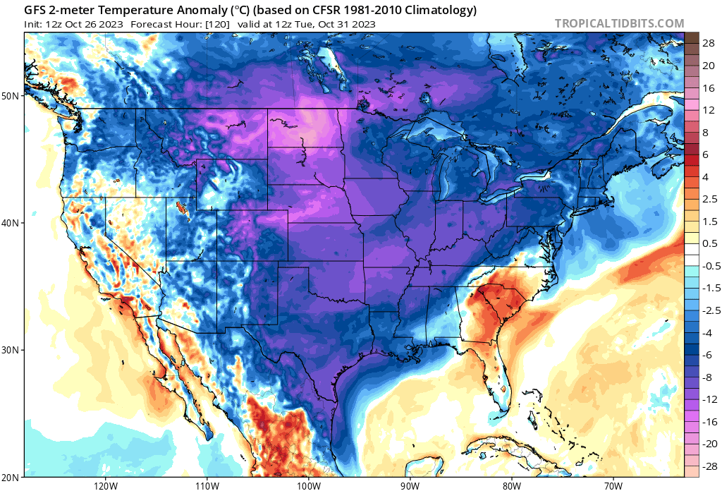
The cold that follows will be a big change from the mild weather we've seen much of this month. A reinforcing shot of cold air arrives Saturday morning along the Front Range, with temperatures well blow average across the Intermountain West and High Plains:
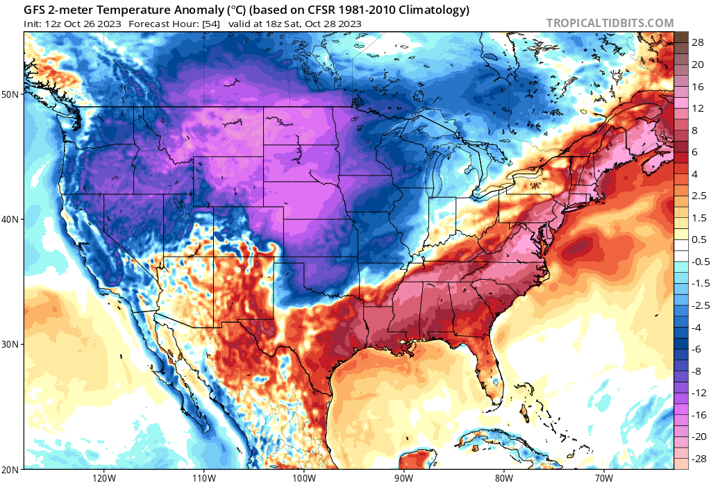
By Sunday morning the cold has plunged south into Texas with anomalous heat holding on for one more day across the Southeast:
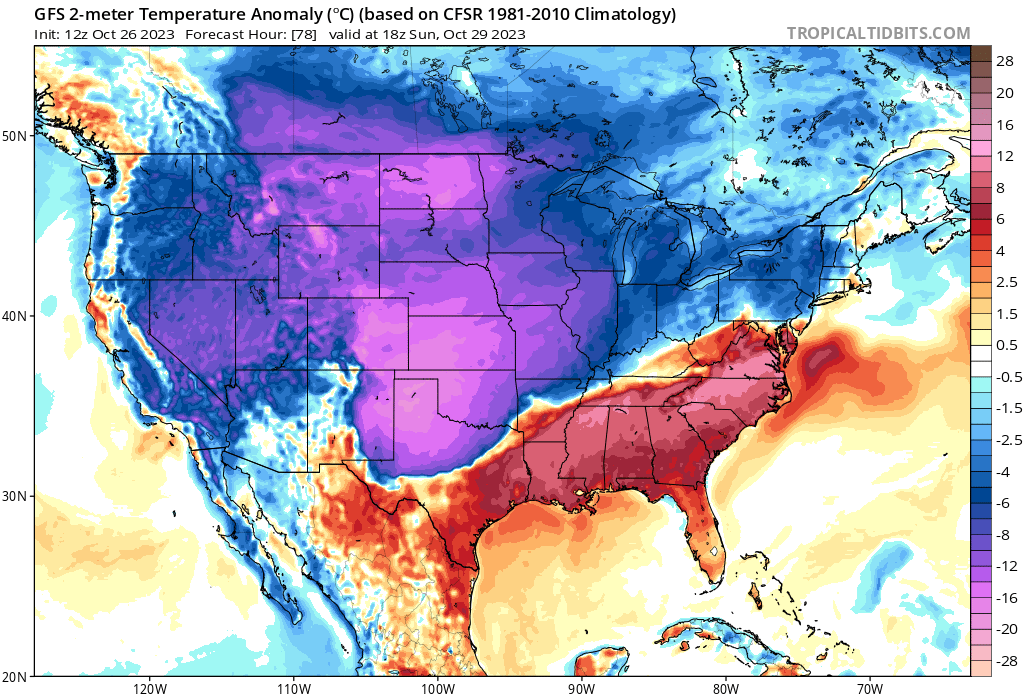
And by Halloween day, most of the nation will be experiencing below average temperatures:
Bundle up!
Snowfall forecast
It looks like much of the urban corridor will see its first measurable snow of the season this weekend, and if so will come about 10 days later than the long-term average first snow of the season in Denver. Keep in mind that ground temperatures are warm, and a lot of melting will occur during the snowfall, especially anything that falls before sunset.
Something else to consider will be any thing that DOES melt, will potentially "flash freeze" after sunset as temperatures crater into the 10s and 20s. Decent driving conditions could RAPIDLY deteriorate if that plays out. Consider that for Saturday evening plans along the I-25 corridor.
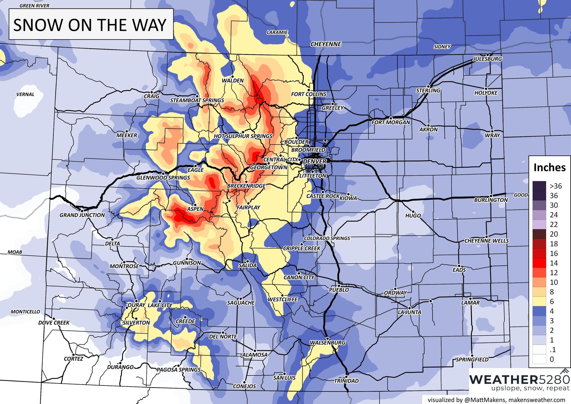
For the central and northern mountains this will be a good snow to round out the month, with upwards of 12" possible for the higher peaks through Sunday evening. Across the urban corridor we expect most locales to end up in the 3 - 6" range, with higher totals across the foothills possible, and (generally speaking) lighter totals as you move east of I-25, though localized banded snowfall could buck that idea in some areas.
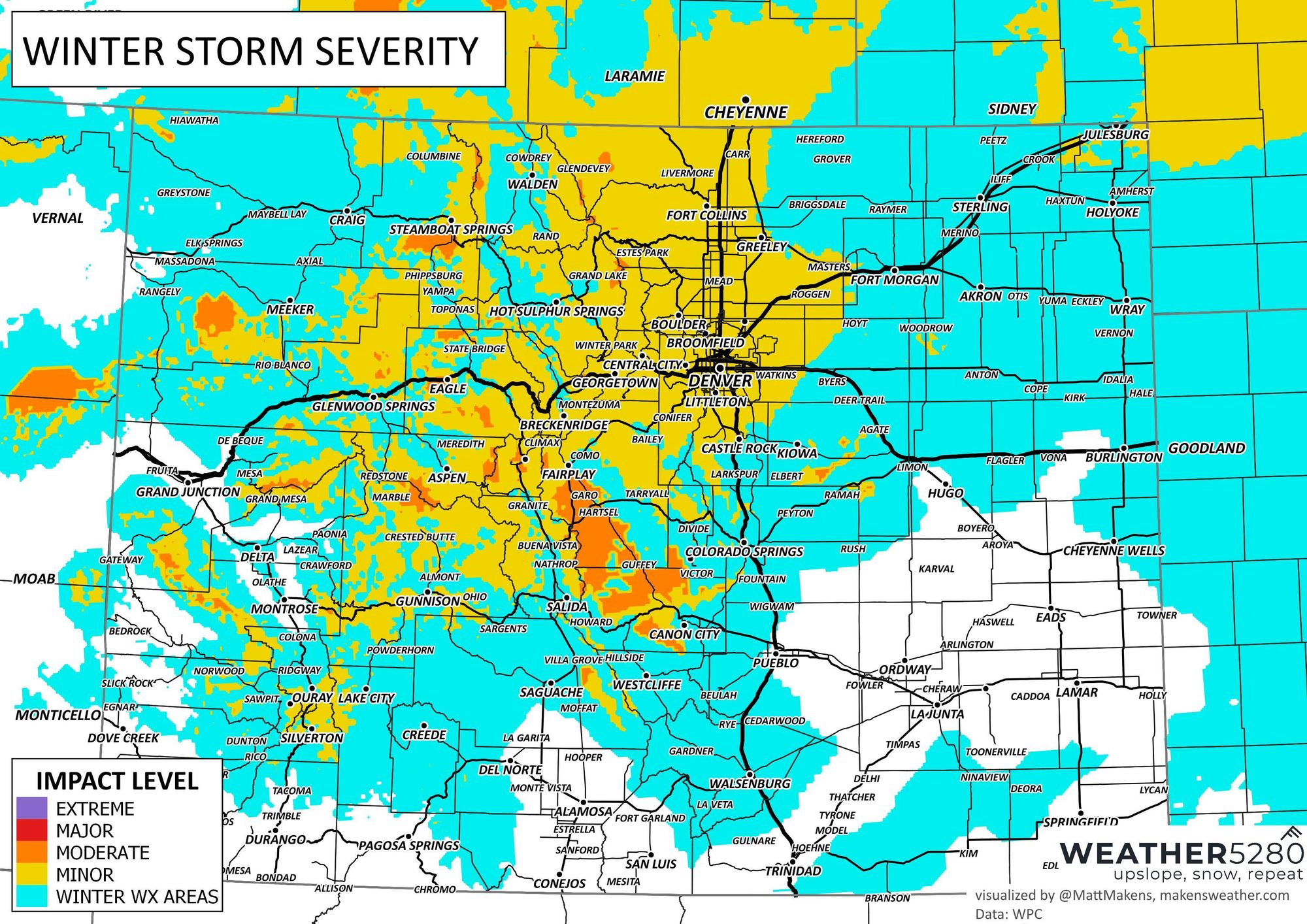
At the state level, here's how much snow to expect through the weekend:
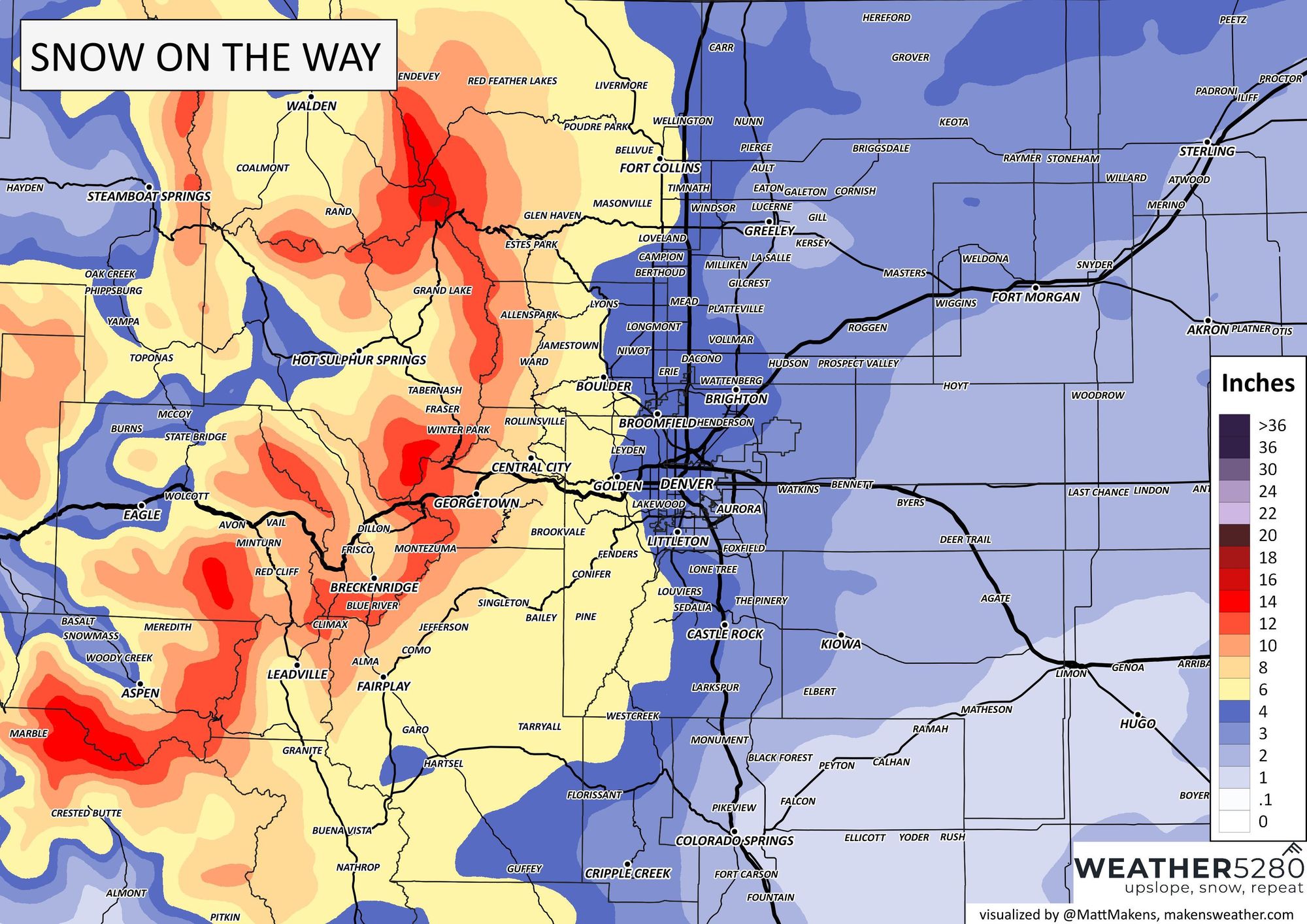
Zooming in we see areas west of I-25 favored for the greatest totals, so snow totals in excess of 6" are certainly on the table for places like Golden, Boulder, and Fort Collins:
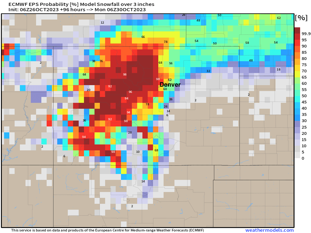
Probabilities for 3" of snow or more (below) are pretty healthy, particularly from Denver north and west of I-25. Odds are lower south of I-70. You can also note a hint of a favored band of heavier snow north of Denver here? Perhaps. In fact, a number of models are latching onto the idea of a band of heavier snow setting up Saturday night somewhere between Denver and Fort Collins, which if this were to verify could bring at least a localized swath of heavier snowfall totals to some communities along the urban corridor. This is something we'll be watching closely for as we get closer to the event.
Timing and impact
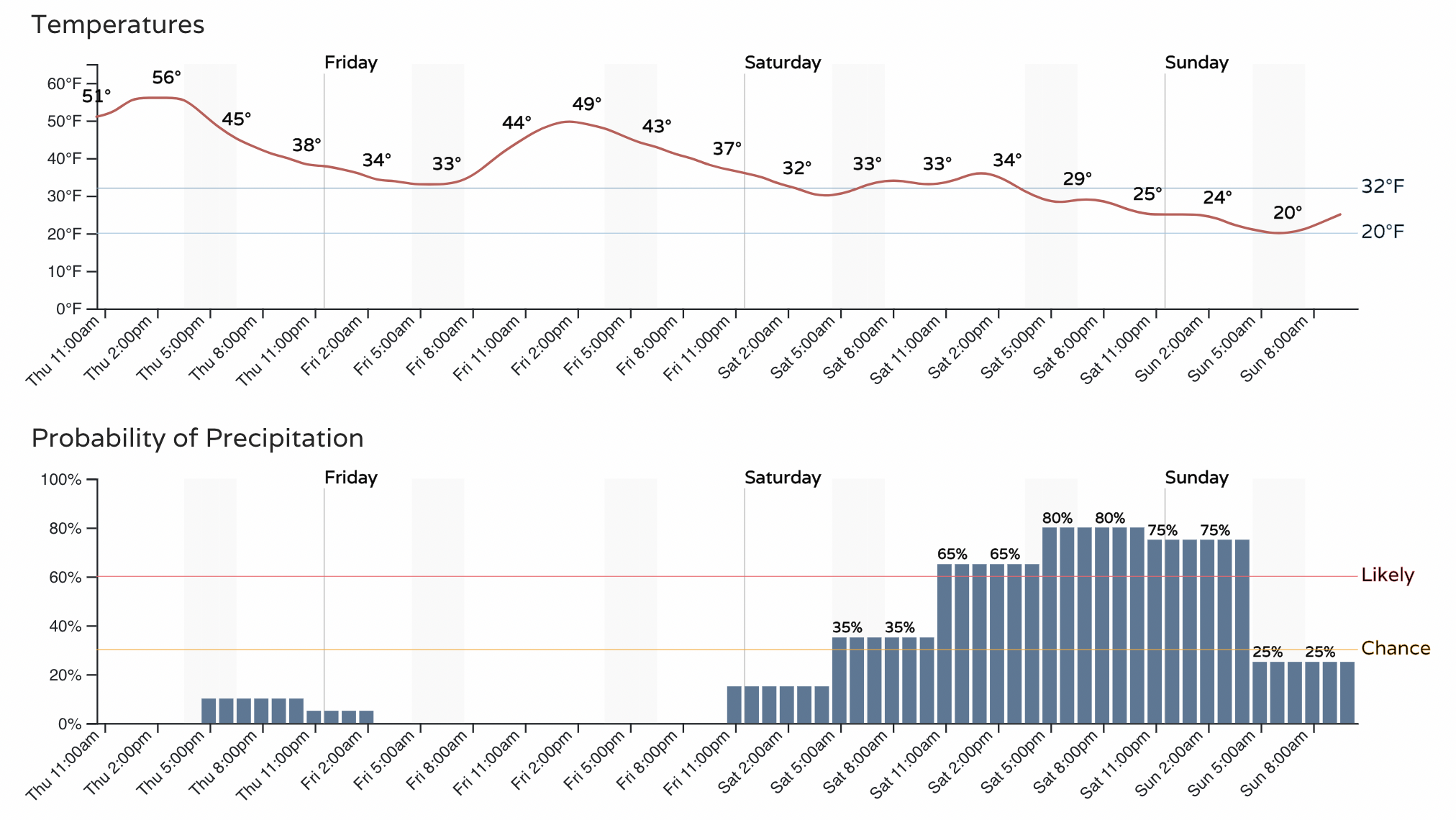
For the Denver metro area another day or two of relatively mild weather before the big change arrives this weekend. Highs in the 50s today for most of us, 40s to maybe low 50s on Friday, then much colder Saturday, particularly by the afternoon and evening.
Right now we see the chance of precipitation pick up by late morning on Saturday, with the best chance for snow coming Saturday afternoon and Saturday night across the metro area:
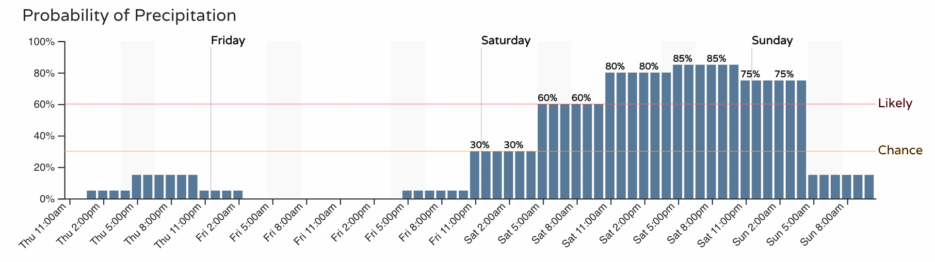
For northern cities, we see the timeline moved up a little, here's Fort Collins for example with probabilities moving into the "chance" category by 6am on Saturday:
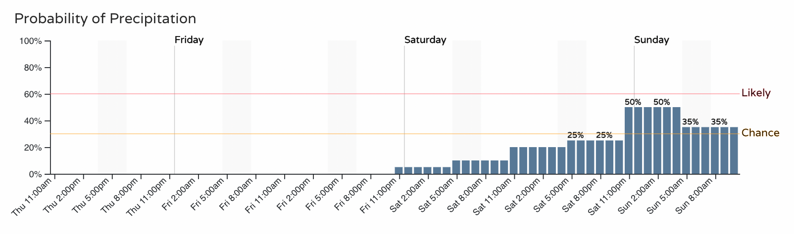
While Colorado Springs sees a lower chance across the board, and not until much later Saturday night:
Expect travel conditions to deteriorate late Friday night across the high country, with winter travel conditions in the forecast for the mountains through the weekend. By Saturday afternoon and evening conditions will also deteriorate along the Front Range, with the first snow of the season often adding a bit of a unique challenge on the roadways as well. If you can avoid travel Saturday, please do! Snow is best enjoyed from the comfort of ones home anyway, or perhaps sneaking down the hill on skies if you plan to spend the weekend up high.
The system clears most of us early Sunday, with lingering snow showers across southern Colorado possible into the evening. The blend of models shows temperatures are slow to rebound next week, with a chilly Halloween in the forecast for the Denver area with highs only in the mid 40s on Tuesday and overnight lows in the teens. By the middle to latter half of the week we warm back to seasonal highs or perhaps a bit warmer, with the season's first snow behind us.
More to come! As always, stay one step ahead of the changing weather by subscribing to our email list today!