
Thanksgiving Day forecast update: Colder air has arrived, snow in the forecast for much of Colorado

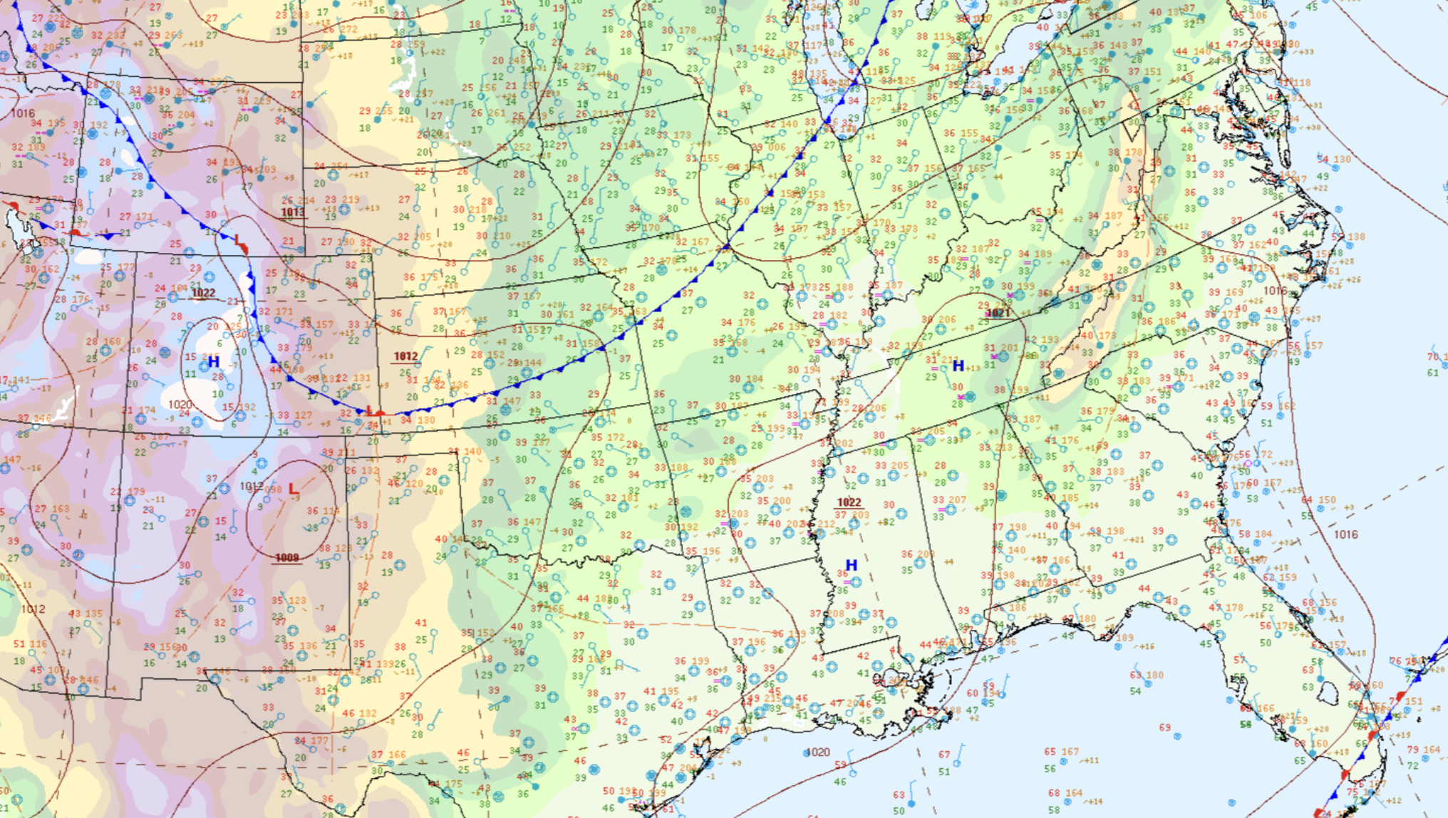
The initial cold front associated with the incoming chance of snow has pushed through Northeast Colorado this morning. Highs today will be more than 20-degrees colder than the balmy highs we saw yesterday, and we'll be colder yet on Friday. You can see the front draped across east-central Colorado this morning:
For the greater Denver area that means we'll see a high of about 40°F today, before falling into the teens overnight tonight into Friday morning. Highs in Denver on Friday likely won't make it out of the 20s.
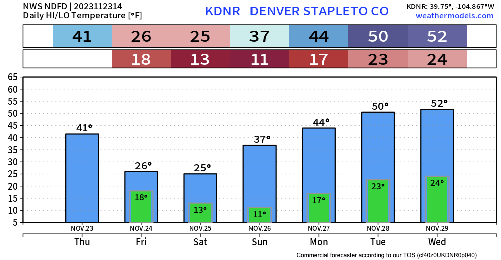
The "warmest" temperatures of the day come right now through early afternoon. By the time folks are sitting down for Thanksgiving Dinner temperatures will be in the mid-30s for most locales, and will be dipping below freezing by this evening. If you're heading out to see friends or family today, dress accordingly!
Snowfall forecast
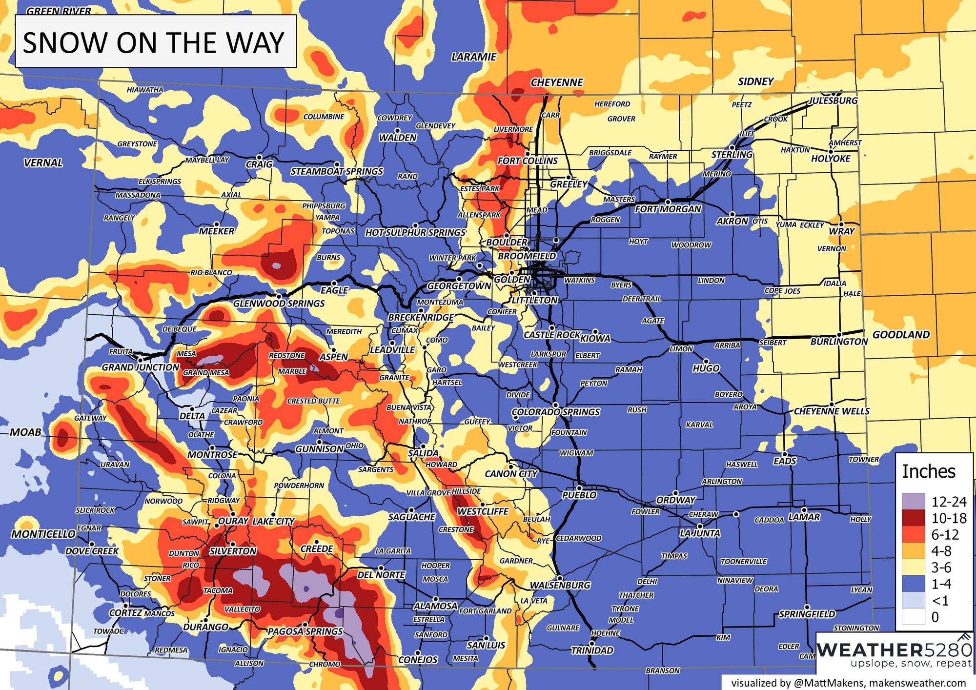
A few changes to the snowfall outlook as data has generally trended lower with amounts since our update yesterday. Still, most of us will see snow off and on from this evening through Friday, and for some areas that will add up to several inches before things come to an end Saturday.
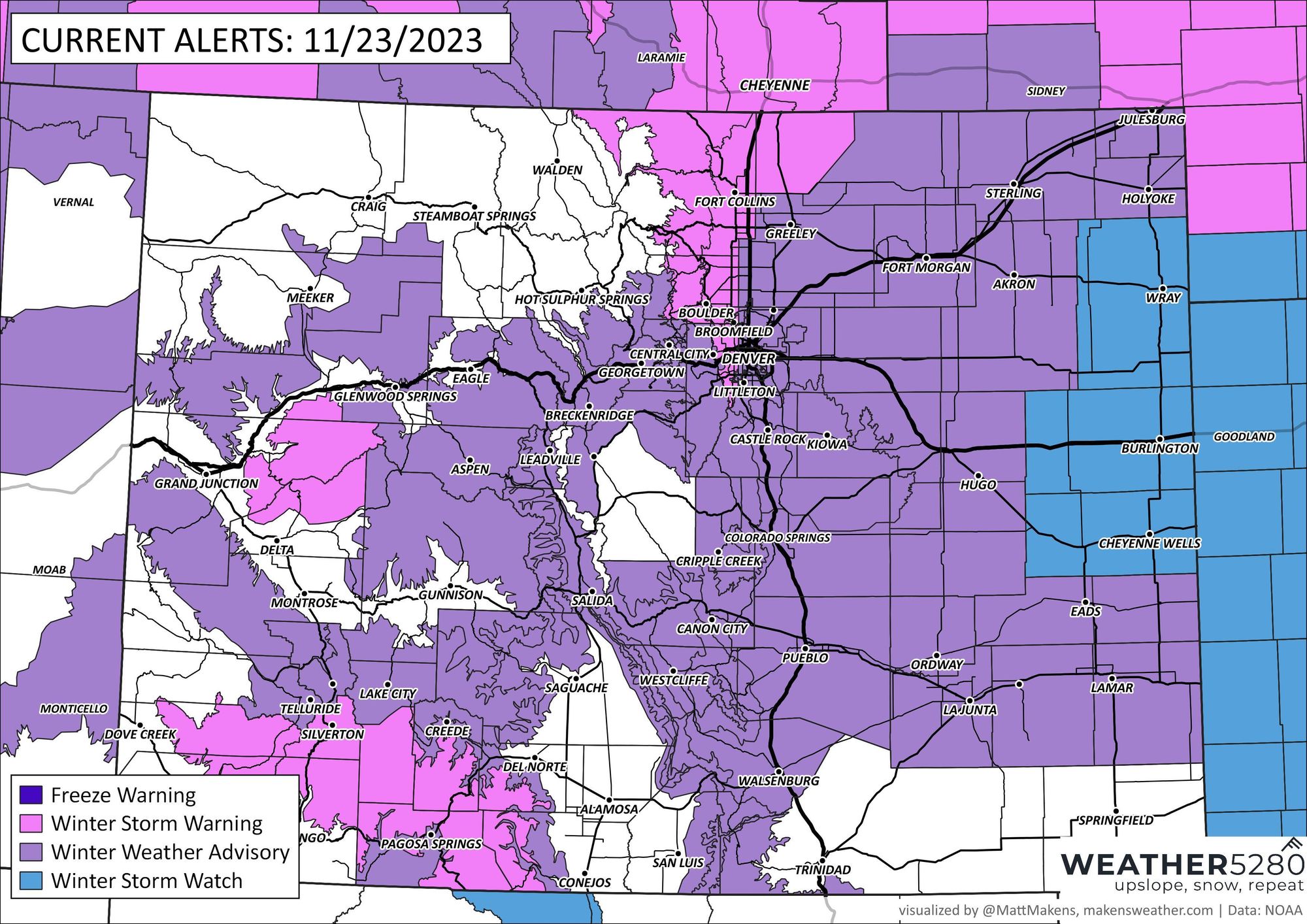
Since our post yesterday the National Weather Service has issued several winter weather alerts ahead of the incoming snow. For Denver, a Winter Weather Advisory is in place from 8pm this evening through Friday night. For the foothills west of Denver and points north, including Boulder and Fort Collins, a Winter Storm Warning goes into effect this evening, as this is where the heaviest snowfall is anticipated.
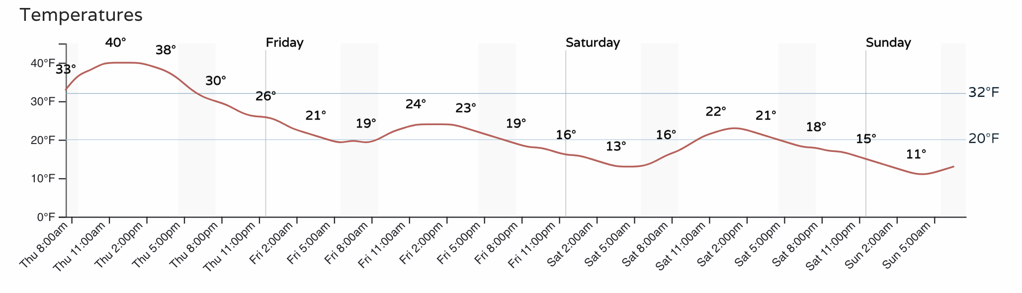
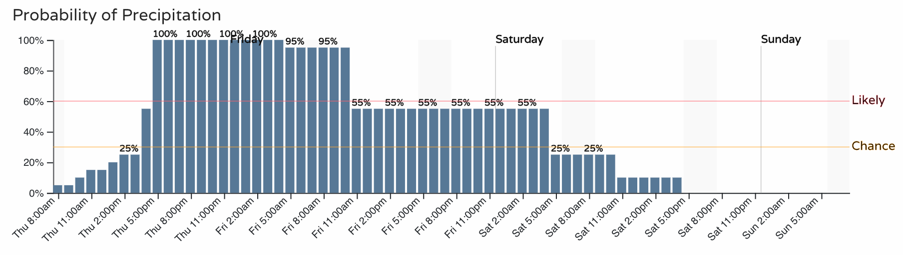
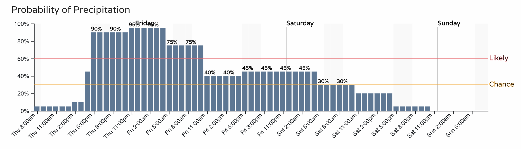
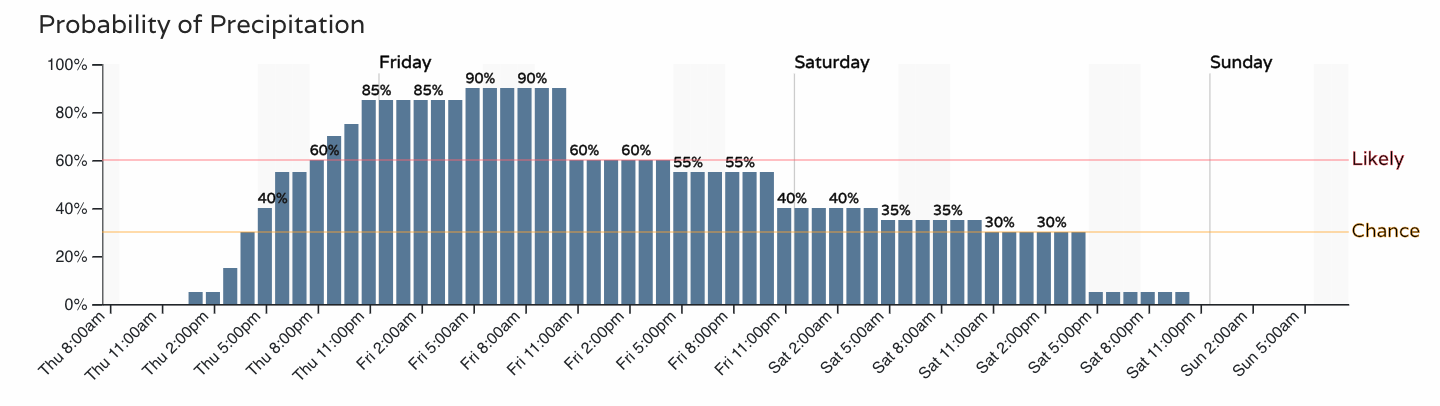
The hourly planner shows the chance for snow picks up in earnest this evening across the urban corridor, with the greatest chance of snow coming overnight tonight into Friday for most of us. Lingering snow showers and flurries stick with us through Friday night, however, along with those bitter cold temperatures for your Black Friday.
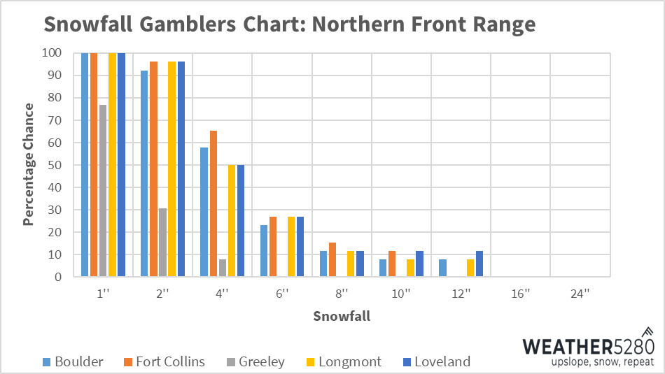
Fort Collins
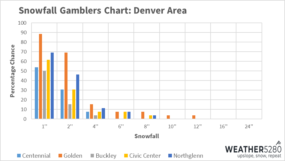
Denver Area
Colorado Springs
While this will be a prolonged period of off and on snow and cold, for many locations totals will be on the light side it appears. This is especially true the further east you get from the foothills – where DIA may see very little snow from this storm, and Denver's western suburbs several inches.
Snowfall forecast:
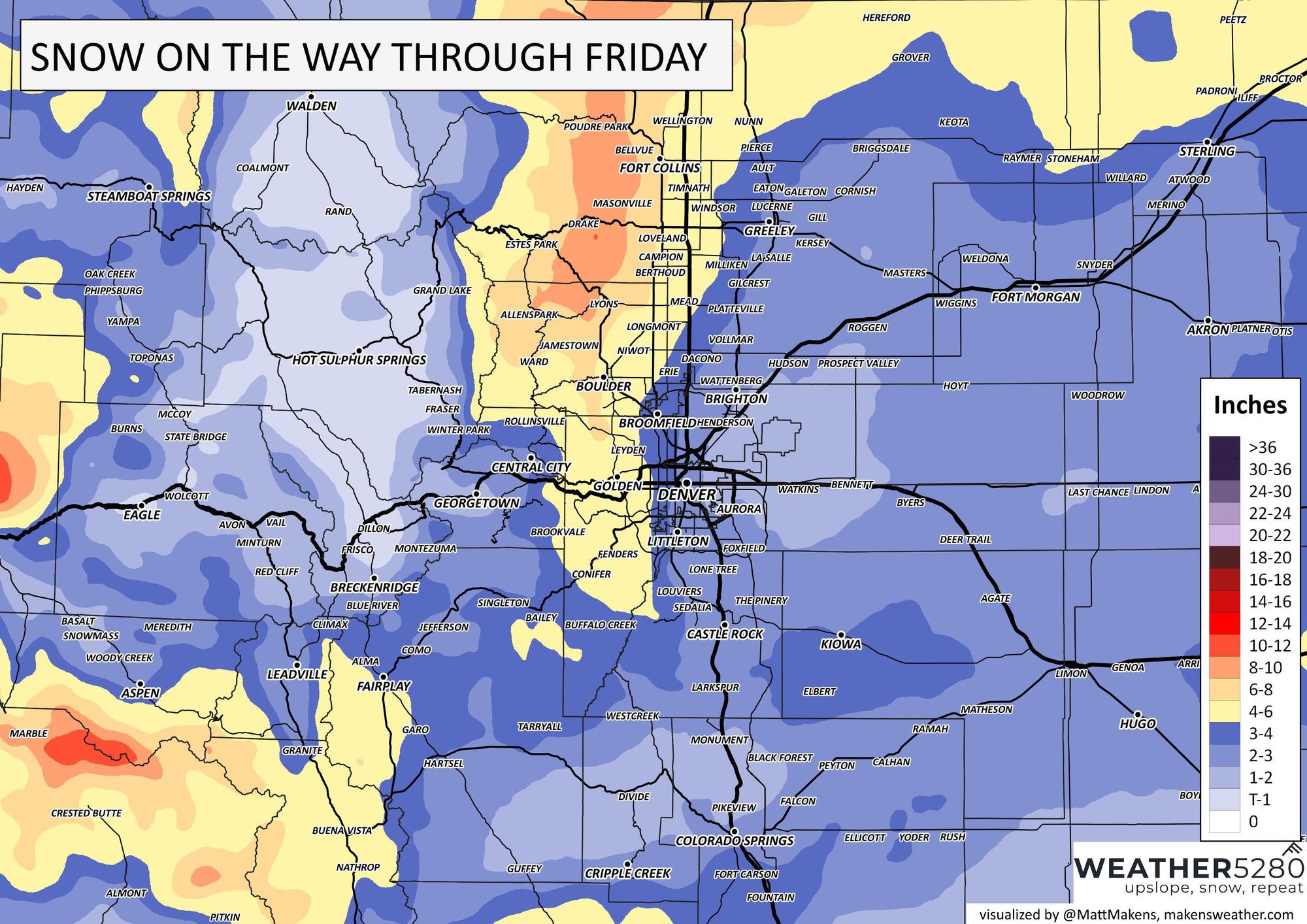
Statewide outlook:
While data has trended down with snowfall potential, cold and high snowfall ratios may save our forecast in the end. For the northern cities in the Warning, still decent odds for 4" of snow or more:
the further south and east, lower odds overall:
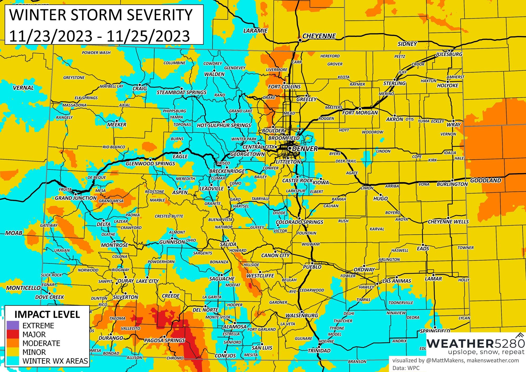
As you might expect, the greatest travel impacts will be across the northern Front Range foothills. Still, even with generally light snow across most of Eastern Colorado, impacts will be felt. Given the holiday and lots of folks eager to get out on the road Friday, please plan for those winter travel conditions.
We wish you all a Happy Thanksgiving! Stay warm, and if you need to head out on the roads tonight or Friday, please stay safe! If you can push your travel plans to the weekend, do. Please share your storm reports below!
We'll continue to keep tabs on this storm, but plan on travel trouble across Colorado both on the ground and in the air Friday and Saturday, stick with Weather5280 and keep yourself ahead of any weather changes by subscribing to our email list today!