Foothills, Palmer Divide see freezing drizzle and fog, update on snow potential for Colorado Springs, SECO

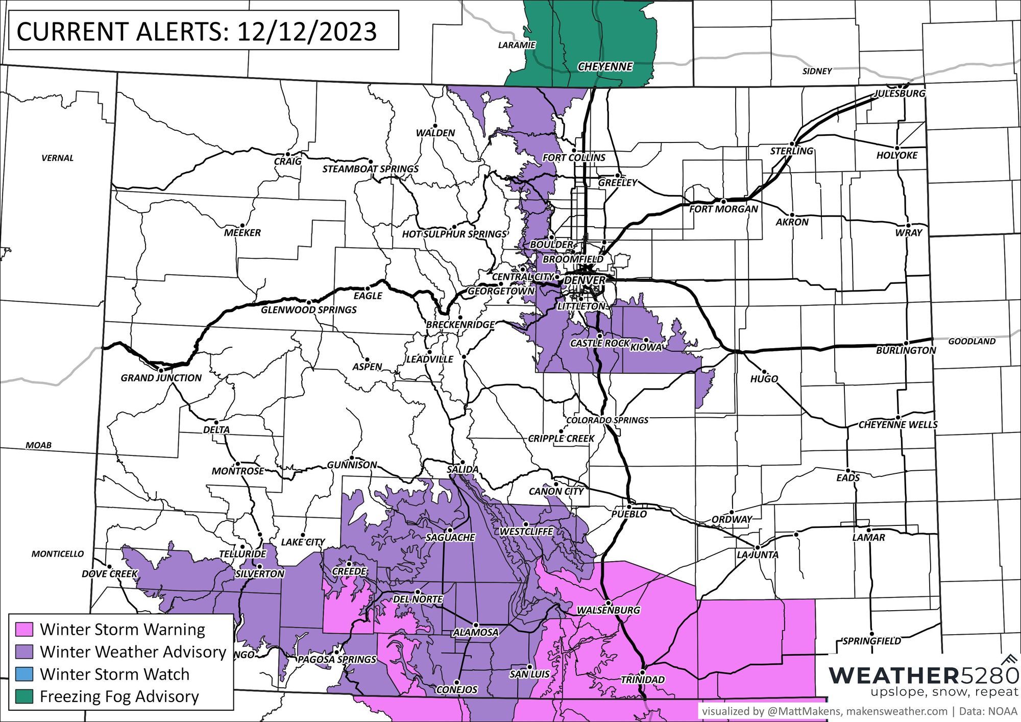
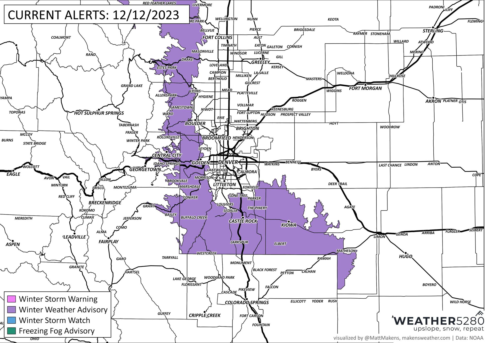
A busy, and well, wintry update this Tuesday evening for you. We've got Winter Weather Advisories in place lining Colorado's Front Range and Palmer Divide, and continue to track rain and snow for southeast Colorado – which gets going in earnest later tonight and on through much of the day Thursday.
First for the northern urban corridor and foothills where we are seeing pockets of freezing drizzle and fog tonight. A Winter Advisory is in effect through noon tomorrow to account for low visibilities at times and some slick areas on the roads.
* WHAT...Freezing drizzle and dense fog with visibilities as low as a hundred yards. Light ice accumulations.
* WHERE...The Northern Front Range Foothills, The Southern Front Range Foothills, and Castle Rock.
* WHEN...Until noon MST Wednesday.
* IMPACTS...Roads will likely become slick and hazardous. Low visibilities will slow travel.

For these areas we don't expect a lot or in many cases any snow to accumulate, but some light dustings and and there are possible, with perhaps a bit more than that as you head south of Denver.
Wednesday through Friday
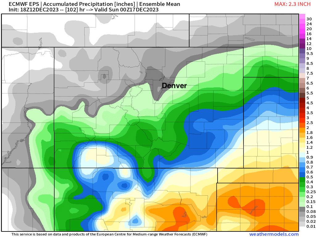
A rather wet system gets going Wednesday morning across the southern plains states and will bring some great beneficial moisture to the region through the end of the week.
While the bulk of the heaviest precipitation is forecast to stay south and southeast of Colorado, southern Colorado will be in the running for some of the good moisture, much of which will fall in the form of snow.
The European ensemble mean shows anywhere from 0.2" of liquid near Colorado Springs to upwards of 1.0" of liquid across the far southeast corner of the state through Saturday afternoon. We'll take it!
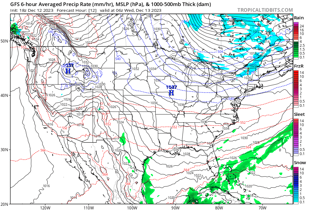
We'll see precipitation get going during the early morning hours Wednesday first across the Texas panhandle then coverage spreading into southeast and south-central Colorado during the course of the day. The low gradually moves east through Wednesday night, with rain and snow coming to and end for Colorado from north to south on Thursday.
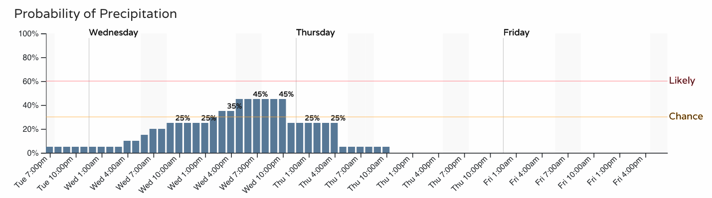
For Denver this will mean about a 30 to 40% chance of snow through the day on Wednesday, with little accumulation expected:
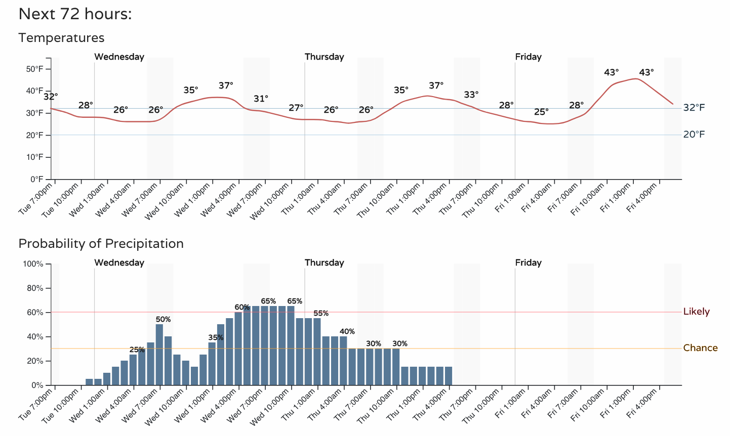
While for Colorado Springs those odds will be higher that we do see some snow – and if we do, several inches will be possible:
Something to keep into account around Colorado Springs – the heaviest part of tomorrow's snowfall likely arrives around the evening commute Wednesday... Some short-range models have indicated the potential of 1"/hr snowfall rates which would create nasty travel conditions during that time.
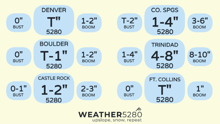
Snowfall totals
The blend of models likely is a good starting place with how much snow we're likely to see Wednesday into Thursday. Some modeling keeps the bulk of the snow south and east of Colorado Springs, while other models back things up into the city quite dramatically. In the scenario things stay south/east we'll only see a Trace - 2" around COS, while the snowy solution puts us in the 3 - 6" range. A compromise has us at 1 - 4" for COS from this system, with greater totals possible west and east of the city center.
Another way we can talk about totals is by using a boom & bust chart. You can see where there will be haves and have nots. Colorado Springs likely sees the most uncertainty from this storm, with lowest end potentials below 2", with boom totals as high as 6".
Forecast map:
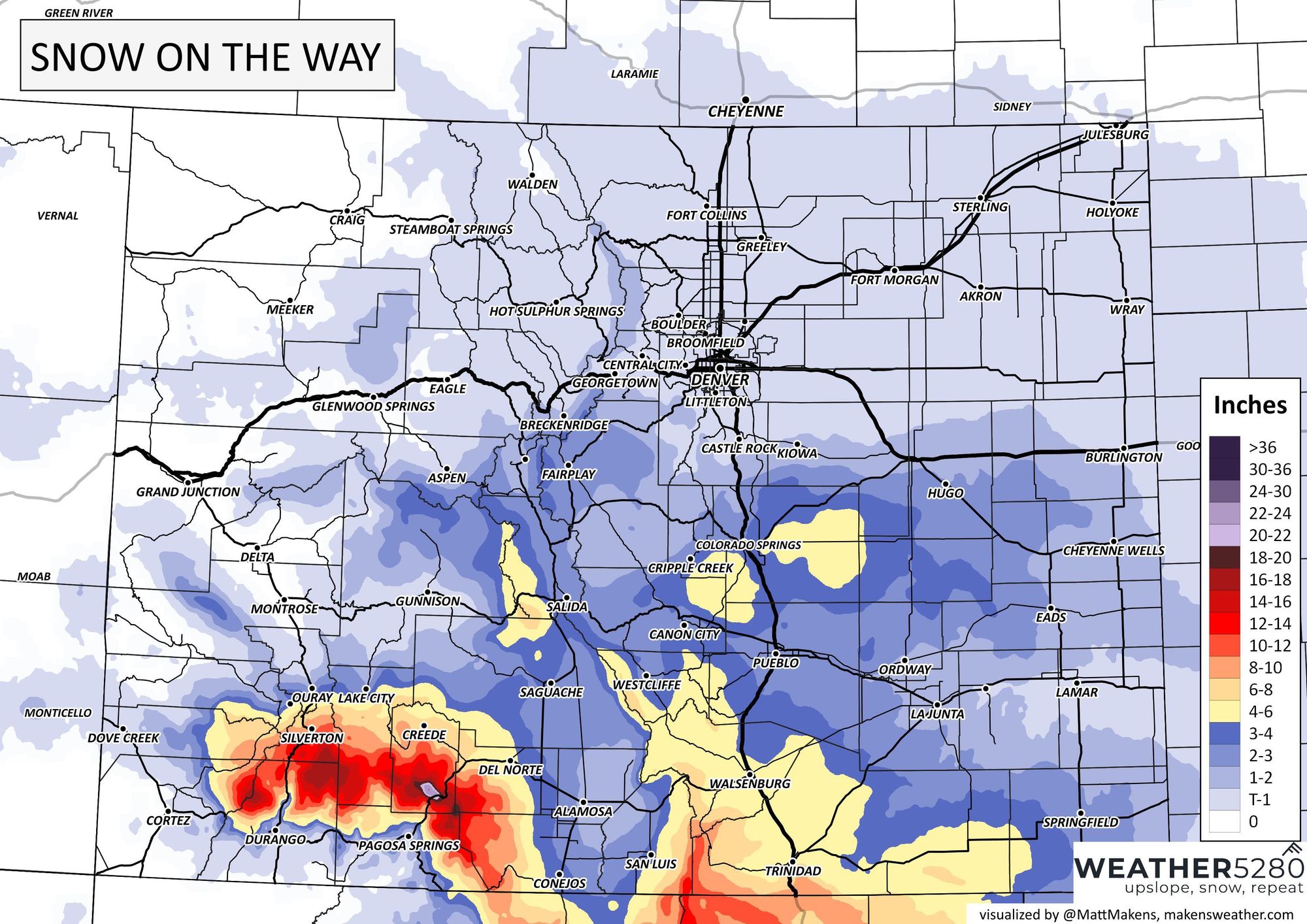
As you can see, north of Colorado Springs really isn't expected to see much snow from this system. If a band works its way north of where we expect things to set up some 1 - 3" totals across the Palmer would be possible, but right now not all that likely. One thing that looms large with this storm is how much rain it will likely put down across southwest Kansas, western Oklahoma, and west Texas. Colorado Springs and Denver will already be on the far northwest side of this storm. That coupled with all that moisture being wrung out to our southeast, might spell not much happening from Colorado Springs northward. Certainly something we'll be watching.
We'll babysit thing here tonight and see how overnight data looks as things get going in the morning.
If you haven't done so already, subscribe to our email list, you'll get notified about our latest posts on Wednesday's system as we continue to track it through midweek!