Active weather pattern continues, tracking more snow chances and Arctic cold on tap for Colorado

I fully realize that in that title there are plenty of folks rolling their eyes a bit, especially if you live along the urban corridor north of Denver. What active pattern, amirite?
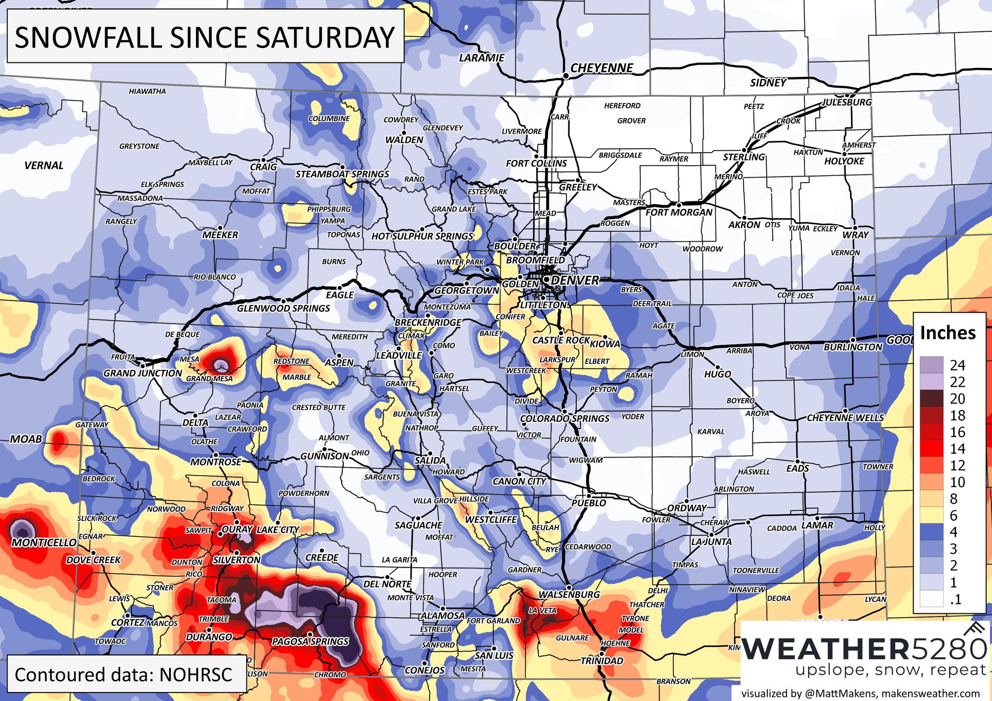
Yesterday's snow was really not exception to the pattern we've seen over the last weeks – Denver and north hard-pressed to squeeze meaningful snow out of the system, with the Palmer doing pretty well, and happily more than 2 feet of snow for parts of our southern mountains over the last three days.
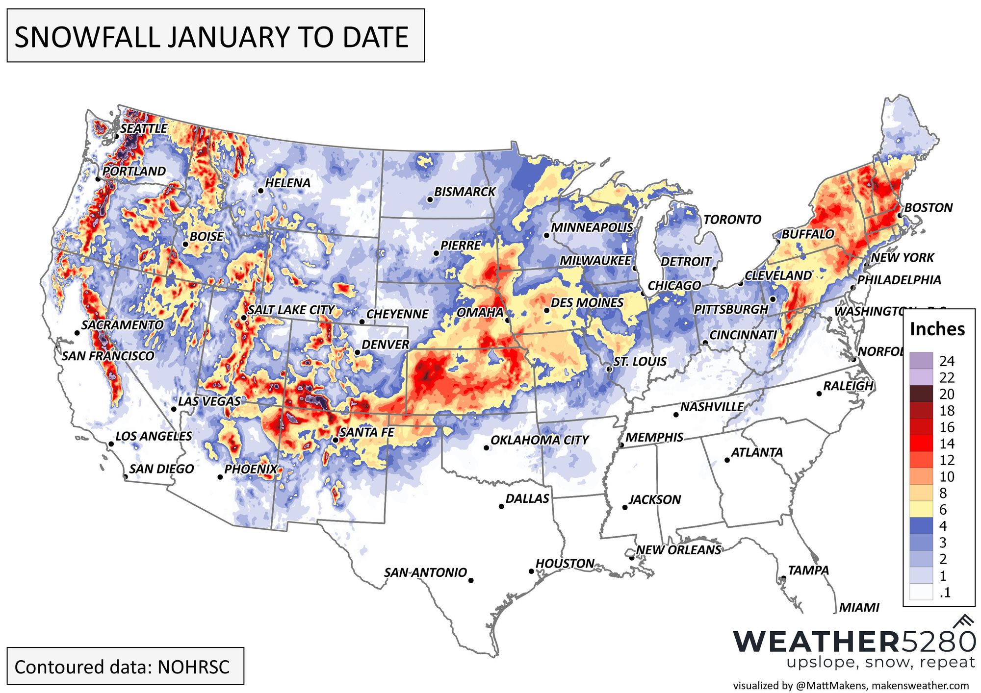
We've seen some good snow to start the month, with another monster storm moving through the upper Midwest and Great Lakes today, and more snow plowing into the Pacific Northwest as well. Below are the snowfall totals to date for January:
For Colorado, we've got more snow in the forecast and what looks to be some very cold air for parts of the state as well as we move later in the week and into the coming weekend.
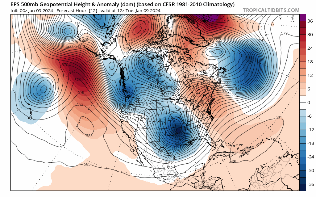
Big picture is we have a hyperactive pattern locked in across the CONUS which will send wave after wave through our region, and eventually pull down some mighty cold air from the north as well. Here's the 500mb pattern from the European ensemble mean through late next week, showing this loaded pattern.
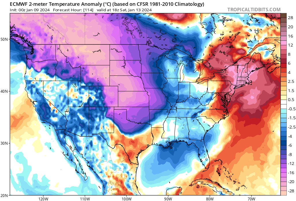
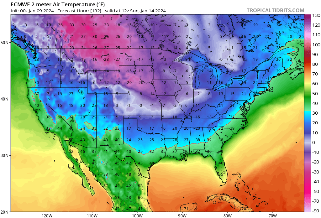
If we look at 2-meter temperature forecasts for the same period we see the COLD is about to really takeover the pattern, first across the northern tier about eventually pushing south across the plains states as we head into the weekend. Remember, this is an ensemble mean, so it's likely under doing some of the extreme cold we are likely to see across parts of the CONUS from this outbreak.
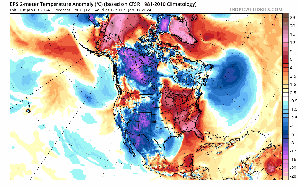
Timing for when the coldest air arrives, and of course HOW cold it'll be across Eastern Colorado remains a bit tricky to pin down. Models differ on both items, and this pattern has a lot of moving parts.
Let's break it down a bit.
The next system to watch will carry with it some of that colder air, though nothing too brutal, as well as another chance for at least light snow along the urban corridor. We start seeing some of those impacts late tonight, but the main chance for some light snow accumulation will come Wednesday night into the day Thursday. Here's the hourly planner for Denver:
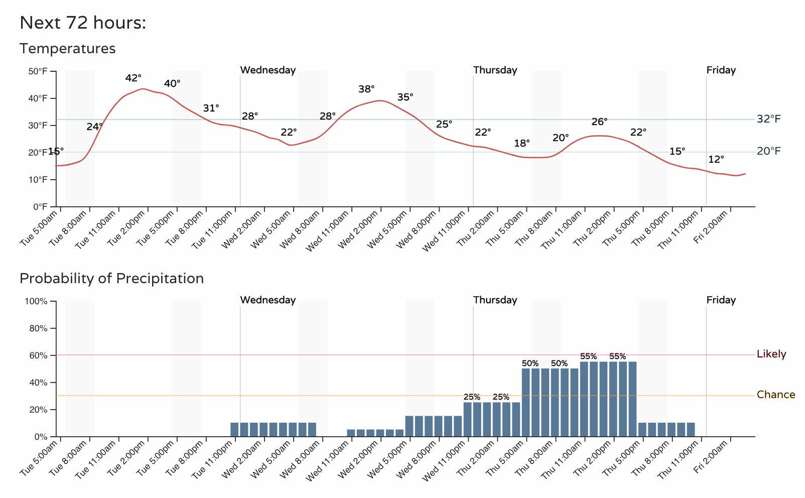
Most models have very little snow east of the hills from this system, as in less than an inch for most locations, but the northern mountains could score and even some light snow coupled with the reinforcing show of cold will leave the door open for a few slick spots by Thursday and no-doubt a wintry feel across the region.
Here's how much snow to expect through Thursday:
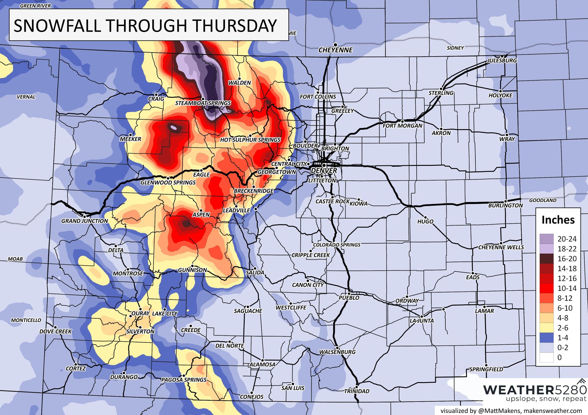
Beyond Thursday forecast confidence erodes a good bit. The main story headed into the weekend will be the cold for eastern Colorado and the most meaningful snow likely getting locked up in the mountains.
The timing of the cold differs. Some models have the first shot moving in Saturday, others more like Sunday into Monday. Some are extremely cold, others cold but manageable. All have some meaningful cold at some point during the Saturday -> Tuesday timeframe, so do plan accordingly.
A blend of models shows Thursday's system and chilly temperatures, but the coldest air holding for that Sunday/Monday timeframe. Even here, that 33°F on Saturday could come early in the day with a much colder afternoon depending on the timing of the front. If the Euro is on it, we won't be anywhere close to 33°F on Saturday in Denver.
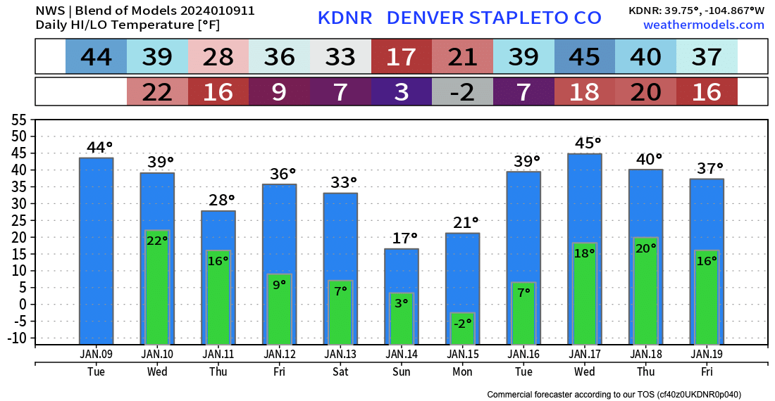
Individual models have backed off some of the most extreme solutions for the Denver area from this cold outbreak – the coldest I'm seeing this morning is from the GFS with -8°F Monday morning in Denver, but that's not to say that cold air won't slosh west a bit more than currently advertised, or that parts of the plains won't see some double-digit below zero cold by late weekend/early next week.
As we sit today, it does seem like models want to keep the coldest stuff to our north and northeast this weekend/early next week... but I wouldn't sleep on the potential either! AND if it's not cold enough for you around here, head north this weekend, some -25°F+ forecast by the Euro across Montana Sunday morning, with wind chill values WELL below that!
We'll keep you posted if anything changes with regard to the snow potential from our next system, and of course keep you updated on the cold as well as we get closer to the weekend.
The best way to stay informed ahead of all this is by subscribing to our email list! Updates will come straight to your inbox as we publish them!