
Cold front, upslope, and an active jet will combine to provide Denver area chance for accumulating snow Friday into Saturday

A bit more chilly and unsettled weather to work through here to end the week and start the weekend with what looks like a decent chance for much of the northern Front Range and urban corridor to pick up a bit of snow and slush later today and overnight into Saturday.
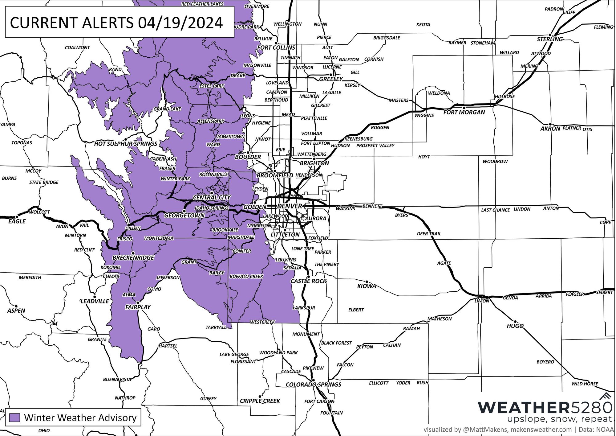
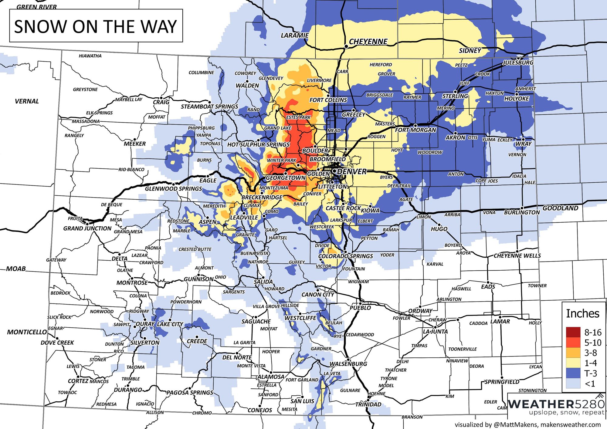
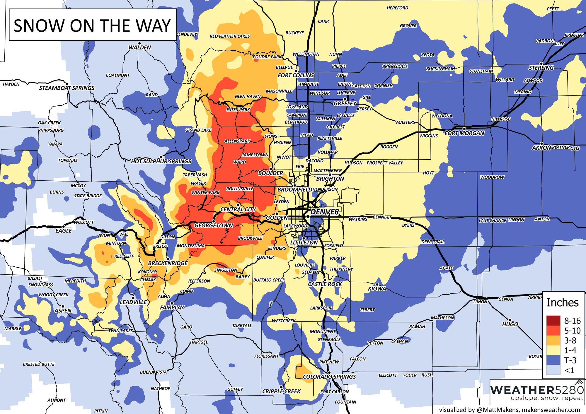
The greatest snowfall totals will favor higher terrain to the west of I-25 as you might expect. Here there is a Winter Weather Advisory issued which will go into effect at 6 pm this evening and expire at 9 am Saturday morning. Anywhere from 5 - 10" will be possible under this alert area.
Here's a map showing the latest alerts from the NWS:
While temperatures won't be all that cold, they do look cold enough for much of the precipitation to change to snow overnight tonight, especially with some decent dynamics at play. The hourly planner shows precipitation chances ramping up this afternoon across the metro area, peaking overnight, then diminishing as we head into Saturday morning.
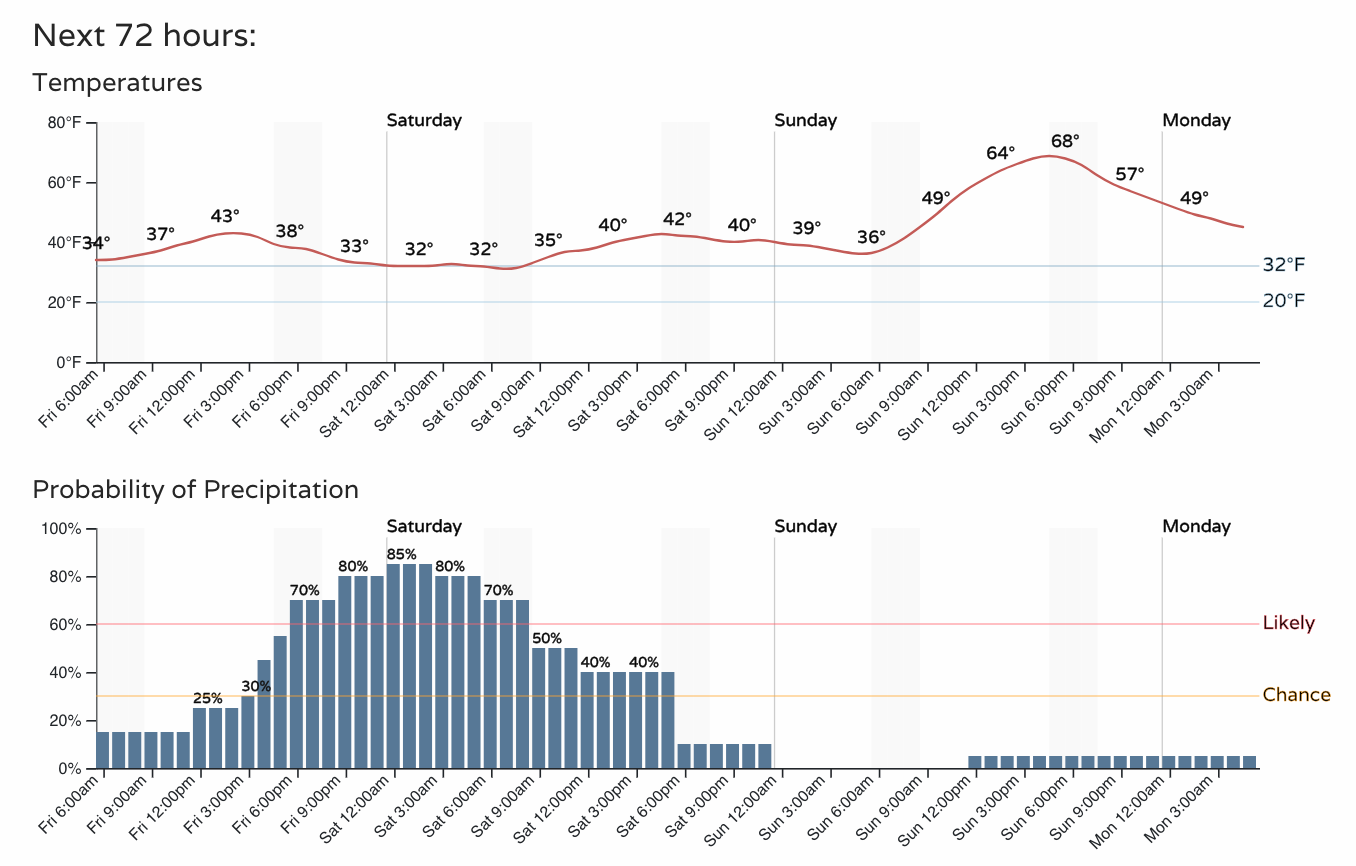
Some of that precipitation, especially across the plains, will fall in the form of rain initially. It could be that we even see some areas with freezing drizzle Friday evening at lower elevations. During the evening hours temperatures should cool enough that most of us see any precipitation change over to snow.
Snowfall forecast
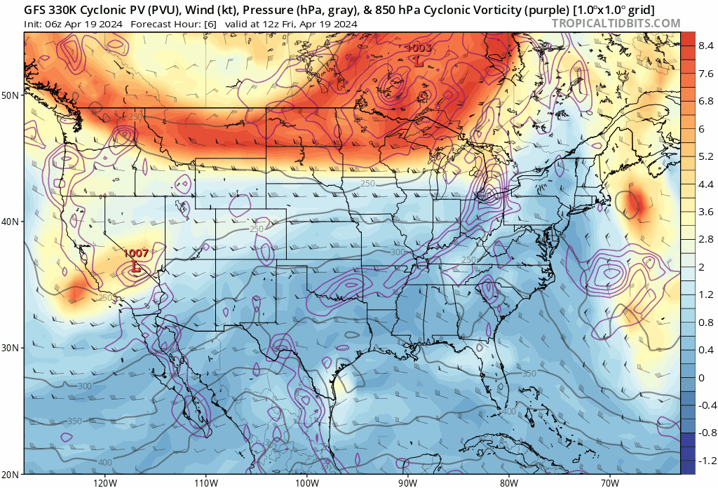
For many of us this likely won't be a hugely impactful event. Marginal temperatures, warm ground, all will help make more slush than accumulating snow in many cases. The wildcard seems to be the chance for some enhanced banded snowfall with a pretty good upper jet forecast over northeast Colorado tonight.
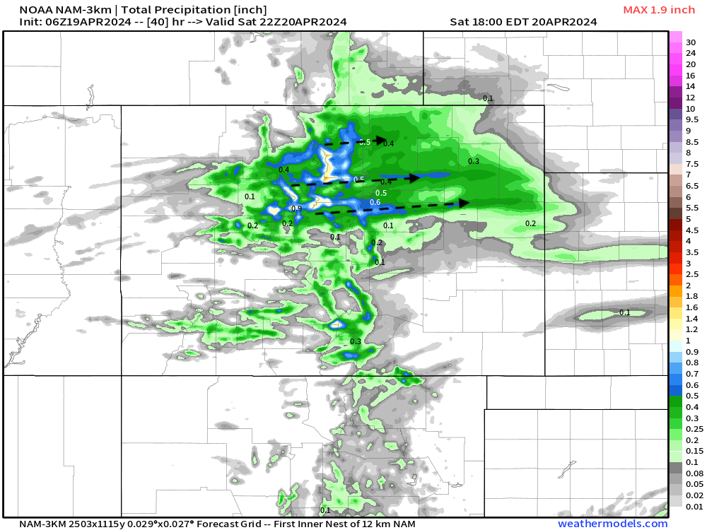
Where that band is likely to setup is always a challenge, though most guidance would suggest the suburbs north/northwest of Denver will be favored. It could be we see one primary band setup with little action elsewhere, or a few bands of heavier snowfall develop. You can see in the NAM (below) several, albeit narrow, bands of heavier precipitation peeling off the foothills, with lesser totals in between.
And here is the HRRR, a bit more northerly with the placement of the bands, favoring the heaviest snow up near Fort Collins...
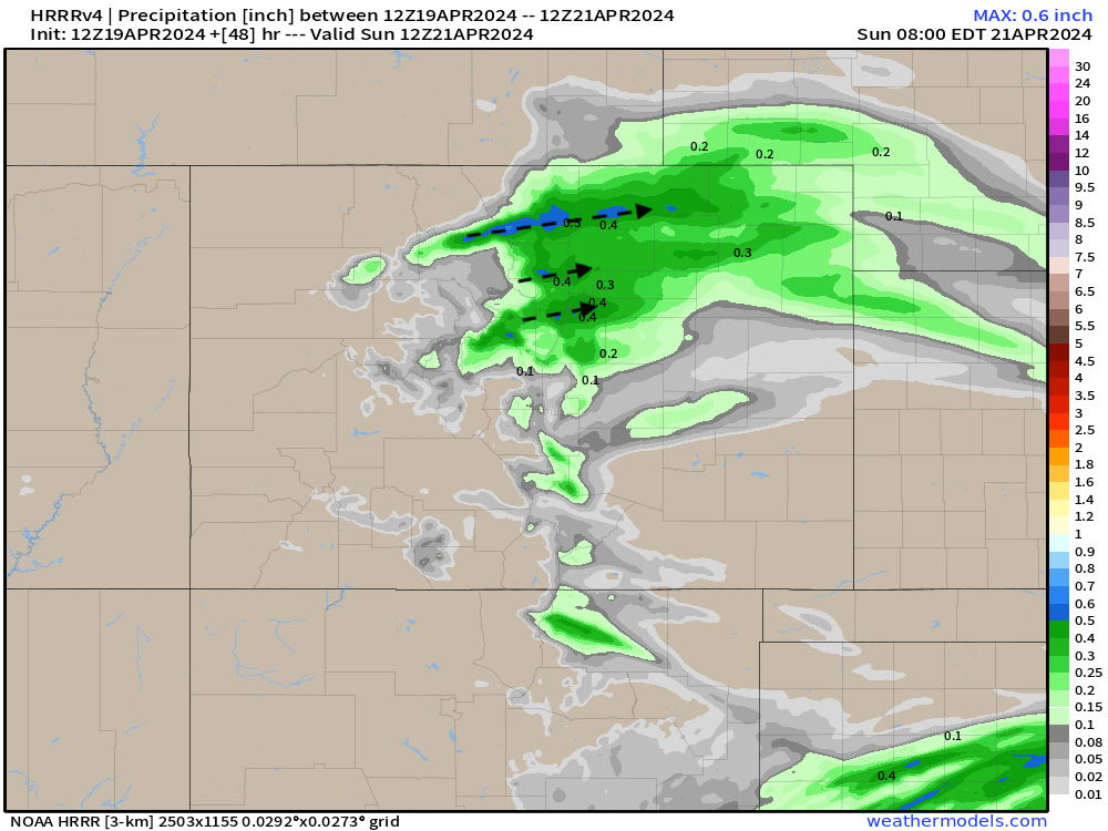
Should these bands setup, several inches of snow will be possible. Outside of these bands most folks will just see a Trace to 2" of slushy accumulation. The "boom" under the heaver snowbands at lower elevations (outside of the Watch area) will likely be in the 3 - 5" range.
Below is our snowfall forecast. It's broad-brushed and not likely to pick up on the details of the banded snowfall that may occur, but generally speaking we expect 1 - 4" at lower elevations along the I-25 urban corridor (locally more), and 4 - 8" (locally higher) for the foothills west of Denver.
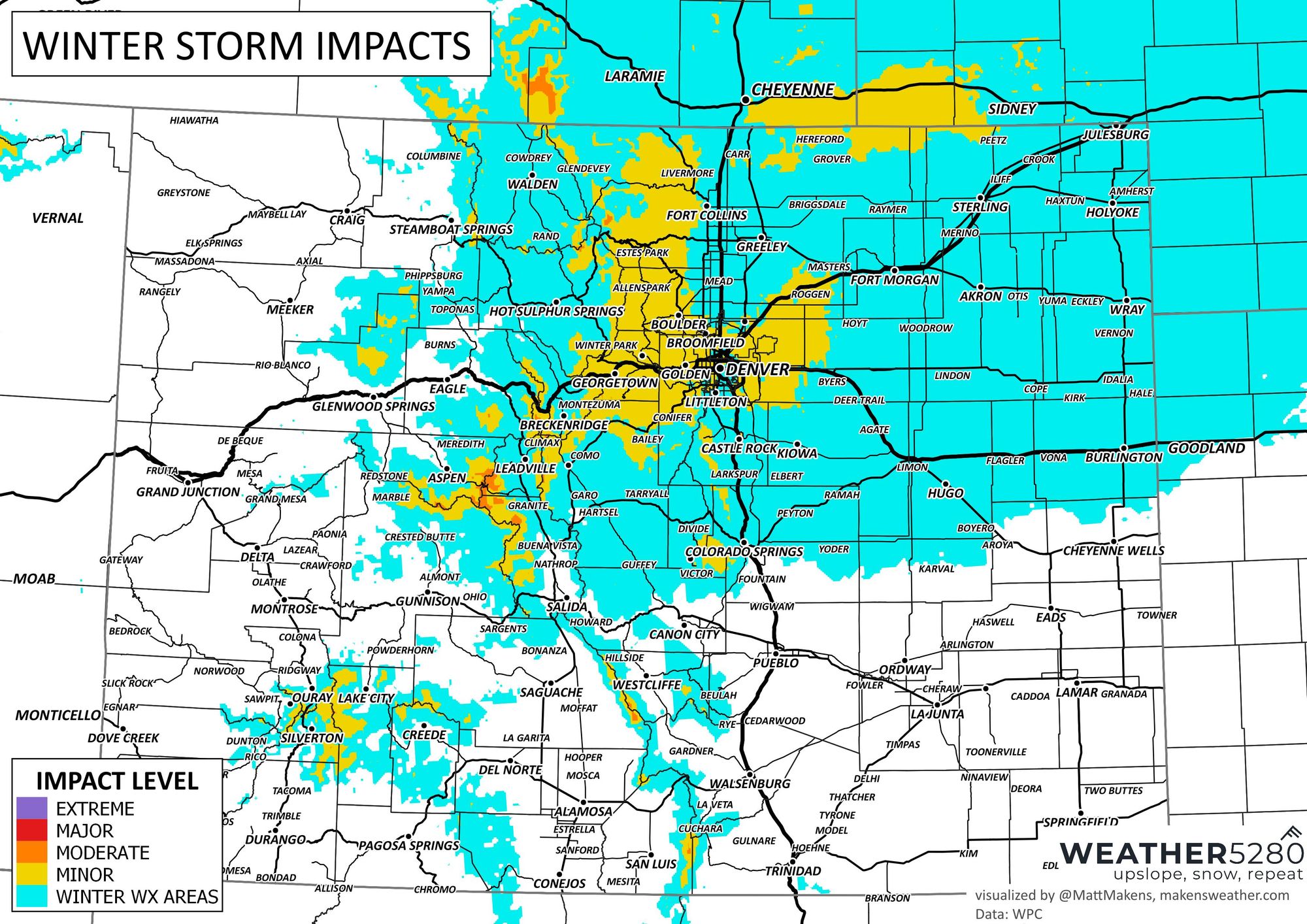
Of course with the potential for some freezing drizzle, slushy roadways, and eventual freezing (especially across raised surfaces) by Saturday morning travel will be impacted by this event overnight. Please consider staying off the roads until conditions improve on Saturday!
Here is the latest impact forecast:
Looking ahead...
Saturday will be raw behind the passage of tonight's front and precipitation. The rebound, however, looks to be quick! Lows around freezing tonight with highs back in the 60s and 70s by Sunday and Monday!
As always, stick with us and as subscribe to that email list if you haven't - pretty please!