
Gusty wind ahead this weekend

Hey folks, a brief update for this weekend: we figured we'd let you know about a storm system on approach. This will go well to the north keeping most of us dry, but does lead to gusty wind along the Front Range.
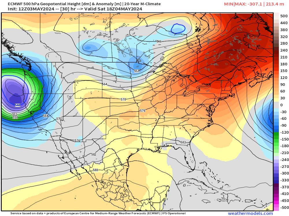
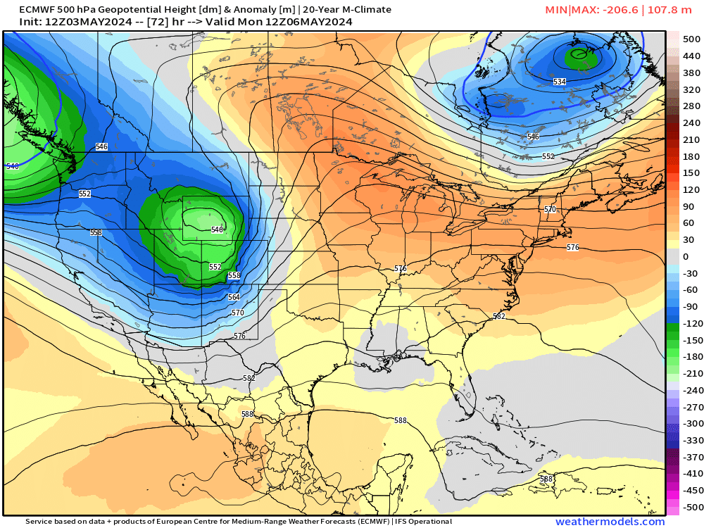
To start, Saturday will feel a bit cooler compared to today & Sunday - not by too much, though. In general, 60s for Denver Saturday, warmer with some downsloping winds with mid to upper 70s Sunday.
Below is a peek at what winds look like on Saturday. It will feel "cool" every time the wind picks up tomorrow, but if you're out in the sun it shouldn't feel too bad. Better than the rain and snow last Saturday, right? (we guess... 😏)
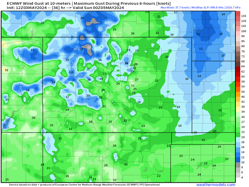
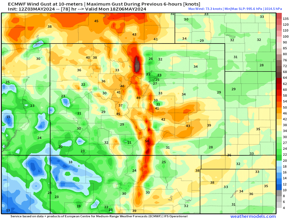
Sunday will feature a bit more wind... notice how winds really start to crank across the western slope as that Pacific storm moves in. Gusts on Sunday could push 30-40 mph, with 50+ mph gusts in the mountains.
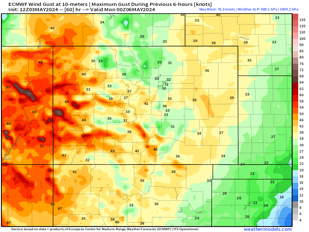
As those winds crash into the mountains, we're likely to see a fast burst of snow Sunday night into Monday morning for the central and northern mountains. Travel here will likely be a bit dicey during that time, but this system is moving fast, so impacts should be relatively brief.

We'll see windy conditions linger into Monday, creating elevated fire danger risk along I-25 and over the plains.
Mother's Day Weekend Moisture?
Most of next week is looking relatively tame. A storm system will try to get its act together... somewhere in the Rockies. It's a bit tough to pin down the exact evolution of this system at this time, but it looks like it could be a wetter and cooler pattern into next weekend.
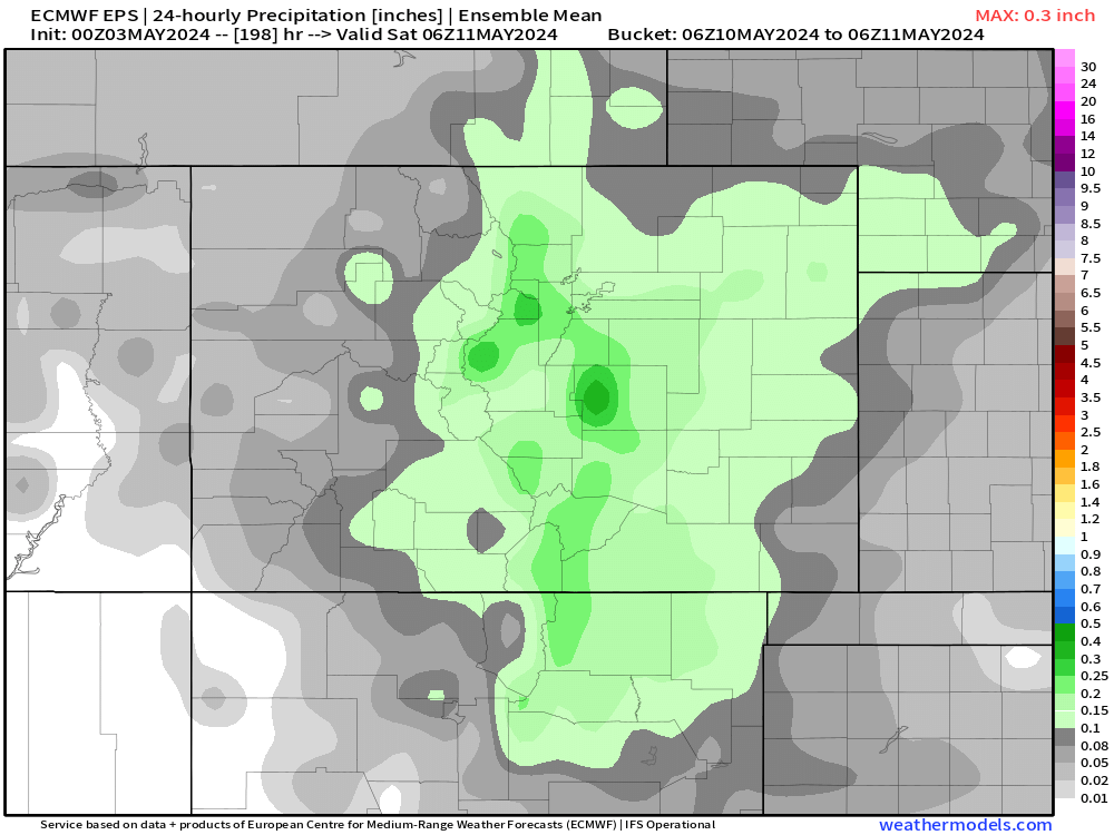

Moisture maps look fairly decent this far out for a slow-moving system with some upslope. We'll watch this closely and give you updates over the next week or so (click here to receive our alerts).
