Devastating hailstorm pounds Yuma, Colorado Monday night

We spoke to you yesterday on the severe weather threat expected over northeast Colorado yesterday afternoon and evening, you can read about it below:

Well, this event clearly delivered. Several supercells spawn across the South Platte River Valley yesterday evening and exploded in intensity as the sun began to set. While most of the storms impacted mainly rural farmland, a few small towns in northeast Colorado were not so lucky. Areas near Otis and Akron saw hail up to 1-3" in diameter.
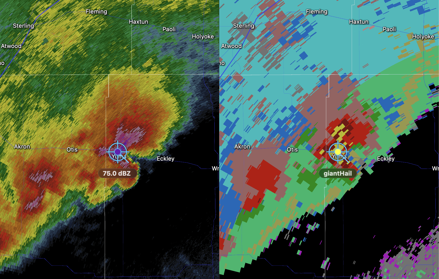
Unfortunately, that wasn't end of it by a long shot. This supercell continued to produce large hailstones in an increasing amount as it approached Yuma.

Radar estimated 75+ mph winds, baseball size hail heading into Yuma right now:#COwx pic.twitter.com/dE5dLfI0jj
— Chris Bianchi (@BianchiWeather) May 21, 2024
Several storm chasers captured footage and pictures of the devastation left behind
Huge hail drifts & accumulations in Yuma, Colorado following a vicious hailstorm between 9 & 9:20pm MDT. Biggest stones baseball size and bigger - most stones 1 to 2.25 inch. @NWSGoodland #cowx pic.twitter.com/CPObP2eBMN
— Thomas Hinterdorfer (@hinto62) May 21, 2024
Extreme hail storm just came through downtown Yuma, Colorado. Up to softball size, many cars lost all of their glass and some are even stuck in hail drifts. pic.twitter.com/3RCeFT1C7F
— Bryce Shelton (@BryceShelton01) May 21, 2024
Reports from media indicate nearly every piece of property, including real estate, vehicles, and farmland seemed to have sustained some kind of damage. We'll keep on top of updates from the National Weather Service and updates from the state on just how much damage this complex of storms caused.
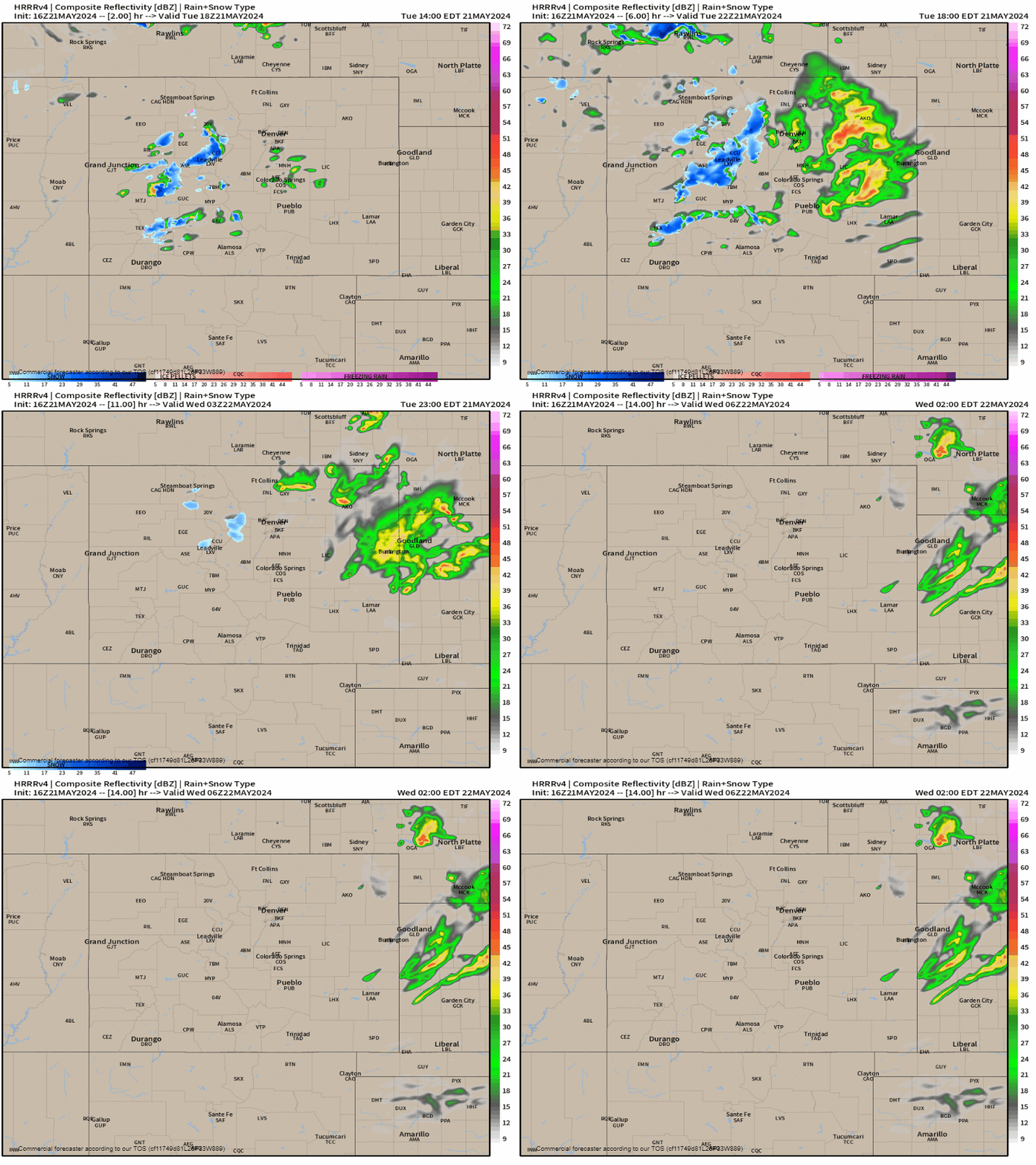
Looking forward to this afternoon, showers and storms will be possible over the Denver metro and out east. Thankfully it won't be as intense as yesterday, but some minor hail, lightning and heavy rainfall are all possible threats into the evening commute.

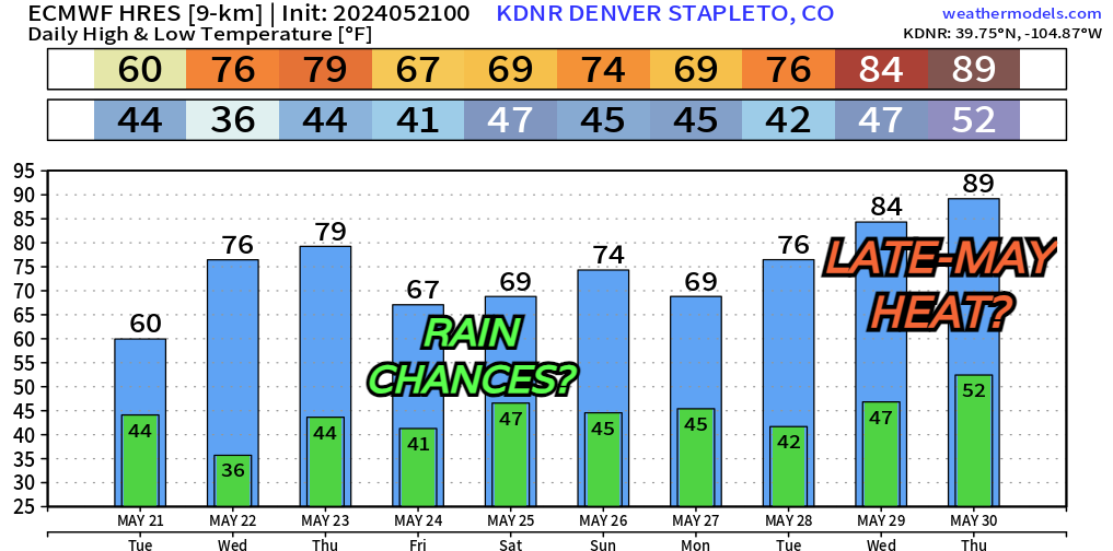
The rest of the week look a bit quieter. Some questions marks are out on rain chances developing Friday into Saturday – that could throw a wrench into some Memorial Day weekend plans potentially.

We'll keep an eye out on those rain chances. For now, no big hiccups seem to be on the way in your extended forecast.
