Heat Advisory in place through Tuesday for Denver metro area

Temperatures climbed into the upper 90s on Sunday and are forecast to do so again today and tomorrow before perhaps shaving a few degrees off highs on Wednesday. The heat has been much anticipated, though this offers little relief to hear.
The NWS in Boulder has issued a Heat Advisory for the metro area, which extends from this morning through Tuesday evening. A Poor Air Quality alert is also in place today for the northern urban corridor.
From the NWS...
...HEAT ADVISORY REMAINS IN EFFECT FROM 11 AM THIS MORNING TO 9 PM MDT TUESDAY...
* WHAT...High temperatures both Monday and Tuesday will be in the mid to upper 90s. Overnight lows will be in the mid to upper 60s.
* WHERE...Metropolitan Denver.
* WHEN...From 11 AM this morning to 9 PM MDT Tuesday.
* IMPACTS...Hot temperatures may cause heat illnesses.
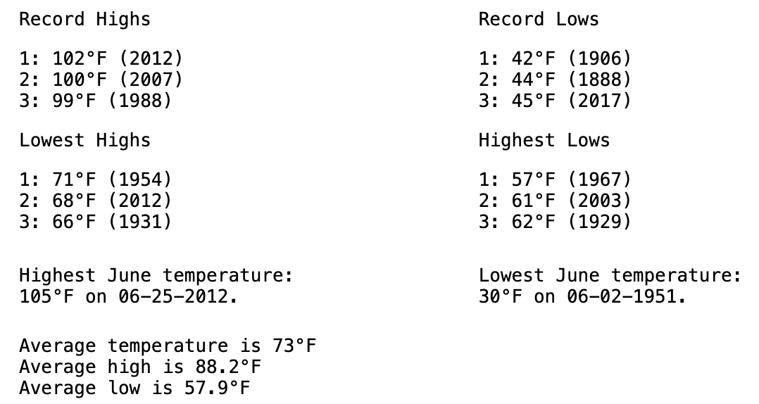
While hot, we should end up a few degrees shy of the record high for the date today (record 102°F, 2012) and tomorrow (record 105°F, 2012) with forecast highs just shy of the century mark in Denver. Here are the numbers for June 24:
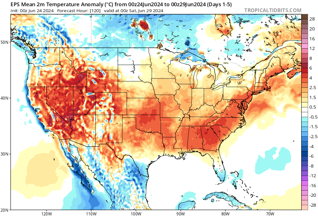
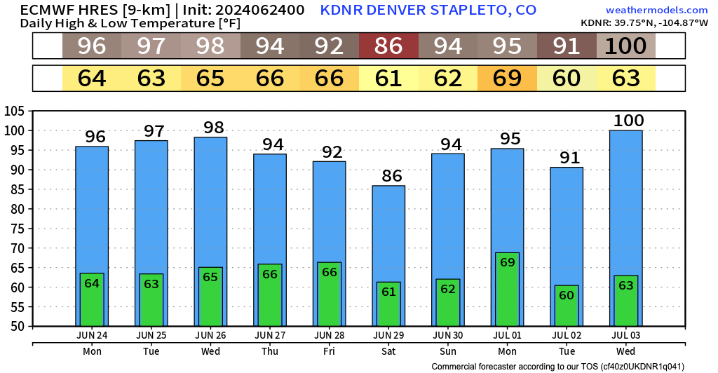
Looking at the European model for temperatures in Denver over the next 10 days we see plenty more heat in the forecast. In fact, our optimism for Wednesday we mentioned above doesn't hold up well at all if this model proves correct. By the latter half of the week most guidance has a bit of a break from the heat before more mid-90s to perhaps 100°F heat starts showing back up in the medium range:
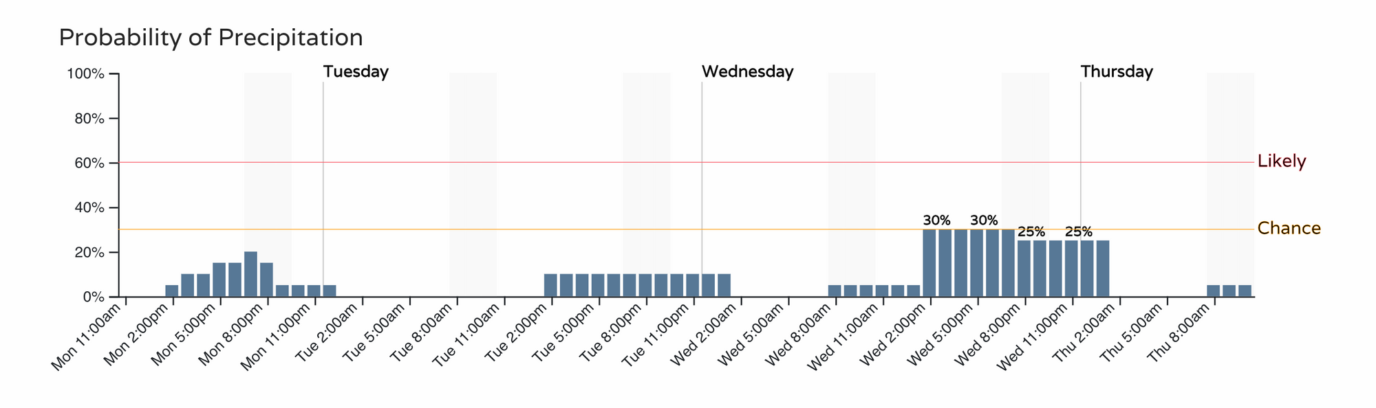
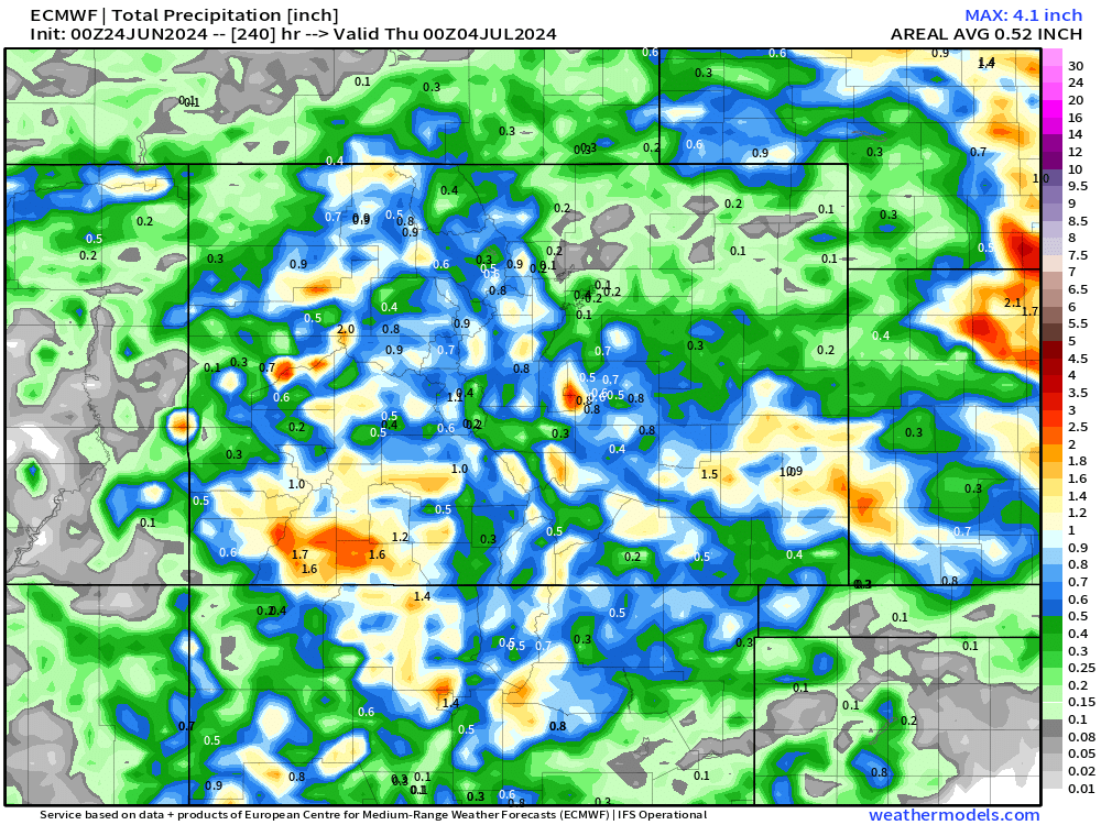
Not much in the way of rain expected over the next couple of days, but hints of better storm chances across Eastern Colorado for the middle and latter half of the week as subtropical moisture makes its way into the state.
The hourly planner shows just isolated, likely high-based, showers the next two days, but starting to get toward that chance category by Wednesday afternoon. It could be some areas pick up some at least brief heavy rainfall, even a few stronger storms by Thursday and Friday along with the anticipated reprieve from the heat.
The GFS is a bit more bullish for Northeast Colorado while the European is... not so much. Still, I doubt many folks would complain about this – some good moisture for both Western Colorado and Southeast Colorado over the next 10 days as the monsoon shows some signs of life.
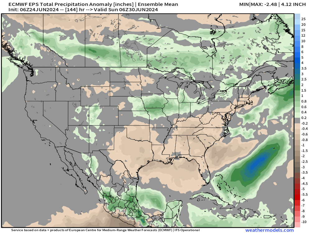
Nationally we see this as well, with some above average precipitation forecast over the Four Corners region through this weekend... Yes PLEASE!
Stay cool, and stay safe, we'll track storm chances for northeast Colorado later this week and keep you posted!