
Denver area weather: Storms electrify your afternoon and evening plans

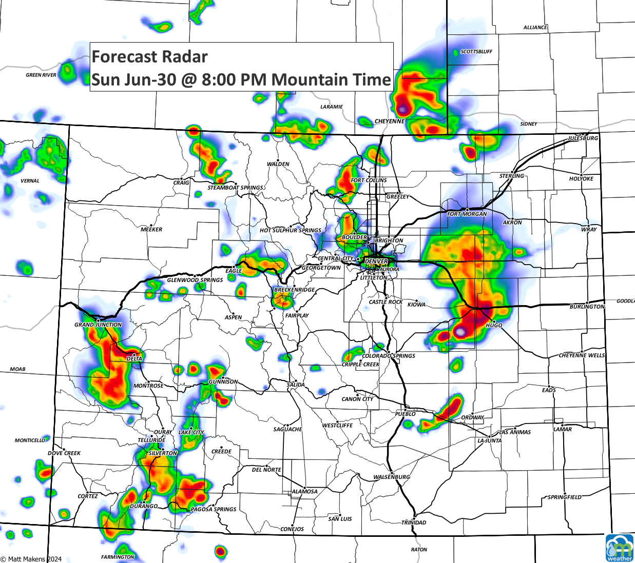
There are storms floating around, mostly over the Castle Rock area, as of 4 p.m. The chance for storms around the metro area continues through the early evening. What's the worry? Lightning will be pretty legit for a time, plus severe wind and hail threats.
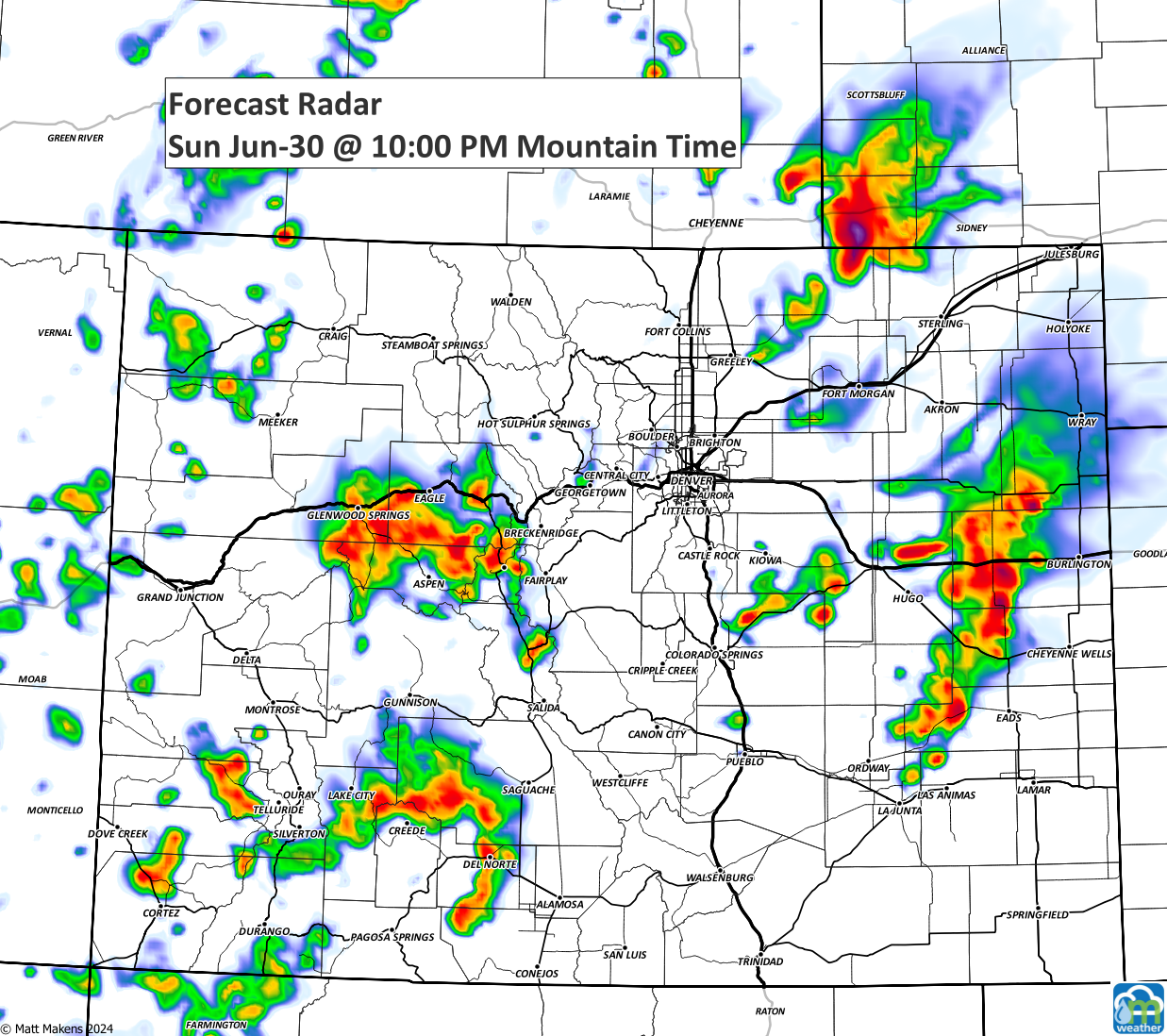
For the mountains, a steady supply of thunderstorms will create risks not just from the lightning but for flash flooding too.
Storms moved east from the high country after lunch. Just after 4 pm, the radar was "lighting up" over Douglas County.
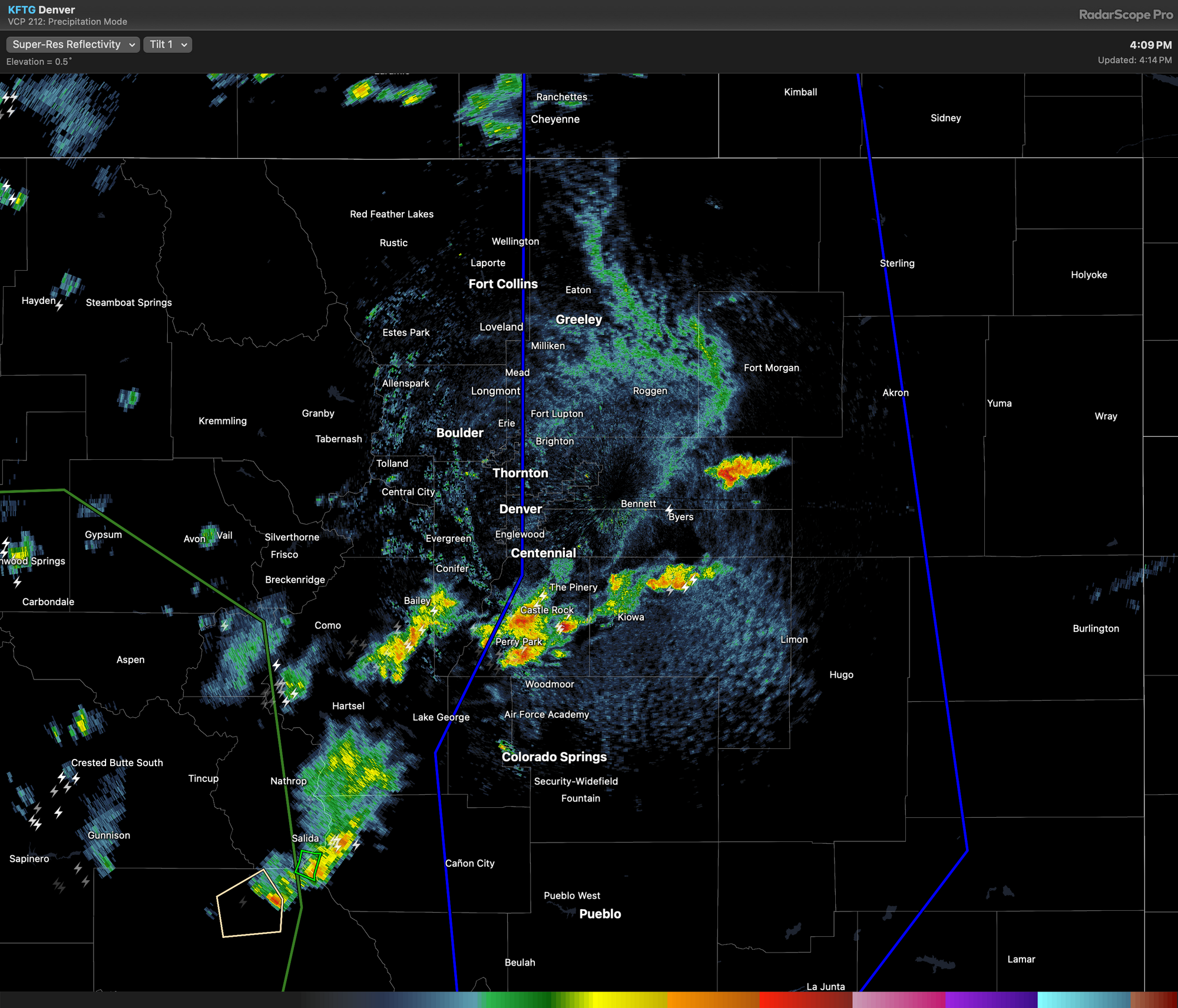
Over most of the region, the risk of damage is low, and the storms are pretty spaced apart. Thus, a watch is not likely, even though you may be pinged with a severe thunderstorm warning at some point.
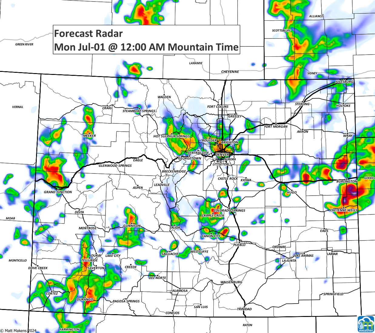
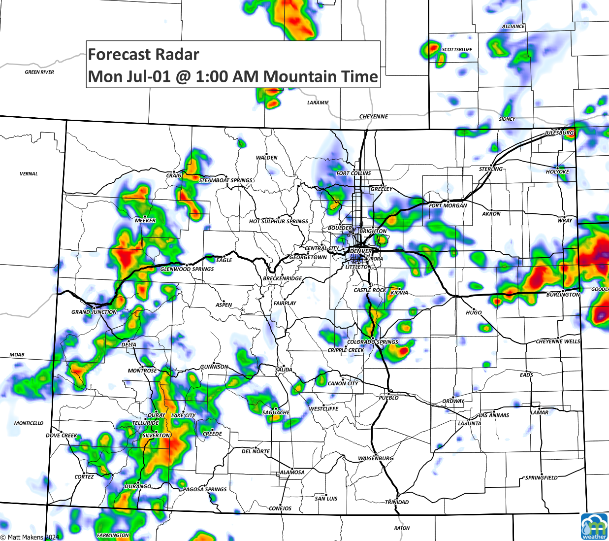
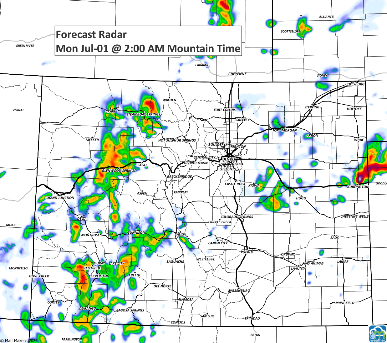
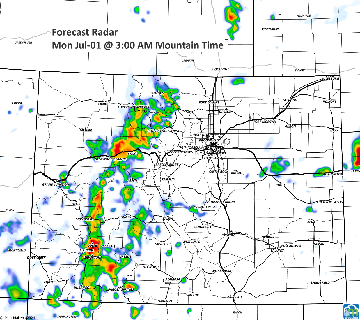
Here is the timeline of storms through the evening:
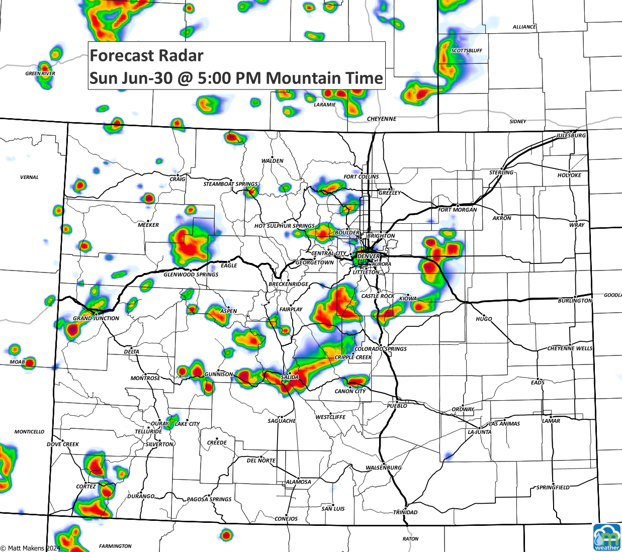
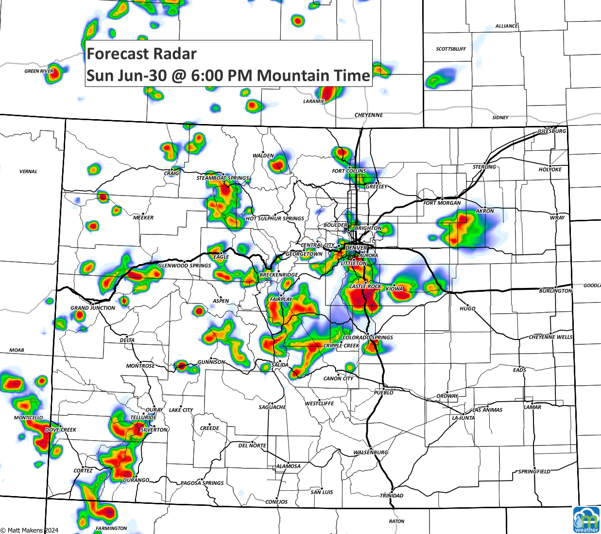
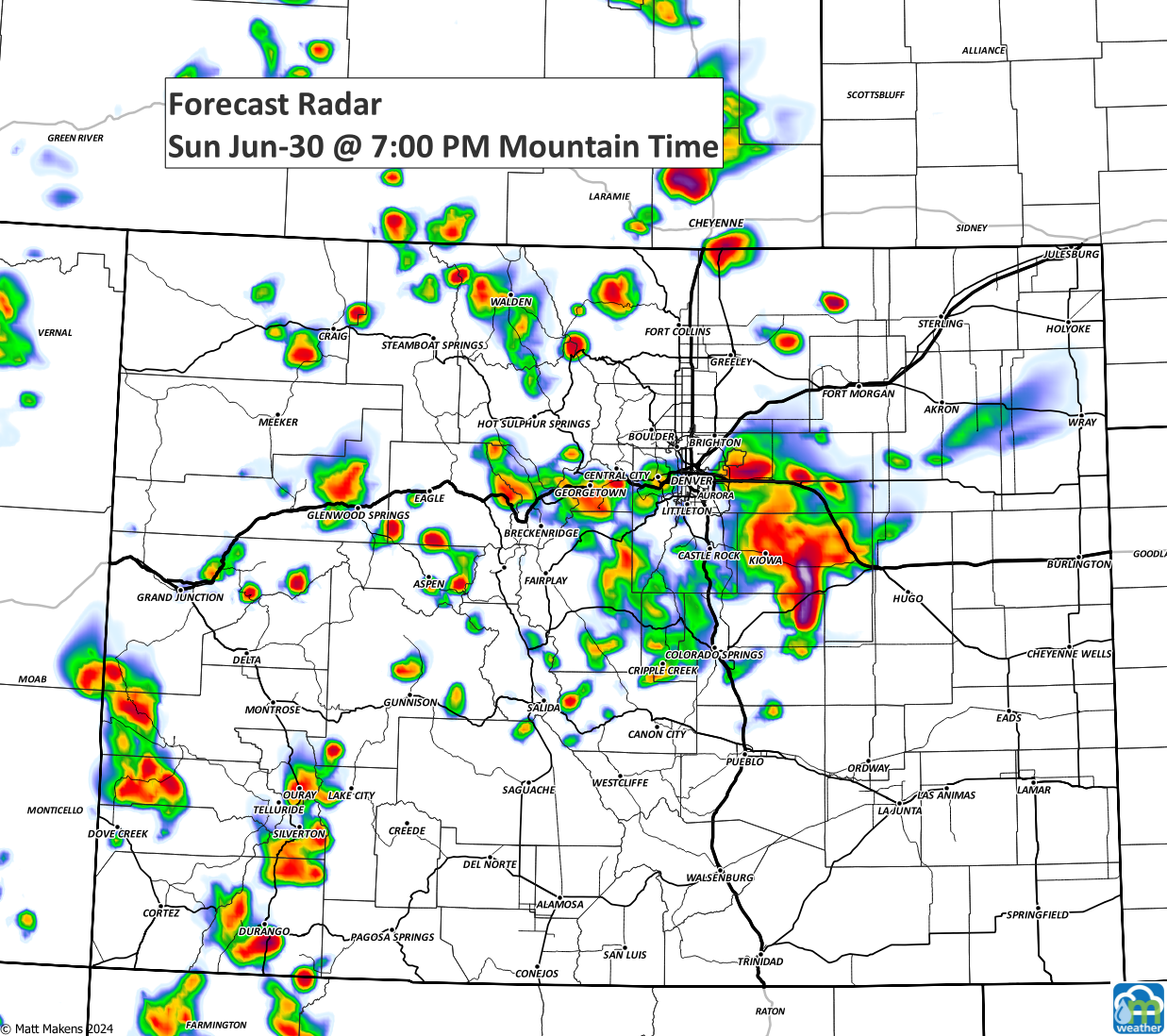
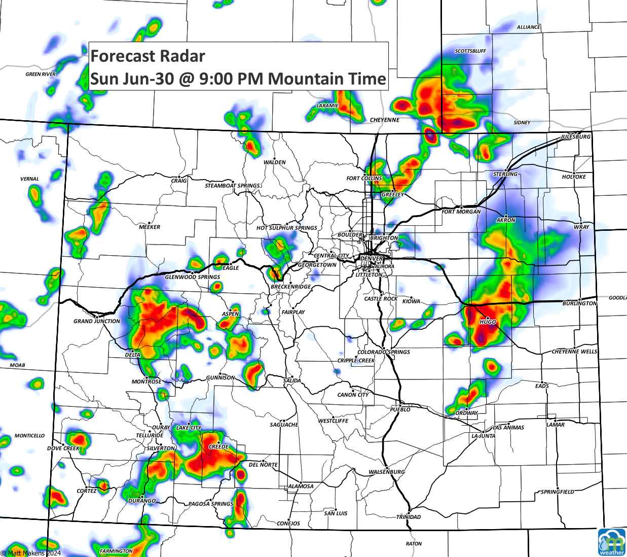
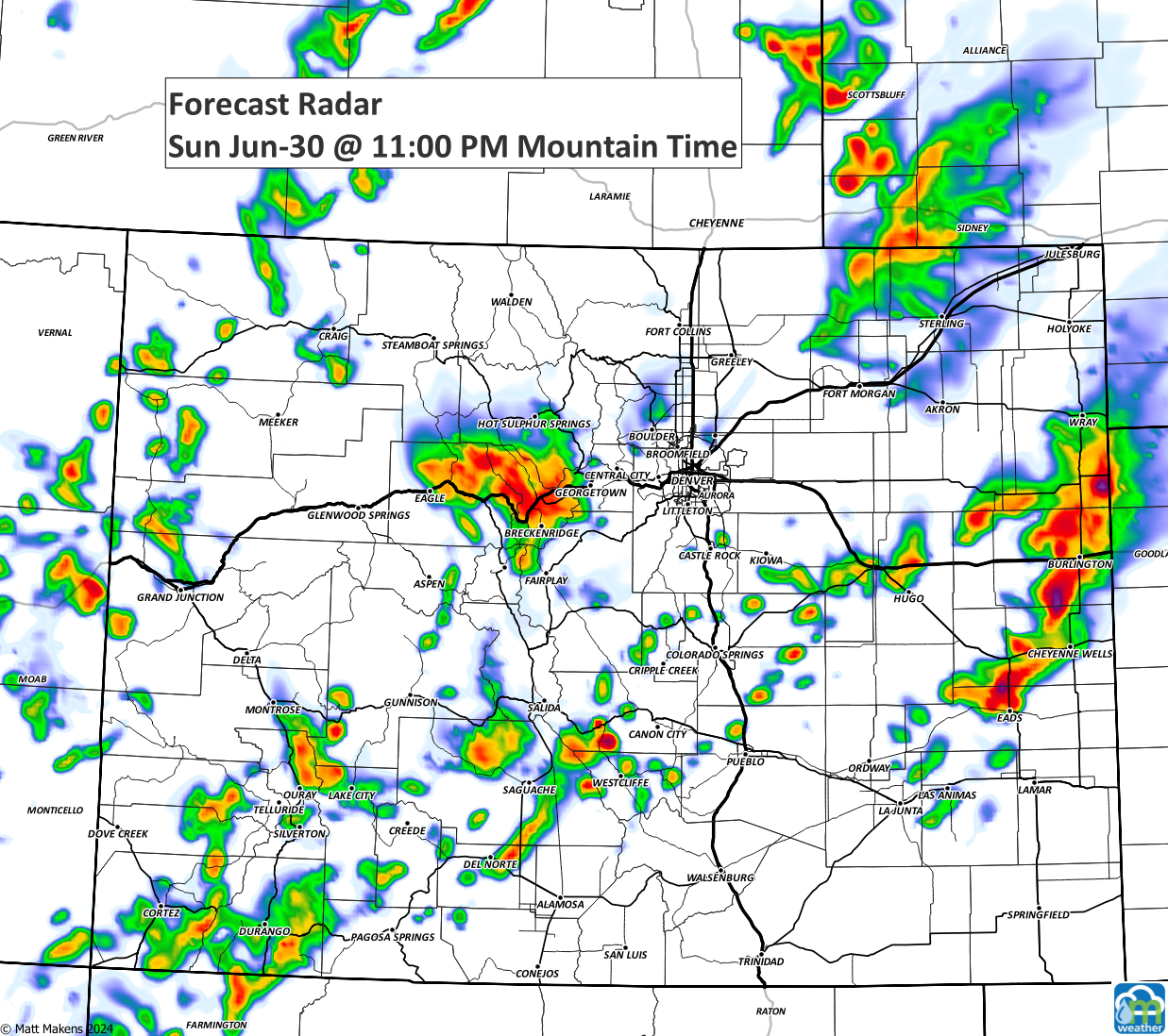
If you have plans to BBQ or head to the pool today, keep a sharp eye out. Not many of us will get rained on, but you'll undoubtedly see the thunderheads in your view through sunset, and some of us will have a storm well into the night.
Speaking of, the mountains keep thunderstorms rolling through the night, which can lead to flash flooding concerns for some of the valleys.
Here's a quick look at the hourly planner from now through mid-week as you plan your workweek.
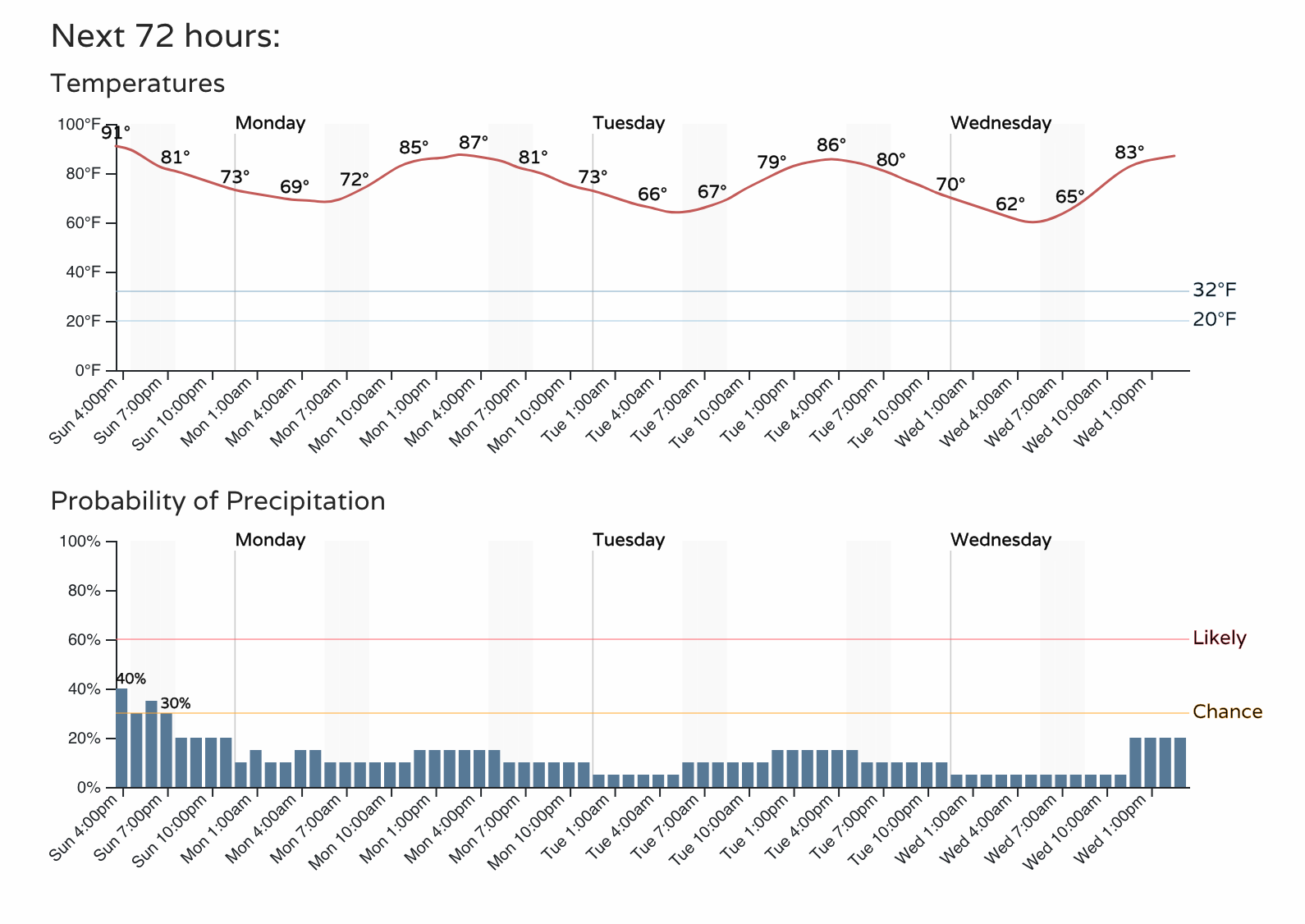
Yes, there are persistent storm chances and highs in the 80s. We'll contact you with more weather forecasts for the week ahead.