Hot June across Colorado, what's ahead for July; Beryl booms

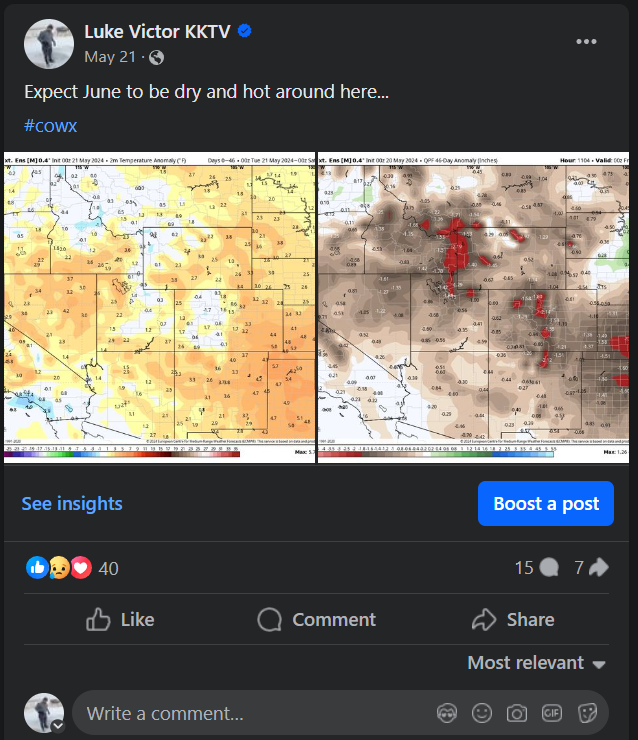
As early as May, there were plenty of signals that June was going to be a hot one across Colorado. It's likely the data was even underdone a bit.
Below are some charts on how hot it actually got. Both Denver and Colorado Springs experienced their second hottest June on record! However, you look back to 2012 for both locations, we were still shy of that year by a good amount. A testament to the parched springs and scorching summer which birthed the infamous Waldo Canyon Fire.


Denver's hottest temp of 100º came on June 25th, while Colorado Springs' hottest temp of 97º came on the 13th.
Also of note, 16 of the 30 days in June, Denver saw high temps of 90º+! ... 13 of 30 for Colorado Springs.
Looking ahead to July
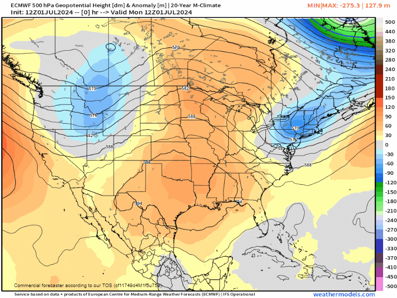
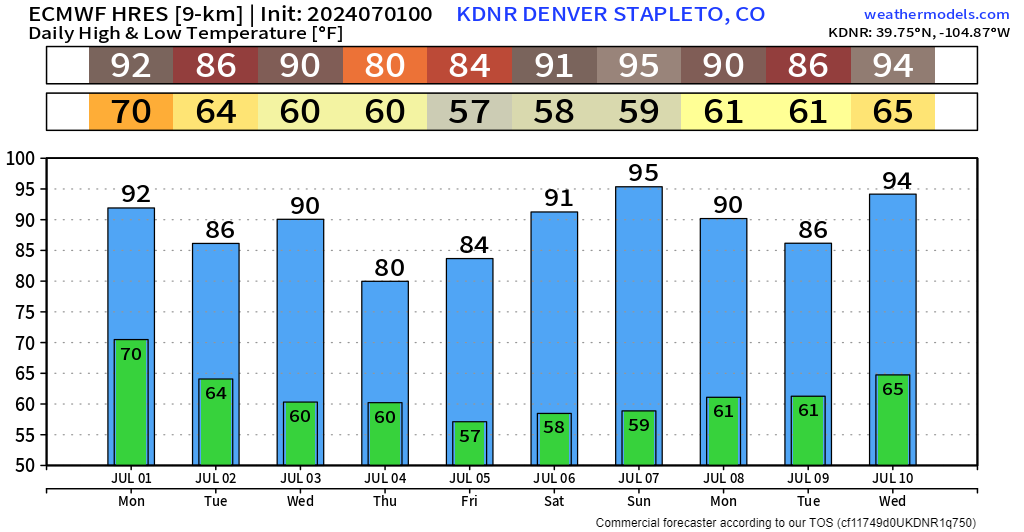
Overall, trends are for the ridging to continuing over the Rockies. This will likely keep the hot streak going – although, the first week is looking alright as some monsoonal flow has set up, giving us cloudier skies and cooler temps the next few days. We're seeing the strongest ridging just off the west coast, which is squeezing out most of the stormy weather/cooler air over head. As that ridge nudges east, likely around the 9/10th timeframe, we likely see heat build back in.
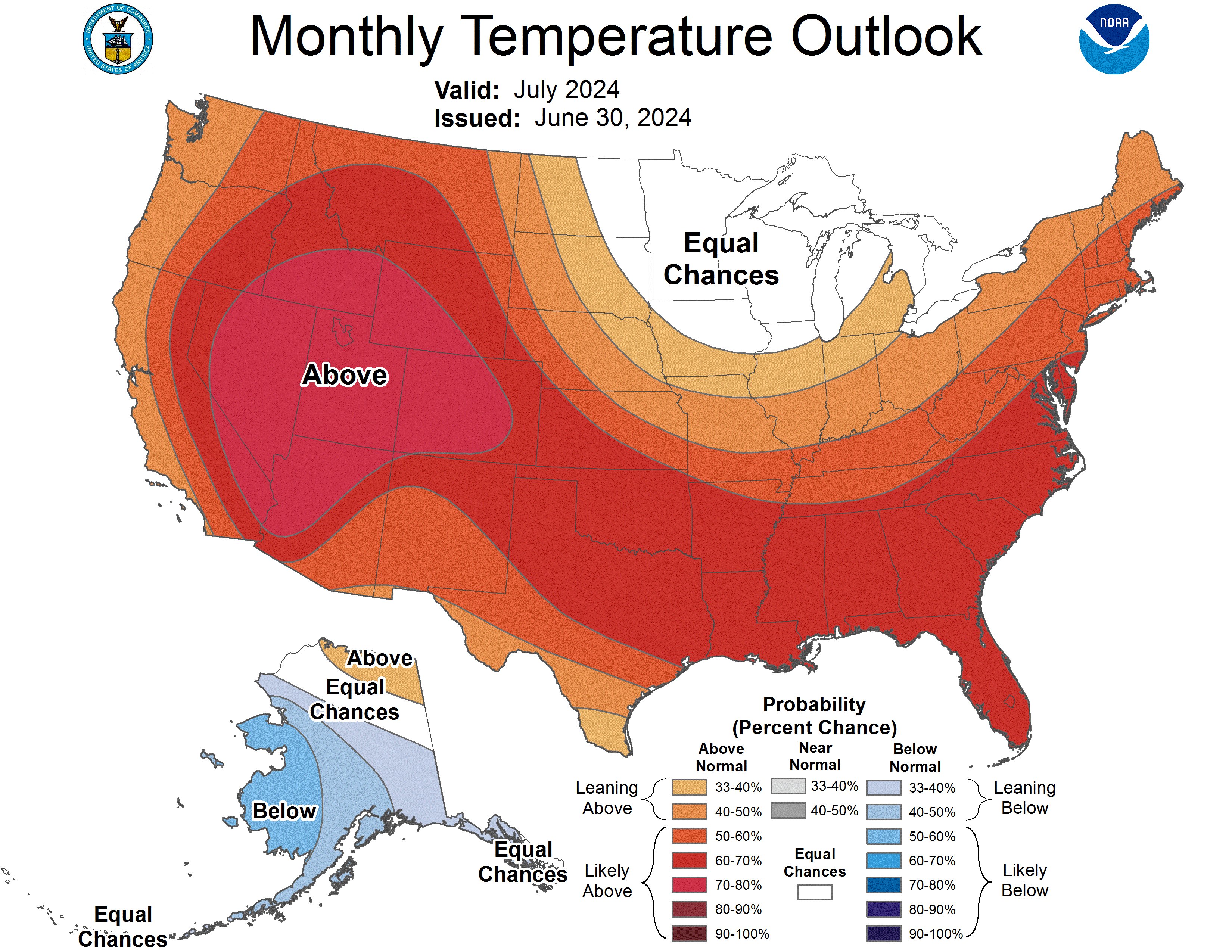
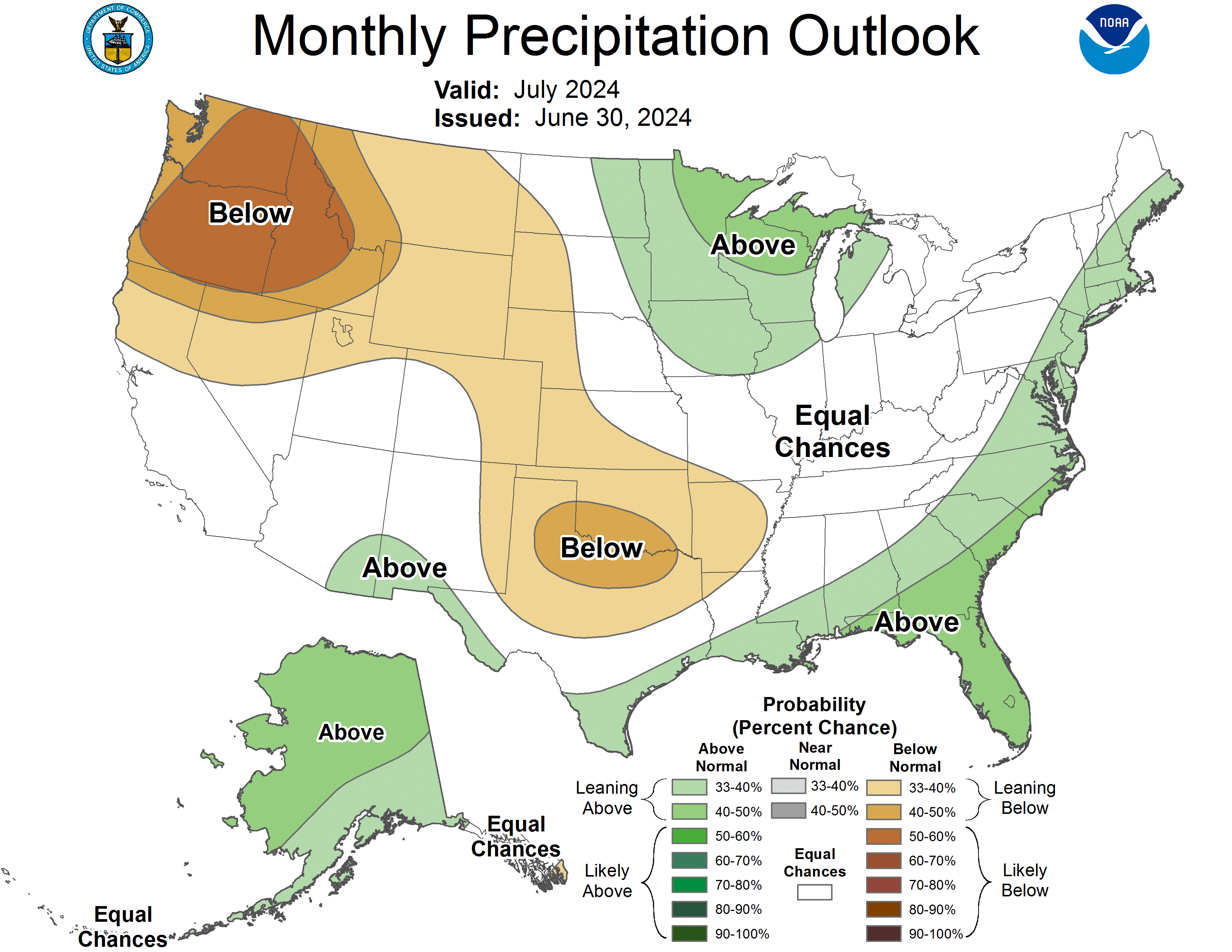
Official reports from the Climate Prediction center trend drier and warmer than normal for most along the front range for July. A couple extra nudges from any additional monsoon pushes could help us tilt in the other direction in terms of water.
Beryl booms!
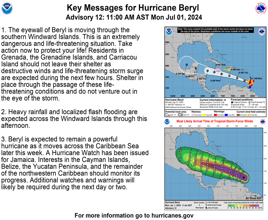
A record-breaking hurricane has formed in the Atlantic the last few days. You've likely seen some of the headlines about Hurricane Beryl which has exploded to category 4 intensity as of Monday. June is the earliest a category 4 hurricane has ever been recorded in the Atlantic Basin.

The latest satellite imagery show a harrowing eyewall with clusters of intense thunderstorms driving around the eye. The system itself is making landfall across the Lesser Antilles, near Grenada.
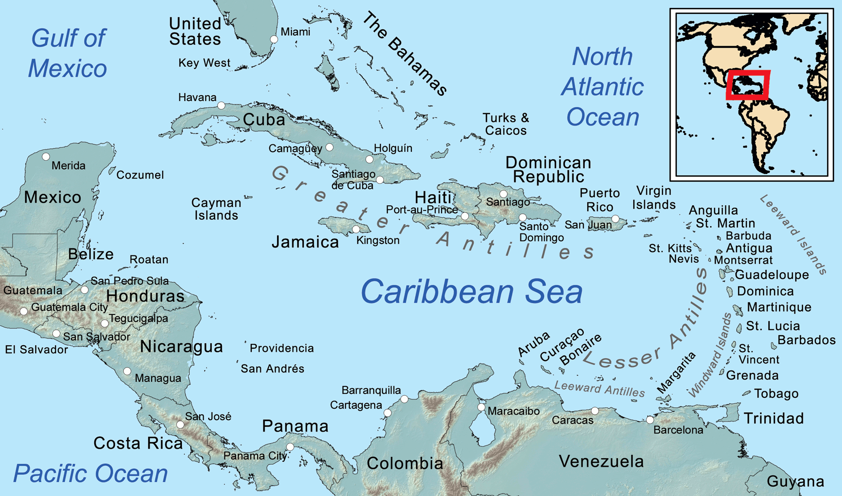
A storm, this far south in the Atlantic MDR (main development region for tropical systems) is uncharacteristic this early in the season – this type of storm is more akin to August.
Here is the latest advisory on Hurricane Beryl ⬇️
What's ahead this week?
A quick peek at the forecast for Denver is showing a little bit of heat relief for your holiday week, especially on the 4th itself. We'll likely have to dodge some isolated storm chances between now and the weekend, but nothing is looking terribly organized at the moment.
If any of that changes, we'll throw another update your way as needed! Stay cool!