Record heat wave likely this weekend, Boulder fire breaks out

An intense heat wave is taking hold across Colorado today and into the weekend. We're expecting the potential for 3 or 4 days of 100+ in Denver.
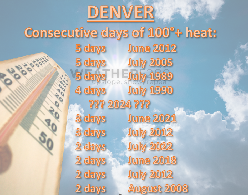
A stretch like that has only occurred 6 times in since records have been kept since 1872. The "official" record at DIA which dates back to 1994 has occurred 5 times.
⬇️ Below is a look at current alerts from the NWS ⬇️
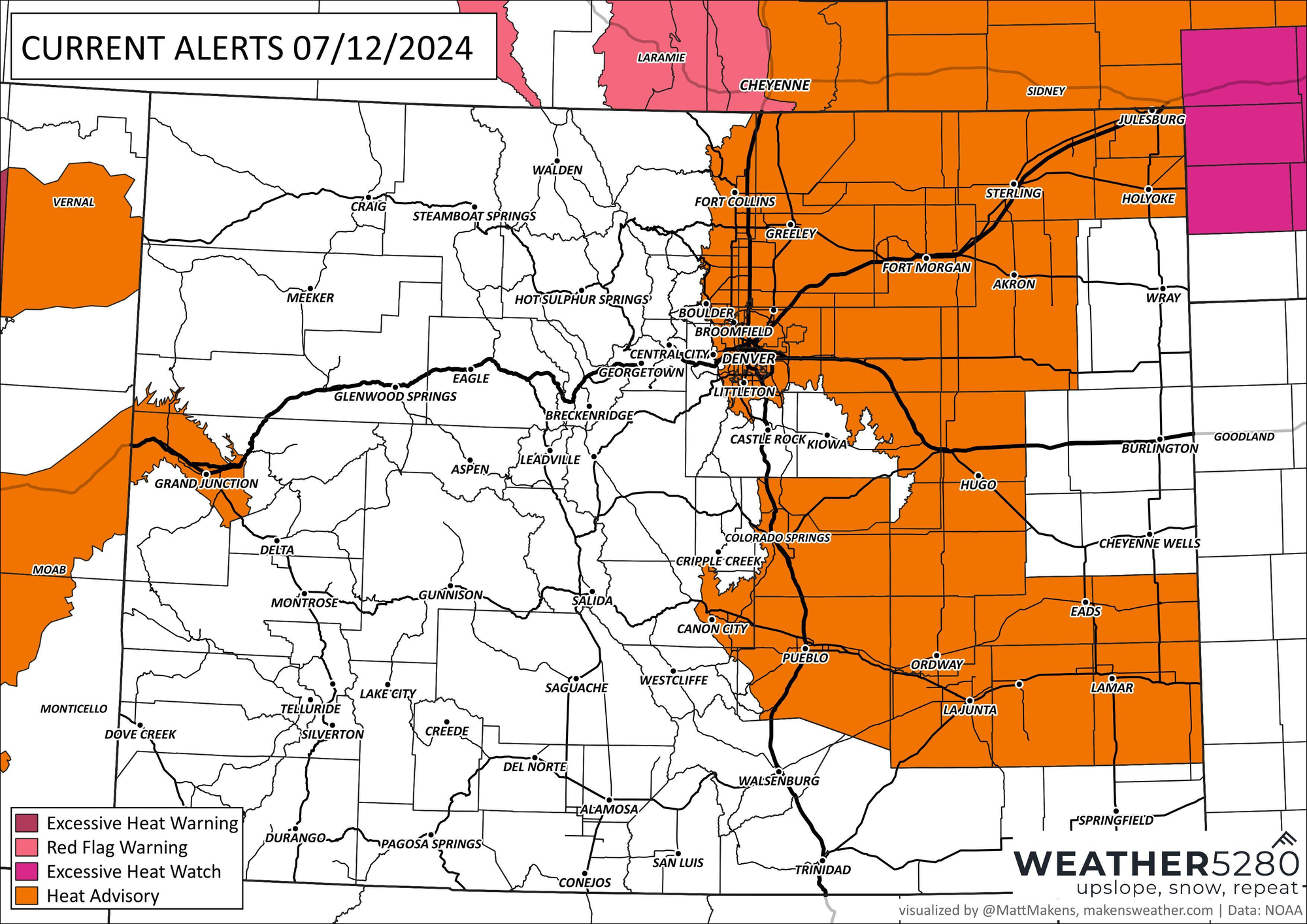
Heat advisories stretch along I-25 and over most of the eastern plains including the I-76 and HWY 50 corridors. The main message with those advisories: find ways to stay cool and stay hydrated.
Clearly this is the most important for folks who are sensitive to this heat, and for people planning to spend time outdoors this weekend. At this rate, if you can find something to do indoors, that's a better option.
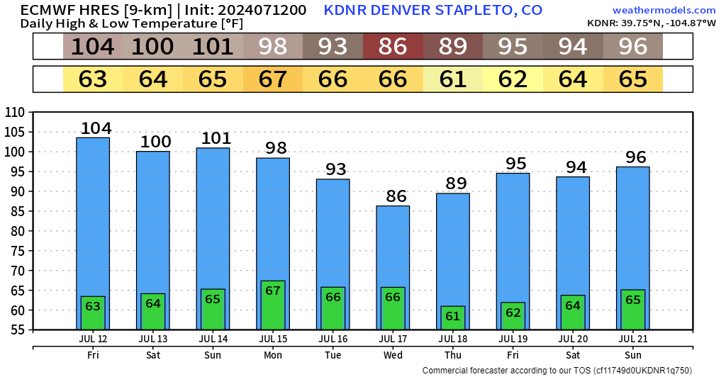
The EURO is downright rude as far as temps are concerned at Denver's Central Park/Stapleton location:
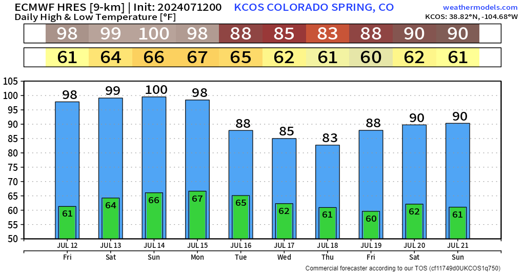
It's not much better for Colorado Springs either:
We've got an animation of the 500 mb height anomaly: you can see the big bubble of high pressure (big orange blob) over Colorado the next few days.
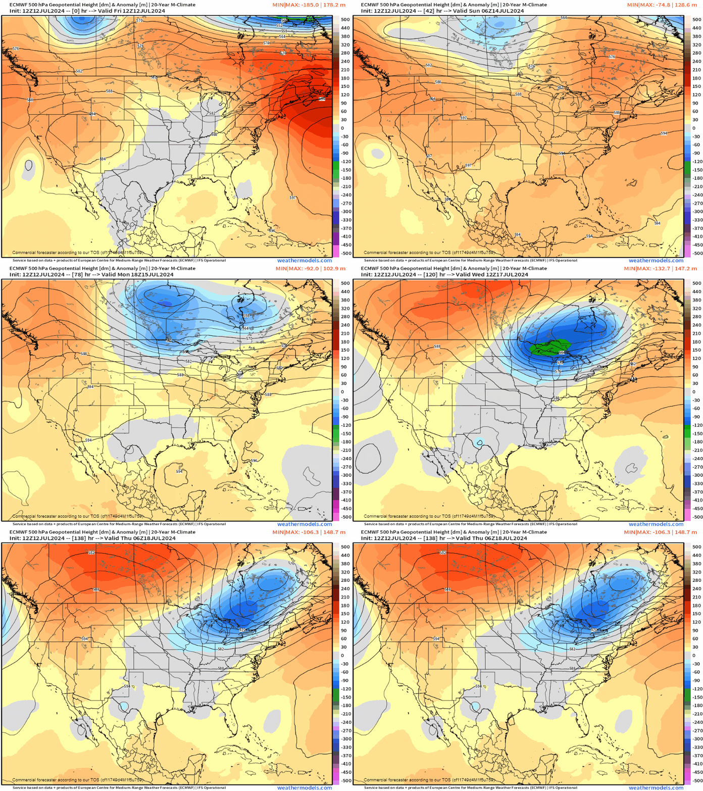
It will soften up a bit into next week as that big area of low pressure over the Great Lakes swoops down. That should send a cold front our way, and may even link up with that weak area of tropical moisture down in Texas... models have been hinting that the combination of those two features could bring us some beneficial July rains along the front range, as well as a much deserved cooldown.
FIRE POTENTIAL
Unfortunately, to tag team this heat will be some timber fire potential – especially in areas that have been hard-pressed to get moisture. Boulder recently had it's driest June on record; and as of 11:46 AM on Friday, a wildfire had broken out at the base of the Flatirons.
Rapidly developing fire in the #Boulder Flatirons just west of town. I saw flames briefly. pic.twitter.com/sBNljZxxcA
— Bob Henson (@bhensonweather) July 12, 2024
This is a quickly developing situation and we'll make sure to update this article if it's needed. Stay cool folks! Summer means business this weekend!
