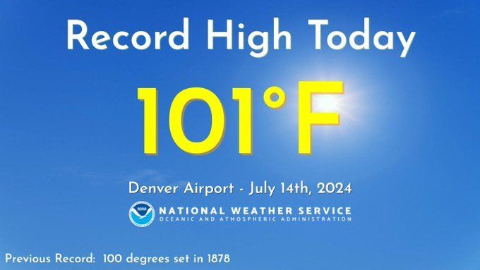
Denver breaks 146-year record high; Increased storm chances with cooling through midweek

We've been cooking over the last couple of days. Denver set two new record highs over the last four days, and came close the other two days.
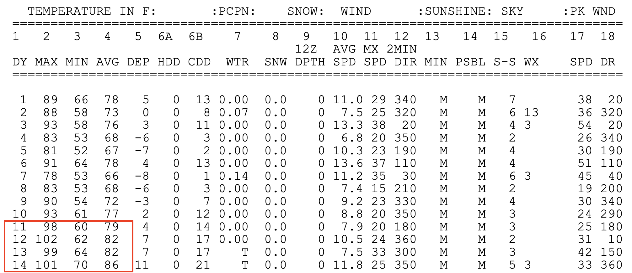
- Thursday: 98°F (Record 102°F (1954))
- Friday: 102°F (NEW Record – Prior 101°F (1971))
- Saturday: 99°F (Record 100°F (2003))
- Sunday: 101°F (NEW Record – Prior 100°F (1878))
We'll shave a few degrees off highs this afternoon in the Mile High City, but it'll still be nothing short of hot. Blended guidance tops the city out at 97°F this afternoon, the record for the date is 101°F set in 2006.
Tuesday we "cool" into the low 90s, with perhaps at least one day in the 80s this week on the way Wednesday. Here is the latest forecast temperature trend for the metro area:
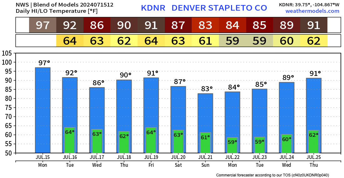
After warming into the low 90s to end the week again, it could be we see another push of cooler air establish itself east of the Rockies by the weekend.
The relief from the extreme heat this week will come with an increased chance of storms as well. And thank goodness. Denver has only officially picked up 0.21" of precipitation this month, about 0.6" below average for the date. Across the state, here are the chances for a thunderstorm today:
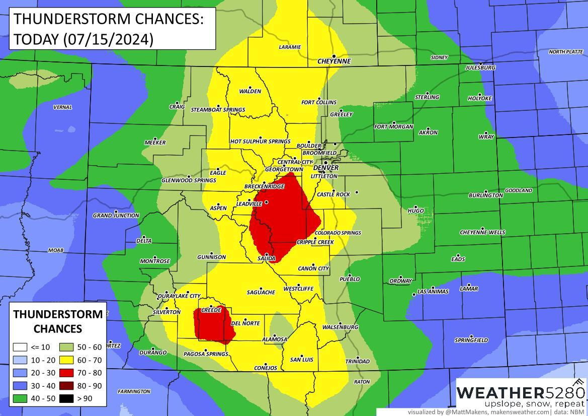
Get hourly specific for Denver, the 40 to 60% storm chances over the next several days are welcome, but of course – there's still a bit of luck involved in ending up under a storm!
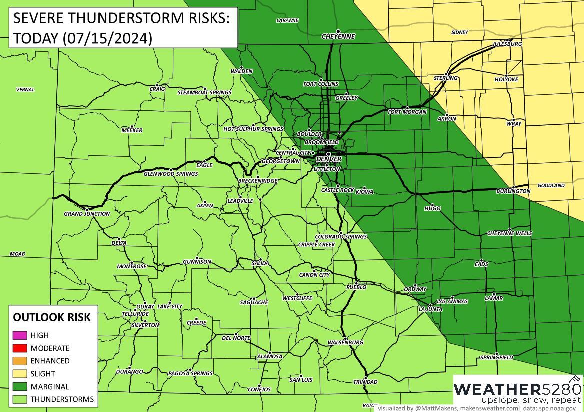
Not a huge severe threat for the urban corridor, but any storms that develop will be capable of becoming severe, particularly with the threat of hail and damaging wind.
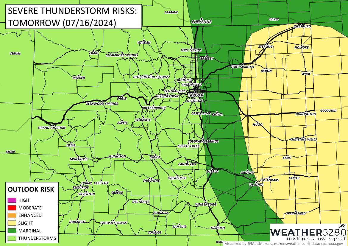
East of Denver the severe threat will be higher, particularly on Tuesday. Here are the latest severe weather guidance outlooks from the SPC.
Today:
Tuesday:
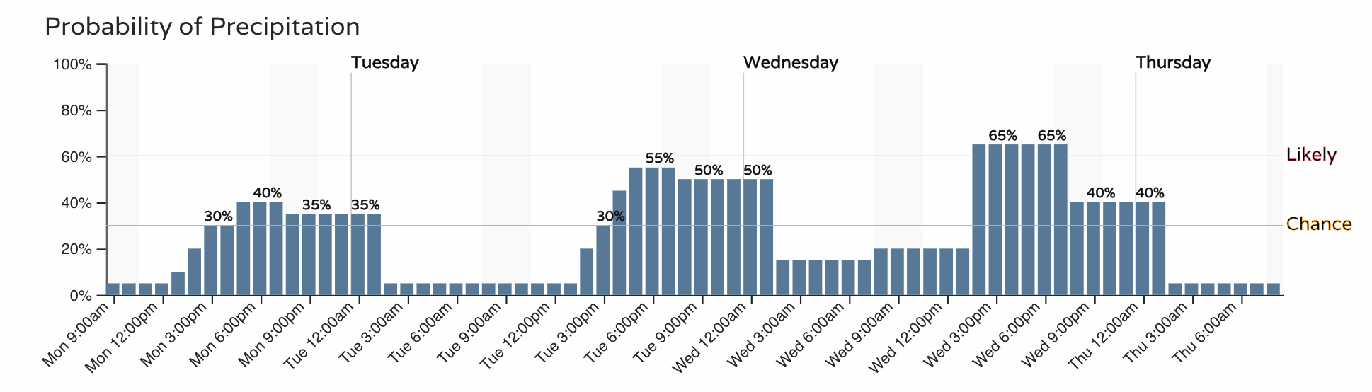
As for how much precipitation? It'll be hit-and-miss... so some folks will see upwards of an inch over the next days while other folks regrettably will end up with a goose egg.
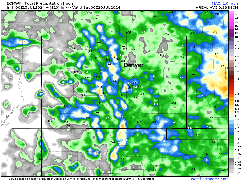
A look at the European (global) model we see it focuses all meaningful precipitation across the higher terrain west and south of Denver through Friday afternoon. For the urban corridor all but dry.
High resolution models (the 3km NAM below) show this a probably a bit more nuance here, with some of those cells peeling off the hills and at least delivering pockets of the urban corridor with some – much needed – water.
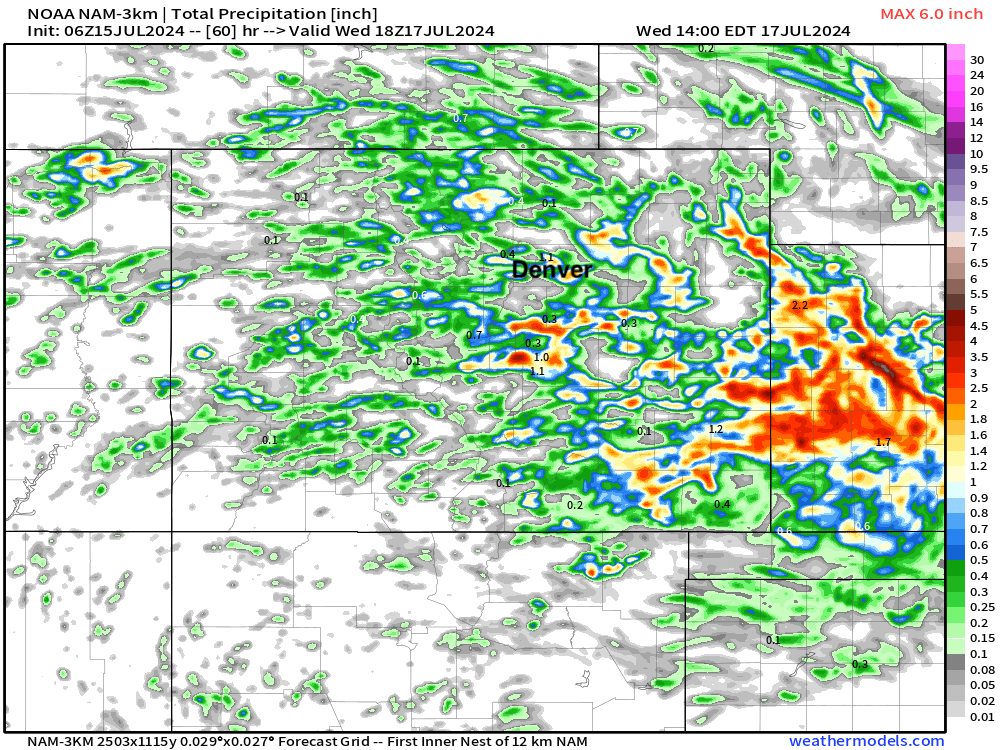
Both models agree that the most impactful / widespread precipitation is favored well to our east, with parts of Kansas in line to get some good water this week.
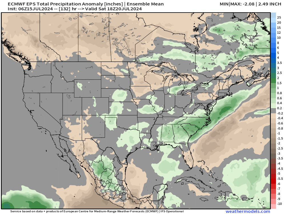
This is reflected in the means as well. Near average for most of eastern Colorado (perhaps a bit better along the foothills) but pocket of above average green showing up just east of Colorado, extending south into the Oklahoma/Texas panhandles.
So, let's see how the storms shake out. Most days should be okay, but good to stay weather-aware this week as any given afternoon could feature some storms.
Week 2
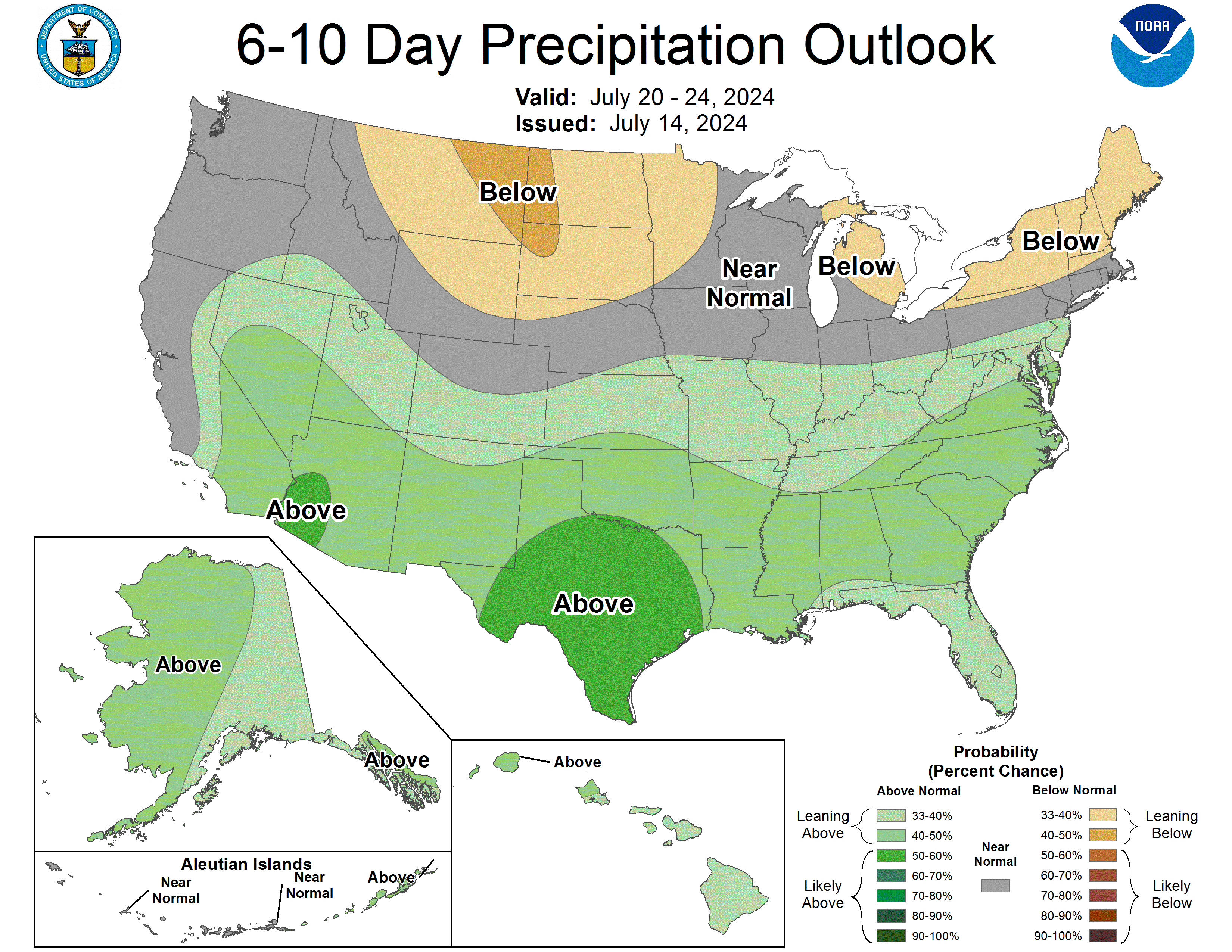
The 6 - 10 day forecast will try to stay average to below average in the precipitation department, but more heat appears to be lurking...
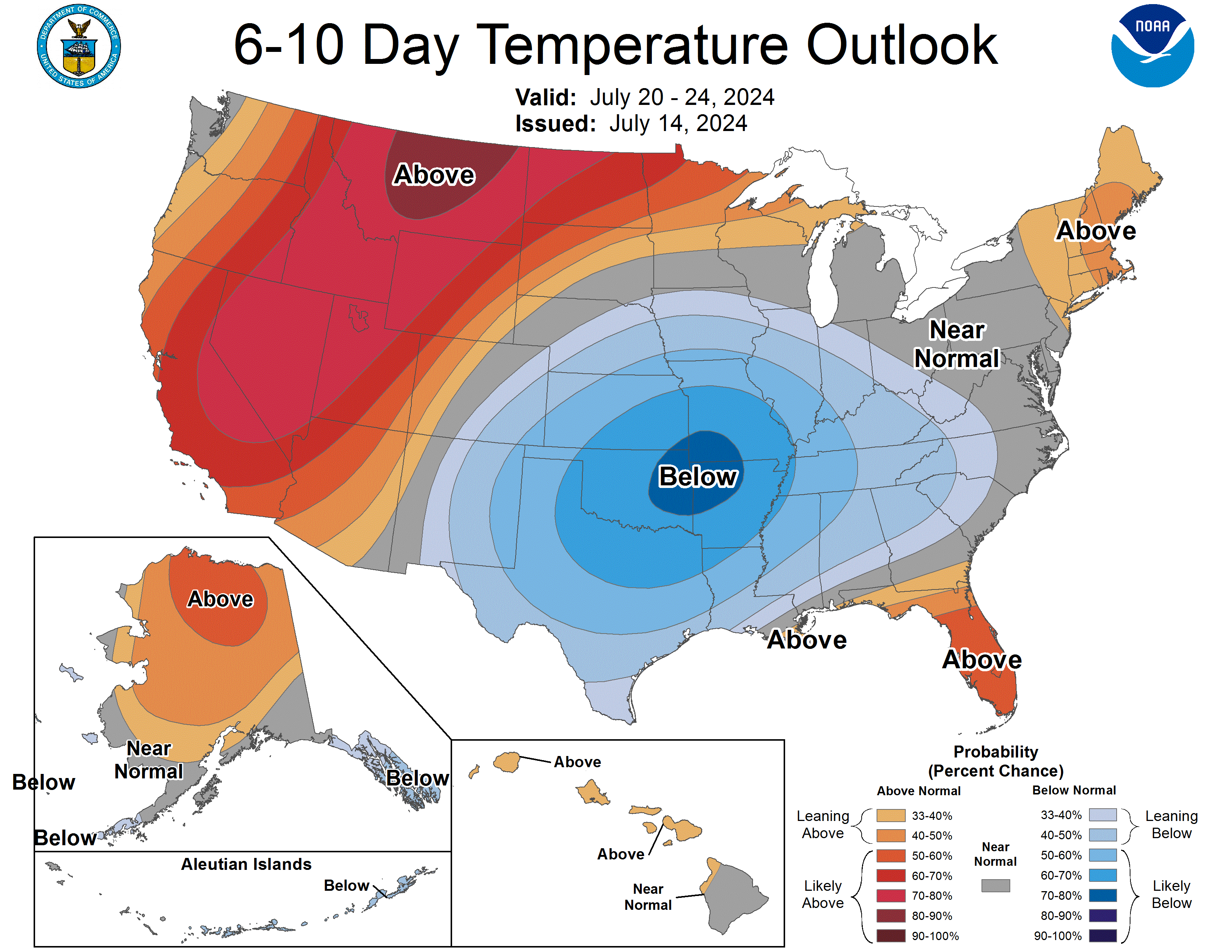
Not crazy dry either it appears... but we'll see. The wettest weather favors the southern tier in week two, with near average precipitation forecast for Northern Colorado.