Another Colorado heat wave on tap this week

After some rain and cooler temps on Friday and Saturday, we're going to see a return of more summer heat on Sunday—mid-to-upper 90s look aplenty for the Front Range. We'll also have some gusty winds (20-35 mph) out of the west. Some scattered fire danger is also possible.
Here are high/low estimates for the next ten days for Denver and Colorado Springs.
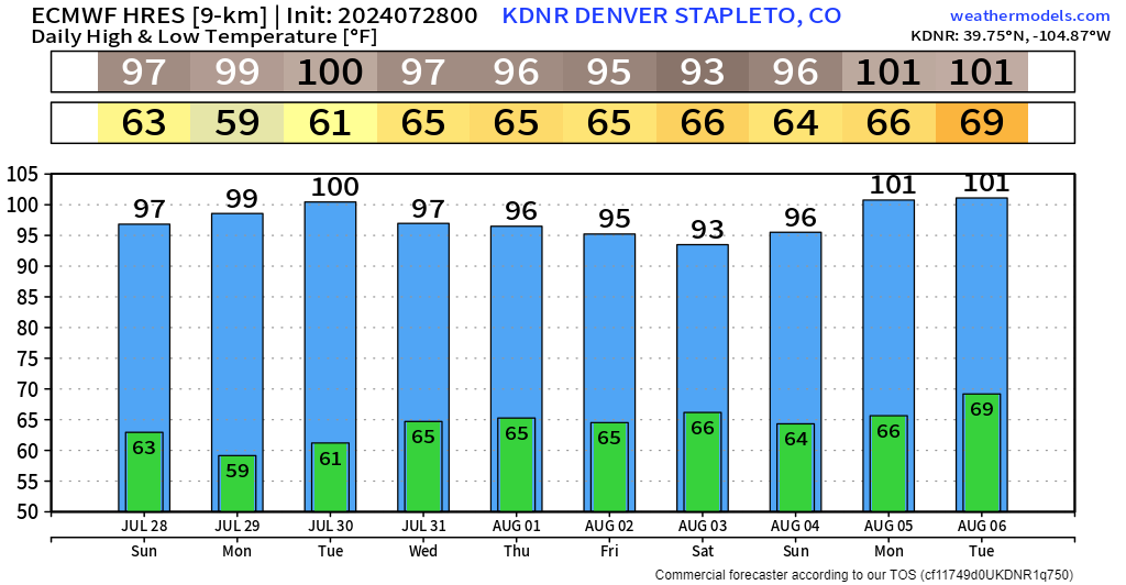
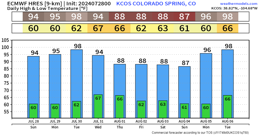
Temp trends show a signal for heat through most of the week in Denver. We'll see a bit of a breakdown in this late week into next weekend, which could come with some scattered rain & storm chances over the Palmer Divide and southeast Colorado by late-week.
A look at the national weather pattern shows initial ridging early week over the south plains, giving us the heat Sunday through Tuesday. A weak wave ripples by between Wednesday and Friday... but it's going to be fading on approach, hence mostly minimal moisture chances. Then we see the western ridge REALLY crank by next weekend. This is likely the beginning of the HOT & DRY signal that he month of August has had on most of the long-range weather modelling.
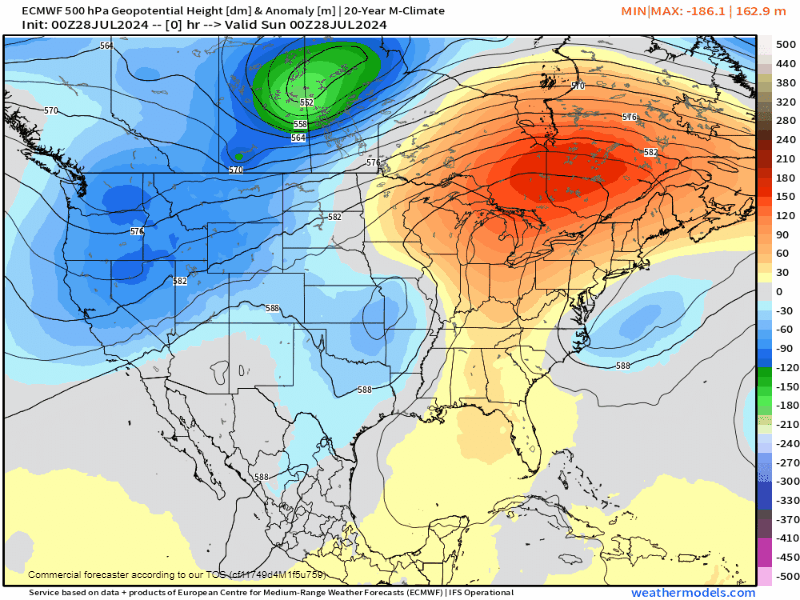
With the pattern seeming to have the ridge favoring a setup a bit to our west, we may end up in another northerly flow pattern that will pinwheel wildfire smoke in our direction.
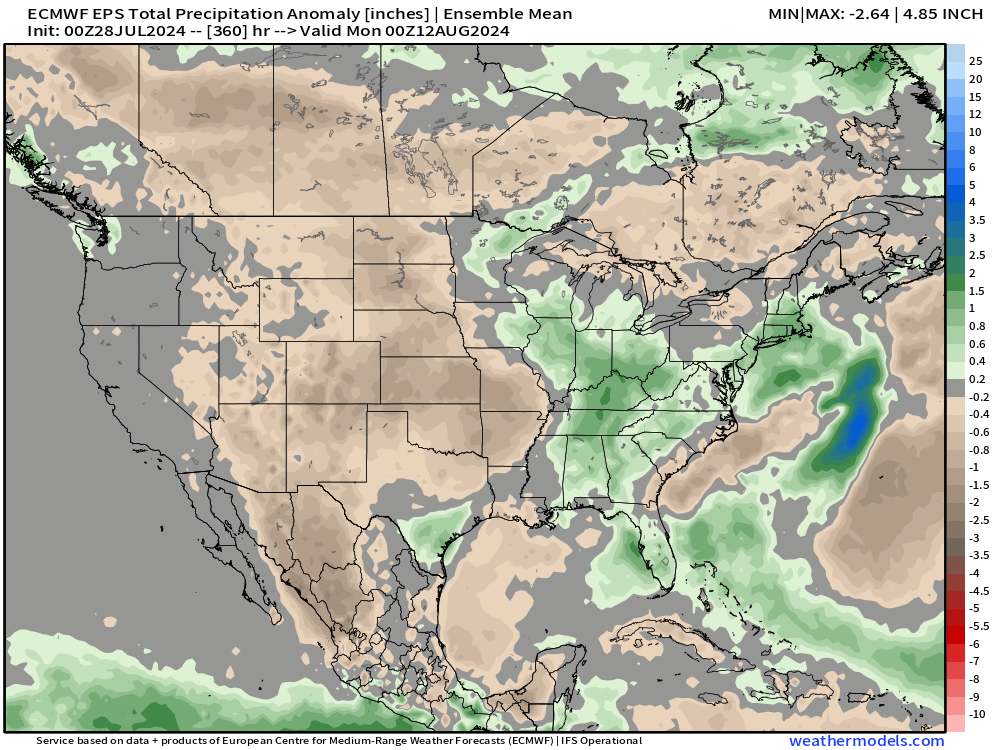
As for the monsoon... still looking pretty non-soon at this rate. Precip anomalies on the Euro Ensembles support moisture numbers that may run 1-2" below normal during our peak monsoon season. With likely little moisture to work with ahead for August, we can expect hot weather to crank too.
Overall, things aren't looking great if you're starting to get over the summer. So far, it's been run by hot and dry, and that looks like it will continue to be the case going forward.
We'll work on updates for any of those late-week rain chances. Stay tuned!