
Denver Weather: Flood watch issued as storms develop

If you looked west during your lunch hour, you no doubt saw thunderstorms developing. These will move into the metro area later today, bringing a risk of excessive rainfall, which could result in some flooding.
Let's begin with that threat - flooding. If your county is shaded here, your risk is highest.
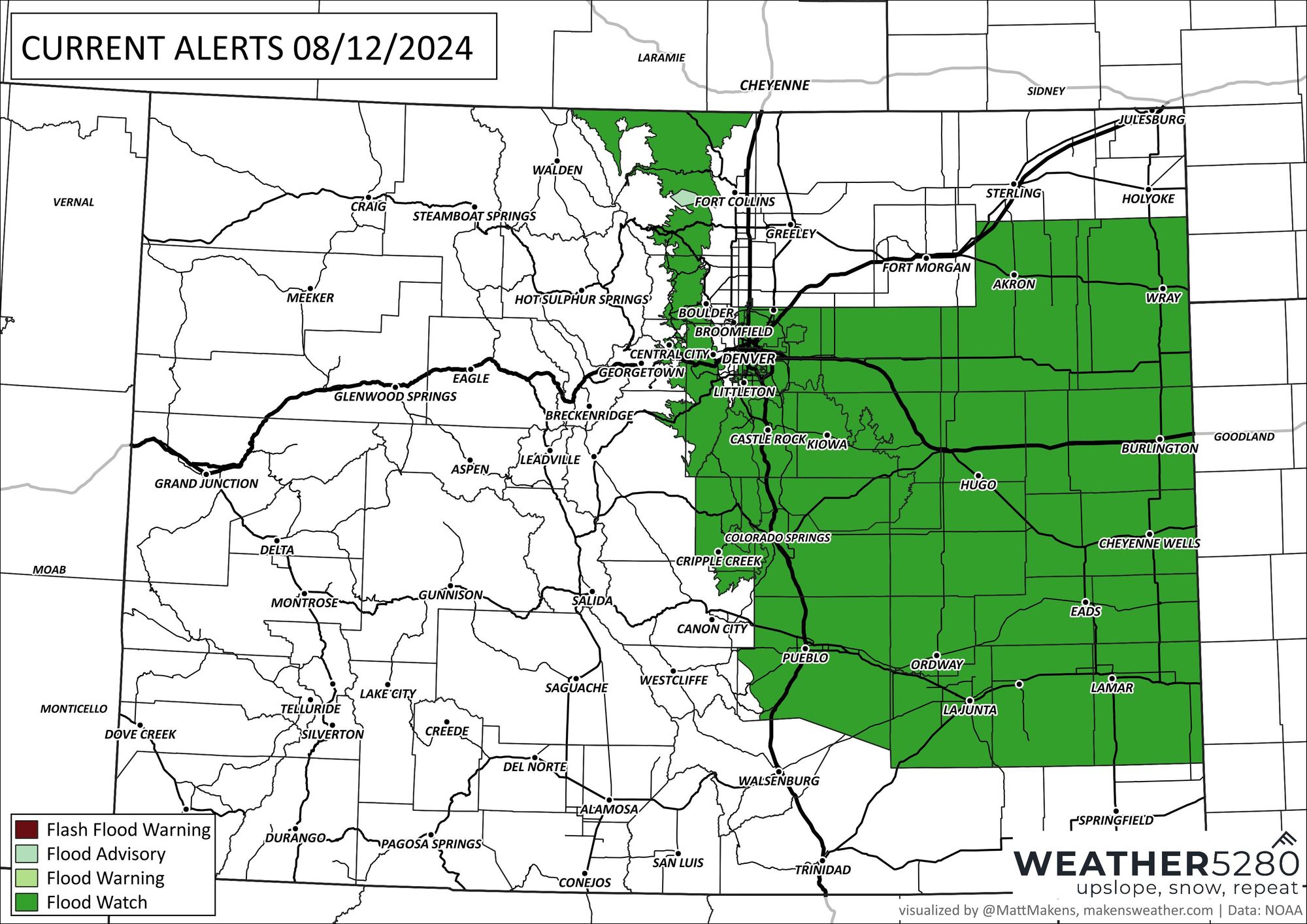
* WHAT...Flash flooding caused by excessive rainfall is possible.
* WHEN...From 3 PM MDT this afternoon through this evening.
* IMPACTS...Excessive runoff may result in flooding of rivers, creeks, streams, and other low-lying and flood-prone locations. Creeks and streams may rise out of their banks.
* ADDITIONAL DETAILS... Thunderstorms with heavy rain will develop late this afternoon and continue through the evening. The stronger storms will be capable of producing 2-3 inches of rain in an hour. Localized rainfall totals of 3 to 4 or more inches will be possible
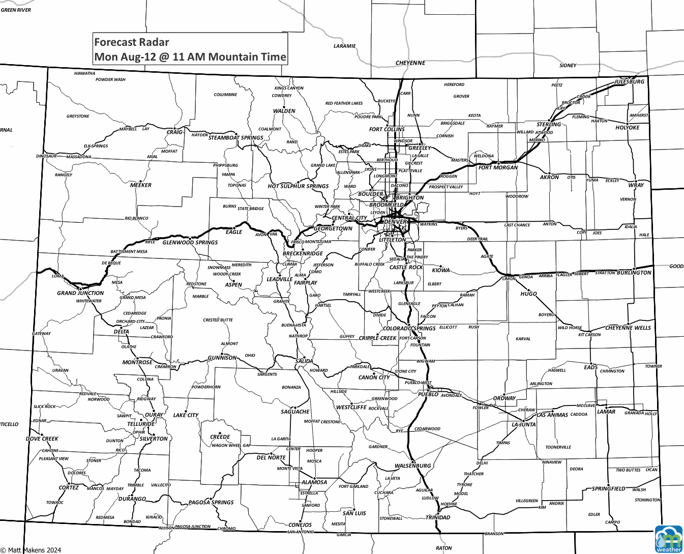
From that, let's turn to the timing of the storms. Here's an hourly animation for today and tomorrow.
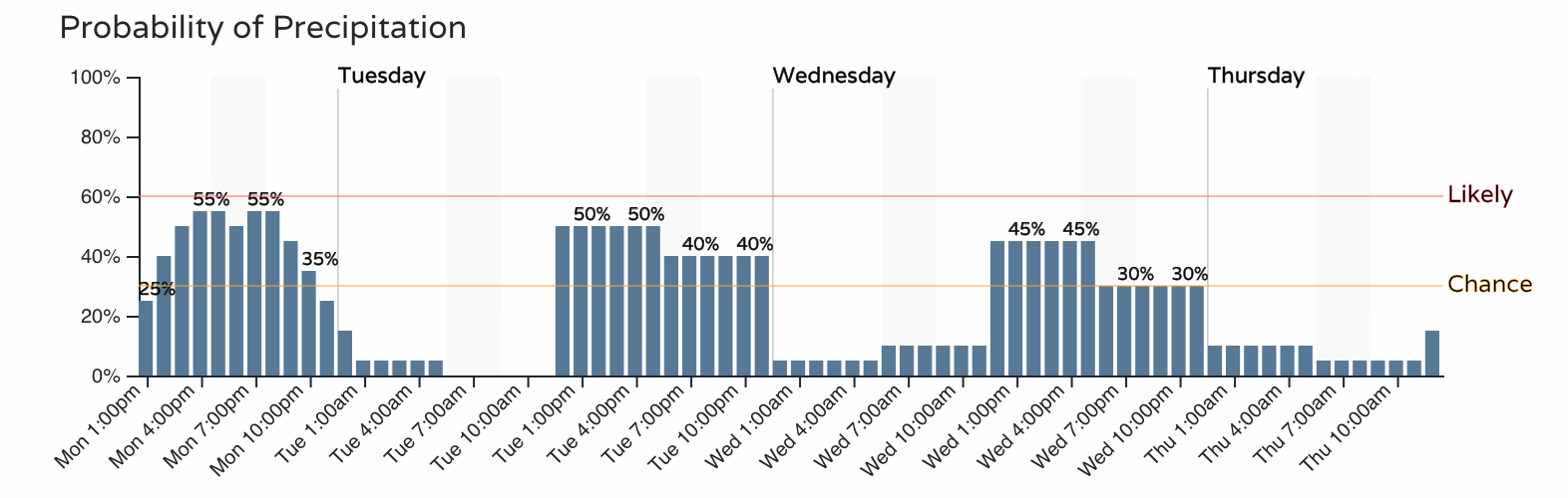
Here is an hourly planner for Denver itself for the next three days. Note that the timing each day will focus on the storms in the afternoon and evening, but you should not be shocked if you hear rain and thunder overnight, too.
I'll show you two different maps. One will show the potential rainfall for just today, and the other will include all rain estimated for the next three days.
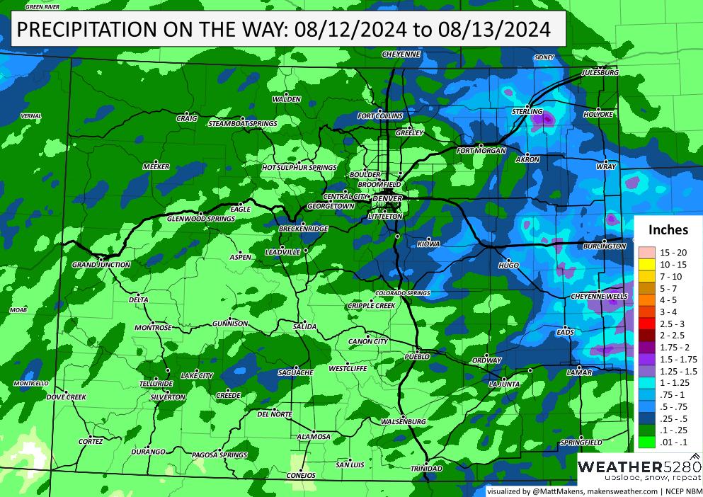
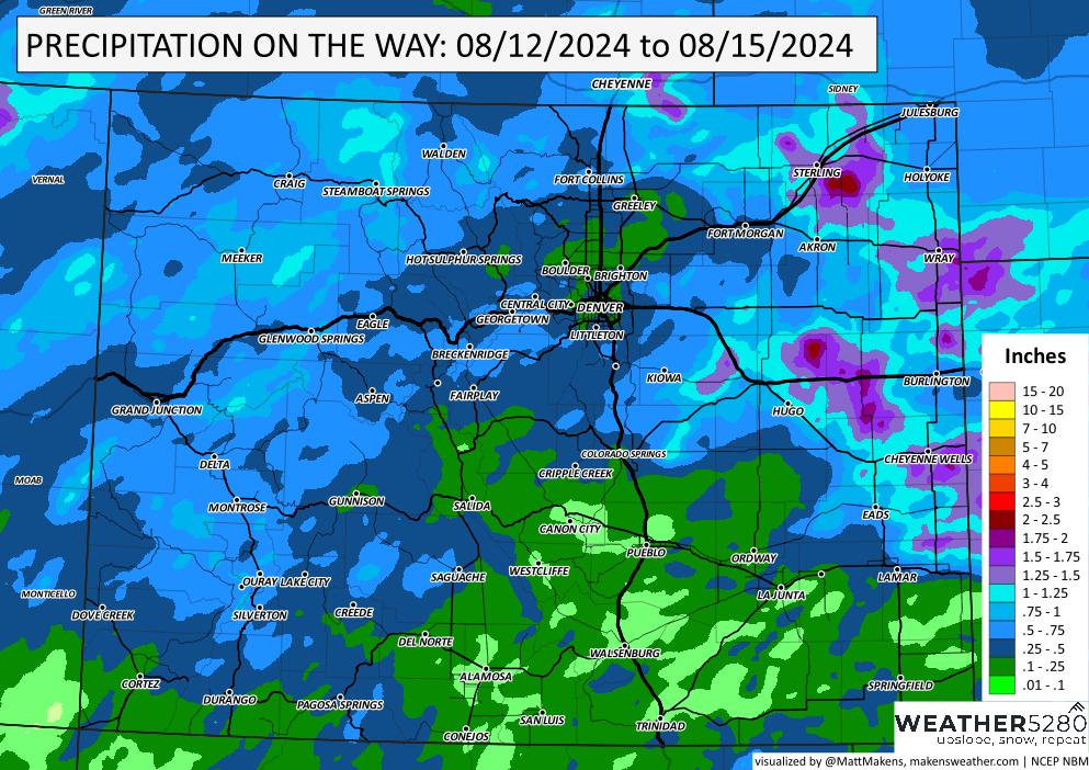
Looking at those rainfall estimates, you may think, "Hey, why am I on a flood watch, and I'm not forecast to get that much rainfall?" That's a great question, but note that forecast modeling here is a most-probable amount (an average) and does not show what is possible on the high end.
In this case, the high end is that we could see two to three inches in a short period of time. That flood watch issuance highlights the most likely areas for that higher end potential, as shown above.
Let us know how things go. The comment area below is an excellent way to reach us.