After weekend heat, a chance of storms across Eastern Colorado today, some severe

Yesterday, we celebrated our 11th day of 90°F+ heat so far this month. While not as hot as Saturday (98°F), Sunday again topped out in the mid-90s across the region, with only a Trace of precipitation at the airport. The average high for this time of year is 87°F.
Today we'll be closer to that average. Most guidance has us topping out in the upper 80s to near 90°F in Denver. It should feel better, generally, than this weekend in particular in areas we manage some storms this afternoon.
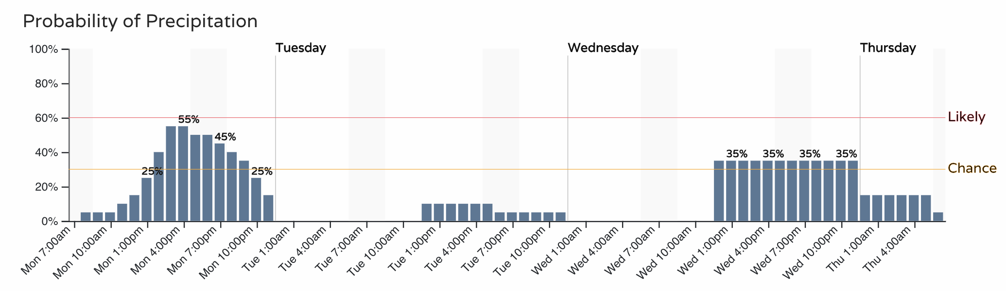
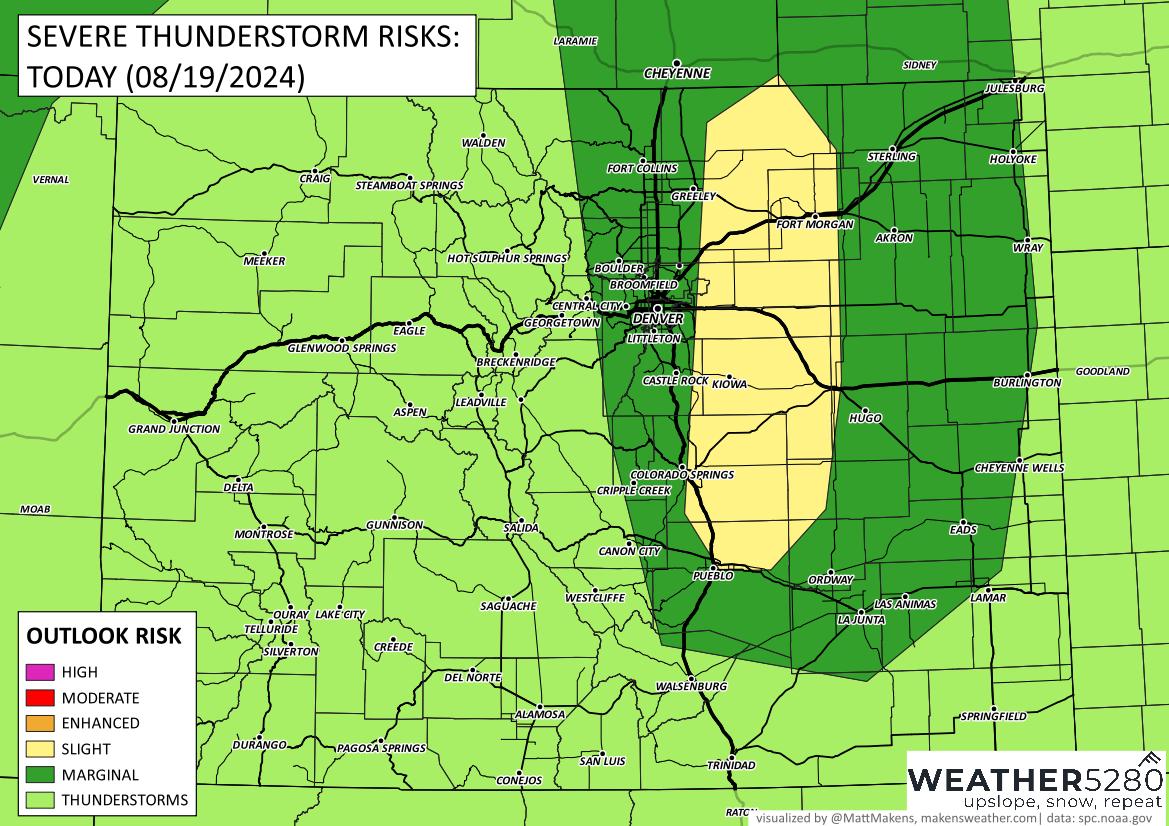
It's hard to be super excited about rain chances along the Front Range, with most of the heaviest activity expected east of the urban corridor. That said, about a 50% chance of storms for the Denver area, perhaps a bit higher for Colorado Springs, and likely enough clouds / storms building off the highs later today to help keep those afternoon temperatures down a few degrees.
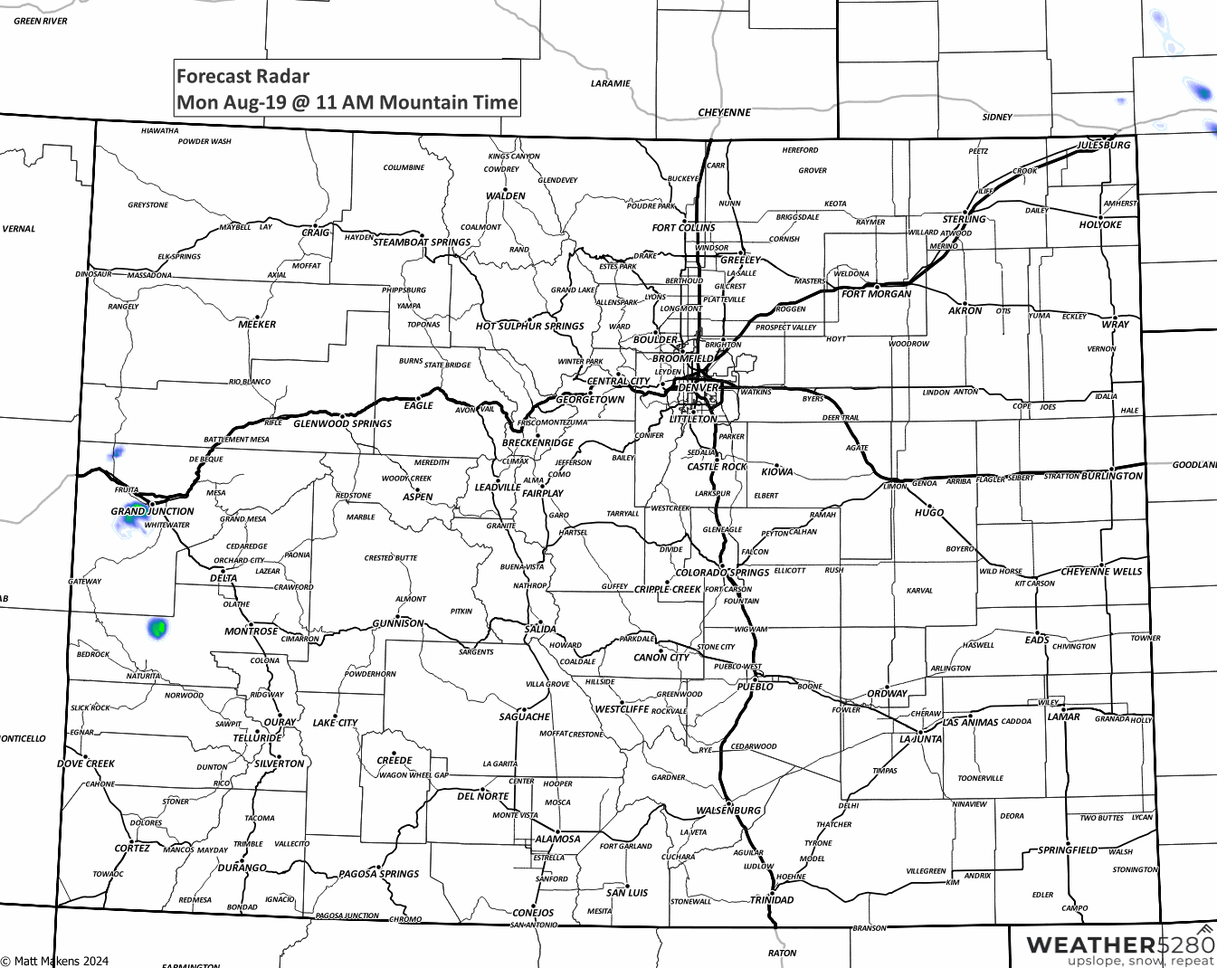
Just after lunch, storms develop along the Front Range first...then push east.
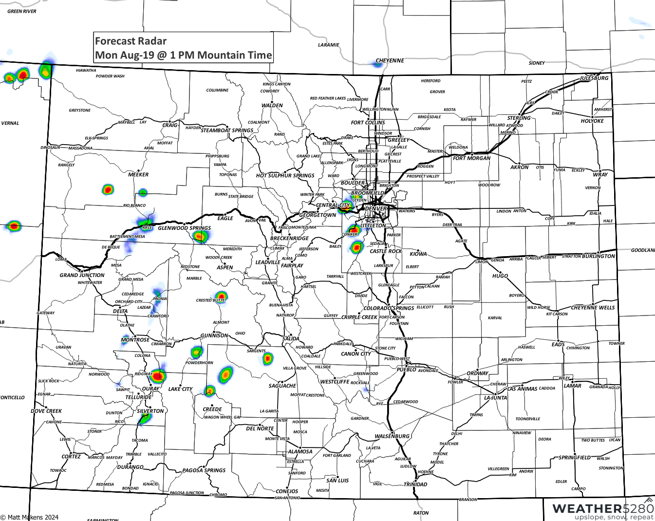
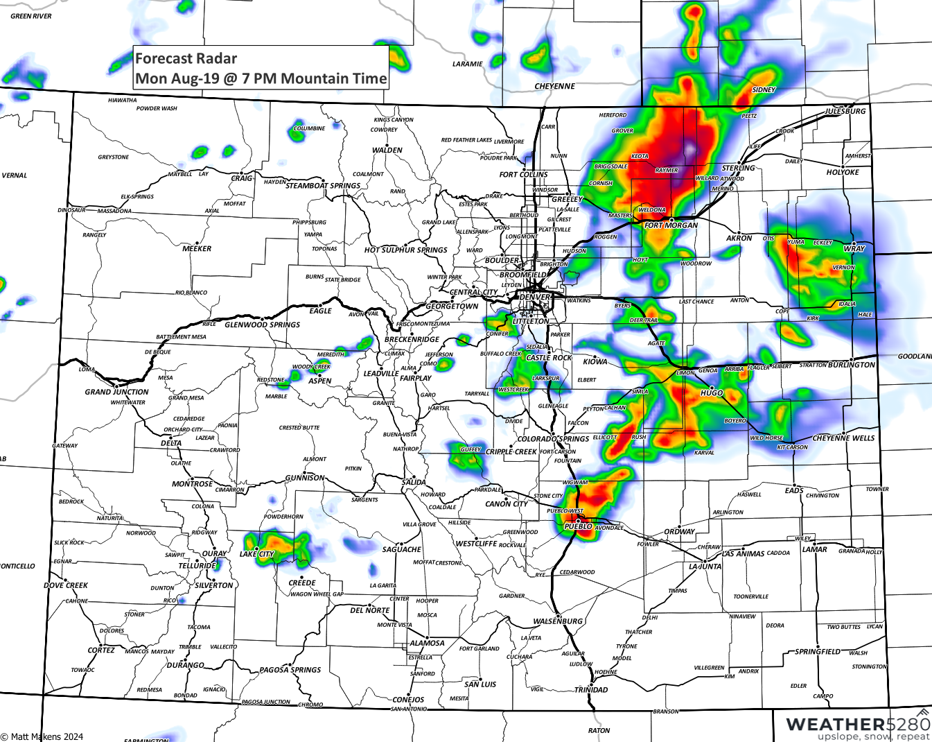
Intensifying as those storms push east...
Here's a full animation to show the progression of the snapshots above:
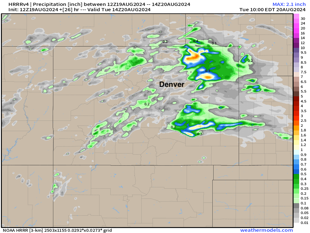
That model, the HRRR, shows just spotty measurable precipitation for the urban corridor, with locally heavy rain expected across the Eastern Plains of Colorado:
Here, east of the city, we see the most significant threat of severe weather this afternoon and evening. This is not to say that there is a zero chance for the city's storms to become severe, but the greatest likelihood for a storm to become severe (wind, hail, isolated tornado) would be east of the metro area.
The blend of models shows Denver's highs in the low 90s today (we hope we'll end up a few degrees cooler than that). Tuesday and Wednesday look to top out in the mid-90s again, before perhaps we shave a few degrees from the forecast later this week. Overall, there is no epic heat in the outlook, but also no epic cold.
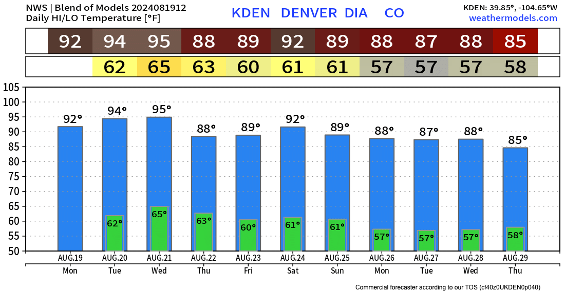
Similarly for precipitation... Some storms today, then off and on again through the week. While some storms could produce locally heavy rain, no significantly wet or dry signal for the next week either across the Northeast Plains.
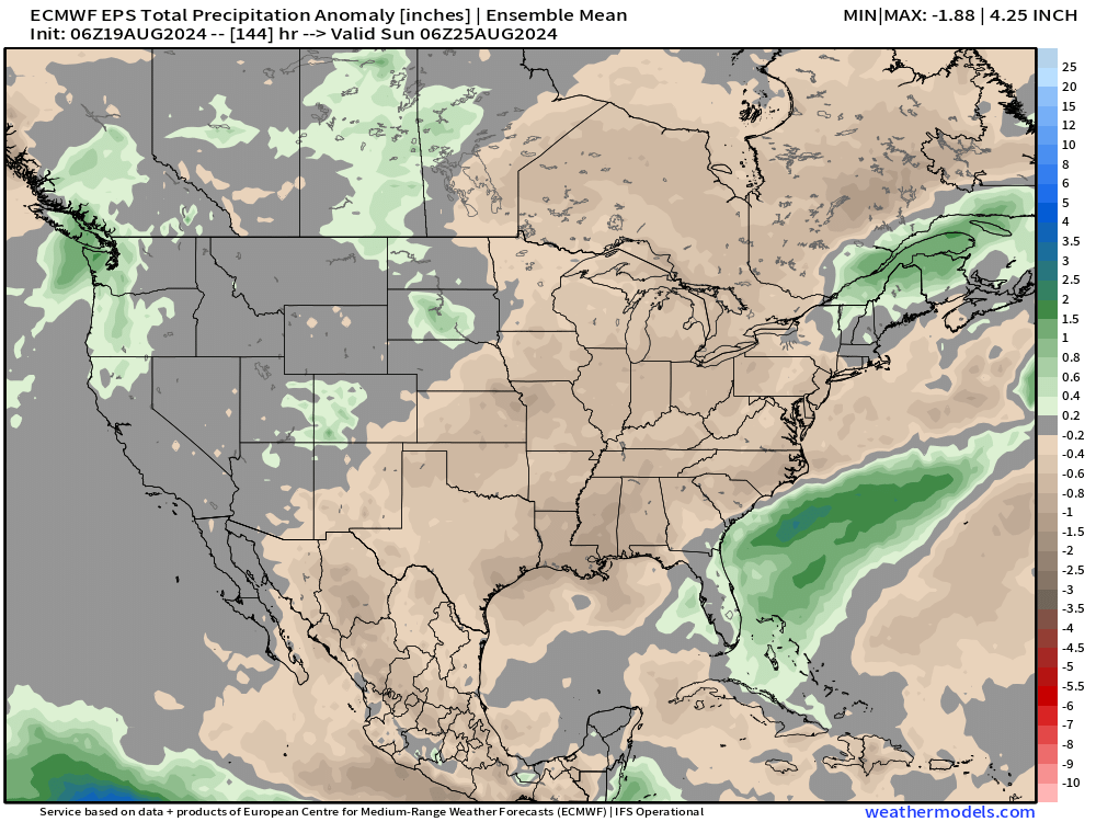
This is reflected in the EURO precipitation anomaly forecast as well – showing near average precipitation for our area through next weekend, below average for Southeast Colorado, and perhaps an uptick in storms for the high country... yes please!
