Colorado Weather: Cooler with widespread thunderstorms

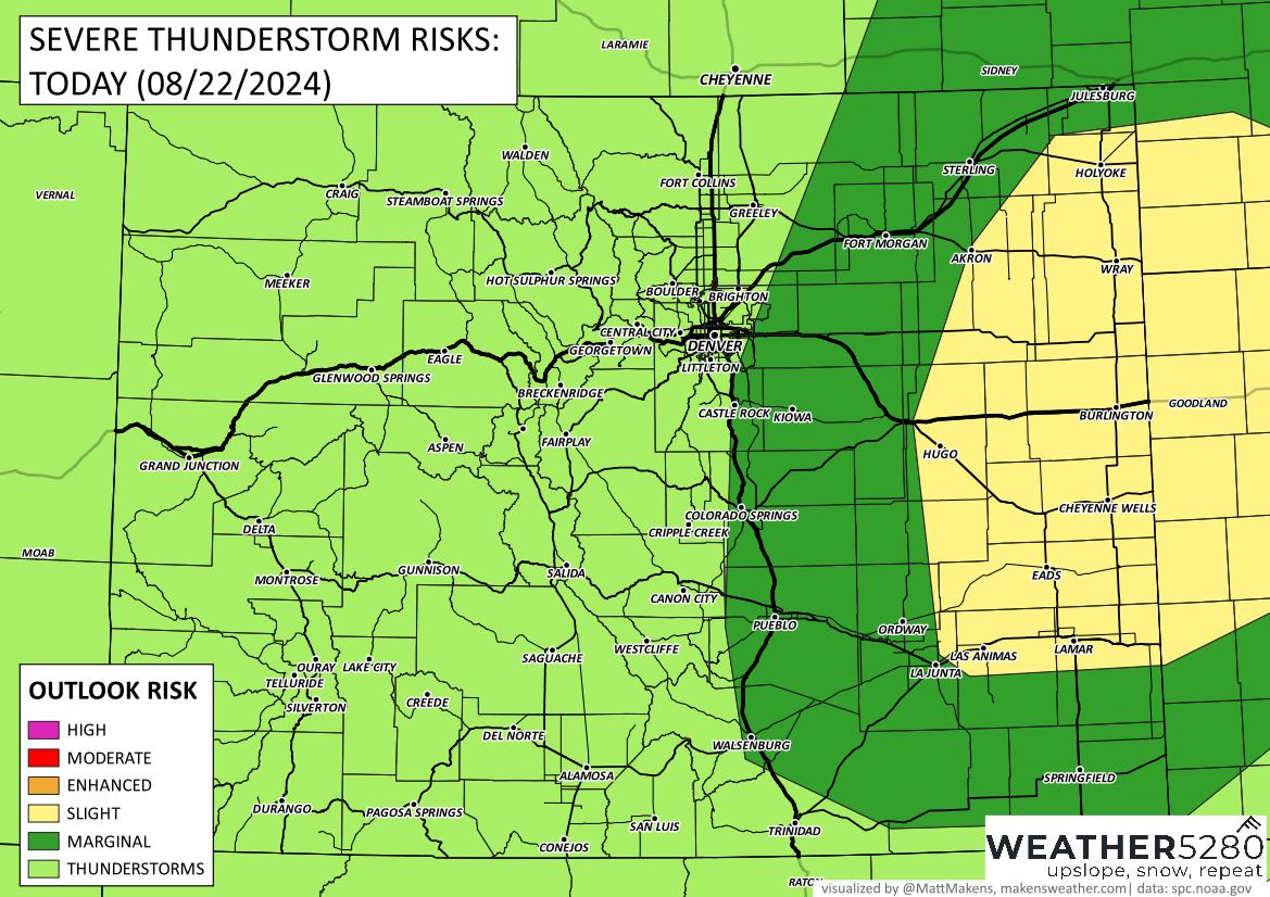
Quite a few thunderstorms will hit the state today, starting in the mountains and then an increase of storm activity around Denver and on the plains later today. Of the threats, heavy rainfall and isolated flooding is first followed by a hail and wind threat (perhaps a tornado) from the storms on the plains.
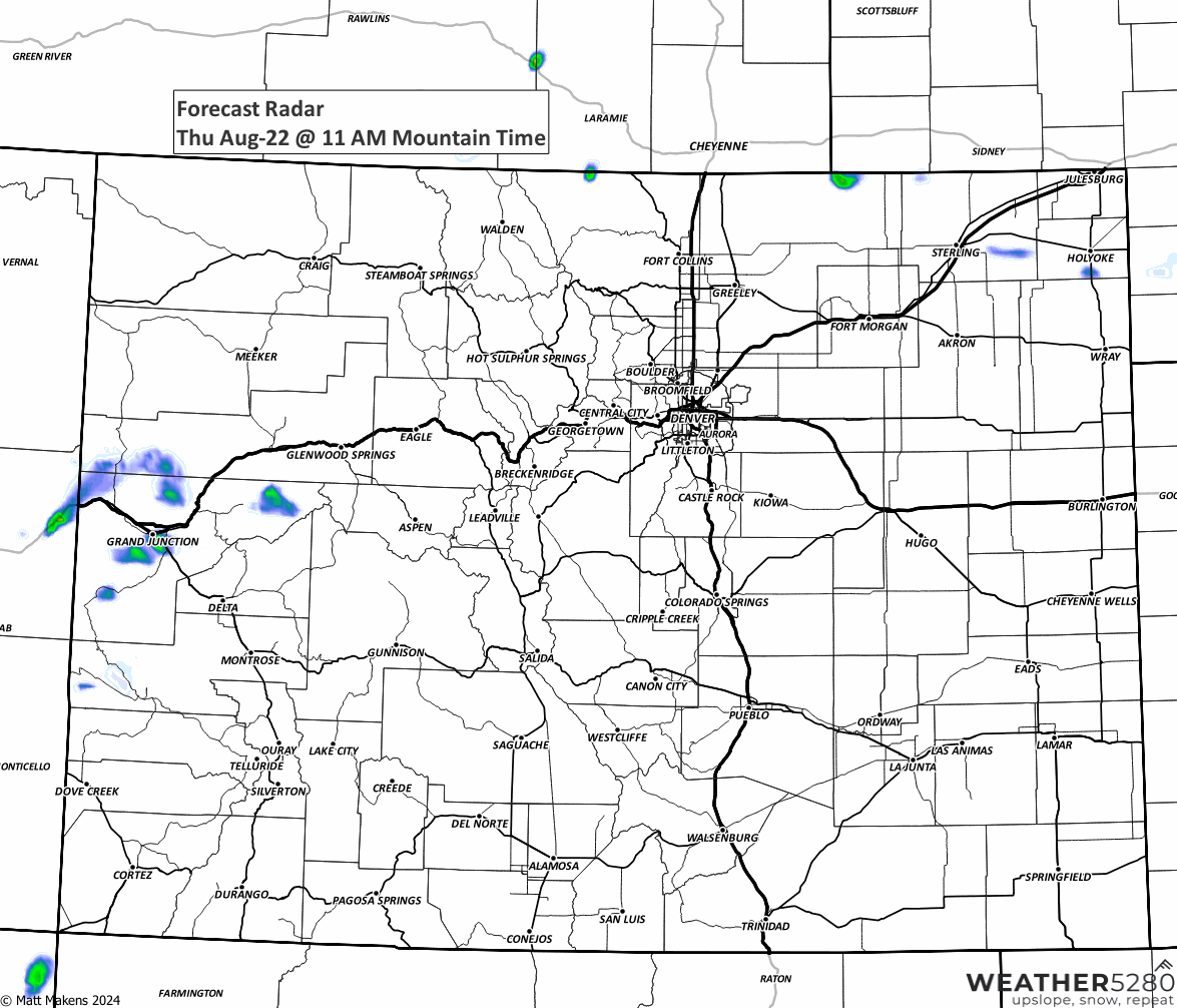
I'll start with an animation to show where the storms will be, based on some requests, I'll slow this down to make it easier to see each timestep.
For the Denver metro area, we could see a lonely storm or two until late afternoon and then the chance of widespread thunderstorms into the commute/dinner timeframe. Perhaps some sports practices will be placed on lightning delays...
Of these storms, sure they can become severe near/over the city. I'll be watchful for gusty wind at my place. Let's turn our focus to where the storms are more likely to be severe (hail, wind, etc.), shown here in the yellow highlighted area. So, Limon eastward overall.

From this, IF IF IF, I said IF, you get the rain today what would be a good estimate as to the total? Here you go:
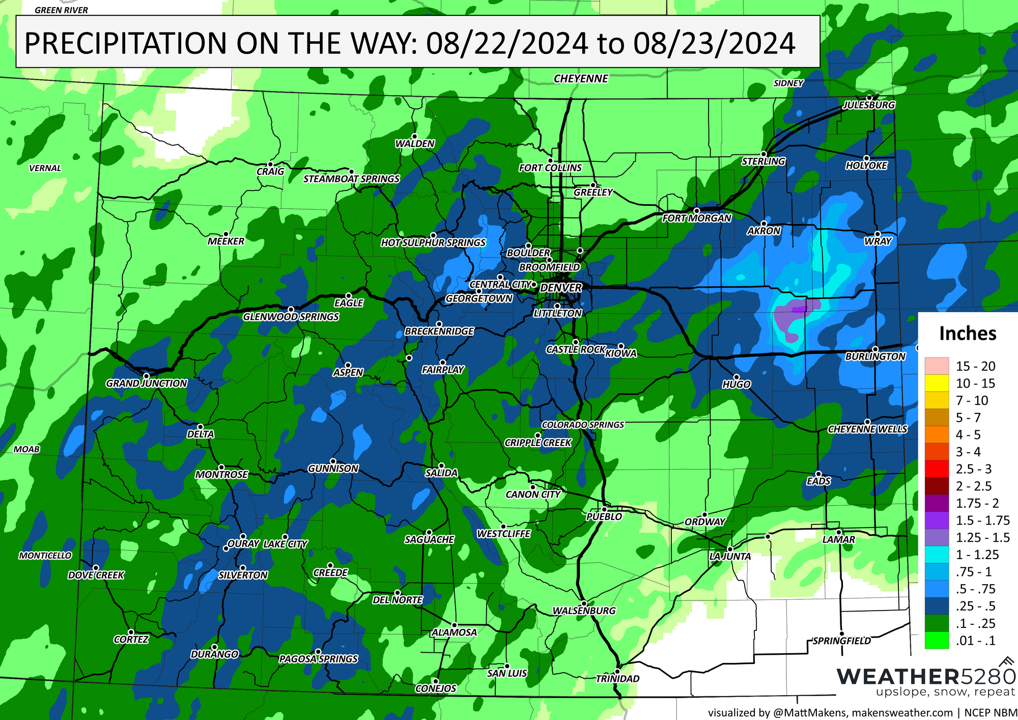
For those dark to light blue shades over the mountains and foothills, sure, that could come quickly enough for some isolated flooding/washouts but the heaviest rainfall totals will come from the plains.
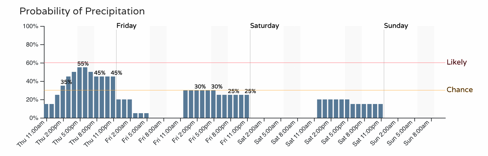
If you don't get the rain today, there is a bit of a chance tomorrow (shown above) but by Saturday I'm not holding my breath. As we dry out into the weekend, temperatures will warm and hover around 90 or so. Overall, a pretty nice weekend and one of our last "pool weekends" of the year. Enjoy.