
Colorado weather: Monsoon flow and some mountain snow possible!

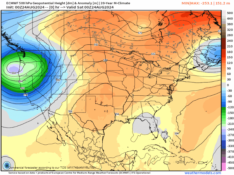
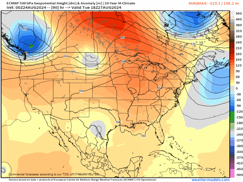
A potent trough over the western US continues to churn this weekend, bringing enhanced monsoonal flow. Generally, moisture will stay in the mountains, but a few storms will attempt to get going along and east of I-25 both Saturday and Sunday.
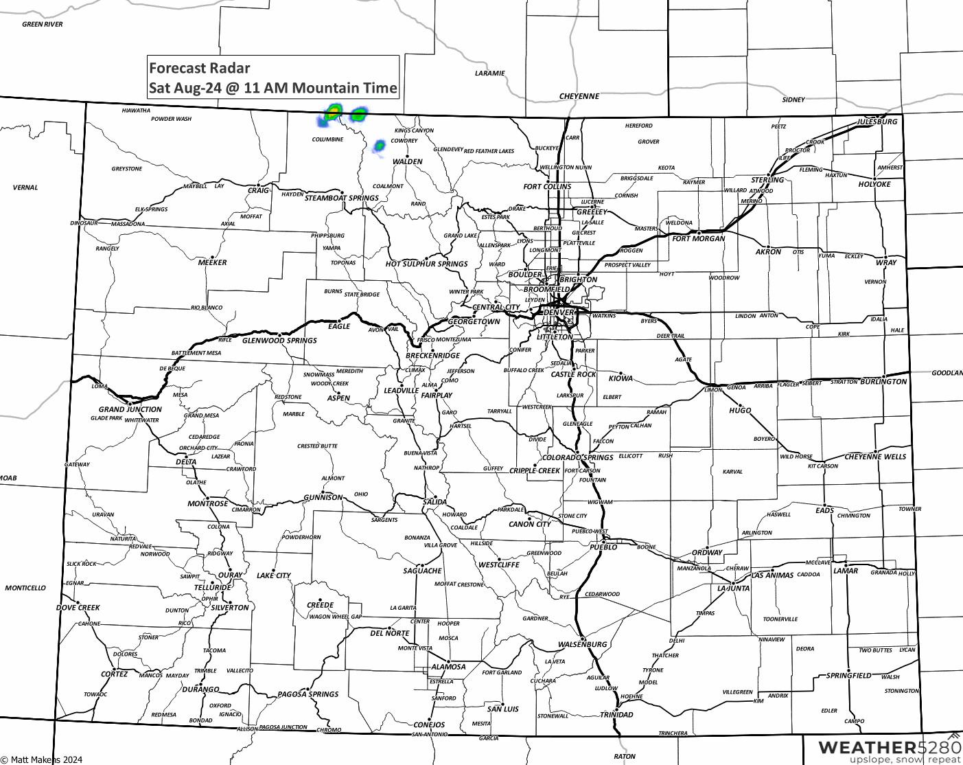
Showers and storms will be mainly driven diurnally, or, with the heating of the day. However, overnight and morning storms in the mountains are likely over the next 36 hours.
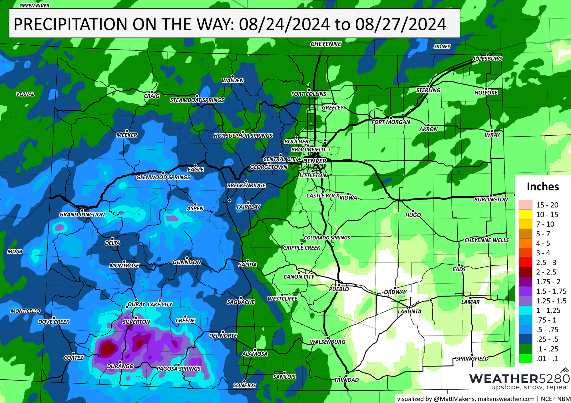
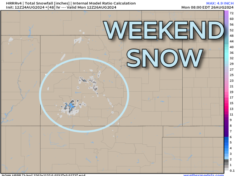
Moisture will be most prominent in the San Juans as the component of the wind will be out of the SSW, leading to intense upslope flow in that region. In fact, we'll also have cold enough air, mainly above 12,000 ft where snow is likely!
Following the passage of this system, we see some brief ridging around Tuesday/Wednesday of next week, before more weak ripples of lower pressure pivot in from the Pacific and Gulf of Mexico by late next week.
This should stave off any major heat waves in the next 7 to 10 days. It could also keep the slightly unsettled pattern in place too...
Looking longer range...
There's some discrepancy with how next weekend (Labor Day) plays out. While the Euro keeps the core of the colder air in eastern Canada, the GFS and its ensemble members are much more potent with a push south of that chillier air.
A solution like the GEFS for next weekend, and into parts of that week following could lead to a solid round of pure fall weather. We're talking highs in the 50s, with soaking rain showers...
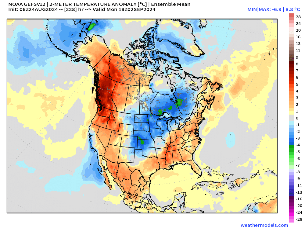
Regardless to how that cold potential plays out, we're not seeing any indication of any big September heat through the first week of the month. That means any summer-like weather is likely on borrowed time.
Stick with us as summer slowly fades and the cold season makes a return. Keep up with out latest posts by subscribing to our e-mail list.