
Snow headed to RMNP, rain to parts of Denver metro area

There will be a system sliding through the next couple of days which will increase chances for showers and will drop temperatures a bit. For the mountains, we could see some snowfall on those peaks!
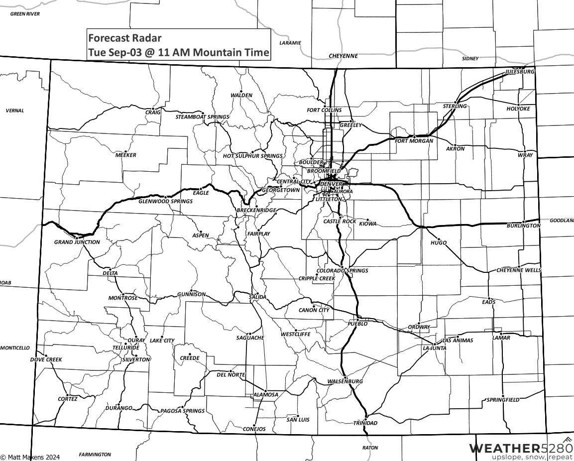
First a timeline if you prefer the hourly chart, followed by a statewide animation to walk you through the showers as they hit a few areas the next two days.
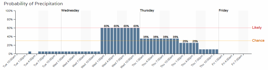
There will be a couple showers around today, but few and far between. From Wednesday morning through Thursday morning, notice how showers form a bit of a line and become much more widespread... that's the system swinging through.
No, not everyone will have moisture but IF you are a lucky one, here are the totals you can expect.
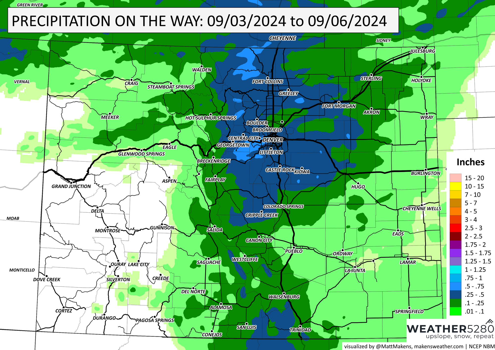
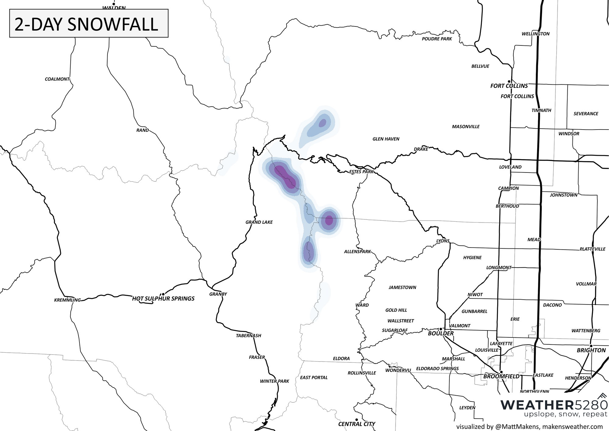
For much of the Front Range, we have potential for 0.25 to 0.5" - I REALLY hope we can realize some of that as we are pretty darn dry out there. Notice the brighter blues on the Front Range Mountains where those totals can be greater than 0.5" and this is where we can see a hint of snowfall. Here are two maps showing a light bit of snow, the best chance of this will be on RMNP.
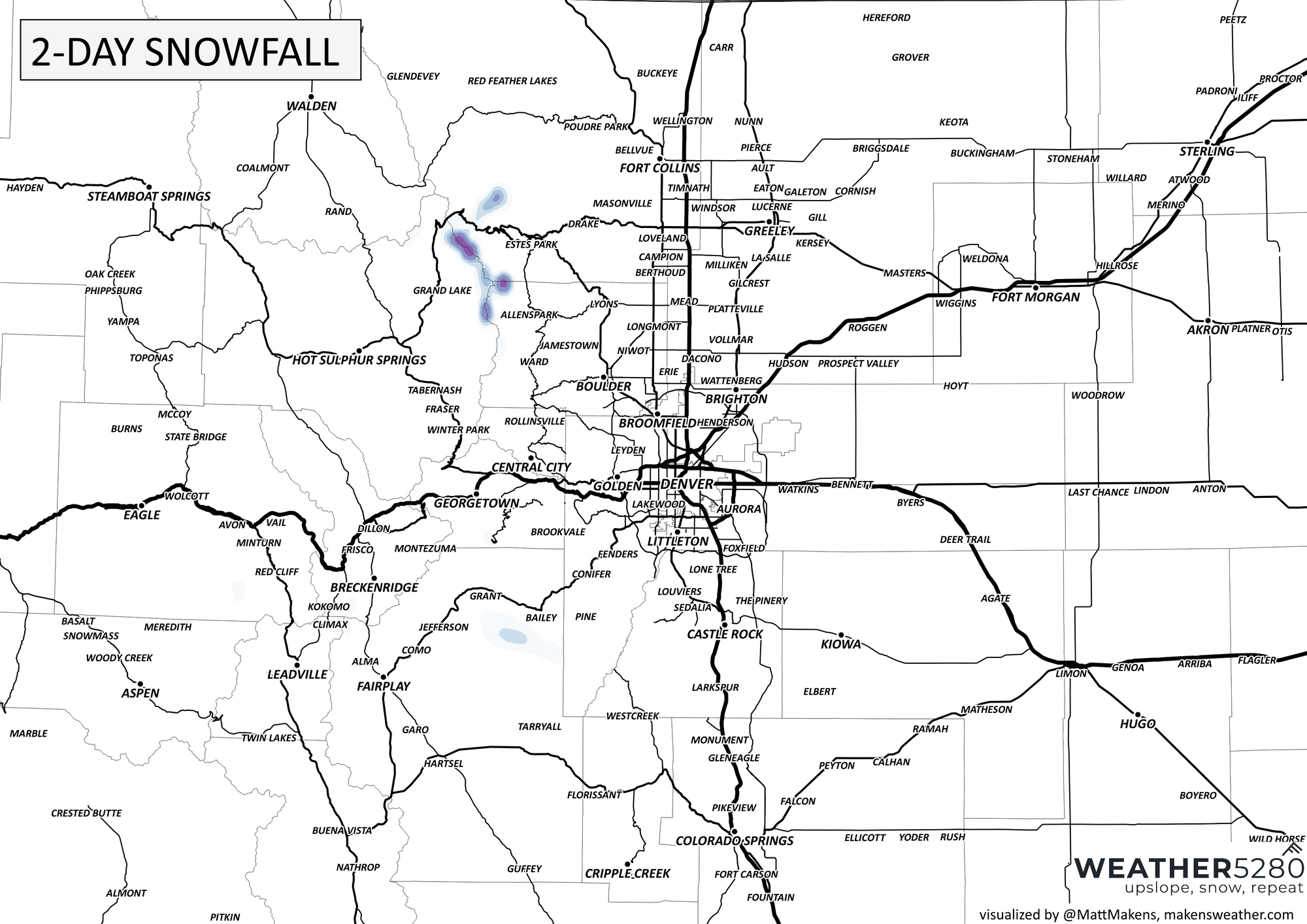
Same data, just a zoomed in map.
Okay, so it is not a snowy setup but sure does have me excited... I'm easy to please I guess ;-)
With the thunderstorms for the Front Range and Plains, there is a slight increase in the chance for them to be severe. Something to watch for will be wind, and perhaps some hail, too.
Enough on that, as this system swings through we have a bit of a temperature drop. The forecast dayparts are below.
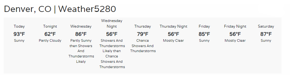
From the 90s today to near 80° on Thursday... not bad. I'm running through first frost and freeze data and will have more on that in a future post. You don't want to miss out on the updates as they come out this season, subscribe now for emails only when new content is posted that you will be interested in.