Colorado weather: Fall cold front next weekend?

So far, September has brought the heat across Colorado – but, big changes are possible as we approach next weekend. Let's dig into the details below!
First off: the heat so far this September has been no fun.
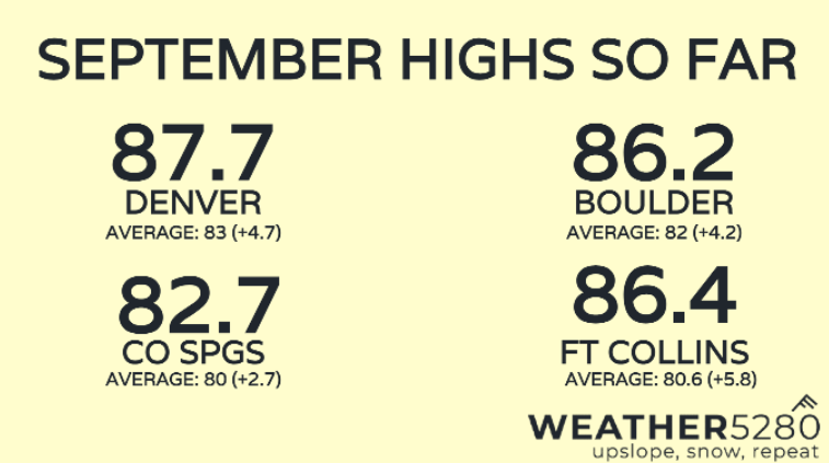
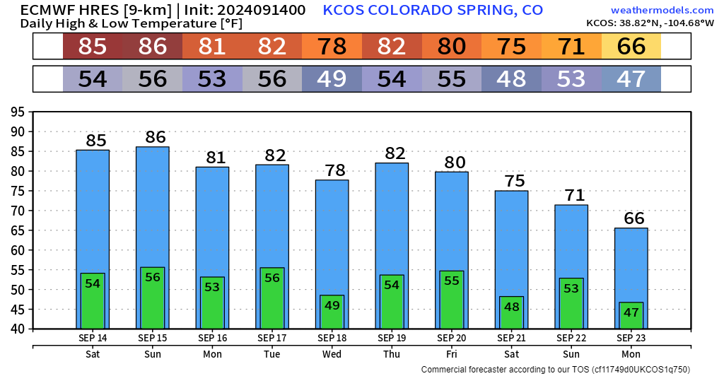
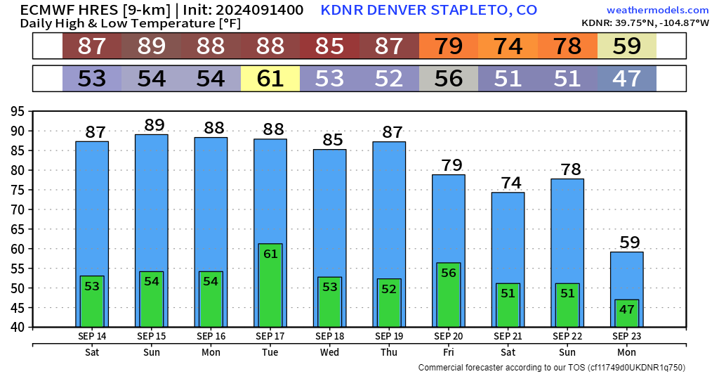
Average high temperatures are up all across the board. One of the hot spots is Fort Collins, where the first 2 week of September has featured high temps running nearly 6 degrees above normal! For Denver, there's only been one day so far this month where high temps were below normal (last Thursday, 9/5). Denver's hottest day this month came on the 3rd at a scorching 94 degrees.
Don't miss our latest seasonal update:
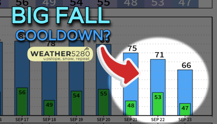
Now that we're halfway through the month, what's next? It could be our first snap of fall weather next weekend, plus or minus a day (Just in time for the official start of the season next Sunday 9/22).
Through early this week
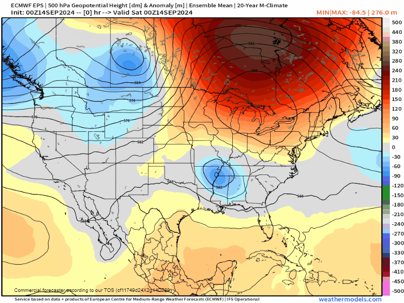
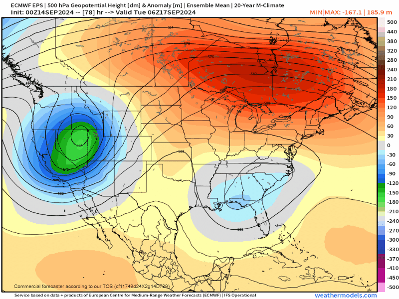
Signs of the pattern change are well underway starting this week. A vigorous trough of low pressure will dig into the western United States. This one likely stays west, and the biggest changes it brings are gusty winds to the front range. 20-35 mph southwesterly gusts are looking likely today through Wednesday.
These winds will downslope, leading to extended warmth through this timeframe. After that, temps look to trend downward next weekend pretty notably next weekend and into the week following.
Fall arrives on time?
Beyond that, we'll see some trailing energy dig even further south into western Arizona before weakening and spreading eastward. The strength of this system will dictate how much we actually cool things down next week. As things look right now, moisture could be decent, but that's still a bit iffy at the moment.
A peek at precip charts show where the best chances are – mainly from the Great Basin through Montana, and over the Central Plains. Jury is still out on if we can cash in a bit more than "average" up along the Front Range. Models are still pretty back and forth on that prospect. At the very least cloudier, cooler and wetter weather seem to have good chances at this range.
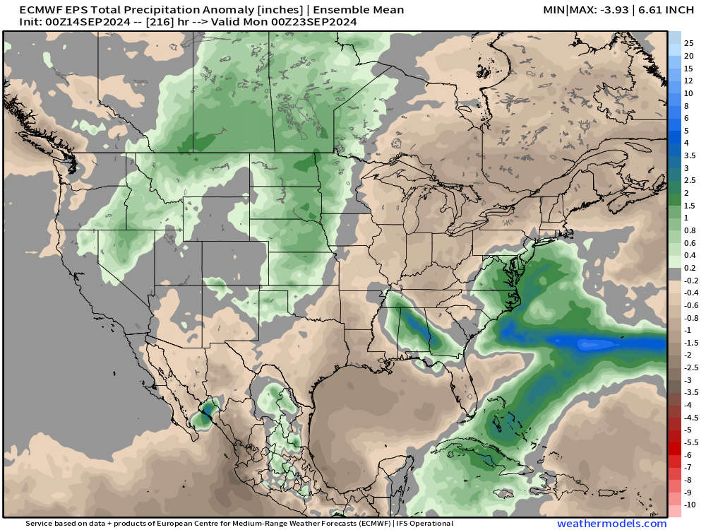
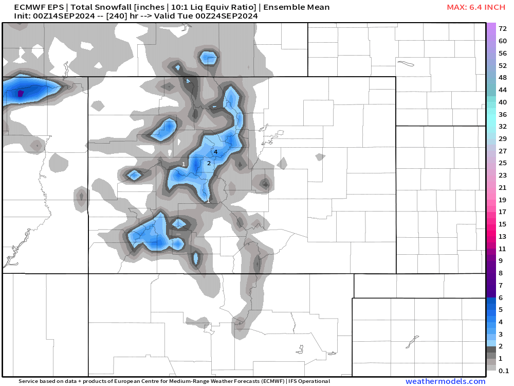
So: cooler, wetter... does that mean snow for anyone? For the Front Range, probably not (though yes, some guidance has show some snow from time to time), outside of a few wet flakes on the Palmer Divide. Our mountains will likely get their first good coating though, with much of the data printing out 2-4" of snow for the Continental Divide, central mountains and San Juans. This is a week out of course, but you get the idea – seasonal change is coming!
As far as the big headlines are concerned, it's looking like our first appreciable round of fall weather is on the way next weekend/early next week. Highs in the 50s, 60s and 70s for parts of the I-25 corridor are possible, along with cloudier and wetter conditions.
We'll be sure to update you on this forecast over the next week or so. Stick with us by subscribing to these articles into your e-mail!