
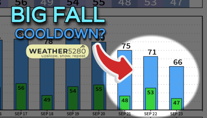
Colorado Weather: An active 48 hours sets trend for the rest of the week

A number of showers and thunderstorms will cross the state through Wednesday morning. This is the beginning of a more active weather period which will include a more significant cool down with snow chances as Luke discussed in yesterday's post.
Here's a look at the timing and placement of showers and thunderstorms in the next two days.
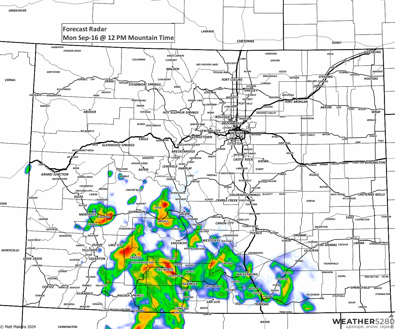
Here is how that will look hourly for Denver:
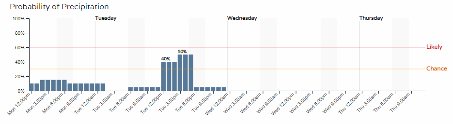
For the metro area, the peak in rain chances happens from Tuesday's lunch through dinner.
The days will be gustier anyway, but nearby storms will add to the wind gusts - don't forget your patio umbrella you may have left open this weekend.
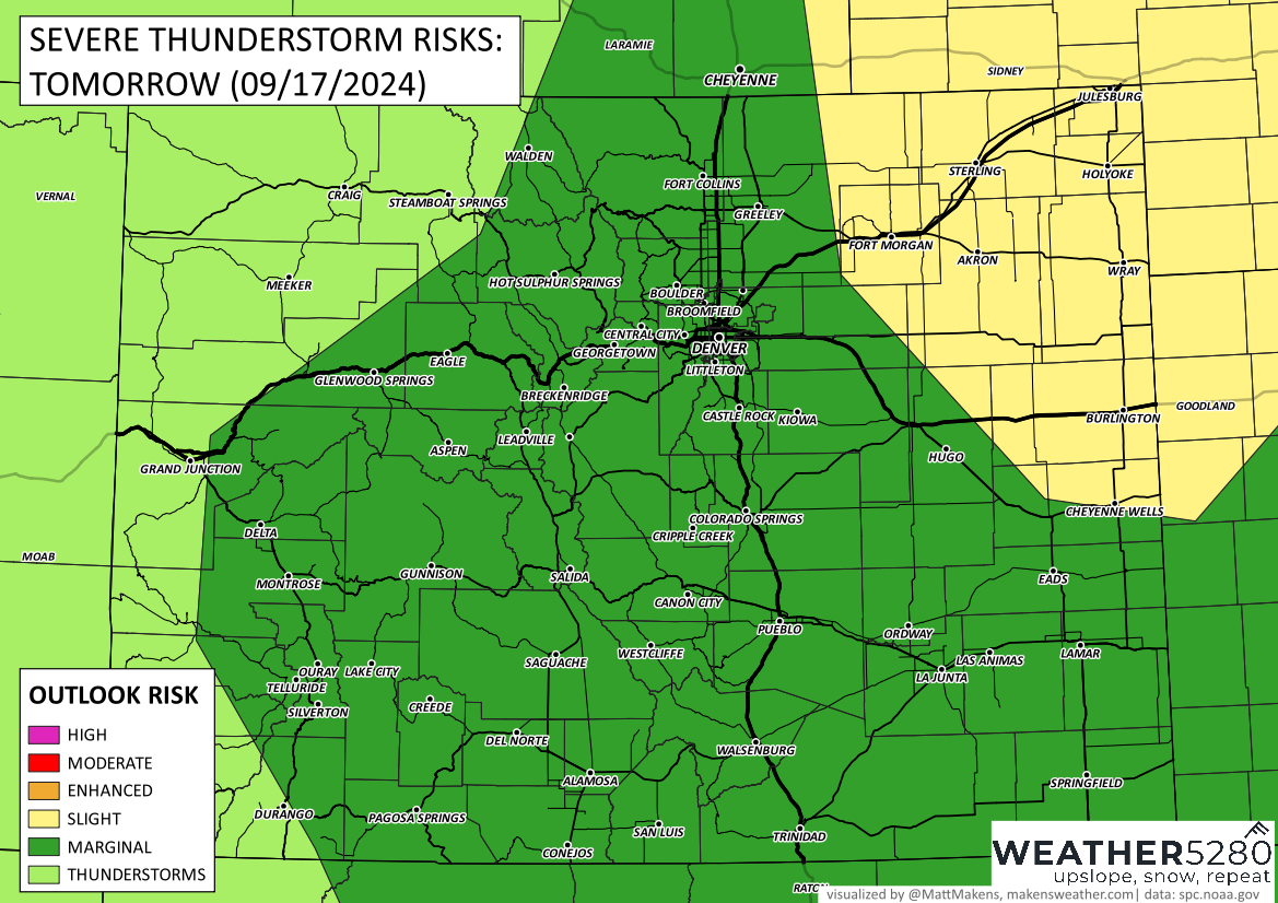
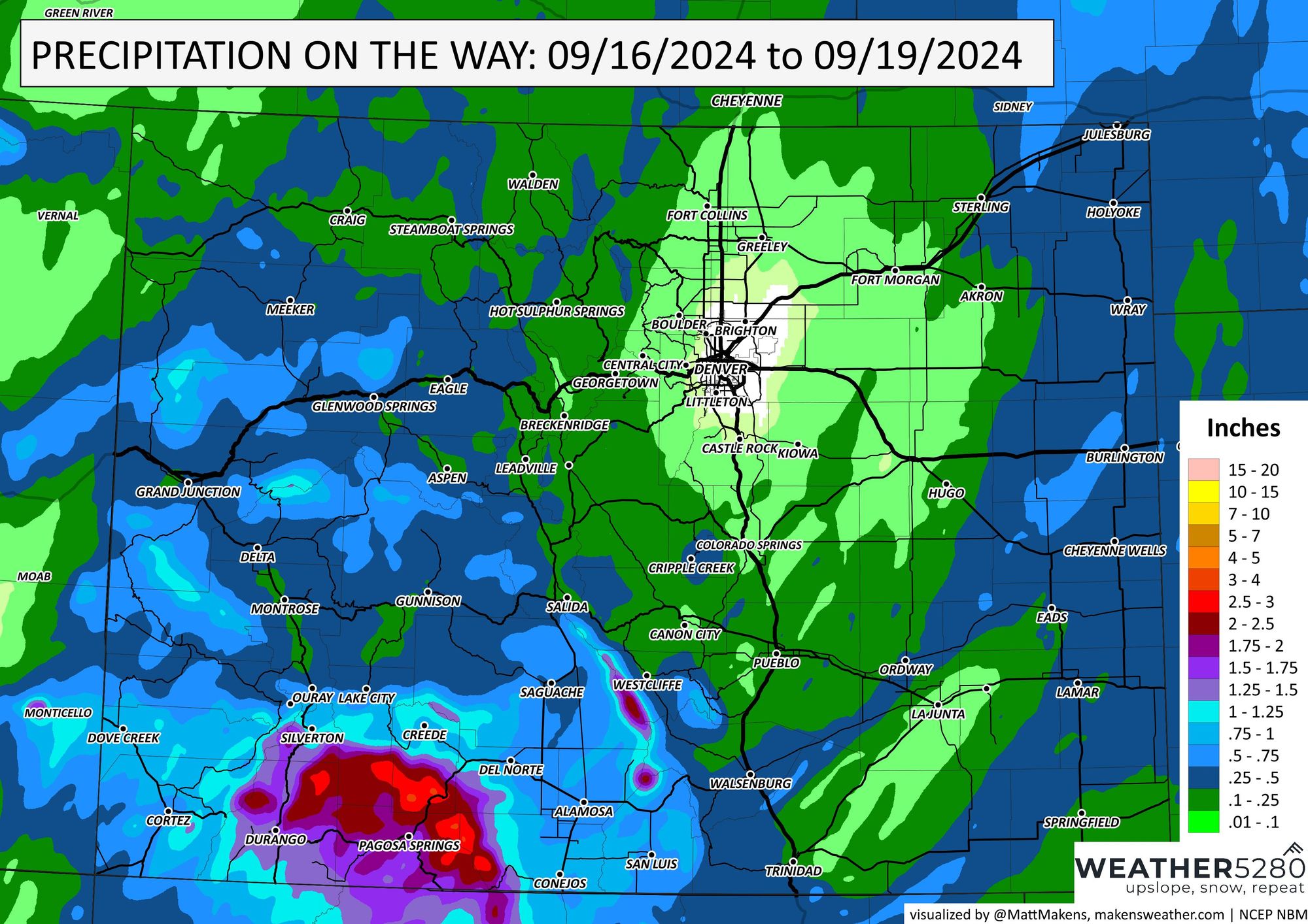
I'll show you total moisture in a moment, but it should be noted that we do need to watch for potentially strong and damaging thunderstorms - wind mostly. This is more likely over the state's northeastern corner.
Okay, onto potential rainfall totals. IF IF IF you get the rain, you could be looking at more than 2" for the Southwest, more than 0.5" for parts of the West and East, and not likely to exceed a tenth in the metro areas...that's quite a doughnut hole there on the city.
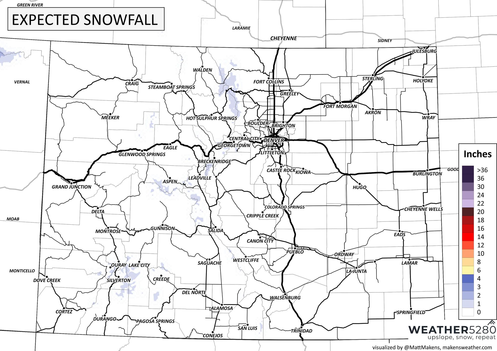
And for snow lovers we have a hint of snow for the peaks.
Again, per yesterday's post we are moving into a more active period of weather. Look for more moisture, snow chances, and much cooler weather to arrive into the state throughout the next week.