Colorado Weather: Big Changes! An update on September rain and snow chances this weekend

We mentioned the possibility of a significant pattern change in our last couple of posts – those chances look to be solidifying a bit more as modeling continues to show widespread rain and snow chances from the mountains to the plains.
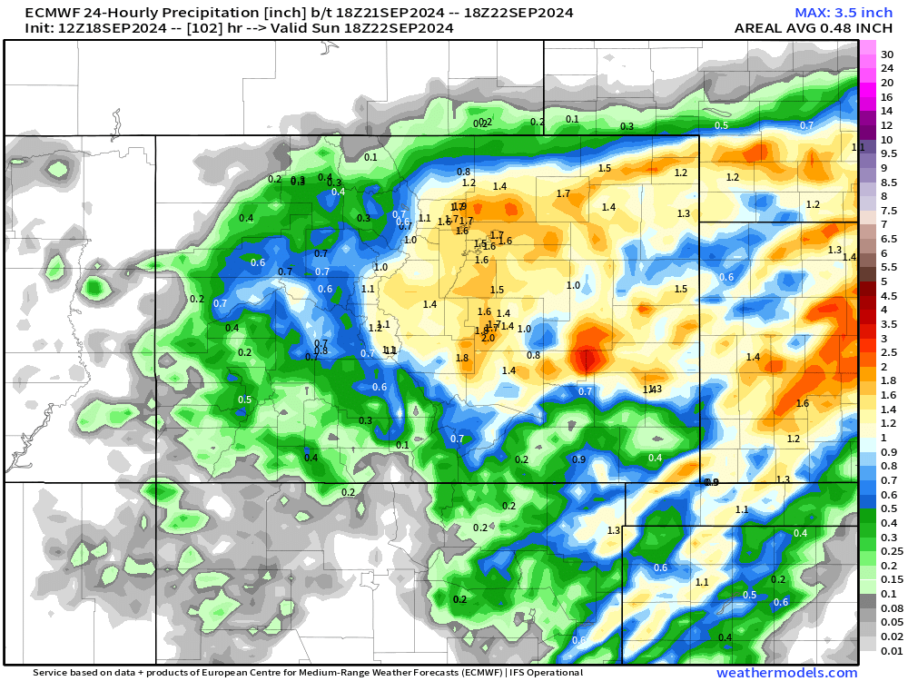
The way things look to shake out right now: There will be an initial wave that passes through Colorado Saturday night into Sunday which has the potential to bring an inch or more of water content from the foothills to the eastern plains.
Folks above 8,000 ft could see snow, which could be significant in spots if the moisture lines up properly.
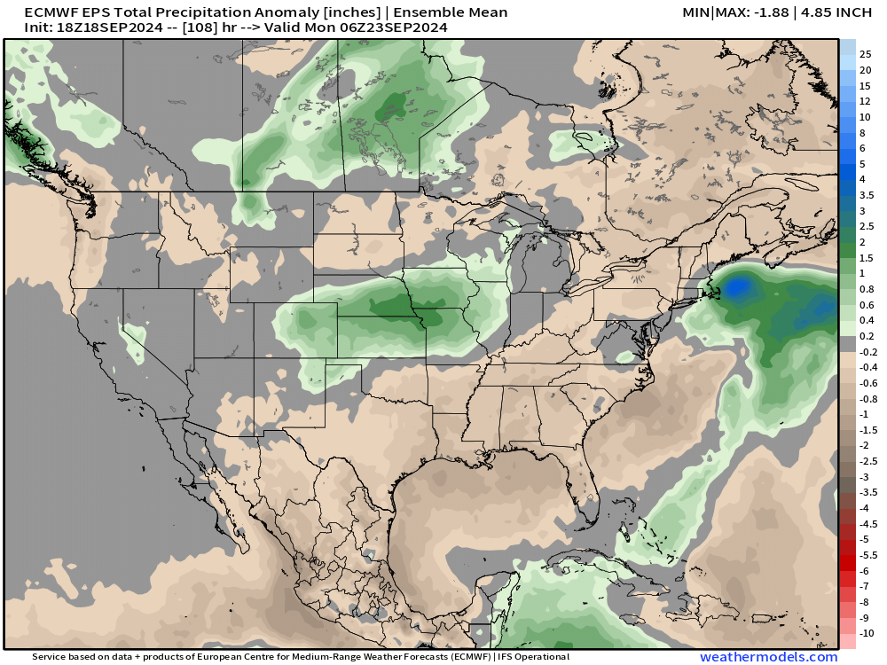
As that wave exits, another northern stream wave could follow, leading to additional moisture early next week. (Both parts of this equation are still pretty uncertain given we're still early, but at the very least, the weekend part is starting to become a bit more clear).
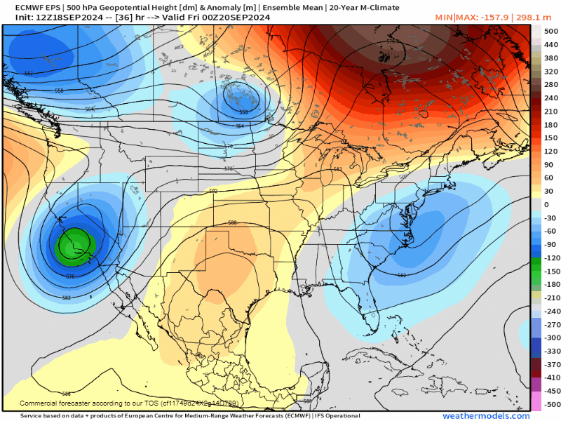
Taking the deterministic EURO at face value, it doesn't seem like a completely unreasonable scenario. A slow-moving pacific system can do work around here, even if it's out of the norm for this time of year.
Below are the solutions from the EURO and GFS ensembles. Both are showing similar solutions with significant moisture across eastern Colorado.
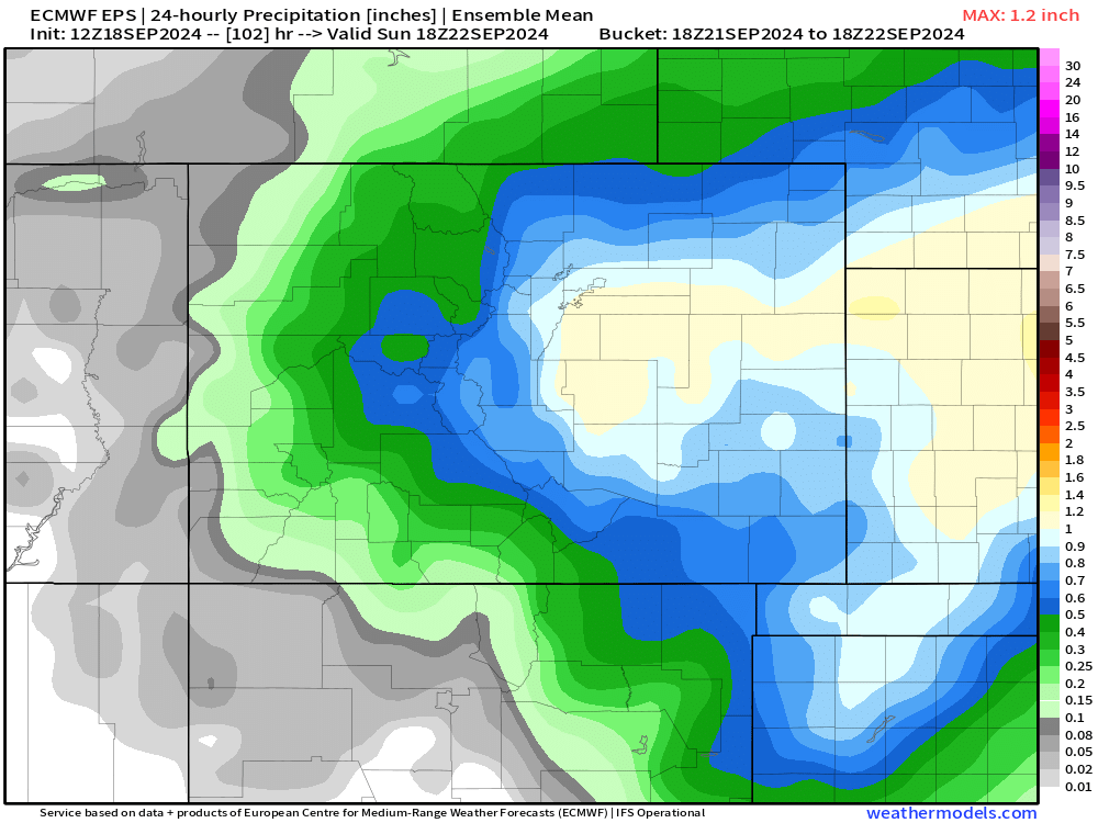
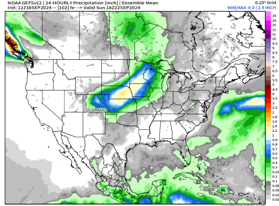
And overall a healthy looking above-average swath of precipitation from central Colorado east across the central plains into early next week. Yes, please!
The track of this system will be important in determining if this is more of a north or south of the Palmer Divide type-storm. The track this time of year can be a little less volatile since the jet stream is not quite as active just yet.
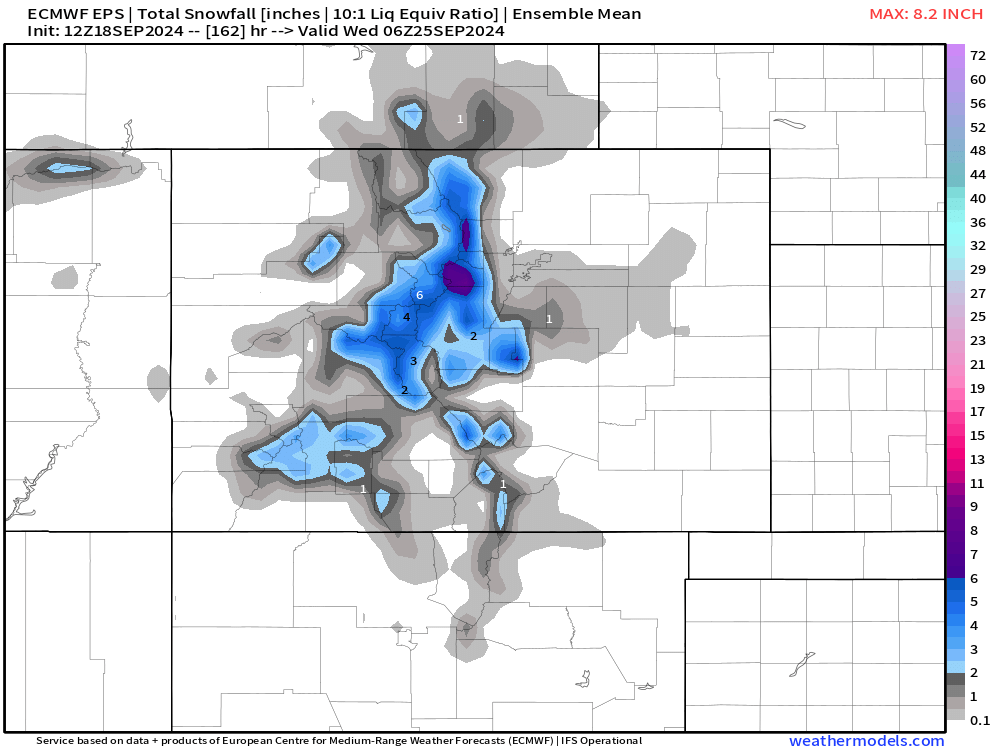
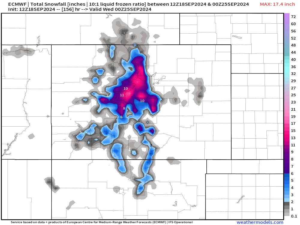
This also means that this system won't have a ton of cold air to work with – so for lower elevations, this is almost certainly a rain in the 40s and 50s type of event. However, areas above 8,000 feet could see some heavy wet snow. EURO ensemble and deterministic models show snow totals of 4-12"+ for our higher elevations.
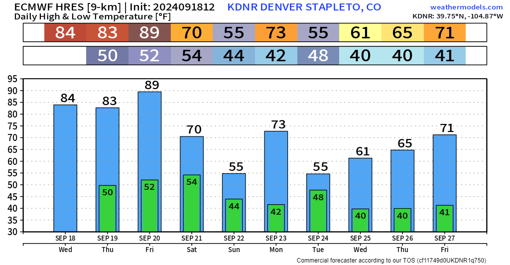
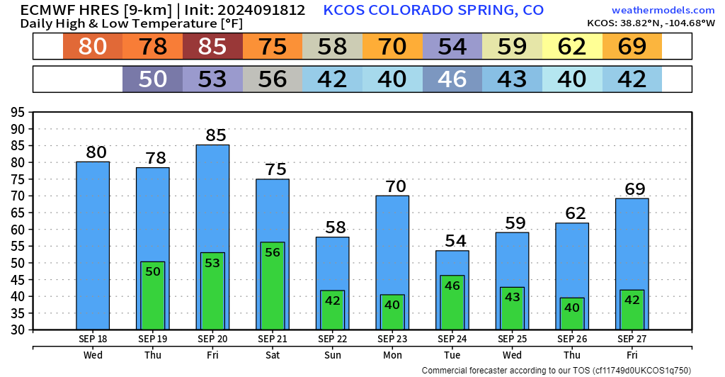
Temp trends for Denver and Colorado Springs do a good job of telling the story. We look to completely flip the script with a nearly 40 degree temp drop between Friday and Sunday.
There's not a whole lot of other detail to get into with this upcoming system... While ensembles are in reasonable agreement that some good moisture is on the way, the devil of course in details. Given how much movement we've seen in the operational modeled storm track the last couple of days, this could turn into a headache to forecast as we move towards the end of the week. As mentioned above, a few focus the moisture north, some south, and placement of course has big impacts on who sees how much water this weekend. Bottom line: We'll definitely have more updates for you in the next few days.