
Colorado weather: Weekend washout or near miss? Tracking rain and snow across the region

The weekend, and with it the much anticipated shift in our weather is nearly upon us. Let's take a look at what trends in the data have been like since our last update, and who's likely to see rain and snow this weekend and how much of each.
Overall no huge shifts in the overall look of things we've been tracking all week. We still see, broadly speaking, a good early fall cool down on the way for the weekend and widespread moisture across the region. The devil is in the details, and some of those details remain a bit fuzzy.
In brief: We have a wet system to move through this weekend, giving heavy rain and snow to much of the region along with cooler temperatures. You will notice these changes progressively Saturday into Sunday with the first fall-like system to hit. All the details, including timing is below.
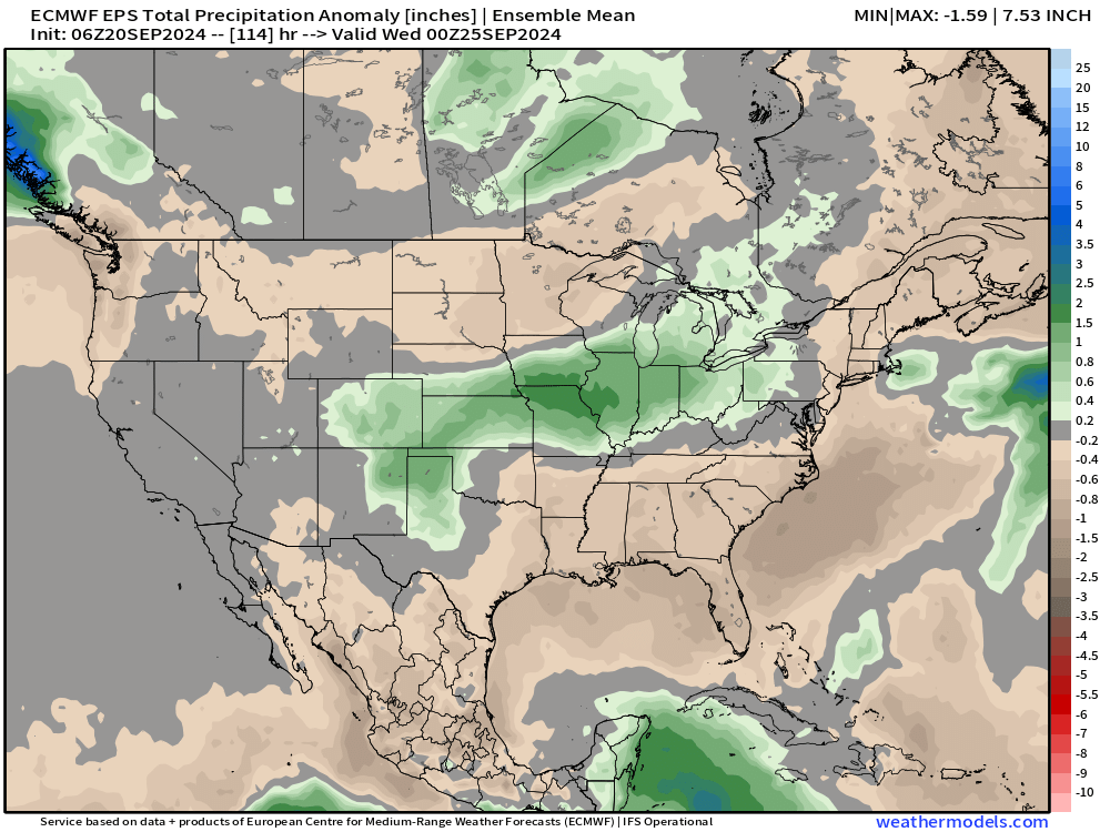
The latest ensemble guidance continues to show above average precipitation for our area through the middle of next week:
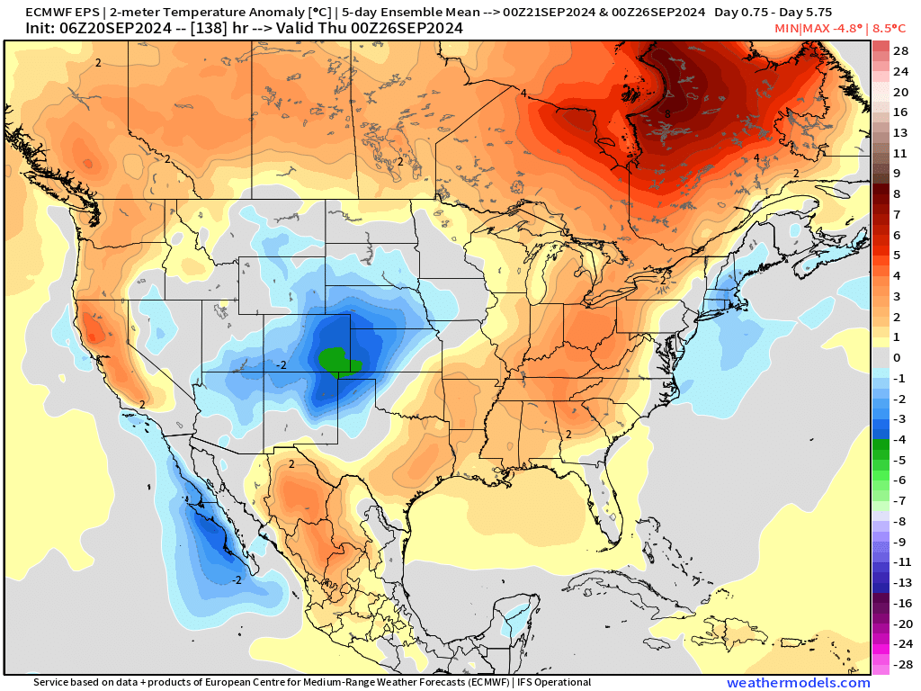
With the 5-day average temperature anomaly (in Celsius) ending next Wednesday evening showing the core of the colder-than-average temperatures across the CONUS focused over Eastern Colorado:
While large-scale features have been generally steady, we've seen some pretty wild swings in potential QPF (precipitation) between models and model runs which leads to a continued medium to higher uncertainty with regard to how much moisture we ultimately end up picking up. We'll discuss this further below.
Temperatures
Temperatures will again be warm today, with highs in the upper 80s for Denver. While today's high will be about 10-degrees above average for the date, tomorrow's high in the upper 60s will be about 10-degrees below average for the date. Not exactly frigid temperatures on the way, but a notable cool down for sure!
Here's the latest temperature forecast for Denver, with all cities along the urban corridor looking to see a similar temperature profile over the next couple of days:
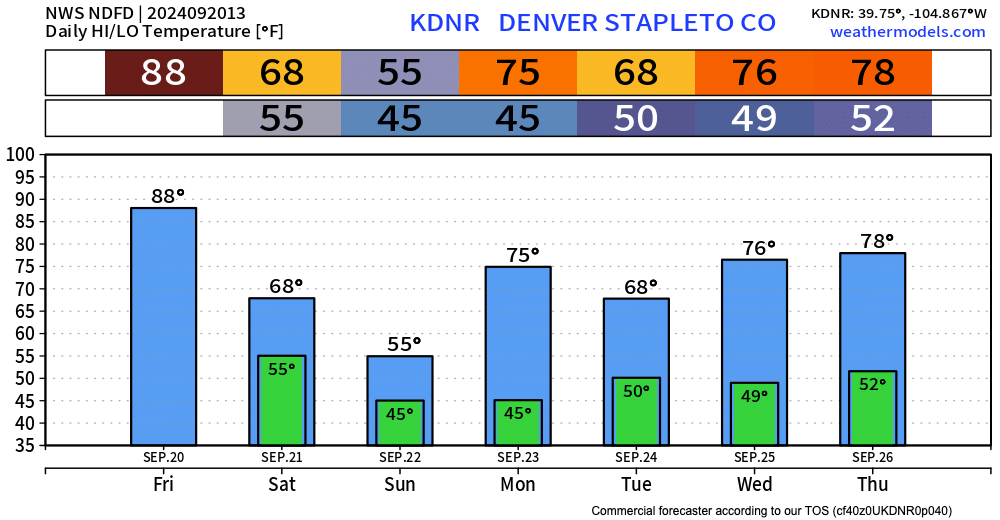
This system shouldn't bring freezing temperatures to lower elevations, but lows in the 40s Sunday and Monday, combined with the anticipated rain Saturday night into Sunday, will make things feel quite brisk and fall-like!
Rainfall forecast
I wish confidence around how much water to expect this weekend were higher, given it is Friday morning already. While the setup supports a good amount of water, there's still some guidance hedging on the dry side and perhaps even some concern that the greatest QPF misses us to the south tomorrow. We'll see.
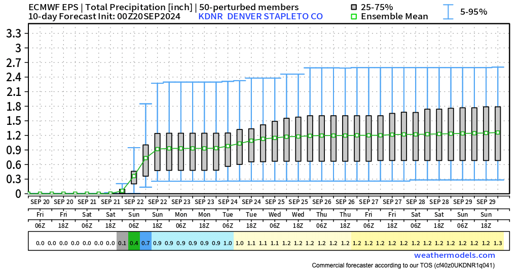
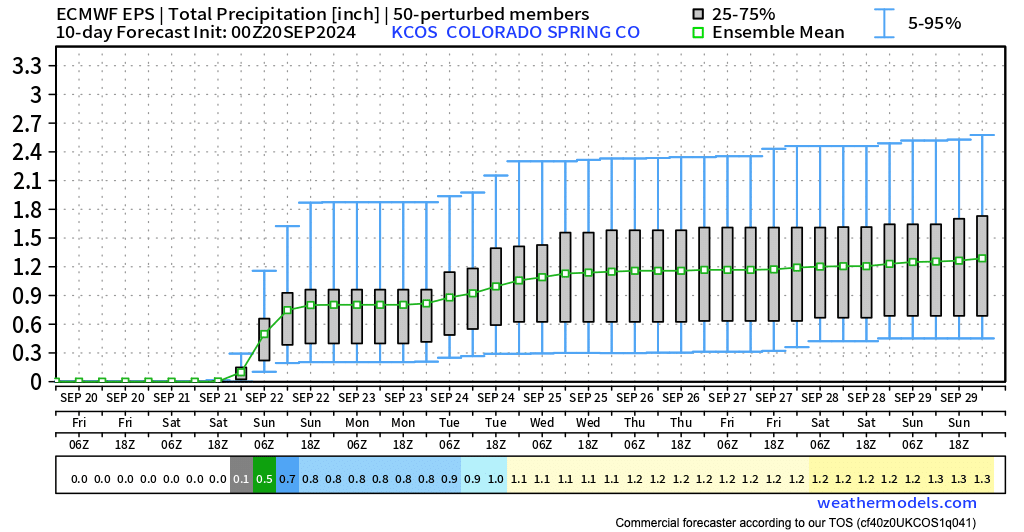
Ensemble guidance shows roughly 0.8" to 1" of precipitation from Colorado Springs north through Fort Collins this weekend, with perhaps a bit more added to that early next week. You'll see in each of the charts below, however, a pretty good spread in the ensemble members (0.3" to 2.3" for Denver for example), with a healthy number of those members favoring the lower-end totals. The mean for Denver is 0.9".
A similar idea for Colorado Springs, with a mean of 0.8":
And a bit lower in the means further north across the Fort Collins area:
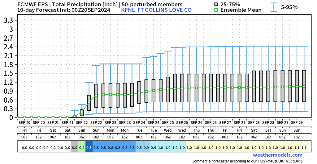
So, a widespread possibilities of outcomes, but a healthy rain event is possible should things align right, with even some high-end potential (more then 1.5" in spots) still on the table. As for bust potential? I think it's highest the further north you go, you see that a bit in the means for Fort Collins, but some models are pretty dry up that way...
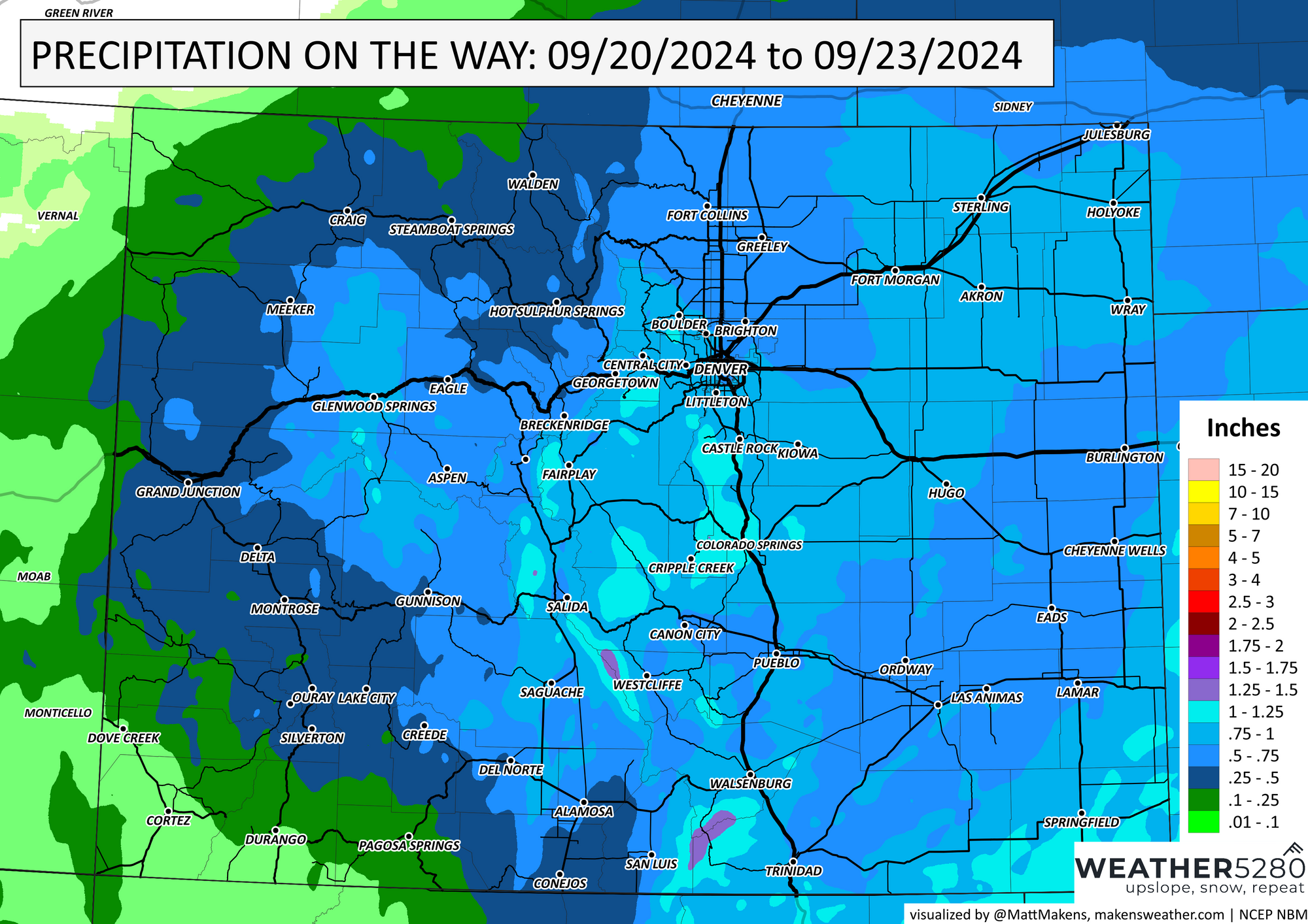
Here is our latest precipitation forecast map, we'll see how today goes and adjust as needed. Keep in mind this represents the most likely total in the event you get the heavier showers:
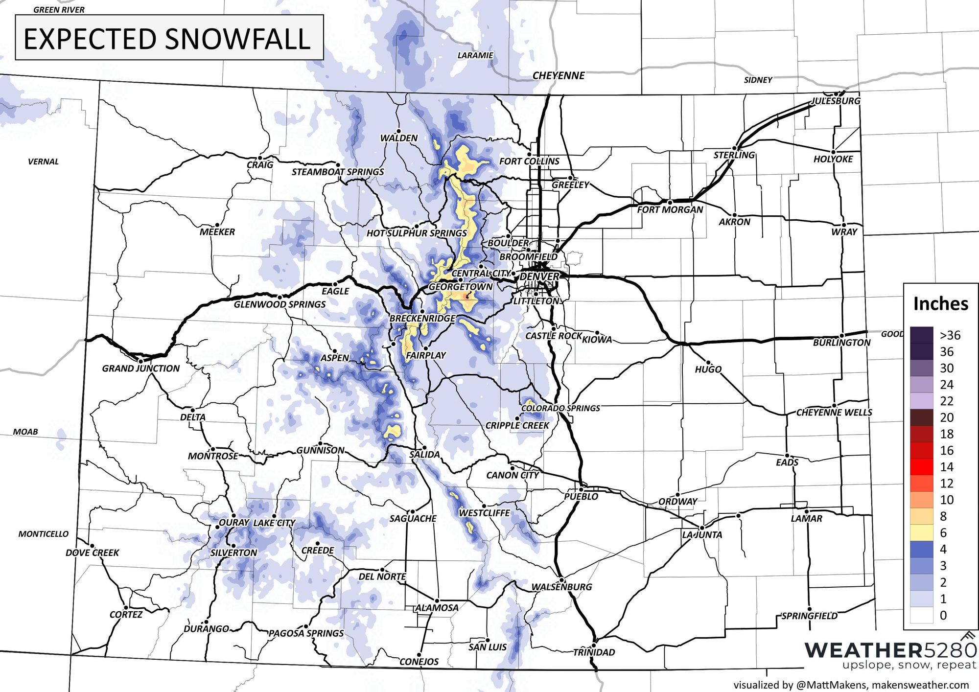
Snowfall forecast
We have some Winter Weather Advisories posted for the highest terrain of west-central Colorado. Pretty exciting! Places like Pikes Peak, the Western Mosquito Range, and the Sawatch Mountains could pick up from 5 - 10" of snow, mainly above about 10,500 feet.
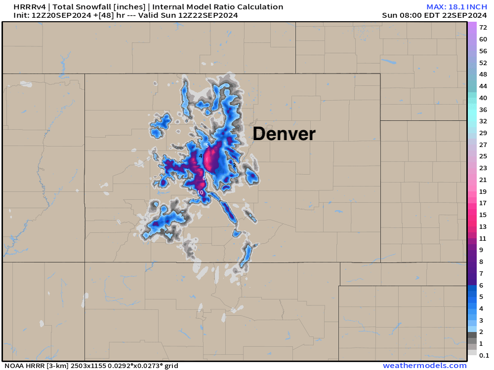
Closer to the metro areas we could see snow as low as about 8,500 feet Saturday night, especially if the heavier precipitation sets up as we see on some modeling. Should that happen, many Front Range foothill communities will see their first snow of the season this weekend!
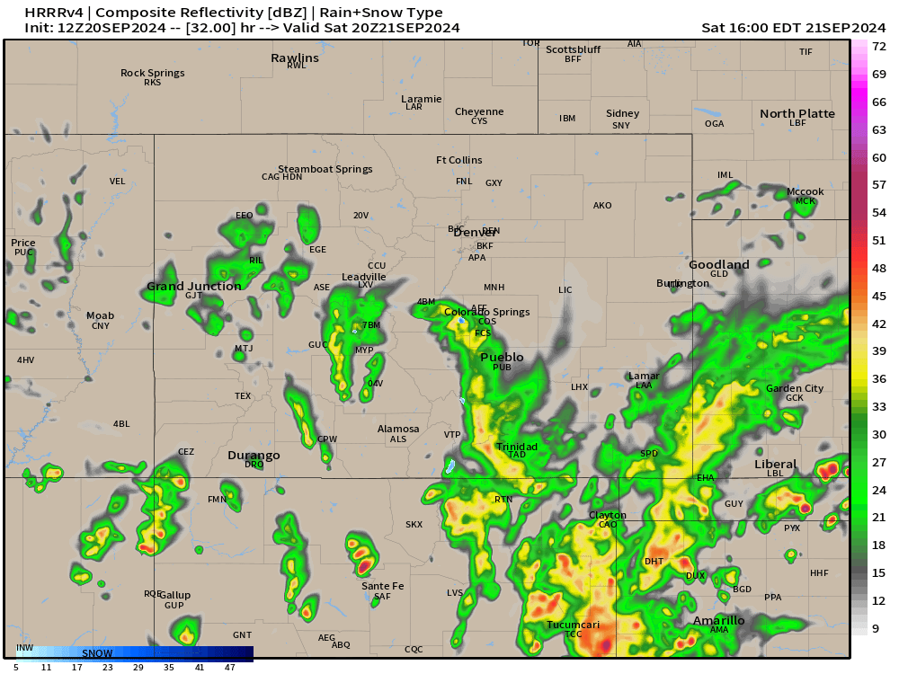
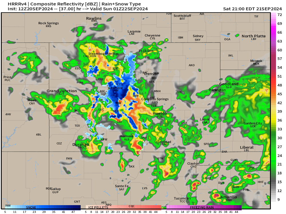
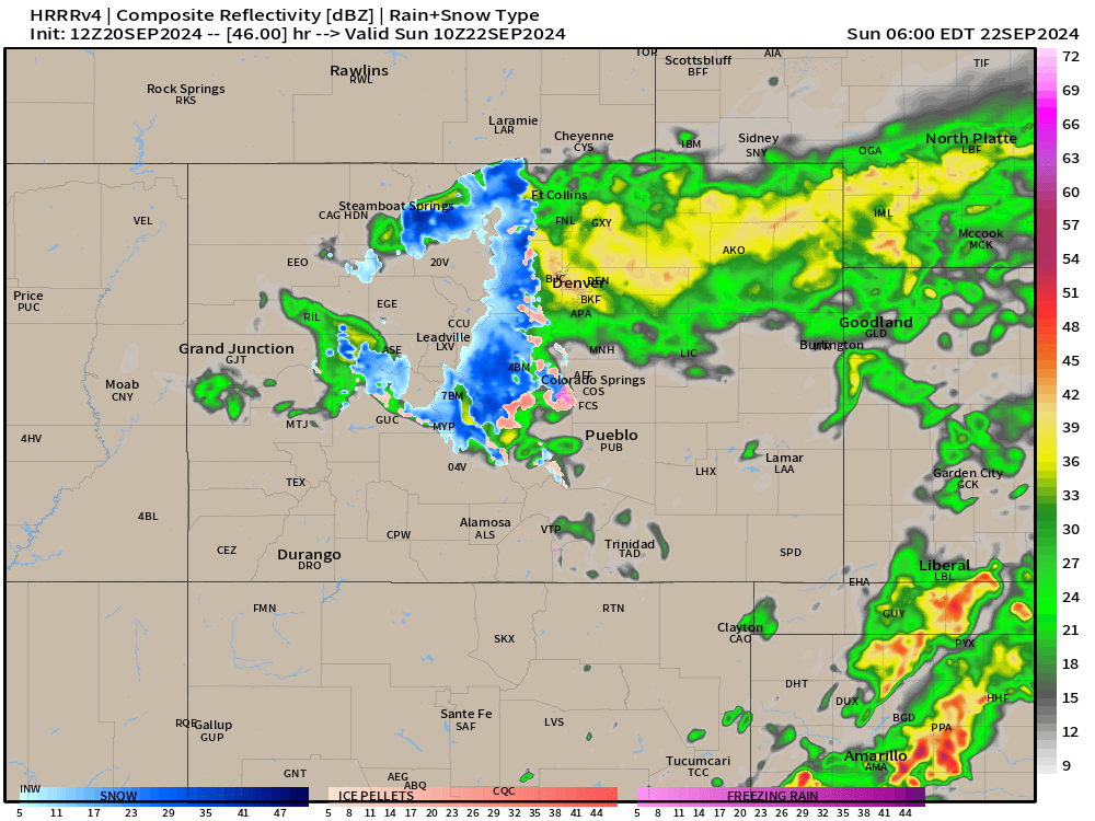
Some of the high-res models that are coming into range are hinting at this as well. We see the HRRR below through early Sunday morning with some accumulating snow west of Denver and Boulder, with precipitation still falling at this hour. Should this trend continue, look for potential winter weather alerts to be posted by the NWS in Boulder.
Here's our latest snowfall forecast:
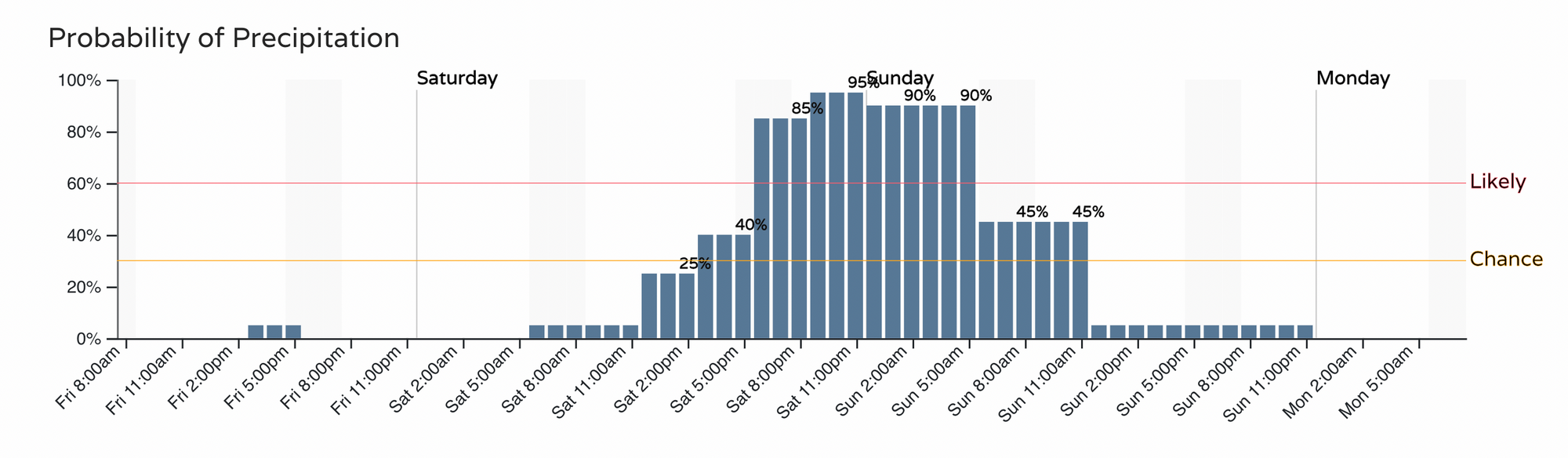
Timing and impacts
Cooler air arrives for your Saturday, but the best chance for rain will hold of until later in the day and overnight into Sunday. Here's the timeline for precipitation along the I-25 northern urban corridor, with rain getting going a bit earlier across the Colorado Springs vacinity.
Here is the HRRR at 2pm Saturday:
With widespread rain and snow across the high country by 7pm:
And this model not really filling in along the urban corridor until closer to sunrise on Sunday (though it might be a bit slow on that):
This will be the first snow event of the season for many areas, so if your travels take you west this weekend consider delaying or getting a jump start today or early Saturday. The wet weather will work its way east of us Sunday afternoon, with a quieter Sunday evening on tap as things look today.