Colorado weather: Rain and snow on the way, but some spots almost sure to miss out

Pretty rough morning of weather modeling as much newest guidance continues to show the trend we discussed as a possibility yesterday – that is a narrowing window of meaningful precipitation across our area, and for some communities a possible full-on-miss.
Ensemble guidance still looks healthy enough (relatively), but even here the trend has been drier. And frankly, with the drying showing up in the operational models this morning, I'm not sure this will be enough to save us. What's new?
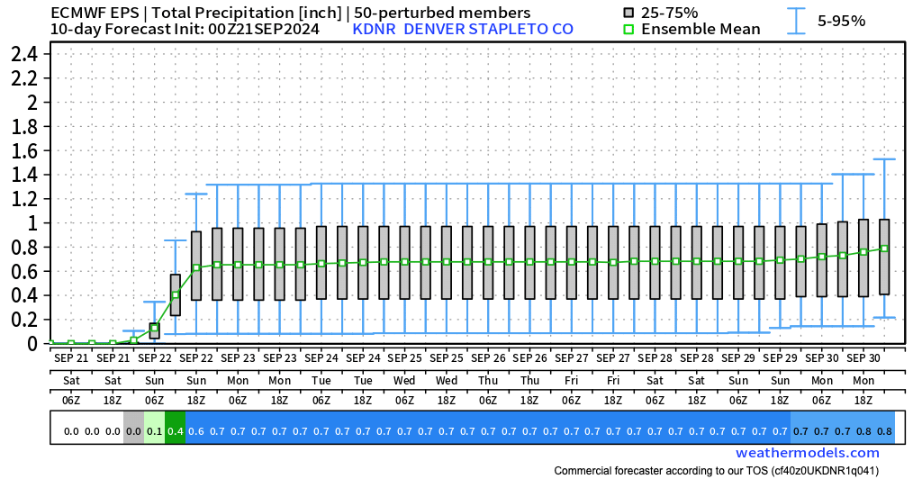
The European ensemble model's QPF dropped from roughly 0.9" for Denver yesterday to 0.6" overnight, with high-end potential now much more reasonable looking (1 - 1.5" rather than 2"+).
The shift in the operational models has been even more dramatic.
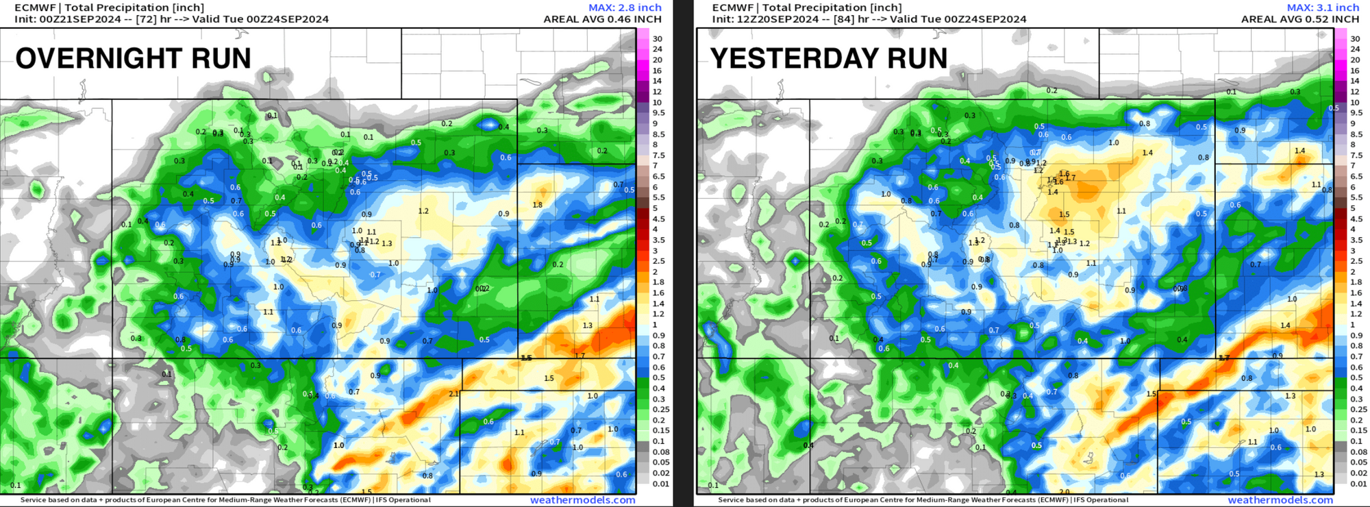
Take a look at the European operational model from yesterday morning's run (right) to last night (left). A notable drop in QPF, and a notable southern shift as well – the more recent run nearly dry up north of Denver, and only 0.3 - 0.4" of precipitation for Denver vs over an inch!
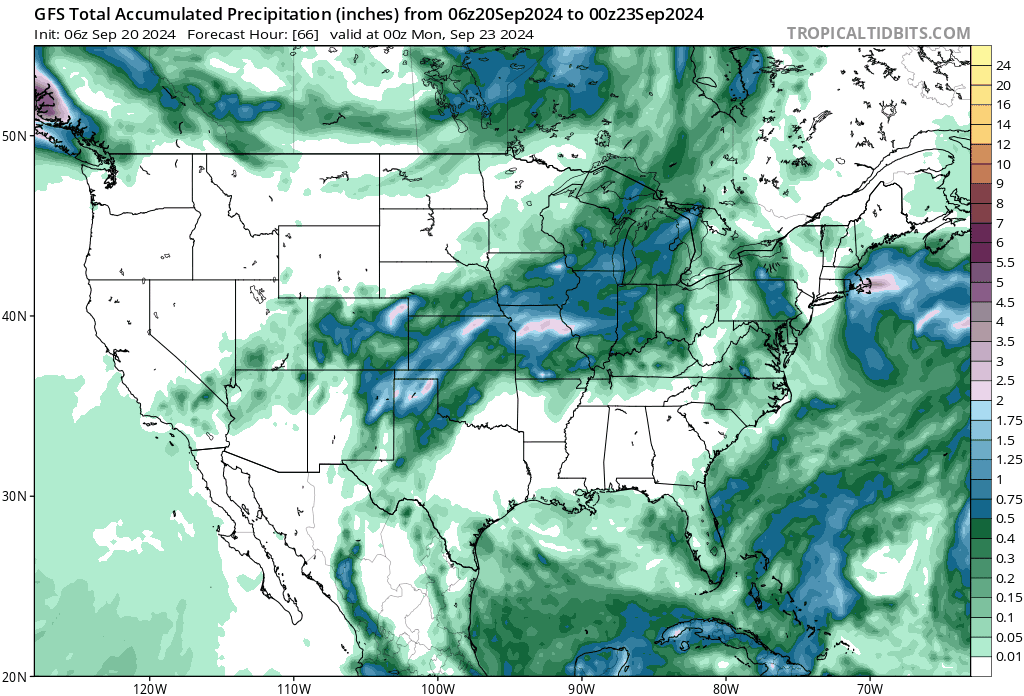
A similar trend is evident in the GFS. First, here's the GFS from yesterday morning. It shows roughly 0.8" of water across the Denver area, with a swath of 1"+ totals from southeast of Denver extending northeast across the plains:
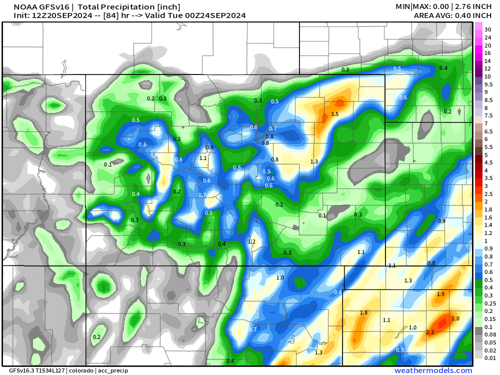
This morning's run has just a very narrow swath of heavy precipitation from south of Colorado Springs extending northeast, with just 0.1" to 0.3" of precipitation for the Denver area!
And the trend from the last 6 runs from the GFS showing QPF pretty systematically being cut across the northern extent, with the focus of heaviest precipitation setting up across the Texas/Oklahoma panhandles and extending east/northeast:
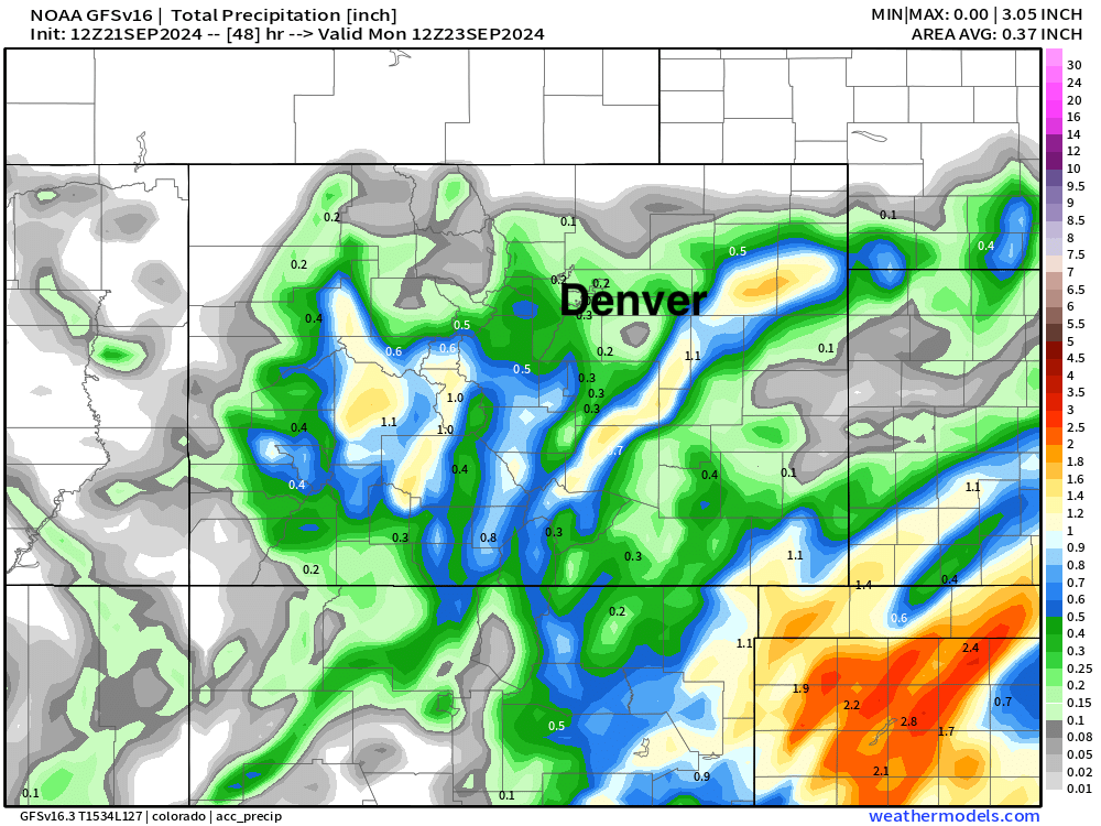
The high-resolution HRRR shows roughly 0.1" to 0.5" for the northern urban corridor, with a notable dry slot hurting totals over Denver and points southeast. We again see the southern bias of the heaviest precipitation from this event across extreme southern Colorado and the Panhandles, but someone across northeast Colorado still in the running for some meaningful QPF. This 0.1" to 0.5" may ultimately be the best forecast range for most communities along the I-25 corridor.
A wait and see
Trends aside, we are right up against this thing so let's see how it all plays out. The drying trend in the modeling, and a rather potent dry slot pushing into the state now definitely has us concerned, with a very real bust potential on the table.
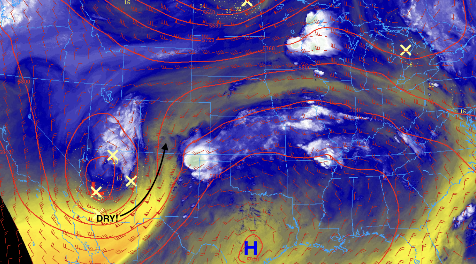
As our system moves in later today we'll have quite a bit of dry air to overcome before rain gets going across the region as evident by the most recent water vapor imagery showing a lot of dry air wrapping around the low. With any luck at all we can saturate things in earnest this evening and take advantage of our upslope flow before it's too late for some better-than-currently-advertised precipitation along the urban corridor!
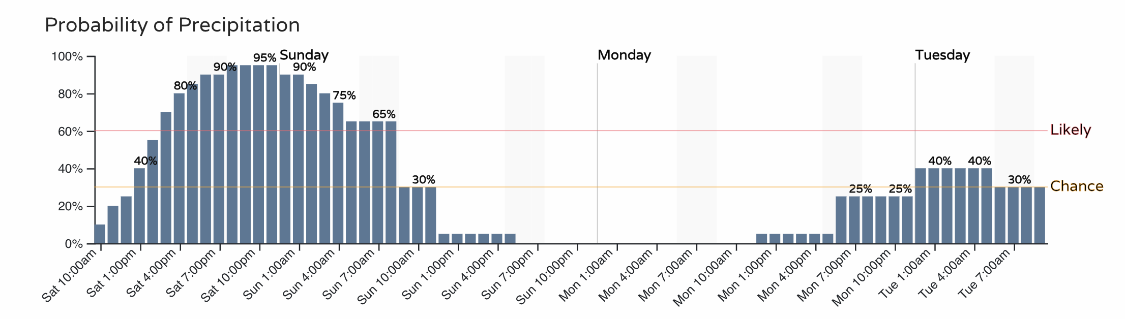
As for timing, not much change there. It still looks like our best precipitation chances are from late this afternoon (perhaps evening if dry air is stubborn!) through the overnight hours. We dry our Sunday afternoon through most of Monday before the next system swings through:
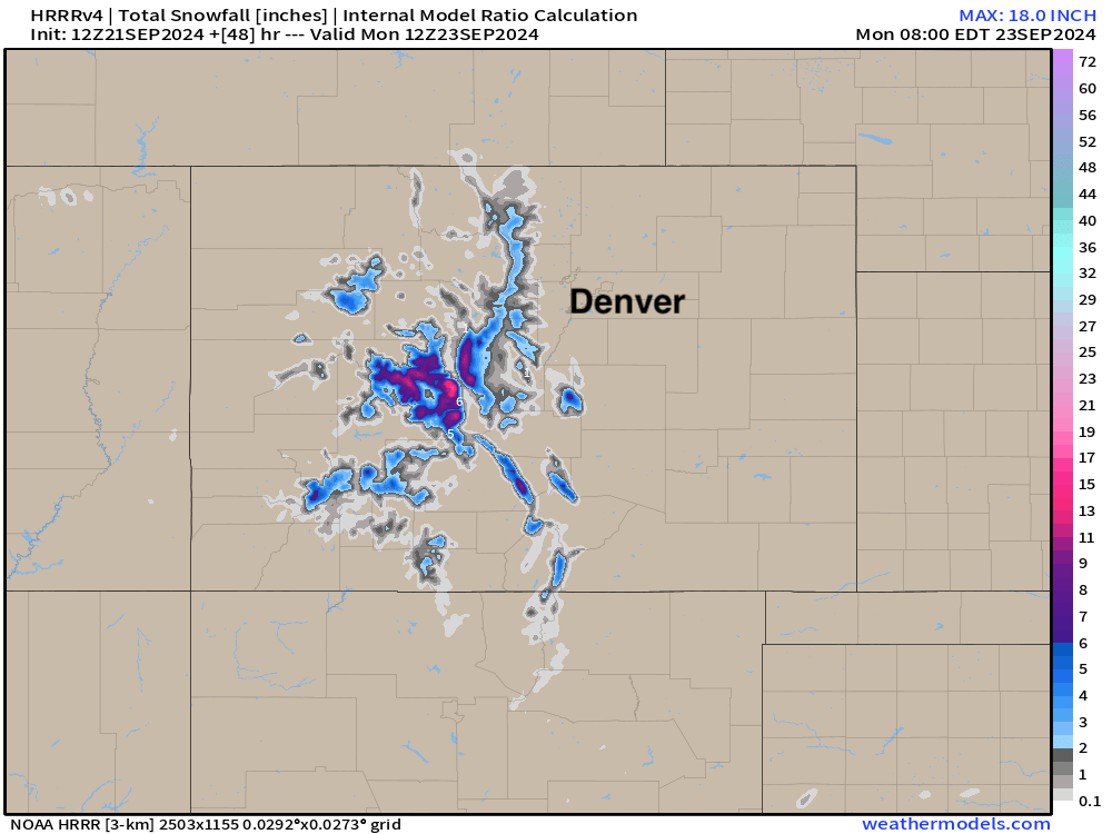
Snowfall
Still some good mountain snowfall on the table, especially for the higher peaks southwest of Denver. A lack of heavier precipitation would hurt snowfall potential for the northern Front Range mountains, but again, let's see how this all plays out.
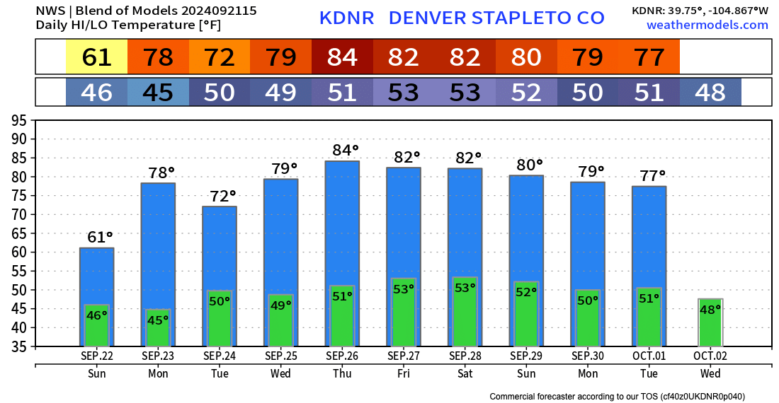
And FINALLY, enjoy the nice cool fall weather, moisture or a lack there of! Sunday should see highs in the 50s to low 60s (cooler end of range if we get heavier rain, warmer if we don't) with 70s in the forecast through Wednesday for the Denver area!
As always, let us know how things shake out in your neck of the woods as things get going later today!